Discover Cabeceiras de BastoFree independent guide
ViveCabeceirasYOUR GUIDE TO CABECEIRAS
ENEnglish
SearchSaved

Stories of Cabeceiras

Choose a story to start with. You can change the subject or fine tune the search.

337 stories · All themes · Search: lã

Crafts and memories

Through hands, food and community: small stories of how people lived and what they pass on.

Choose a story · 60
Formigueiro · working heritage

Water worked the wool too

Wool and grain: two tasks beside one stream.

Includes an activity to try →Explore: Same water, different jobs →
Read here and view sources

Beside the Cavez stream, an old building brought wool and grain work together: wool was fulled — compacted — there, and grain was ground. The municipal description places the ruins on the descent from Formigueiro. The trail offers a way to discover this memory of work; access to the interior is not confirmed.

The operations need to be kept separate: fulling wool and grinding grain are different tasks, even though the description brings them together in that building. We should not imagine a single machine making flour and treating wool without documentation of its mechanism. The municipal introduction mentions remains of equipment in the ruins, but provides no inventory from which to reconstruct all the parts.

The same landscape connects work with relief. Formigueiro lies above the fulling mill, on a descent the source describes as steep; Nariz do Mundo is another part of the route, offering a view over the valley. Understanding the mill’s history and preparing a walk complement each other: distance, difficulty and conditions belong in the trail profile.

Getting to know the parish See Fact sheet: Trilho do Pisão e Nariz do Mundo
Source and context

Municipality — the former pison near the brook of Cavez

Accessed: . Editorial summary; the date of consultation is not the date of the facts.
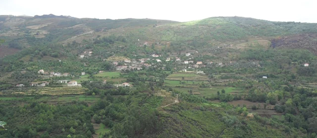
Painzela · oil mill documented in 2008

The stream powered the oil mill

Lagar do Senhor connected water with olive processing.

Explore: From watercourse to processing →
Read here and view sources

At Lagar Velho in Painzela, the survey of 6 May 2008 identified the Lagar do Senhor as a water-powered granite building. Its own channel brought water from the Arejal stream. The record placed its closure in the 1970s and described the building as ruined at the time, with few milling components. This documents privately owned equipment; it does not confirm present visiting conditions.

Source and context

Municipality — inventory of mills, Lagar do Senhor (Old), record LA12 (06/05/2008)

Accessed: . Editorial summary; the date of consultation is not the date of the facts.
Gondiães and Vilar de Cunhas · memory and landscape

Wool became socks too

Small pieces belong to the memory of crafts.

Includes an activity to try →Explore: Small pieces, long stories →
Read here and view sources

Woollen socks appear in the municipal portraits of Gondiães and Vilar de Cunhas. For Vilar, the source also mentions lace.

Crafts live in small pieces too, alongside blankets and capuchas. The reference describes a local repertoire without identifying workshops or makers currently available.

The introduction to Vilar de Cunhas places Vilar, Cunhas and Uz in a landscape of plateaus and mountains, mentioning farming and pastoralism. This setting brings crafts close to rural daily life. It does not, however, establish which flocks supplied the wool for each piece or describe the lace-making technique.

Compare without confusing: a woollen sock, a blanket and a linen cloth are not the same object and do not necessarily require the same gestures. The stories about Bucos and spinning help explore materials and tools; the municipal reference to Vilar preserves the particular place of socks and lace.

Getting to know the parish
Source and context

Municipality — Gondiães e Vilar de Cunhas, landscape, heritage and crafts

Accessed: . Editorial summary; the date of consultation is not the date of the facts.
Casa da Lã and Mulheres de Bucos · sharing skills, 2024–2026

Bucos’s wool travels with those who teach

Preserving a craft includes sharing it.

Includes an activity to try →Explore: Meetings that share knowledge →
Read here and view sources

On 10 October 2026, the Mulheres de Bucos took part in the Ciclo da Lã in Santo Tirso, representing Casa da Lã. The Museum’s report describes demonstrations of fibre preparation, spinning and weaving. This is a documented episode of sharing these skills beyond the municipality, not an announcement of a future activity.

Sharing had already taken place at Casa da Lã on 14 March 2024: the Mulheres de Bucos welcomed the Mulheres do Atelier Pontinhos from the Centro Interpretativo das Minas da Borralha for a gathering devoted to this work.

On 6 June 2026, Casa da Lã hosted Dia da Tosquia. The report published two days later describes demonstrations led by the Mulheres de Bucos, with public participation and support from the parish council. This is another documented example of learning across generations, not a future activity date.

This transmission also brought Bucos and Rio Douro together. In the report of 21 October 2024 about the Da Lã ao Fio e ao Feltro workshop at Landra, the municipality records the Mulheres de Bucos taking part. They showed tasks such as washing, teasing, carding and spinning. The initiative belonged to the Saber a Terra project, which connected learning, artistic creation and relationships with local ecosystems. The report announced another session for the following weekend; that forecast is not treated here as proof that it happened.

See Fact sheet: Casa da Lã
Source and context

Basto Land Museum — Women of Bucos promote ancestral wool art in Santo Tirso, 2026-10-14

Museum of Lands of Basto — “The wool that unites us” brought together women from Bucos and the Mines of the Rubber Casa da Lã, 2024-03-19

Basto Land Museum — shear day Bucos, 2026-06-08

Municipality — From Wool to Yarn and Feltro, Landra in Riodouro, 21/10/2024

Accessed: . Editorial summary; the date of consultation is not the date of the facts.
Pedraça and Bucos · textiles and design

Linen and wool took new steps

Local skills enter footwear design.

Includes an activity to try →
Read here and view sources

The Terra Inesgotável catalogue presents shoes made with linen grown and woven by Fátima Mota in Pedraça, and others with wool from Bucos woven by Maria Jorge under Helena Cardoso’s guidance. This is a contemporary use of traditional skills. The publication documents the pieces; it does not confirm that they are for sale or in an exhibition currently open to visitors.

Source and context

Museum of the Footwear — Inexhaustible Land, pp. 42–43 (PDF pp. 44–45)

Accessed: . Editorial summary; the date of consultation is not the date of the facts.

Painzela · changing oil mills in the 20th century

When the oil mill changed its power source

In Painzela, the story continued beyond the water channel.

Includes an activity to try →
Read here and view sources

The 2008 municipal inventory describes the Lagar do Senhor Novo in Igreja as the successor to the Lagar Velho. Built in 1971, it used electric motors. It was restored in 2001 and taken out of use shortly afterwards.

The change lets us compare two ways of powering an oil mill in the same parish. The survey is historical and confirms neither current operation nor visits.

Source and context

Municipality — Lagares inventory, LA13, survey of 06/05/2008

Accessed: . Editorial summary; the date of consultation is not the date of the facts.
Alvite · 1758 account

When animals powered the oil mill

Not all power came from water.

Explore: Where did the force come from? →
Read here and view sources

In 1758, vicar João Lobo de Sousa described two olive-oil mills powered by oxen and other draught animals. The parish was particularly dry in summer and had neither grain mills nor fulling mills. Many residents went to neighbouring parishes to grind grain and make olive oil.

The same account mentions small flows of water from Orada, retained in reservoirs to benefit the fields. Irrigation and milling did not necessarily rely on the same solution: here, storing water for crops coexisted with using animal power at the oil mill. It is a picture of how work was organised in 1758, not an inventory of present-day equipment.

Getting to know the parish
Source and context

Basto Land Museum — Parish Memories of 1758: Alvite

Accessed: . Editorial summary; the date of consultation is not the date of the facts.
Outeiro · history of clog making

Learning a craft beside a master

In Outeiro, clog making passed from hand to hand.

Includes an activity to try →Explore: Three supports of the work of the tamanceiro →
Read here and view sources

In the study published in 2017, Teresa Soeiro recounts how Manuel Alves Leite, born in Pinhel in 1899, learned from Bernardino José Pereira, a clog maker from Sobreira. The skill passed to his descendants. This story of learning brings clog making close to families and places, without assuming that the workshop remains open.

The Museum’s inventory offers a glimpse of the workspace. It calls the low table used by Manuel António Teixeira Leite an ofício. A bench with a small block supported the finishing of the wooden soles; a wood-and-leather last connects production with Manuel Alves Leite’s generation. The objects show different working supports without reconstructing the layout of a particular workshop.

Dimensions help distinguish the supports: table T15 measures 82 centimetres long, 74 wide and 55 high; bench T14 is 87 long, 28 wide and 50 high. Despite similar lengths, they offer very different surfaces. The inventory links the bench with finishing the wooden soles, supported on a small block.

Words in this story: see explanations →Getting to know the parish
Source and context

Teresa Soeiro — Soqueiros and Tamanqueiros, municipal edition of 2017, chapter The tamanqueiros of Outeiro, p. 68
Accessed:

Land Museum of Basto / Teresa Soeiro — In the country of Tamanco, introduction and inventory T10/T13/T16–T19
Accessed:

Editorial summary; the date of consultation is not the date of the facts.

Jogo do Pau · historical context

Fairs had a side of conflict too

The game’s past helps explain its transformation.

Includes an activity to try →
Read here and view sources

The inventory recalls confrontations at fairs and pilgrimages, in a rural setting where the staff served as support and defence. It distinguishes that past from the cultural practice of demonstrations. Understanding this change lets us see Jogo do Pau as a tradition that adapted to communities and times.

The record connects the transformation with changes in rural society and transmission between generations. In demonstrations, it highlights training, attention and decision-making. The schools of Abadim and Bucos appear as places of learning in the inventory process. The same object gains a different social setting: knowing its history includes understanding why people practise and how they learn.

Source and context

MatrixPCI — Cabeceiras de Basto Stick Game, INPCI_2023_016

Accessed: . Editorial summary; the date of consultation is not the date of the facts.

Crafts · Bucos

Clothing for mountain life

Wool connects livestock with shelter.

Includes an activity to try →Explore: Follow the thread between places and times →
Read here and view sources

A throw, a blanket and a capucha serve different needs: covering, warming and sheltering people working outdoors. The municipal introduction associates Bucos with Barroso woollen throws, shepherds’ capuchas and bedspreads, connecting wool with pastoral life and weaving.

The same source places crafts in a daily life where nearby resources provided materials for houses, clothing and utensils. It also notes how many objects have moved from mainly practical functions to decorative uses. Looking at a piece means asking what it is made from, what it was used for and where it fits today.

Casa da Lã, opened in 2012, provides a place to interpret this work. The municipal introduction highlights the opportunity to follow different tasks carried out by the Mulheres de Bucos, by appointment. There is more to see than finished pieces: the gestures and experience of the people making them are also part of this heritage. The venue profile brings together practical information to plan a visit.

Words in this story: see explanations →See Fact sheet: Casa da Lã
Source and context

Municipality — crafts and services of the parishes

Municipality — Casa da Lã, interpretative centre in Bucos

Accessed: . Editorial summary; the date of consultation is not the date of the facts.

Formigueiro · weaving and trade

Textiles that left the village

Wool and linen travelled to the São Miguel and Santa Luzia fairs.

Read here and view sources

Formigueiro’s memory brings together throws, bedspreads, towels and blankets made from wool, linen and rags. The municipal guide connects their sale with the São Miguel fair in Cabeceiras and the Santa Luzia fair in Arco de Baúlhe.

Following these textiles connects work within the village with the movement of people and goods. The account preserves a memory of trade, not a list of present-day stalls.

Getting to know the parish See Fact sheet: Formigueiro
Source and context

Municipality — Village Guide of Serra da Cabreira: landscape, work and heritage

Accessed: . Editorial summary; the date of consultation is not the date of the facts.

Rural heritage · 2008 survey

One water supply, several tasks

In Eiró, the oil mill connected with field irrigation.

Read here and view sources

The inventory of 7 February 2008 describes the olive-oil mill at Casa da Portelada in Eiró, Rio Douro, alongside a grain mill in the same building with a separate entrance. Water from the Levada de Moinhos powered the equipment before continuing to irrigate fields. This successive use connected food processing with farming. The record of private property does not confirm current visiting arrangements.

The record places the oil mill’s former working season in January and February. It also describes water arriving from the west through a granite structure, and distinguishes the grain mill’s northern entrance from the oil mill’s southern entrance. These are clues to the building’s arrangement. The document contains contradictory information about surviving parts, so it cannot establish that the whole installation was complete or operational.

Source and context

Municipality — Lagares inventory, LA20 fiche, Portelada House (07/02/2008)

Accessed: . Editorial summary; the date of consultation is not the date of the facts.

Museum collection · household object

Warmth in a copper object

An object helps us imagine comfort in another time.

Read here and view sources

Brazier MTB251, recorded by the Museum, is made of copper and held embers for heating. The record gives a height of 12.5 centimetres and a diameter of 46.5. Alongside oil lamps and cooking vessels, it reveals another function of metal objects in domestic life: providing warmth. The inventory documents the piece without confirming that it is on display today.

Source and context

Basto Land Museum — Latoaria: MTB251 and AB295C inventory

Accessed: . Editorial summary; the date of consultation is not the date of the facts.

Terras de Basto · from fibre to fabric

Spinning is not weaving

Between fibre and cloth lies a world of tools.

Includes an activity to try →
Read here and view sources

The specifications for Linho das Terras de Basto distinguish preparing thread from building a fabric. Spinning may use a distaff and spindle, but the document also mentions a spinning wheel. A reel winds thread into skeins, which can then be wound into balls using a swift. Weaving requires preparing the warp and the thread that will cross it. The shuttle, shaped like a small boat, carries the weft between the warp threads. This description covers the Terras de Basto region; it does not identify a particular workshop in Cabeceiras.

Words in this story: see explanations →
Source and context

AMBT / CETRAD–UTAD — Land Linen Specification of Basto, pp. 19–27

Accessed: . Editorial summary; the date of consultation is not the date of the facts.

Material culture · Museum inventory

How much did a quartilho hold?

Containers were also tools for measuring.

Includes an activity to try →Explore: ♪ From the middle to the canada ♪ →
Read here and view sources

In the Museum’s tinsmithing inventory, a set of olive-oil measures includes a two-litre canada, a litre measure, a half-litre quartilho and a quarter-litre meio quartilho. These capacities belong to the documented pieces; they do not mean that old measures were the same in every region.

Try reading the pieces as a set: two quartilhos make one litre; four fill the canada recorded here. Moving between containers changes the number of fills, not the total quantity. The diagram lets you compare these relationships before following the olive oil to its carrying container and the piece used to serve it at the table.

Source and context

Basto Land Museum — Latoaria, Teresa Soeiro text and inventory of pieces

Accessed: . Editorial summary; the date of consultation is not the date of the facts.

Community associations · Faia

Os Amigos da Faia

A community story that began in 2006.

Includes an activity to try →
Read here and view sources

The municipal directory dates the founding of Os Amigos da Faia to 2006 and links the association’s creation to community life. Collective activity adds another dimension to the parish’s history, alongside churches, houses and crafts.

The full name brings together four dimensions: recreational, sporting, cultural and social. Think about what each word can bring to life in a parish. The directory describes an intention to encourage community participation; for dated activities, check the agenda or the association’s own channels.

Getting to know the parish
Source and context

Municipality — Presentation of Friends of Faia in the associative directory

Accessed: . Editorial summary; the date of consultation is not the date of the facts.

Crafts · Outeiro

Baskets that hold knowledge

Twigs and willow transformed by hand.

Includes an activity to try →
Read here and view sources

The municipal description highlights Outeiro’s basketry. Baskets, shallow trays and large carrying baskets recall handmade answers to everyday needs. In April 2025, the report on the Artes e Ofícios exhibition at Casa do Tempo identified Joaquim Leite’s relatives as the representatives of basketry. The exhibition brought this skill together with clog making, tinsmithing, linen and wool. This records that initiative; it does not indicate an exhibition currently open.

Getting to know the parish
Source and context

Municipality — crafts and services of the parishes

Municipality — Arts and Crafts at Casa do Tempo, news of 14/04/2025

Accessed: . Editorial summary; the date of consultation is not the date of the facts.

Heritage · Painzela

One house, two centuries in view

The building and garden tell different chapters.

Explore: Painzela per layer →
Read here and view sources

Casa de Pielas and its garden are not presented as the work of a single period. The municipality dates the house’s architecture to the 18th century and the garden to the 19th, suggesting English influence as a possibility.

Separating these layers helps you read the whole: a building can gain new spaces and new ways of being framed over time. This is a heritage reference, without confirmation of current visiting arrangements for the private property.

Getting to know the parish See Fact sheet: Casa de Pielas, jardins e anexos
Source and context

Municipality — assets of Painzela

Accessed: . Editorial summary; the date of consultation is not the date of the facts.

Arco de Baúlhe and Refojos · craft history

When sheet metal took shape

The workshop supplied home, fields and fair.

Explore: What was the metal for? →
Read here and view sources

João Pacheco in Arco de Baúlhe, and Luziário Pereira de Magalhães with his son António in Refojos, are central figures in the Museum’s research into tinsmithing. Luziário and António’s workshop stood in Beco dos Ofícios; the nearby fair was their main point of sale. Teresa Soeiro links the craft’s decline to the spread of aluminium and plastic.

The inventory connects this work with everyday actions: copper mug MTB 241 was used to make coffee, pitcher MTB 240 held water and oil lamps provided light. These functions are documented for identified pieces. Knowing the objects helps explain the workshop, but the collection does not confirm that these craftspeople or businesses remain active.

Teresa Soeiro’s research led to the exhibition A Arte da latoaria em Cabeceiras de Basto, at the Museum’s premises in Arco de Baúlhe. The work traced the craft back to artisans who began using tinplate, known as ferro branco or folha-de-flandres, at the start of the Early Modern period. Recording the last professional careers was thus connected with a longer history of materials.

The objects reveal the variety of tasks: lighting a house, carrying wine, watering plants or storing oil for a locomotive. The craft spanned home, farming and transport. Comparing these functions reveals metalworking in actions that seem to belong to separate worlds.

Words in this story: see explanations →Getting to know the parish
Source and context

Basto Land Museum — Latoaria, Teresa Soeiro text and inventory of pieces

Accessed: . Editorial summary; the date of consultation is not the date of the facts.

Faia · sacred art, 2025

Roots and light renew a chapel

At Senhora do Amparo, materials tell a story too.

Includes an activity to try →Explore: Material, memory and transformation →
Read here and view sources

Olive-tree roots shaped the new altar and ambo in the chapel of Nossa Senhora do Amparo. The Archdiocese of Braga’s report of 6 October 2025 attributes the work to Atelier Amadeus and describes a refurbishment centred on the altar. A suspended cross forms part of the element called Corpo de Luz.

Parish priest Rui Filipe Marques Araújo explained the lighting’s symbolism: groups of lights refer to the Trinity, the Evangelists and the Apostles. The publication also highlights the contribution of artists, technicians, workers and the community. The intervention shows heritage continuing to gain new forms and meanings; the 2025 report does not give visiting hours.

The account presents the celebration, presided over by José Cordeiro, as a gathering of Faia with the communities of Arco de Baúlhe and Vila Nune. The choice of roots also receives a religious interpretation: according to the priest, transforming previously discarded material expresses renewal and redemption. This is the symbolic reading attributed to him in the report, distinct from the description of the materials. To understand the work, we can look at both layers: how it was made and the meaning given to it.

Getting to know the parish See Fact sheet: Capela da Senhora do Amparo da Faia
Source and context

Archdiocese of Braga — renewal of Lady of Amparo, news of 06/10/2025

Accessed: . Editorial summary; the date of consultation is not the date of the facts.

Carrazedo · Bucos

Maize left its mark on the village

Carrazedo’s granaries tell a farming story.

Read here and view sources

Maize shaped Carrazedo’s economy and left its mark in buildings: the canastros, also called espigueiros. The municipal guide attributes a capacity of between 14 and 18 tonnes of maize to the largest example.

That scale helps us imagine the importance of storing the harvest. It is the capacity given in the source, not the quantity currently stored. The photograph lets you observe the building.

The municipal page for Bucos lists the Espigueiro da Casa de Fundevilla in Carrazedo among the parish’s heritage features. The building makes visible a stage between harvesting and milling: storing the grain. It is not a mill, and its capacity does not tell us how much maize a family produced in a year.

To follow the food’s journey, connect three places in the readings: the field where the grain grows, the granary where it is stored and the mill where it is processed. This sequence helps explain distinct functions without imagining that all the buildings presented belonged to the same farm.

See Fact sheet: Espigueiro de Carrazedo
Source and context

Municipality — Village Guide of Serra da Cabreira: landscape, work and heritage

Municipality — parish of Bucos, patrimony and poultice of Casa de Fundevilla

Accessed: . Editorial summary; the date of consultation is not the date of the facts.

Vilela · Rio Douro

Granite shapes the village too

Panoramic view of Vilela, Rio Douro, with houses and agricultural plots on the slopes.
Vilela · architecture and landscape of Rio Douro© Ambcruzⓘ

In Vilela, the walls help you recognise the landscape.

Includes an activity to try →
Read here and view sources

The municipal introduction to the Cavez stream trail highlights granite masonry in the old streets of Vilela, in Rio Douro. After irrigation channels and meadows, the reading of the territory continues through its houses: the region’s material also helps shape the settlement.

The municipal text presents a sequence linking buildings with farming: channels, mills and irrigated meadows precede the description of the village streets. Vernacular architecture here means building connected with local materials and practices. Granite is not only a rock in the landscape; it enters the walls and the settlement’s visual character.

To explore this relationship, compare the photograph of Vilela with the reading about granite’s grains. A village view shows volumes and surfaces; a close look at the rock reveals another scale. The municipal description neither dates each house nor allows us to conclude that every wall has the same history.

Words in this story: see explanations →Getting to know the parish See Fact sheet: Vilela, Rio Douro See Fact sheet: Trilho da Ribeira de Cavez
Source and context

Municipality — stream of Cavez and agricultural landscape

Accessed: . Editorial summary; the date of consultation is not the date of the facts.

Cavez · rural economy in 1758

The mountains supplied charcoal too

Cavez’s 1758 account connects scrubland with fuel.

Includes an activity to try →Explore: The landscape had several jobs →
Read here and view sources

Cavez’s parish priest mentions carqueja, heather and other woody vegetation in the hills and notes abundant charcoal production. In the same account, he describes maize, rye and vinho verde, from which aguardente was made. Fields and scrubland fed different kinds of work and products.

The account connects vegetation with an economic activity, but does not explain how the charcoal-burning structures were built, where they stood or who worked in them. Nor does it allow production to be calculated. Separating what the text tells us from these open questions makes the picture more faithful: abundance is the assessment of the author writing in 1758.

Getting to know the parish
Source and context

Municipality of Cabeceiras de Basto — Parish memories of 1758: Cavez

Accessed: . Editorial summary; the date of consultation is not the date of the facts.
Gondiães · organising the celebration in 2012

A house organised the celebration

Cooking below; food waiting for the table above.

Includes an activity to try →
Read here and view sources

In the account of the 2012 visit, the Casa do Mártir São Sebastião followed the slope of the ground over two floors. The oven, fire, pots and kneading equipment were downstairs.

Prepared food and serving equipment gathered upstairs: the house connected preparation with distribution. This arrangement belongs to the record of that visit, without confirming the layout today.

The upper floor also held the table’s presentation: broa on shelves decorated with coloured cut-out paper, papas in bowls and pork ribs on glazed earthenware plates. Long linen cloths covered the benches used as tables. The materials show that preparing the celebration meant cooking, storing, carrying and arranging food.

Getting to know the parish
Source and context

Basto Land Museum — Visit to the Feast of Popes, published in 22/01/2012

Accessed: . Editorial summary; the date of consultation is not the date of the facts.

Cavez · inventoried object

Sweets had luggage too

A metal box connected work with celebrations.

Includes an activity to try →
Read here and view sources

Metal box L 104, belonging to Joaquina Basto of Arosa, Cavez, carried sweets to celebrations. It measured 88 centimetres long, 45.5 high and 43.5 wide.

These dimensions help us imagine the work behind the celebration; the inventory does not identify the contents of each journey or the weight carried.

Number L 104 identifies this box in the inventory and distinguishes it from other containers. The record connects it with a name, a locality, a material and a function. Rather than showing only finished sweets, this object draws attention to the transport a celebration required.

Compare its length with its height: the box was considerably longer than it was tall. You can draw a rectangle to scale to imagine the space it occupied, without deducing how many sweets it carried. The inventory records external dimensions, not usable capacity or weight.

Getting to know the parish
Source and context

Basto Land Museum — Latoaria, Teresa Soeiro text and inventory of pieces

Accessed: . Editorial summary; the date of consultation is not the date of the facts.

Pedraça and Basto · material culture

Carrying and measuring in one container

Two pitchers, two recorded capacities.

Includes an activity to try →Explore: Name doesn't say full capacity →
Read here and view sources

The Museum’s inventory distinguishes two pieces made from sheet zinc: pitcher L 16 from Pedraça, holding 12 litres, and pitcher L 62 from Devesa, Basto, holding seven. Both measured and carried wine.

The capacities belong to these objects, not to a universal measure. Comparing them shows why a container’s name alone cannot tell us how much it holds.

The dimensions add a surprise: the 12-litre pitcher is 46 centimetres high and 16.7 in diameter; the seven-litre pitcher is shorter, at 34.5 centimetres, but has a diameter of 23.3. Greater width alone does not mean greater capacity.

The inventory associates the first piece with Fátima Magalhães of Pedraça and the second with Álvaro Magalhães of Devesa. These are recorded owners, not attributions of craftsmanship. Their names help connect the objects with the people who preserved them.

Getting to know the parish
Source and context

Basto Land Museum — Latoaria, Teresa Soeiro text and inventory of pieces

Accessed: . Editorial summary; the date of consultation is not the date of the facts.

Cavez and Basto · material culture

Light in a small object

Oil lamps tell another story of the home.

Includes an activity to try →
Read here and view sources

Two oil lamps from Casa da Ponte in Cavez appear in the inventory with heights of 46 and 17 centimetres. Hanging paraffin lamp L 53 from Devesa, Basto, is made of tinplate and measures 27 centimetres.

They shared the function of providing light, but differed in size and form. The record lets us compare them without assuming how they were positioned in each house.

Getting to know the parish
Source and context

Basto Land Museum — Latoaria, Teresa Soeiro text and inventory of pieces

Accessed: . Editorial summary; the date of consultation is not the date of the facts.

São Nicolau · 1758 account

At dusk, livestock returned home

Fields and hills followed a daily rhythm.

Includes an activity to try →Explore: Between the field and the hill →
Read here and view sources

In 1758, São Nicolau’s parish priest described goats in the hills and working animals taken there when pasture was scarce in the fields. At nightfall, the livestock returned home.

This daily rhythm connected places with different functions: fields, hills and shelter. It is a memory of rural practices, without confirmation that they continue unchanged today.

The description distinguishes goats, raised in greater numbers in the hills, from livestock used by farmers for work. The latter also sought pasture there during part of the year, when it was lacking in the fields. Going to the hills was therefore connected with food availability and the animals’ role. The rector gives no fixed calendar for these movements: what he leaves is a link between need, landscape and the nightly return.

Getting to know the parish
Source and context

Basto Land Museum — St Nicholas Parish Memories (1758)

Accessed: . Editorial summary; the date of consultation is not the date of the facts.

Museu das Terras de Basto collection · Arco de Baúlhe

This mug made coffee

Not every mug was only for drinking.

Includes an activity to try →Explore: Three objects, three heights →
Read here and view sources

Copper mug MTB 241 was used to make coffee. The inventory records a height of 12 centimetres and a diameter of 7.2.

The piece belongs to the Museu das Terras de Basto in Arco de Baúlhe. No manufacture date or recipe is given. Compare the dimensions in the diagram: similar heights can conceal very different widths.

Source and context

Basto Land Museum — Latoaria, Teresa Soeiro text and inventory of pieces

Accessed: . Editorial summary; the date of consultation is not the date of the facts.

Museu das Terras de Basto collection

A “fingernail” for the grape harvest

An object’s name can hold a small surprise.

Includes an activity to try →
Read here and view sources

The Museu das Terras de Basto’s unha — “fingernail” — MTB 437 was used to cut bunches of grapes. Made from sheet zinc, it measures 4.5 centimetres high. The inventory documents the utensil without explaining how it was used or attributing it to a village of origin.

The recorded diameter is 2.7 centimetres: a small piece with a very specific task. Its name, function and dimensions provide different clues. Unha is the inventory’s name for it; cutting bunches is its documented use.

The record connects vineyard work with the craft of shaping metal. Moving on to the stories of grape varieties and wine containers changes the scale: from a small utensil to the plant, harvest and movement of the product.

Source and context

Basto Land Museum — Latoaria, Teresa Soeiro text and inventory of pieces

Accessed: . Editorial summary; the date of consultation is not the date of the facts.

Bucos · communications in 1758

Letters arrived through another place

Receiving news also meant covering a distance.

Includes an activity to try →
Read here and view sources

Bucos had no postal service of its own in 1758: it used Raposeira’s, three-quarters of a league away. The account also gives distances to Braga and Lisbon, showing how the vicar placed the parish within a wider network.

The same account describes hills between settlements and villages hidden by the terrain. Receiving news meant connections beyond the village. Historical distances are not directions for present-day travel.

The vicar also mentions a wooden bridge at Casares on the road to Braga, considering that frequent traffic justified a dressed-stone structure. This offers a clue to the importance of routes for the population. It is not, however, proof that the mail crossed that bridge: the document describes both subjects without tracing a postal route.

Source and context

Municipality — Parish memories of Bucos (1758)

Accessed: . Editorial summary; the date of consultation is not the date of the facts.

Gondiães · historical link to the Barrosã breed

Barrosã cattle helped work the land

Before the meal comes a story of fields and animals.

Includes an activity to try →
Read here and view sources

CAPOLIB includes Gondiães in the historic home territory of the Barrosã breed. It describes cattle linked with work and meat production, adapted to mountain farming: they help work small plots, and their manure fertilises the soil. This connects animal heritage with rural life; it is not a survey of the herds currently present in the parish.

Source and context

CAPOLIB — Barrosan breed, historical area and designation of origin

Accessed: . Editorial summary; the date of consultation is not the date of the facts.

Bucos · craft described in the inventory

Before the game comes woodwork

The staff also preserves a craft.

Includes an activity to try →
Read here and view sources

The heritage record highlights lodão among the woods used for Jogo do Pau. Cutting and shaping the staff requires its own knowledge. The inventory links this craft to a master in Bucos and warns of the fragility of its transmission. This is a picture from the inventory process, not a current count of craftspeople.

The distinction between playing and preparing the object matters: mastering the practice and knowing how to work the wood are connected but different skills. Preserving the tradition also involves those who choose and shape the material. The heritage record lets us see the staff as the product of a craft as well as an instrument for demonstrations.

Source and context

MatrixPCI — Cabeceiras de Basto Stick Game, INPCI_2023_016

Accessed: . Editorial summary; the date of consultation is not the date of the facts.

Refojos · 1956 newspaper account

The roads filled for the fair

The journey was part of the gathering.

Explore: Come to the fair and follow the stories →
Read here and view sources

The 1956 account describes people arriving along the roads, by bus and by train. Alameda do Sêco and the garden of Praça da República concentrated the bustle. Products and blankets from Barroso joined the fair: the gathering connected territories and transport.

In the excerpts collected by the Museum, the fair was also an occasion to display animals and wear new clothes. The text evokes pairs of oxen decorated with flowers on their way to the livestock competition, and lists aprons, scarves, skirts, blouses and slippers. The celebration combined work, trade and public display.

It is a journalistic description, with expressive language and its own view of people. It helps us imagine the atmosphere, but does not count arriving visitors or allow every habit described to be treated as universal.

Source and context

Basto Land Museum — St Michael of other times, 26/09/2024; excerpts from The Journal of Cabeceiras of 16/09/1956 and 08/09/1977

Basto Land Museum — archive, page 4: Saint Michael of old, publication of 26/09/2024

Accessed: . Editorial summary; the date of consultation is not the date of the facts.

Refojos · food described in 1956

Fresh chestnuts and earthenware mugs

The celebration’s memory has flavours too.

Includes an activity to try →
Read here and view sources

In the 1956 description published by the Museum, eating establishments and food stalls filled up. Regional wine accompanied merendeiros or fresh chestnuts, served in white glazed earthenware mugs. These details from a newspaper chronicle bring the fair close to its everyday gestures.

Food appears amid a fair in motion. The chronicle evokes groups crossing paths, buses and trains, blankets from Barroso and people arriving at Alameda do Sêco and Praça da República. Eating and drinking were part of that gathering, alongside trade, religious celebration and the livestock competition.

Keep two dates in mind: the quoted text appeared in the newspaper on 16 September 1956; the Museum shared it again on 26 September 2024. The excerpt uses the expressive language of a chronicle and gives no counts of visitors or meals sold. Comparing it with the memory of dried chestnuts during farm work reveals the same fruit in different settings and forms of preservation.

Source and context

Basto Land Museum — St Michael of other times, 26/09/2024; excerpts from The Journal of Cabeceiras of 16/09/1956 and 08/09/1977

Accessed: . Editorial summary; the date of consultation is not the date of the facts.

Outeiro · festive traditions

Three names in a devotional calendar

Pilgrimages offer another way to know Outeiro.

Explore: Places, objects and encounters →
Read here and view sources

The municipal introduction to Outeiro highlights Santa Maria, Senhora da Livração and Senhor do Livramento among its pilgrimages. These names add a community dimension to a parish known for basketry and clog making. The source describes traditions but gives no dated programme here: this reading does not announce celebrations or their times.

Source and context

Municipality — Parish of Outeiro: pilgrimages and crafts

Accessed: . Editorial summary; the date of consultation is not the date of the facts.

Painzela · crafts and traditions

Threads and celebrations in Painzela’s memory

Beyond manor houses, there are skills and celebrations.

Explore: A land is also made of people →
Read here and view sources

The municipality connects Painzela’s crafts with weaving and highlights Santo André and São Sebastião among its celebrations and pilgrimages. The dedication to Santo André also appears in the 1758 description of the parish church. These are clues to the parish’s cultural life, without assuming workshops open to the public or a current celebration calendar.

Source and context

Municipality — Freguesia of Painzela: trades and traditions

Municipality — Parish memories of Painzela (1758)

Accessed: . Editorial summary; the date of consultation is not the date of the facts.

Pereiras, Refojos · memories of the 1960s

A street holds crafts too

School, trade and work shaped local life.

Includes an activity to try →
Read here and view sources

The Museum recalls that in the 1960s Pereiras had a primary school, a tailor, a blacksmith and a grain warehouse. These examples show a place where learning, shopping and work crossed paths. They are memories of activities at that time, not a list of services still open.

The memory gains another dimension alongside the local fairs. For the first half of the 20th century, the Museum’s article describes the Feira dos Trinta and the Feira das Cebolas, also known as the Feira de Santo Antonino. Trade extended beyond shop doors to regular gatherings, with cattle particularly prominent.

The same place also brought together the old prison and the football ground opened in 1925. Connecting these stories turns the street into more than a row of buildings: learning, work, administration and leisure appear. The references belong to different moments; they are not a snapshot of everything operating on the same day.

Source and context

Basto Land Museum — The place of the Pereiras of Refojos de Basto, 28/07/2024

Accessed: . Editorial summary; the date of consultation is not the date of the facts.

Rural heritage · 2008 survey

Two pools, shared water

In Além do Rio, water tells a story of neighbours.

Includes an activity to try →
Read here and view sources

The 2008 survey describes two pools side by side on the Levada do Recoucão in Bucos. The Poças de Vilela allowed two shared users to be served at the same time. They also received water from Veiga, shared by the whole population. The record helps explain how space was arranged to distribute a common resource.

The document adds a seasonal change: in winter there were two shared users; in summer, many. The levada also supplied four mills. The same infrastructure thus connected storage, sharing and work throughout the year.

Source and context

Municipality — inventory of levadas, fiche L8, Recoucão (28/01/2008)

Accessed: . Editorial summary; the date of consultation is not the date of the facts.

Rural heritage · 2008 survey

Water had a calendar

At Vessada de Baixo, the week organised irrigation.

Read here and view sources

In Santa Senhorinha, the 2008 inventory recorded three shared users on the Levada da Vessada de Baixo, fed by the Petimão stream. Casa da Cerca had the water from Monday until Wednesday night; Casa do Prado from then until Sunday. A third user had it one day every fortnight. This is a historical record of sharing, not a current timetable.

The third user is identified as Lavoura de Minas. The record describes an open channel in the ground, used throughout the year. Reading the weekly distribution shows that sharing water also required organising time.

Source and context

Municipality — inventory of levadas, record L5, Vessada de Baixo (11/04/2008)

Accessed: . Editorial summary; the date of consultation is not the date of the facts.

Rural heritage · 2008 survey

The stones on the way to the mill

A short paved stretch tells a working story.

Read here and view sources

At Carrazedo in Bucos, the survey of 11 January 2008 recorded about 30 metres of paving beside the wayside cross, providing access to two mills. The granite slabs varied in shape and size. These short paths are also part of rural heritage: they connected the village with places where grain was processed. The inventory cannot confirm their condition or access today. Carrazedo’s profile introduces the village to which this memory belongs; it does not mark the exact location of the thirty metres of paving.

See Fact sheet: Carrazedo
Source and context

Municipality — sidewalk inventory, Carrazedo, C5 fiche (11/01/2008)

Accessed: . Editorial summary; the date of consultation is not the date of the facts.

Painzela · irrigation documented in 2008

Seven users shared the channel

In Terreiros, irrigation left a trace in the ground.

Includes an activity to try →Explore: The water had different jobs →
Read here and view sources

The inventory of 3 May 2008 describes the Levada da Rebouta in Terreiros, Painzela, as a channel in natural ground. It received water from a small tributary of the Painzela stream, starting at Granja, and belonged collectively to seven shared users. The record noted that it had fallen out of use in the 1990s. This trace helps explain past irrigation arrangements, without assuming that the channel remains usable or accessible.

Source and context

Municipality — inventory of levadas, Rebouta, fiche L39 (03/05/2008)

Accessed: . Editorial summary; the date of consultation is not the date of the facts.

Outeiro · clog-making materials and tools

Before the clog, a piece of alder

Choosing the wood was part of the work.

Includes an activity to try →
Read here and view sources

In the Museum’s inventory, an alder log from Pinhel is raw material for clog soles. The axe split the wood, the adze shaped it and the chisel prepared the edge where leather was nailed. A last used by Manuel Alves Leite connects the objects with the family history of clog making.

Work continued with other tools: pincers pulled the leather onto the wood and an awl opened holes for nails. Each object preserves a particular gesture. The inventory lets us follow these operations without indicating a workshop currently open to visitors.

Words in this story: see explanations →Getting to know the parish
Source and context

Land Museum of Basto / Teresa Soeiro — In the country of Tamanco, introduction and inventory T10/T13/T16–T19

Accessed: . Editorial summary; the date of consultation is not the date of the facts.

Cabeceiras · advertisements from 1939

Bread was advertised in verse too

A newspaper preserves flavours and ways of selling.

Includes an activity to try →
Read here and view sources

In December 2023, the Museum recovered advertisements for four bakeries in the municipality, published in O Jornal de Cabeceiras in 1939. Their Christmas selection included loaves for rabanadas, regueifas, bicas, lançadeiras, biscuits and bolo-rei. The advertisements ended with a four-line verse. Beyond the products, they offer a clue to the language of trade: bread reached the reader accompanied by poetry. This is a window onto the selection of that time, not a directory of current bakeries.

The set mentioned by the Museum also includes bijous, vianas, pão espanhol and pão coado. The variety of names opens a line of enquiry: which were familiar to each generation? An advertisement shows what sellers wanted to sell, but not how much people bought or what reached every home.

The Museum’s article dates from 2023; the advertisements are from 1939. Keeping those dates distinct helps us read a recovered memory: a recent publication can open a much older document.

Source and context

Land Museum of Basto — At Christmastime. Our bakeries for 84 years, 2023-12-22

Basto Land Museum — archive, text from 22/12/2023 on advertisements of 1939

Accessed: . Editorial summary; the date of consultation is not the date of the facts.

Refojos · fairs in the first half of the 20th century

Feira dos Trinta had a meeting day

The name did not give the day of the month.

Read here and view sources

According to the Museum, in the first half of the 20th century the Feira dos Trinta took place at Pereiras on the last Sunday of each month. The locality also hosted the annual Feira das Cebolas, or Feira de Santo Antonino, in late August or early September. Both were known for cattle sales. This calendar belongs to the historical account and does not announce current fairs.

Source and context

Museum of Lands of Basto — The place of the Pereiras Refojos de Basto (28/07/2024)

Accessed: . Editorial summary; the date of consultation is not the date of the facts.

Arco de Baúlhe · railway collection

A small jug helped care for the train

The railway depended on modest objects too.

Includes an activity to try →
Read here and view sources

A locomotive needed maintenance, and the Museum’s inventory preserves a clue to that work: oil jug AB 295C from the Núcleo Ferroviário do Arco de Baúlhe. Made from sheet zinc, it held three litres of oil and was intended for lubricating locomotive parts.

The record gives a height of 34.5 centimetres and a diameter of 18. These dimensions help us imagine the container’s scale beside the large machines. The inventory identifies its function and the object, but not the particular locomotive on which it was used or whether it is currently on display.

See Fact sheet: Núcleo Ferroviário de Arco de Baúlhe
Source and context

Basto Land Museum — Latoaria: MTB251 and AB295C inventory

Accessed: . Editorial summary; the date of consultation is not the date of the facts.

Pedraça · memory of learning linen crafts

A bowl of seeds, a skill passed on

Learning from another person is heritage too.

Includes an activity to try →Explore: Follow the thread to another object →
Read here and view sources

A bowl of seeds can be the start of a craft. In the Terra Inesgotável catalogue, Teresa Soeiro recounts how Fátima Mota of Pedraça learned from weaver Amélia Alves de Moura. After joining a flax harvest, she received linseed from her. She took it to her father, a farmer, who sowed it; harvesting the seeds allowed a larger area to be planted the following year. In this way, she obtained raw material to spin and weave independently.

The story brings three contributions together: the weaver’s teaching, the father’s farming and Fátima Mota’s own practice. Cloth begins long before the loom, through the connection between cultivation and learning.

The same catalogue shows linen grown and woven by Fátima Mota used in experimental footwear. Tradition enters another conversation: how can an old material and skill be used in a new object? The reference documents that experiment; it is not a catalogue of products currently for sale.

Source and context

Museum of the Footwear — Inexhaustible Land, pp. 42–43 (PDF pp. 44–45)

Accessed: . Editorial summary; the date of consultation is not the date of the facts.

Museu das Terras de Basto collection · carrying olive oil

Olive oil travelled in this case

An object’s name does not always reveal its contents.

Includes an activity to try →
Read here and view sources

Case MTB 341 (2/2), recorded by the Museu das Terras de Basto, was used to carry olive oil. It combines painted sheet zinc and wood; the lid includes cork wrapped in hessian. The paint is rust red. Imagine it beside a travel suitcase: materials, closure and function tell different stories. The inventory does not confirm where the piece is displayed today.

Source and context

Basto Land Museum — Latoaria, inventory of objects

Accessed: . Editorial summary; the date of consultation is not the date of the facts.

Museu das Terras de Basto collection · everyday utensils

A blue watering can tells of work

Caring for plants left objects in memory too.

Read here and view sources

Watering can MTB 441 is made from sheet zinc, painted blue and measures 57 centimetres long. The Museu das Terras de Basto records its function: watering plants. The piece connects the history of tinsmithing with work involving vegetation, but its record does not identify the garden or field where it was used.

The inventory also gives a height of 40 centimetres and a depth of 24. These are external dimensions, not a capacity in litres. Blue belongs to the description of this particular piece; it does not define the appearance of every watering can made by tinsmiths.

Other containers in the same collection carried liquids for different purposes. The watering can opens a comparison: what changes when water is intended for a plant, wine is being measured or oil is stored for a machine?

Source and context

Basto Land Museum — Latoaria, inventory of objects

Accessed: . Editorial summary; the date of consultation is not the date of the facts.

Cabeceiras de Basto · water heritage documented in 2011

Water had a built route too

A levada is not always a dressed-stone channel.

Includes an activity to try →
Read here and view sources

According to the Museum, levadas carry water from weirs or pools to mills. In Cabeceiras, the study describes both channels made from worked granite and channels in firm ground or cut into rock. Understanding a mill means looking at the whole: the building, water intake and water supply. This explains documented heritage; it does not indicate access to the channels.

Materials also reveal change. The 2011 article mentions rebuilding in cement or fibre cement that altered the original form of some levadas. Distinguishing earlier forms from later interventions helps us read this heritage as a history of adaptation, not a landscape frozen in time.

Source and context

Basto Land Museum — Mills of Cabeceiras de Basto: water capture and conduction, 07/07/2011

Accessed: . Editorial summary; the date of consultation is not the date of the facts.

Alvite and Passos · memory of crafts

From clogs to shoes in Cacheina

Two brothers changed crafts to follow their customers.

Read here and view sources

In the research published by Teresa Soeiro in 2017, Luís and Manuel José Ribeiro are presented as Cacheina’s last clog makers, in Alvite. Both became shoemakers later in life. Luís left clog making around 1980. The change shows a skill adapting to customers’ preferences rather than a tradition frozen in time. This is documented history, not an indication of workshops open today.

Getting to know the parish
Source and context

Teresa Soeiro — Soceiros e Tamanqueiros (2017), p. 64, digital page 66

Accessed: . Editorial summary; the date of consultation is not the date of the facts.

Terras de Basto · clog-making inventory

Pull, pierce and nail: making a clog

Each tool solves a small part of the work.

Includes an activity to try →Explore: Enters the history of the workshop →
Read here and view sources

The Museu das Terras de Basto’s inventory preserves tools used by Manuel António Teixeira Leite. Pincers pulled leather onto the wooden sole; an awl opened nail holes; a hammer fixed the nails. And if a nail was misplaced? Pliers removed it. These objects allow working gestures to be reconstructed without turning the inventory into a workshop currently open to visitors.

The inventory also preserves the setting for those gestures. The low worktable, called an ofício and recorded as T15, was used by Manuel António Teixeira Leite. Bench T14 had a thick plank and a small block supporting the wood during finishing. The workshop was a collection of supports and equipment as well as hand tools.

A sharpening stone, T33, recalls another task: caring for the knives. Making footwear included keeping tools ready to cut. The pair of wooden soles T27 was inventoried at an intermediate stage, with the wood shaped and ready to receive leather. The unfinished object helps reconstruct the production sequence.

Words in this story: see explanations →
Source and context

Land Museum of Basto — In Tamanco Country: table T15, seat T14, tools T20/T22/T24/T25, sticks T27 and stone T33 and Chancas MTB 450

Accessed: . Editorial summary; the date of consultation is not the date of the facts.

Pedraça · object inventoried in 2015

One almude, two colours remembered

The inventory records more than an object’s shape.

Includes an activity to try →
Read here and view sources

Almude L023, associated with Casa de Passo de Vides in Pedraça, was used to carry and measure wine. The 2015 record gives it a capacity of 28 litres and describes sheet zinc painted brown, with flaking paint; the original colour was blue. The capacity belongs to this inventoried piece, not to every almude. Even a layer of paint helps tell an object’s life story.

The record gives a height of 55 centimetres and a diameter of 28, identifying Jacqueline Vilela Passos as its owner. External dimensions, capacity and ownership are different kinds of information: together they make the description more useful than the object’s name alone.

The brown paint and traces of blue also show that a piece may have changed through use. The inventory does not date the repainting. Observing the paint reveals a change, but cannot reconstruct every episode in the almude’s life.

Source and context

Basto Land Museum — Latoaria in Cabeceiras de Basto (05/11/2015), L023

Accessed: . Editorial summary; the date of consultation is not the date of the facts.

Refojos · inventoried heritage

Olive oil had a table vessel too

From carrying case to cruet, the container changes with the task.

Includes an activity to try →Explore: The same product, three tasks →
Read here and view sources

Cruet MSRM88, recorded as belonging to the Igreja de São Miguel de Refojos, is described by the Museum as a metal piece for serving olive oil at the table. The 2016 record distinguishes that function from carrying or measuring. This is an inventory description: it neither confirms the piece’s current display nor allows a particular meal to be reconstructed.

One way to explore the collection is to follow the same product through different tasks: measuring, carrying and serving. The cruet belongs to the serving stage; the measures and olive-oil case let you continue the comparison.

Source and context

Basto Land Museum — Latoaria in Cabeceiras de Basto V (18/01/2016), L63, L18 and MSRM88

Accessed: . Editorial summary; the date of consultation is not the date of the facts.

Santa Senhorinha · objects and devotional memory

Devotion in a candle

Small objects help us understand people from other times.

Explore: Objects, words and memory →
Read here and view sources

In Odília Alves Gameiro’s study, offerings mentioned in accounts of Santa Senhorinha include wax, candles, large ceremonial candles and oil lamps. The author interprets their low cost as a sign of devotion accessible to different social groups. Bell ringing and oral transmission also appear in the spread of the narrated miracles. These are elements of the history of devotion, not proof of the supernatural events described.

The study distinguishes an offering accompanying a request from one giving thanks for a received favour. The same object could therefore take part in different moments of devotion. Its interpretation depends on the narrated context, not only on the material from which it was made.

Source and context

Odília Alves Gameiro — The nobiliarchic appropriation of a rural cult: the hagiography of Santa Senhorinha of Basto, Archipelago · History, 2001, pp. 561–562 and 571–572

Accessed: . Editorial summary; the date of consultation is not the date of the facts.

Outeiro · footwear uses in the Museum inventory

From the fair to work in the fields

A pair of chancas could follow different moments of life.

Includes an activity to try →Explore: From materials to paths →
Read here and view sources

The pair of women’s chancas MTB 449 was made by José Alves Leite and acquired by the Museu das Terras de Basto. Wood, leather, rubber, tacks and cord make up the piece, which measures 26 centimetres long and 15.5 high.

The record associates this footwear with fairs and Sundays. Once more worn, it moved to farm work: wear could change the occasion of use without ending the object’s life. This is a documented description, not a rule for every family.

The collection also includes men’s chancas MTB 450, likewise made by José Alves Leite and acquired by the Museum. The record again mentions more worn footwear moving to the fields. Comparing the pieces lets us follow documented materials and uses without reducing all clog making to a single model.

Pair MTB 450 measures 28 centimetres long, 16 high and 9.5 wide. For MTB 449, the recorded width is 7.5 centimetres. The differences describe these two museum pieces, not a size chart for all socos or chancas. The inventory number keeps each set of dimensions connected with the right object.

Source and context

Basto Land Museum — In the country of Tamanco, women's Chancas MTB 449

Accessed: . Editorial summary; the date of consultation is not the date of the facts.

Faia · account of municipal fairs in 1758

The year was counted in fairs too

Faia’s abbot left a calendar reaching beyond the parish.

Includes an activity to try →
Read here and view sources

In his 1758 answer, Faia’s abbot mentions the São Miguel fair, beginning on 28 September and lasting three days. He also refers to São Tiago on 21 and 22 July, and a monthly fair on the 2nd in the municipality’s main town.

Olela appears with several occasions across the year, including Santa Catarina, December and São Matias in February. The description’s origin matters: this is the calendar related by Faia’s abbot, not a list of fairs all held within the parish. The dates belong to 1758 and are not announcements in the current agenda.

Source and context

Municipality — Parish Memoirs of Faia, João de Lima Lobo de Noronha, 23/05/1758

Accessed: . Editorial summary; the date of consultation is not the date of the facts.

Museu das Terras de Basto · inventory published in 2016

Two containers behind the light

Before lighting a lamp, the fuel had to be carried.

Explore: Liquids with different tasks →
Read here and view sources

The inventory published by the Museum in January 2016 presents two paraffin containers, identified as MTB 436 and MTB 226. Their recorded function is carrying paraffin. Both are metal and have the same stated dimensions: 17.5 centimetres high and ten in diameter.

Matching dimensions do not turn two pieces into one. Each inventory number distinguishes the object and connects it with its record. The Museu das Terras de Basto is listed as owner of both; the text gives no maker, production date or house where they were used.

This offers a look behind the provision of light: alongside the lamp, containers were needed to carry fuel. The reading documents historical objects without proposing their use today.

Source and context

Basto Land Museum — Latoaria in Cabeceiras de Basto V, 18/01/2016, MTB 436 and MTB 226

Accessed: . Editorial summary; the date of consultation is not the date of the facts.

Faia · craft tradition mentioned by the municipality

In Faia, hands made footwear too

Between vines and wood, another craft awaits.

Explore: Three Ways by Crafts →
Read here and view sources

The municipal introduction to Faia includes handmade footwear among the parish’s craft traditions, alongside cooperage. It offers a way to look at the local economy beyond the fields: hands also worked to produce everyday objects.

The source identifies no workshops, craftspeople or footwear models. This reference therefore cannot help choose a present-day shop or establish that these were socos or tamancos. That question remains open. Comparing documented stories of clog makers in other parishes helps reveal how much a craft’s name can conceal about materials, techniques and people.

Source and context

Council — Faia

Accessed: . Editorial summary; the date of consultation is not the date of the facts.

Pedraça · industrial heritage documented in 2008

Behind the factory, another time

Souto do Rego holds the shift from water to electricity.

Includes an activity to try →
Read here and view sources

In Pedraça, the 2008 survey connects two installations at Souto do Rego. The old oil mill received water from the Levada das Águas Santas; the factory that replaced it had four presses and electric motors.

The record placed the factory’s closure in the 1990s. These are two stages of olive processing, documented in private properties, without confirmation of current public access.

Source and context

Municipality — Lagares inventory, LA15–LA16, survey of 12/03/2008

Accessed: . Editorial summary; the date of consultation is not the date of the facts.

The flavours of Cabeceiras

From the garden to the pot, from the oven to the table.

Choose a story · 37
Alvite · mill inventory in 2008

From the Petimão to the olive press

A water channel brought power to the Casa do Ramil.

Read here and view sources

The municipal survey of 2 March 2008 describes the olive press at Casa do Ramil in Alvite, supplied by the Levada do Vale do Moinho with water diverted from the Petimão stream. A granite structure called a cubo channelled the water to the rodízio waterwheel. The building had two presses, and the inventory recorded that it had stopped operating in 2005. This account documents the connection between water, buildings and olive processing. It is private property: the historical survey confirms neither public access nor the equipment’s current condition.

Compare it with Covas, in Peio, where the inventory describes a wooden channel. In both cases, follow the connection between the water channel and the mechanism without assuming all olive presses used the same solution.

Source and context

Municipality — inventory of olive oil mills, record L.A.1, withdrawal of 02/03/2008

Accessed: . Editorial summary; the date of consultation is not the date of the facts.

Pedraça · testimony of 2011

At Christmas, back to the hearth

A family custom kept the old cooking pot in use.

Explore: The year also sat at the table →
Read here and view sources

By 2011, Maria da Conceição Gonçalves Mouta was already cooking on a gas cooker with stainless-steel pans. At Christmas Eve dinner, however, the whole meal returned to the hearth and three-legged pots.

The account recorded in Recovos, Pedraça, also notes that she sometimes returned to this way of cooking outside Christmas. The old utensil still had a place in a kitchen that had changed. It is a family memory, not a custom attributed to every household in the municipality.

Getting to know the parish
Source and context

Basto Land Museum — testimony of Maria da Conceição Gonçalves Mouta, collected by Maria de Fátima Carvalho in 2011

Accessed: . Editorial summary; the date of consultation is not the date of the facts.

Local gastronomy · proposal published in 2025

Alongside the steak, the greens matter too

A side dish connects the vegetable garden to the plate.

Explore: The accompaniment is linked to the land →View ingredients and preparation →
Read here and view sources

In the food selection for Cabeceiras published in 2025, posta barrosã is accompanied by rice with greens. Preparation begins by briefly boiling the greens; garlic and onion browned in olive oil follow, then rice and the final cooking together. Paying attention to the side dish helps us discover a meal beyond the meat. This is the version in that publication, not a single recipe followed in every household.

Source and context

Porto and North Tourism — Gastronomic Weekends 2025, December, Section Cabeceiras de Basto (p. 3 of the PDF)

Accessed: . Editorial summary; the date of consultation is not the date of the facts.

Saint Nicholas · agriculture described in 1758

Not all grain was the same

Rye, milho-alvo and milhão appear side by side in the old account.

Includes an activity to try →Explore: What held the table? →
Read here and view sources

In 1758, the parish priest of São Nicolau distinguishes rye, milho-alvo and milhão among the crops. He adds wine, olive oil, chestnuts and other fruits, describing production intended to support the farmers. When discussing fields in the hills, he particularly highlights rye. The variety of words invites us to read past agriculture without reducing all grains to a single crop.

The account places fields in lower areas between the hills separating settlements. Water was part of this arrangement: it mentions mills, weirs and channels serving fields and estates. Farming was not just a matter of choosing a seed; it also depended on terrain and access to water.

For draught animals, farmers used the hills during part of the year because the fields lacked grazing, bringing them in at night. Read together, these passages show fields, hills, animals and water as parts of the same rural life. They are the priest’s observations from 1758, not production quantities or present-day farming rules.

Source and context

Basto Land Museum — St Nicholas Parish Memories (1758)

Accessed: . Editorial summary; the date of consultation is not the date of the facts.

Local gastronomic tradition

Greens with beans

A winter dish rooted in rural life.

Explore: A kitchen, different moments →View ingredients and preparation →
Read here and view sources

Cabeceiras chose couves com feijões, greens with beans, for the Referencial Gastronómico do Minho. The description connects couve-galega and yellow beans, also called moleiro, with hearth cooking. For more substantial meals, the cooking liquid from pork and the addition of sausages enriched the dish. The Museum also preserves a family version recorded in February 2010: Maria da Conceição Gonçalves Mouta, born in Cavez and living in Pedraça, had learned the dish from her grandmother. In that preparation, the greens and potatoes used the cooking liquid from the beans and meat; olive oil was added at the table.

Source and context

Gastronomic Reference of Minho — Cabeceiras, pp. 214–215
Accessed:

Basto Land Museum — food collections, 2010 and 2011
Accessed:

Editorial summary; the date of consultation is not the date of the facts.

Sweets · contest of 2019

Beans make it to dessert too

The story of Miguelitos has a date and a named creator.

Read here and view sources

Alice da Conceição de Magalhães Alves’s Miguelitos won the Concurso Doce Cabeceirense, whose result was announced at the Casa do Tempo on 18 May 2019. The municipal report describes a rolled preparation made with yellow beans, flour and Vinho Verde, filled with eggs and honey. The competition was part of the Mosteiro de Emoções programme. In February 2020, the municipality highlighted them again as the dessert for the Fim de Semana Gastronómico, alongside cozido as the main course. The sweet thus moved from the competition to the promotion of local food; the report does not confirm current availability.

Source and context

Municipality — Miguelitos win the Sweet Head Competition, 20/05/2019
Accessed:

Municipality — Gastronomic Weekend announcement, 07/02/2020
Accessed:

Editorial summary; the date of consultation is not the date of the facts.

Products referred to by the Municipality

Bread, smoked meats and honey

Flavours that invite you to discover what the land produces.

Explore: Pick a flavor and follow your story →
Read here and view sources

The municipal food guide highlights broa, smoked meats, Mel de Basto and the region’s wines. They offer starting points for discovering the relationship between farming, food preservation and the cuisine of Minho. Their inclusion in this selection does not mean every restaurant serves them every day.

Source and context

Municipality — gastronomy

Accessed: . Editorial summary; the date of consultation is not the date of the facts.

Oral memory · Pedraça

Chestnuts in spring?

Cooking followed the calendar of work.

Includes an activity to try →Explore: From tree to working day →
Read here and view sources

Chestnuts in April and May? In Maria da Conceição Gonçalves Mouta’s memories, dried chestnuts reached the table during ploughing and maize-sowing time. The soup, with beans, cabbage and potatoes, ended the first meal at around nine or half past nine in the morning, after fried cod with broa.

Maria de Fátima Carvalho recorded the account in Pedraça in February 2011. Maria da Conceição had learned the preparation from her mother-in-law. The chestnuts were dried and aired beforehand; the cooked potato was mashed and returned to the pot. Preservation, texture and working hours meet in this family memory.

Two calendars come together here: that of the fruit and that of the meal. Stored dried chestnuts brought to the spring table a food associated with another season’s harvest. The account describes more than ingredients: it explains how household stores accompanied ploughing and sowing. The timing of “almoço” may also surprise people who now use that Portuguese word for the midday meal.

This is a story with a voice and a place, not a rule for every household in Cabeceiras. When talking about a family recipe, it is worth preserving those differences: who taught it, when it was prepared and what changed between hearth and cooker. In this way, an ingredient list becomes a short story of work, learning and domestic life.

Source and context

Basto Land Museum — testimony of Maria da Conceição Gonçalves Mouta, collected by Maria de Fátima Carvalho in 2011

Accessed: . Editorial summary; the date of consultation is not the date of the facts.

Oral memory · Cavez and Pedraça

Carnival went into the cooking pot too

A recipe learned from a grandmother in Cavez.

Explore: Carnival and the flavors of the family →View ingredients and preparation →
Read here and view sources

Pig’s ear, leafy greens and potatoes made up the Carnival meal Maria da Conceição remembered in February 2011. It is a documented family memory, not a menu available all year round. The potatoes and greens cooked in the meat’s cooking water; the pig’s ear went back into the pot at the end, before serving with olive oil.

The account traces the recipe’s passage between generations: Maria da Conceição was born in Cavez and lived in Recovos, Pedraça; she had learned this dish from her grandmother. In 2011, a gas cooker and stainless-steel pans were already part of her kitchen, while the hearth remained in use on special occasions. The account shows a tradition living alongside changes in cooking equipment.

Source and context

Museum of Lands of Basto — Golden Ear (17/03/2011), Maria da Conceição Gonçalves Mouta; collection of Mary of Fatima Magalhães in February 2011

Accessed: . Editorial summary; the date of consultation is not the date of the facts.

Rio Douro · agriculture in 1758

From valley to hill, the harvest changed

The landscape helped shape the pantry too.

Includes an activity to try →Explore: Follow the landscape to the pantry →
Read here and view sources

In Rio Douro, the 1758 account distinguishes the crops grown near the rivers from those grown in the hills. It associates the former with milhão, wine, chestnuts and acorns, and the latter with rye. The landscape also helps us understand the pantry.

In describing the riverbanks, the parish priest mentions fields with oaks and vines and, where there were no fields, heather scrub. The same document portrays cold, windy mountains with snow in winter. These are historical descriptions that help connect crops and terrain; they are not a current agricultural or climate survey.

Getting to know the parish
Source and context

Municipality of Cabeceiras de Basto — Parish memories of 1758: Rio Douro

Accessed: . Editorial summary; the date of consultation is not the date of the facts.

Cabeceiras · Vine vocabulary

A partridge’s foot, but in the vineyard

The same grape variety can have different names from place to place.

Includes an activity to try →
Read here and view sources

The Vinho Verde wine commission identifies Pé de Perdiz as a name for Arinto in Cabeceiras de Basto. It also mentions Pedernã in the region and Perdigão in Mondim. Knowing these names helps when listening to vineyard stories: a local name does not, by itself, mean a different grape variety.

The CVRVV profile adds large, compact bunches with small berries. The variety is used both in wines made only from Arinto and in blends of white grape varieties. Traditional name, grape appearance and wine composition are three different ways into the same story.

Source and context

Viticulture Commission of the Green Wine Region — Grape varieties, chart Arinto

Accessed: . Editorial summary; the date of consultation is not the date of the facts.

Pedraça · 2011 food memory

Winter in a cooking pot

Caldo de farinha had its place in January and February.

Includes an activity to try →Explore: Cereals in three forms →View ingredients and preparation →
Read here and view sources

In the account recorded in January 2011, Maria da Conceição Gonçalves Mouta recalls beans, leafy greens, pork and maize flour. This is a cooking memory passed down by her grandmother from Cavez and recorded in Recovos, Pedraça. The flour went in near the end of cooking and was stirred continuously to break up lumps. This helped thicken the soup.

The account also records a change in equipment: a gas cooker and stainless-steel pans had entered daily life, while the hearth and three-legged pot were still used for Christmas Eve. The memory does not describe a kitchen frozen in time. In 2011, the interviewee said she rarely made this soup, distinguishing the custom she remembered from its frequency at that time.

Compare this dish with the same interviewee’s couves com migas: the soup takes maize flour, while the greens receive pieces of broa after being drained. One account is associated with January and February; the other values the tender greens of April and May. Grain links the dishes, but the preparation and season set them apart.

Getting to know the parish
Source and context

Basto Land Museum — testimony of Maria da Conceição Gonçalves Mouta, collected by Maria de Fátima Carvalho in 2011

Accessed: . Editorial summary; the date of consultation is not the date of the facts.

Pedraça · 2011 food memory

Bread joined the greens too

Couves com migas made use of spring’s tender leaves.

Explore: A kitchen throughout the year →View ingredients and preparation →
Read here and view sources

Maria da Conceição added broa, beans and salpicão to the greens. The account recorded in February 2011 associates the dish with April and May. It is a family recollection, distinct from couves com feijões. After draining, the preparation was mixed with broa, garlic and olive oil in a large bowl, the alguidar. The same bowl went to the table.

The dish follows the vegetable garden’s calendar: in Maria da Conceição’s memory, April and May brought young, tender greens. The recipe also preserves techniques — cutting finely, draining and folding together — and a serving vessel, the alguidar. Ingredients, season and utensils tell different parts of the same memory.

Getting to know the parish
Source and context

Basto Land Museum — testimony of Maria da Conceição Gonçalves Mouta, collected by Maria de Fátima Carvalho in 2011

Accessed: . Editorial summary; the date of consultation is not the date of the facts.

Moimenta, Cavez · landscape of the vineyard

The vines climb the hillside

Before wine reaches the table, there is a landscape to discover.

Includes an activity to try →Explore: The vineyard has more than one story →
Read here and view sources

In Moimenta, Cavez, vineyards occupy terraces on the slopes of a sheltered valley. The municipal description connects this landscape with Vinho Verde production. Looking at the steps in the terrain is another way to discover wine culture. Visits to estates and tastings depend on each venue’s arrangements.

The municipal guide presents the terraces as a dominant feature of the slopes and also highlights Casa do Valle and Casa da Ponte. The vineyard is not isolated: it belongs to a village with built heritage, farming and livestock. This setting encourages us to look beyond the bottle and recognise the work written into the land.

The landscape alone, however, does not reveal the grape variety in each plot. To explore further, compare the grape names in the other Basto stories with the tools used for harvesting. They offer different clues to wine culture.

Getting to know the parish
Source and context

Municipality — Village Guide of Serra da Cabreira: landscape, work and heritage
Accessed:

Municipality — parish of Cavez and places of Moimenta
Accessed:

Editorial summary; the date of consultation is not the date of the facts.

Vila Nune · feed in 1758

They made wine, but bought bread

A small detail reveals how food reached the table.

Includes an activity to try →Explore: Produce, buy, transform →
Read here and view sources

In 1758, the vicar of Vila Nune named wine as the most abundant product, but said almost all residents bought bread. There was enough olive oil for the population and little surplus of chestnuts. The table therefore depended on purchases as well as harvests.

In the same account, the priest described land in a small valley and on descending hillsides. An abundance of one product did not mean people grew everything they ate. The document allows that comparison, but does not say where bread was bought or how much it cost.

Getting to know the parish
Source and context

Municipality — Parish Memoirs of Vila Nune, 23/05/1758

Accessed: . Editorial summary; the date of consultation is not the date of the facts.

Cabeceiras · regional production area

The landscape reaches the honey too

Heather connects the hills with the flavours on the table.

Includes an activity to try →Explore: From flower to sweet →
Read here and view sources

Cabeceiras de Basto lies within the production area of Mel das Terras Altas do Minho DOP described by the PTPT portal. Heather flowers connect mountain vegetation with this dark honey, which can be liquid or crystallised. The story does not end at the hive: the profile describes collection, extraction, settling and packing within the production region. Plants, bees and human work all lie on the path to the jar. The municipality’s inclusion in that area does not mean every honey sold here is certified.

The name also has criteria in the profile consulted. The portal distinguishes the product’s pollen composition and the names “Mel de Urze” and “Mel de Queiró”, associated with more than 35% pollen from the heather family. This information cannot be obtained simply by looking at the jar’s colour.

Presentation can vary: the profile includes centrifuged honey, liquid or crystallised, and honeycomb. For a particular product, read the origin and identification on the label. A landscape photograph or sale at a local market does not, by itself, demonstrate DOP certification.

Words in this story: see explanations →
Source and context

PTPT — Highland honey of Minho: product, know-how and production area

Accessed: . Editorial summary; the date of consultation is not the date of the facts.

Faia · agriculture and food memory

In Faia, fruit matters too

Cherries, wine and olive oil help tell the story of this farming landscape.

Includes an activity to try →Explore: From fruit to containers →
Read here and view sources

The municipal presentation highlights cherries in Faia’s farming and associates the parish with wine production. Cooperage, the craft of making wooden vessels, adds another dimension to this agricultural landscape.

In May 1758, the abbot described a greater abundance of wine, fruit and olive oil than of grain. The two sources bring different periods into view, but do not establish an exact continuity of crops: the older document speaks of fruit in general without identifying cherries. Comparing them reveals both what we know and what remains to be clarified.

Getting to know the parish
Source and context

Council — Faia
Accessed:

Municipality — Parish memories of Faia, 23/05/1758, transcript of José Viriato Chapel (2003)
Accessed:

Editorial summary; the date of consultation is not the date of the facts.

Pedraça · crop memory

Lunch at nine in the morning?

Meal names also preserve the rhythms of another time.

Read here and view sources

During the ploughing work Maria da Conceição remembered, the first meal was called almoço and arrived at around nine or half past nine. Fried cod with broa was served, followed by chestnut soup.

The account associates this rhythm with April and May, when maize was sown and the land ploughed. Meal names also preserve ways of organising work. This is a memory collected from one family, not a general timetable for the municipality.

In this case, the soup was learned from her mother-in-law, who came from Pedraça. The account thus distinguishes different people in the transmission of recipes. The preparation used dried chestnuts, connecting an autumn harvest with spring work in the fields. The remembered meal brought together preserved food, broa and a specific farming task: ploughing and sowing maize.

Getting to know the parish
Source and context

Basto Land Museum — testimony of Maria da Conceição Gonçalves Mouta, collected by Maria de Fátima Carvalho in 2011

Accessed: . Editorial summary; the date of consultation is not the date of the facts.

Gondiães · 2012 account

The papas begin before dawn

White maize and pork ribs in a festive kitchen.

Includes an activity to try →Explore: A party made by many hands →
Read here and view sources

In Gondiães, preparations for the celebration begin days before the food reaches the table. During its 2012 visit, the Museu das Terras de Basto found the broa already ready while the papas were being made before dawn. First the pork ribs were cooked; then white maize flour went into their cooking water. Large iron pots gave way to glazed earthenware bowls, set out for the blessing and sharing. This is an account of communal preparation in that year, not a recipe with quantities or papas de sarrabulho.

The account also distinguishes different moments of eating: on the morning of the feast there were hot papas for those arriving with a bowl and spoon; at the communal distribution they were served cold, firm enough to cut into slices. The next day, the gathering was for residents and the papas were served hot again. These are moments from the documented visit, not times for a future edition.

Getting to know the parish
Source and context

Basto Land Museum — Visit to the Feast of Popes, published in 22/01/2012

Accessed: . Editorial summary; the date of consultation is not the date of the facts.

Bucos · 1758 account

Three grains in one landscape

The pantry in Bucos did not depend on just one grain.

Includes an activity to try →Explore: From grain to mill →
Read here and view sources

The parish priest’s 1758 account lists milho-alvo, milhão and rye, saying they were produced in similar proportions. It also mentions some wine and few chestnuts. This is the agricultural picture he left in writing, not a description of present-day harvests.

And where was the grain processed? In the same account, António Alves Teixeira describes mills on the parish’s two watercourses and farmers taking grain there. The document links the list of crops to milling, although it gives no recipes or breakdown of how each grain was used for food or other purposes. The date, 22 May 1758, marks the moment of the account: the proportions given are the vicar’s assessment, not a weighing of a harvest.

Getting to know the parish
Source and context

Municipality — Parish memories of Bucos (1758)

Accessed: . Editorial summary; the date of consultation is not the date of the facts.

Regional context · wine sub-region of Basto

Summer helps choose the grapes

In the vineyard, terrain and seasons are part of the story.

Read here and view sources

The wine commission describes Basto as the most inland sub-region of Vinho Verde, sheltered from maritime influence. Cold, rainy winters are followed by hot, dry summers. These conditions favour later-ripening varieties such as Azal, Espadeiro and Rabo-de-Anho. This is a regional account: it does not describe the weather in a particular year or the conditions of every plot in Cabeceiras. It does, however, help us look at a vineyard slope and understand that each crop begins long before the grape harvest.

Source and context

CVRVV — Learn all about the Green Wine Region, sub-region of Basto, PDF sheet 17

Accessed: . Editorial summary; the date of consultation is not the date of the facts.

Wine culture · regional context

This Padeiro grows in the vineyard

A familiar word can also be the name of a grape variety.

Read here and view sources

Padeiro de Basto is one of the names of the red grape variety Padeiro, according to the Comissão de Viticultura da Região dos Vinhos Verdes. The same source includes it among the varieties of the Basto sub-region, alongside others such as Espadeiro and Vinhão. Names hold clues to wine culture, but do not establish that a variety exists in only one place. After Pé de Perdiz, here is another name to discover when talking about vineyards and harvests.

Source and context

CVRVV — Castas: Baker / Baker of Basto and sub-region of Basto

Accessed: . Editorial summary; the date of consultation is not the date of the facts.

Alvite · written account from 1758

There was more than maize in the fields

A list of crops opens a window onto the landscape of 1758.

Includes an activity to try →Explore: Follow the cereal, change the source →
Read here and view sources

Milhão appears as the most abundant grain in Alvite’s 1758 account. But the list continues with rye, milho-alvo, painço, wheat and barley. The priest adds beans, vinho de enforcado, olive oil, chestnuts, acorns and fruit.

The list reveals varied farming but gives no quantities for each crop. Compare it with Bucos, where the account describes a different balance between grains. The documents reveal differences without turning priests’ impressions into modern statistics.

The same account places part of the parish on the slopes of Senhora da Orada and another part in flatter land beside a small watercourse. The list of products gains a setting: fields in different positions across the terrain. The text does not, however, connect each crop with a particular plot.

Harvest and meal are also different things. Knowing that people produced grain, beans, wine or olive oil does not reveal the recipe served in a particular house. To reach the kitchen, other sources are needed, such as the family memories and documented preparations on this website.

Source and context

Municipality — Memory of Alvite, 23/05/1758; transcription of José Viriato Chapel (2003)

Accessed: . Editorial summary; the date of consultation is not the date of the facts.

Cabeceiras · regional product framework

Barrosã: a name tied to its origins

The link to the land can be documented too.

Includes an activity to try →
Read here and view sources

Barrosã connects the table with mountain farming. CAPOLIB describes cattle making use of meadows, damp grasslands and common land, with feed that may include grass, hay, straw and maize. It also distinguishes the breed from the certified product: Carne Barrosã depends on production rules and animals entered in the herd book, with traceability through to the consumer. Cabeceiras is part of the area described by the cooperative. Behind the name are breeders, fields and records; simply naming the breed on a menu does not confirm certification of the meat served.

The farming role was not limited to feeding the animals. The cooperative describes a dual-purpose breed used for draught work and meat: it helped work small plots, made use of available natural resources and returned manure to the fields. The animal formed part of a cycle of grazing, cultivation and fertilisation.

The horns are another feature highlighted by CAPOLIB: they project upwards in a shape resembling a lyre. The name refers to the Barroso plateau, but the breed’s history also includes its spread through Minho. Understanding its origins therefore calls for a regional view beyond the borders of one municipality.

Words in this story: see explanations →
Source and context

CAPOLIB — Barrosan breed, historical area and designation of origin

Accessed: . Editorial summary; the date of consultation is not the date of the facts.

Pedraça · testimony collected in March 2011

This broa blends rye and wheat

Not every memory of broa begins with maize.

Explore: The batch continues in other stories →View ingredients and preparation →
Read here and view sources

In the recipe recorded by the Museu das Terras de Basto in March 2011, Maria da Conceição Gonçalves Mouta, who lived in Recovos, Pedraça, combined light rye, dark rye and wheat. The account distinguishes the maize broa she learned from her grandmother from the mixed-grain broa she began making later. Tradition changes even within one kitchen. In the same account, she says she no longer baked weekly: she made bread for celebrations and when she missed homemade broa. She also prepared it for Santa Marinha and for Christmas and maize-husking events at the Associação D. Nuno Álvares in Pedraça. Bread connected the kitchen with community gatherings.

The rhythm of baking also changed the leavening. When bread was baked frequently, dough was kept from the previous batch; in the preparation described in 2011, she used baker’s yeast prepared the day before. The change in ingredients accompanied a change in the calendar, from weekly bread to bread for gatherings.

Source and context

Basto Land Museum — testimony of Maria da Conceição Gonçalves Mouta, collected by Maria de Fátima Carvalho in 2011

Accessed: . Editorial summary; the date of consultation is not the date of the facts.

Cavez and Pedraça · transmission of recipe, 2011

Every recipe has someone who passes it on

Cooking connects people, generations and parishes.

Includes an activity to try →Explore: Who brought this recipe? →
Read here and view sources

In the Museum’s accounts, Maria da Conceição Gonçalves Mouta, born in Cavez and living in Recovos, Pedraça, identifies who passed each dish on to her. Couves com migas came from her grandmother in Cavez; chestnut soup from her mother-in-law in Pedraça. Maria de Fátima Carvalho recorded these accounts in February 2011. The names help us understand that these memories belong to a particular family experience.

Source and context

Basto Land Museum — food and food: collections of February and March 2011

Accessed: . Editorial summary; the date of consultation is not the date of the facts.

Sub-region Basto · vine cultivation

Batoca: a grape variety that likes company

A name particularly associated with the Basto sub-region.

Explore: Compare three varieties of Basto →
Read here and view sources

The wine commission describes Batoca as a grape variety grown mainly in Basto. It produces large bunches, but yields are irregular. It usually appears in white blends with Arinto or Azal and is rarely used on its own. A bottle can therefore bring together different varieties. This regional connection does not identify the varieties planted on a particular estate in Cabeceiras.

The profile describes a large, pale leaf with a reddish area where the veins begin. It gives a medium ripening time; Azal, by contrast, ripens late. Sharing a region does not mean sharing a calendar. That is why knowing several varieties makes the vineyard landscape more interesting than a simple patch of green.

Names travel too: the profile records Alvaraça in the Douro, Espadeiro Branco in Lousada and Sedouro or Sá Douro in the south of the region. These are not additional varieties in the blend, but names for Batoca in different places.

Source and context

CVRVV — Technical data sheets of the varieties Batoca and Azal

Accessed: . Editorial summary; the date of consultation is not the date of the facts.

Sub-region Basto · characteristics of Azal

A ripe grape can still be green

With Azal, colour does not tell the whole story.

Explore: One vineyard, several clues →
Read here and view sources

Azal is a late-ripening white grape variety adapted to dry, well-exposed land in the inland Vinho Verde region, including Basto. The technical profile describes compact bunches that retain a greenish colour even when ripe. Colour alone is not enough to decide whether harvest time has arrived.

The mature leaf is rounded and thick, with regular teeth and plenty of hairs on the underside. The bunch has a side branch described as a wing. These clues show why a variety’s description brings together leaves, bunches and stages of development rather than focusing only on grape colour.

Azal has a long growing cycle: the profile distinguishes early flowering from late ripening. One stage starting early does not mean all the others do too. The variety can be used alone or in blends with Arinto, Batoca and Loureiro; recognising a variety in the landscape and knowing a wine’s composition remain different questions.

Words in this story: see explanations →
Source and context

CVRVV — Technical data sheets of the varieties Batoca and Azal

Accessed: . Editorial summary; the date of consultation is not the date of the facts.

Cabeceiras · gastronomic promotion of March 2012

Honey sweetens rabanadas too

A dessert helps tell the story of how local flavours were promoted.

Includes an activity to try →Explore: A bread, different desserts →View ingredients and preparation →
Read here and view sources

In the food programme of 23–25 March 2012, Cabeceiras presented roast kid as its speciality and rabanadas with honey as a regional sweet. The municipal announcement also links the table to Vinho Verde, meat and honey. This combination shows how food promotion brings products and preparations together. It is the historical programme of that edition, not a current menu or a claim that rabanadas originated exclusively in the municipality.

The 2015 guide adds a preparation with milk and honey. Compare it with Dídia Teixeira’s wine version: the same name can hold different recipes.

Source and context

Municipality — Gastronomic Weekends, 23–25/03/2012

Porto and North Tourism — Gastronomic Weekends 2014/2015, Cabeceiras de Basto, pp. 60–61 (PDF sheet 32), Municipal copy of Mondim Basto

Accessed: . Editorial summary; the date of consultation is not the date of the facts.

Area of Basto · traditional names of grape varieties

A toad’s eye, but in the vineyard

One grape variety can have several names.

Read here and view sources

The Comissão de Viticultura da Região dos Vinhos Verdes identifies Bogalhal and Olho-de-sapo as names used in Basto for the red grape variety Borraçal. Other places use different names. This vocabulary brings the vineyard closer to local speech: a name heard in conversation may refer to a variety already known. The reference is regional and does not identify a particular plot or producer in Cabeceiras.

The botanical description gives Borraçal small bunches and berries of unequal size. Compare it with Arinto: it too can have small berries, but its bunches are large. These profiles help us ask questions; one isolated resemblance in a photograph does not identify a grape variety.

Source and context

CVRVV — Vinhos Verdes: Borraçal, Vinhão and regional diversity

Accessed: . Editorial summary; the date of consultation is not the date of the facts.

Cabeceiras and neighboring municipalities · food memory

Maize the size of rice

Mílheros tell a story of rural food.

Includes an activity to try →Explore: A cereal, different transformations →View ingredients and preparation →
Read here and view sources

The Museum describes mílheros as maize crushed in a mill into small grains. In everyday meals, beans, cabbage shoots or cod bones could be added for flavour. Pork appeared on festive days or in households with more resources. This explains the distinction between “rich” and “poor” mílheros. The 2019 publication places this tradition in Cabeceiras and neighbouring municipalities.

In the Museum’s recipe for mílheros ricos, pork ribs, morcela, salpicão and linguiça accompany the grain. The difference between versions also helps us understand living conditions and occasions for eating them. The same ingredient could sustain a simple meal or form part of a more abundant table.

Words in this story: see explanations →
Source and context

Land Museum of Basto — Millions (2019)

Accessed: . Editorial summary; the date of consultation is not the date of the facts.

Refojos · February 2016 collection

Honey meets cinnamon and aniseed

A recipe has ingredients, and it also has a voice.

Explore: A memory, lots of sweets →View ingredients and preparation →
Read here and view sources

Alcina Teixeira, who lived in Refojos, shared this cake in 2016. She remembered finding it in a magazine by Maria Odette Cortes Valente around 1966, when she was living in Mozambique.

Honey, cinnamon and aniseed meet in this family memory. The age recalled by the interviewee does not establish a proven date of origin.

The account identifies a family practice: Alcina made cakes for celebrations and looked for recipes in magazines. The cake combines honey with sugar and includes olive oil, milk, walnuts and spices. The ring tin belongs to the preparation as recorded. These details help identify this version without presenting it as the only way of making honey cake in Cabeceiras.

Source and context

Basto Land Museum — Honey cake Cabeceiras de Basto (2016)

Accessed: . Editorial summary; the date of consultation is not the date of the facts.

Outeiro · 2013 collection

Red wine reached dessert too

A version of rabanadas preserved in Outeiro.

Explore: The bread also arrives for dessert →View ingredients and preparation →
Read here and view sources

In Dídia Teixeira’s version from Paneladas, the bread is dipped in red Vinho Verde and egg before being fried. Sugar and cinnamon accompany the layers on the serving dish.

Fátima Magalhães recorded the recipe in 2013; the Museum published it in 2014, associating it with Christmas and New Year. This version is identified with the person who shared it, without being presented as the recipe of every household in Outeiro.

Source and context

Basto Land Museum — Wine French toast (2014; 2013)

Accessed: . Editorial summary; the date of consultation is not the date of the facts.

Santa Senhorinha · agricultural production described in 1758

Bread, wine and olive oil in a portrait of the land

The parish account also described what people harvested.

Includes an activity to try →
Read here and view sources

In the 1758 response, the abbot of Santa Senhorinha highlighted bread, wine and olive oil among the most abundant products and praised the variety of fruit. The document connects the table with work in the fields. It does not list grape varieties, grains or fruit varieties here; those details should not be added by assumption.

Source and context

Municipality — Memória de Santa Senhorinha, 23/05/1758, replies 15, 19 and 20; transcription of José Viriato Capela (2003)

Accessed: . Editorial summary; the date of consultation is not the date of the facts.

Refojos · kitchen memory collected by the Museum

Sunday was for cabidela

A recipe from Refojos also preserves a weekly custom.

Includes an activity to try →Explore: At the table of who told the recipe →View ingredients and preparation →
Read here and view sources

Sunday was the day for cabidela in the kitchen described by Isabel Sousa, who was born and lived in Refojos. In the version she shared, chicken accompanies rice; onion, garlic, bay and parsley provide seasoning alongside white wine, blood and vinegar. The publication also preserves words used during preparation, such as estrugido and testo.

Conceição Magalhães recorded the recipe in 2013, and the Museum published it in October 2014. The mention of Sunday places the dish in a family calendar, but does not establish a rule for the whole municipality. This is the voice of an identified cook, with an occasion and her own way of describing what she made.

Words in this story: see explanations →
Source and context

Basto Land Museum — The hanger was held on Sunday, publication of 10/10/2014

Accessed: . Editorial summary; the date of consultation is not the date of the facts.

Refojos · family memory published in 2020

Cassianos: small shapes, a long journey

Another sweet from Cabeceiras preserved in Alcina’s memories.

Includes an activity to try →Explore: A recipe crosses places and generations →View ingredients and preparation →
Read here and view sources

Alcina Teixeira shared these small cakes through Mário Teixeira, who lived in Refojos. The Museum’s 2020 publication connects them with recipes she found in a Portuguese magazine during her years in Mozambique.

Cassianos belong to the same collection of memories as the lemon biscuits and honey cake. The source describes their shape as small balls, but does not explain the origin of the name.

The account traces a family journey: Alcina, born in Penafiel, moved to Vila de Manica in Mozambique at fifteen. There she met Alexandre Teixeira from Cavez, who worked on the railways. Alcina ran a maize mill and a shop, and made cakes for family celebrations. The magazine in which she found the recipes connected her with flavours from Cabeceiras before the family moved to the municipality. The story follows the recipe’s transmission; it does not establish who created it.

Source and context

Basto Land Museum — Cassians Cabeceiras, 11/12/2020

Accessed: . Editorial summary; the date of consultation is not the date of the facts.

Abadim · agriculture described in 1758

Within one parish, the harvest changed

In 1758, the cold separated two farming landscapes.

Includes an activity to try →
Read here and view sources

In Abadim’s account, José Antunes distinguishes the fields of Aldeia da Torre and Santo António from those of Travassô, Porto d’Olho and Torrinheiras. For the first two places he lists maize, painço and rye, as well as wine, olive oil, chestnuts and oak acorns.

In the three places he describes as colder, he highlights rye and little maize. The document brings climate, terrain and food together: harvests were not the same across the parish. It gives no crop weights and does not allow production per resident to be calculated.

The author also places Torrinheiras on top of the hill and Porto d’Olho and Travassô halfway up the slope. His description helps connect names with positions in the landscape without giving measured elevations. On the hills he mentions heather, carqueja, gorse and some grazing. The agricultural picture therefore includes crops and scrubland: the parish does not appear as one uniform field.

Source and context

Municipality — Parish memories of Abadim, José Antunes, 22/05/1758

Accessed: . Editorial summary; the date of consultation is not the date of the facts.

Life you do not always see

Knowing animals begins by perceiving the territory and respecting the distance.

Choose a story · 53
Reptiles · general biology, without a confirmed local record in this profile

A lizard between sun and moisture

Two lizards on stone, one in the foreground and the other in the back, with green coloring and dark spots.
Water lizards photographed in Candelario, Salamanca, Spain, in 2013. Illustration of the species; it is not a record of Cabeceiras.
Photography: David Perez (DPC) · CC BY3.0
About this photograph

Date given at source: . Source consulted in 2026-11-07. EXIF orientation, proportional resize and WebP conversion; no retouching or new clipping of file obtained in Commons.

Request removal or correct the photo credit

Needing warmth does not mean living far from water.

Includes an activity to try →Explore: Grow and feed by the water →
Read here and view sources

Schreiber’s green lizard, Lacerta schreiberi, is associated with damp habitats, riverside vegetation, walls and brambles. The description published in Ambienta explains that it uses the sun’s warmth for activity but shelters during summer’s hottest hours. Being close to water and choosing somewhere to warm up are parts of the same life.

It feeds mainly on invertebrates, including insects and arachnids. Colour varies too: males’ throats can turn intense blue during the breeding season. These general features do not confirm the species of an animal glimpsed in passing. The consulted source is not a Cabeceiras record.

Age also changes the spaces it seeks. The Charcos com Vida project distinguishes adults needing shelters among rocks and dense scrub from juveniles associated with herbaceous vegetation. A varied bank can offer different refuges rather than acting as a uniform strip.

According to the same profile, reproduction takes place between spring and midsummer. Females lay between six and seventeen eggs, with incubation generally lasting two to three months. These ranges describe the species, not a clutch monitored in the municipality.

The lizard both hunts small invertebrates and provides food for other animals. The source names birds of prey, genets and otters among its predators. This is another connection between bank vegetation, water and the food web.

Words in this story: see explanations →
Source and context

Khris Valero — Lacerta schreiberi, magazine Ambienta, January 2004, pp. 61–62; archive of the Spanish Ministry MAPA

Charcoals with Life — Water Lizard, habitat and life cycle

Accessed: . Editorial summary; the date of consultation is not the date of the facts.

General biology · aquatic insects, without a local species inventory

Tiny shelters beneath the water

Some larvae use sand and plant fragments.

Includes an activity to try →
Read here and view sources

Caddisfly larvae live in water; many build shelters from sand or plant fragments. They form part of river and stream food webs, providing food for fish, birds and amphibians. The Tagis guide highlights their usefulness as ecological indicators. Finding one individual, however, does not certify water quality on its own.

The submerged shelter is only part of the story. The adult has hairy wings and slender antennae, and holds its wings like a small roof over its body when resting. It may resemble a butterfly or moth, but those have scales on their wings. Adult caddisflies usually fly around dusk and live near freshwater bodies.

There is no single menu for all larvae either: depending on the group, they may eat algae, plants, organic remains or other invertebrates. They are consumers and, at the same time, food for other animals. A food web describes these relationships better than a line assigning just one food to each species.

Words in this story: see explanations →
Source and context

Tagis — Insects in Order, Odonata, dragonflies, dragonflies and friganiums (pp. 39–43 and 74)

Accessed: . Editorial summary; the date of consultation is not the date of the facts.

Species recorded in the municipality · general ecology

An old trunk still nourishes life

For beetle larvae, decaying wood can be both home and food.

Includes an activity to try →Explore: A photograph, several phases of history →
Read here and view sources

The larvae of Dorcus parallelipipedus live and feed in decaying wood, according to The Wildlife Trusts. The catalogue photograph documents an adult observed in the municipality; it does not show larvae or confirm the tree in which they developed. Connect this story with wood fungi: an ageing trunk can support different forms of life. There is no need to dismantle an animal’s shelter to observe it. In adults, The Wildlife Trusts highlights the broad head, jaws and entirely black wing cases. These are clues to compare with the available photograph, without concluding that every dark beetle belongs to this species.

Source and context

The Wildlife Trusts — Lesser stag beetle, Dorcus parallelipipedus
Consultations: ,

Editorial summary; the date of consultation is not the date of the facts.

Cavez · record from 2016–2017 and general biology

A preferred current changes with age

For a young nase, a calm stretch can make a difference.

Explore: The same river, different ways of living →
Read here and view sources

The Douro nase, Pseudochondrostoma duriense, is native to the Iberian Peninsula. Santa Maria da Feira’s municipal profile describes adults in strong-current river sections and juveniles preferring slower water and fine substrates. It also mentions upstream movements before reproduction. The Cavez record from 2016–2017 confirms the species in that survey; it does not describe the sampled fish’s ages or behaviour.

There is a clue in the mouth: the lower lip is straight and has a well-developed horny edge. The body may show small dark spots. These features complement the habitat story; they do not replace careful identification.

The municipal source places upstream migrations between March and June and gives an approximate lifespan of six years. Upstream means towards the source. The calendar and lifespan describe the species in general, without dating a movement or determining the age of fish sampled in the Tâmega.

Words in this story: see explanations →
Source and context

Municipality of Santa Maria da Feira — Northern Boga, fauna catalogue
Accessed:

Biosphere / Iberdrola, APA file — Monitoring of ichthyofauna 2016–2017, February 2018; pp. 5, 35 and 40, station record 22 on p. 175 PDF
Accessed:

Editorial summary; the date of consultation is not the date of the facts.

Gondiães · record from 1994 and general species biology

An ocellated lizard was recorded in Gondiães

A line in a table preserves an observation from 1994.

Includes an activity to try →
Read here and view sources

A scientific article published in 1996 records Lacerta lepida in Gondiães, Cabeceiras de Basto, on 16 April 1994. The University of Évora lists that former name among the synonyms of Timon lepidus, the ocellated lizard. It describes the species as the Iberian Peninsula’s largest lizard, with dark-edged blue spots on its flanks. The record documents a past occurrence; it does not confirm a current presence or identify an observation point.

Source and context

J. Teixeira et al. — Nuevos datos sobre la distribución de la herpetofauna en Portugal, Boletín AHE 7 (1996), p. 11; PDF sheet 13
Accessed:

University of Évora — Virtual Museum of Biodiversity, Timon lepidus; MVBIO / Darío Estradiz López
Accessed:

Editorial summary; the date of consultation is not the date of the facts.

Ocellated lizard · general ecology, with a historical reference to Gondiães

Sun in view, shelter nearby

An ocellated lizard needs more than open ground.

Explore: Sun, water and different shapes →
Read here and view sources

The University of Évora profile associates the ocellated lizard with sunny areas that offer shelter: shrubs, stone walls, burrows and other cavities. It also describes the use of farmland and pinewood clearings. This is general ecology for a species with a historical record in Gondiães, not an inventory of animals or shelters currently present in that parish.

Timon lepidus is known in Portuguese as sardão or lagarto-ocelado. The University of Évora’s description highlights blue spots edged in black on the flanks and a robust head. Total length may reach 80 centimetres, including the tail: this does not mean an 80-centimetre body alone. The tail can exceed twice the body length.

Sun and shelter are two parts of the same habitat. A clearing offers exposure, while shrubs, cavities and walls provide refuges. The profile describes that combination, not a preference for any simply open terrain. The Gondiães record connects the species with local natural history; the habitat explanation does not turn every wall in the parish into a confirmed presence site.

Words in this story: see explanations →
Source and context

University of Évora — Virtual Museum of Biodiversity, Timon lepidus; MVBIO / Darío Estradiz López
Accessed:

J. Teixeira et al. — Nuevos datos sobre la distribución de la herpetofauna en Portugal, Boletín AHE 7 (1996), p. 11; PDF sheet 13
Accessed:

Editorial summary; the date of consultation is not the date of the facts.

Reptiles · general biology, without a confirmed local record in this profile

No legs, but not a snake

Licran of elongated brown body, bent on the ground between leaves and small plants.
Licensing photographed in Wyhl am Kaiserstuhl, Germany, in 2024. Illustration of the species; it is not a record of Cabeceiras.
Photography: Gzen92 · CC BY-SA 4.0
About this photograph

Date given at source: . Source consulted in 2026-11-07. EXIF orientation, proportional resize and WebP conversion; no retouching or new clipping of file obtained in Commons.

Request removal or correct the photo credit

A slow worm’s silhouette does not tell the whole story.

Includes an activity to try →Explore: Body and Way of Life →
Read here and view sources

The slow worm, Anguis fragilis, is a legless lizard. The Xunta de Galicia’s agricultural biodiversity guide describes it in cool, damp places such as meadows and walls, where it feeds on slugs and insects. Its elongated shape may resemble a small snake, but that similarity does not determine its group.

This explanation helps compare forms and ways of life. The guide concerns Galicia’s agricultural landscape; it does not prove an occurrence in Cabeceiras or allow identification from an unclear photograph alone.

There is more to observe than the absence of legs. The Wildlife Trusts highlights movable eyelids, which let the slow worm blink, and the ability to shed its tail. The female retains eggs inside her body until the young are born. These are general characteristics of Anguis fragilis, without a local record associated with this story.

Its rhythm also changes through the year. The organisation describes a state of winter dormancy called brumation. The source’s calendar concerns the United Kingdom and is not transferred to Cabeceiras. Getting to know the species means distinguishing body shape, behaviour and the information’s geographical context.

Words in this story: see explanations →
Source and context

Xunta de Galicia — Guía for the conservation of biodiversity in Galicia, Anguis fragilis, p. 54

The Wildlife Trusts — Slow worm (Anguis fragilis), general biology; British context

Accessed: . Editorial summary; the date of consultation is not the date of the facts.

Species biology · documentary reference in the municipality

A mussel begins by travelling with a fish

Two lives connected beneath the surface.

Includes an activity to try →Explore: The mussel ride with the fish →
Read here and view sources

The larvae of Margaritifera margaritifera, called glochidia, attach themselves to the gills of salmonids such as trout. The fish acts as a host and carries them while they develop.

After their transformation, they detach and settle on the bottom. Success at this stage also depends on where they land: dispersal and finding conditions for survival are different things. The diagram summarises general biology, not reproduction observed in the municipality.

This journey does not immediately produce an adult capable of reproducing. The ICNF profile places sexual maturity between seven and twenty years and describes a long lifespan. These are general values from that source, not ages measured in specimens from Cabeceiras. The presence of adults and the arrival of new generations are therefore different questions when studying a population.

Words in this story: see explanations →
Source and context

ICNF — Margaritifera margaritifera, ecology, reproduction and threats, pp. 2–3
Accessed:

PDM — Environmental Assessment, p. 50
Accessed:

Editorial summary; the date of consultation is not the date of the facts.

Serra da Cabreira · species biology

A bird of prey that nests on the ground

Montagu’s harrier is also known in Portuguese as águia-caçadeira.

Read here and view sources

Visit Cabeceiras includes Montagu’s harrier among Cabreira’s fauna. SPEA describes Circus pygargus as a summer visitor that returns to Portugal in spring to breed. It prefers open spaces, hunts mainly insects and nests on the ground among tall vegetation. The reference covers the mountain range; it does not identify nests or sighting points in the municipality.

Its annual cycle connects continents. The LIFE SOS Pygargus project describes wintering in Africa and a return to the Iberian Peninsula in spring to breed, with birds remaining in breeding territories until September. This general calendar does not set precise arrival or departure dates for Cabreira.

Long, narrow wings and a long, narrow tail are part of the portrait presented by LPN. Its mini-guide includes low mountain scrub among the habitats and mentions nests in cereal fields or tall fallow vegetation. The menu is also broader than insects: it may include birds, small mammals and lizards. A bird of prey in open country therefore depends on both prey and suitable vegetation for nesting on the ground.

Words in this story: see explanations →
Source and context

Visit Cabeceiras — natural heritage of Serra da Cabreira
Accessed:

SPEA — Hunting Eagle / Circus pygargus
Accessed:

LPN — Bird guide, Imperial LIFE project: hunting turtle
Accessed:

Palombar / LIFE SOS Pygargus — Identification: migration and breeding period (text consulted in search result)
Accessed:

Editorial summary; the date of consultation is not the date of the facts.

Interpretation centre

A first encounter at Moinhos de Rei

Learn about Cabreira before heading into the countryside.

Explore: From interpretation to discovery →
Read here and view sources

The Núcleo Interpretativo de Vida Selvagem opened on 31 August 2013 in Abadim. The municipal presentation explains its connection with the fauna and flora of Serra da Cabreira and with raising awareness of the forest. Consult the place profile to prepare your visit.

The building has a history too: the municipal presentation places the centre in a small annex previously used by the Social Services. Its new role brought learning about animals and plants together with an appreciation of the forest and local customs.

It is a starting point for asking questions about the landscape: how are scrub, trees and animals connected? The following stories let you continue exploring at home. Learning about a species or habitat does not guarantee a sighting during a visit.

See Fact sheet: Núcleo Interpretativo de Vida Selvagem
Source and context

Municipality — Núcleo Interpretativo de Vida Selvagem

Accessed: . Editorial summary; the date of consultation is not the date of the facts.

Occurrence mentioned in the environmental document

The Iberian wolf

A documented presence in the municipality’s landscape.

Includes an activity to try →Explore: Meet the wolf through the landscape →
Read here and view sources

The environmental assessment of the municipal master plan records a wolf pack in the area, based on ICNF information. This reflects Cabeceiras’s ecological importance; it is not a promise of a sighting. Learning about this presence does not require searching for the animals or revealing their shelters. The national platform links a shortage of wild prey with livestock consumption and conflict with pastoral communities. It presents protecting flocks and restoring natural prey as complementary parts of conservation.

A pack is also a family that changes. The platform describes a breeding pair, offspring from different years and sometimes other related adults. The group defends a territory, but its composition changes through births, growth and dispersal.

In the general cycle described for Portugal, pups are born in late April or May. During summer, rendezvous sites become centres of family activity; in autumn, the young begin accompanying adults as they travel and hunt. This is not an observation calendar for a particular pack.

As they grow, some young wolves leave their original group to seek a territory, a mate or another pack. Others stay longer when enough food is available. A count at one moment therefore does not describe an unchanging family: social life follows the annual cycle and the opportunities offered by the landscape.

Source and context

PDM — Environmental Assessment, p. 50
Accessed:

Lobo-Iberico platform in Portugal — wolf prey; registration of Cabreira without date indicated
Accessed:

Lobo-Iberico Platform in Portugal — Life in pack
Accessed:

Editorial summary; the date of consultation is not the date of the facts.

Mammals · behaviour and local reference

Wild boar come out as the light fades

A long snout and a very varied diet.

Includes an activity to try →
Read here and view sources

The wild boar, Sus scrofa, is omnivorous and is mainly active at dusk and at night. During the day it may shelter in dense scrub. Plataforma Lobo-ibérico documents a wild boar killed by wolves in Serra da Cabreira, in Cabeceiras, without giving the record’s date. Its long snout and thick coat distinguish it from the domestic pig. Despite being omnivorous, the source describes a mainly plant-based diet. This flexibility helps explain its adaptation to different landscapes.

The platform also uses the Portuguese name porco-bravo and describes marked differences between the sexes. It discusses the species’ expansion in Portugal, including areas near urban centres. That national context cannot tell us how many wild boar live in Cabeceiras.

The Cabreira record and the description of habits answer different questions: one documents an encounter between predator and prey; the other helps explain the species’ life. This single reference cannot establish how often predation occurs or the size of local populations.

Source and context

Lobo-Iberico platform in Portugal — wolf prey; registration of Cabreira without date indicated

Accessed: . Editorial summary; the date of consultation is not the date of the facts.

Species biology · Portuguese context

Roe deer change their coats

Profile hind in a field, with stems, raised ears and reddish brown coat.
Male hind in Dobruja, Romania, in August 2022. Illustration of the species; it is not a record of Cabeceiras.
Photography: Charles J. Sharp · CC BY-SA 4.0
About this photograph

Date given at source: . Source consulted in 2026-11-07. EXIF orientation, proportional resizing and WebP conversion of the current version in Commons; no retouching or additional clipping.

Request removal or correct the photo credit

One coat for summer, another for winter.

Includes an activity to try →Explore: The same world, different rhythms →
Read here and view sources

The roe deer, Capreolus capreolus, changes from a reddish-brown coat in summer to a grey one in winter. It eats plants and also uses open areas and scrub. This species description does not identify a sighting point in the municipality. Roe deer are small deer: the platform’s description gives a weight of up to 30 kg. Males have antlers; the white rump patch is kidney-shaped in males and heart-shaped in females.

Antlers follow a cycle too: the platform describes annual growth and shedding in roe deer and red deer. They are therefore not a feature that stays the same all year. On the head, the mostly black nose and upper lip contrast with the white lower lip.

Activity patterns add another difference. Although mainly active at dusk and at night, the source presents the roe deer as Portugal’s most daytime-active deer. These are species tendencies, not a guaranteed time to see one. Shape, season and behaviour need to be considered together when learning about an animal.

Words in this story: see explanations →
Source and context

Lobo-Iberico platform in Portugal — wolf prey; registration of Cabreira without date indicated

Accessed: . Editorial summary; the date of consultation is not the date of the facts.

Wolf ecology · Portuguese context and documentary reference to Cabreira

A landscape is food too

The wolf belongs to a network of relationships.

Explore: Who lives in the landscape? →
Read here and view sources

Wild boar, roe deer, red deer and Iberian ibex are the main natural wolf prey presented by the platform for Portugal. This national list does not mean that all occur in Cabeceiras. Understanding a predator also means understanding its prey. The platform explains that restoring wild prey depends on both natural expansion and reintroductions. These stories have different scales and origins: restoring a species in one region does not demonstrate its presence in another.

The page includes a photograph whose caption identifies a wild boar killed by wolves in Serra da Cabreira, in Cabeceiras de Basto, credited to Ismael Cunha. The caption establishes a local connection but gives no date and cannot show how often predation occurs. The photograph has not been reproduced here.

Another distinction is useful when looking at mountain animals: a domestic breed kept free-ranging, such as the Garrano, does not thereby become a wild species. A landscape can bring together animals with different histories. This comparison does not demonstrate that a particular animal is wolf prey or that all the species mentioned share the same stretch of mountain.

Source and context

Lobo-Iberico platform in Portugal — wolf prey; registration of Cabreira without date indicated

Accessed: . Editorial summary; the date of consultation is not the date of the facts.

Serra da Cabreira · species biology

A tail longer than the body

The gold-striped salamander’s life is closely tied to moisture.

Read here and view sources

The gold-striped salamander, Chioglossa lusitanica, is mentioned by Visit Cabeceiras for Serra da Cabreira. It has a slender body, a tail longer than its body and two golden or orange stripes along its dark back.

According to LPN, vegetation influences how it uses space: in farmland and forests of exotic species it tends to stay closer to streams, while in native woodland it may move farther from water. The bank is therefore part of this amphibian’s story. This is species biology, not a sighting point.

It is endemic to the Iberian Peninsula and is nocturnal. Its front feet have four toes and its hind feet five: details that help us learn about the species without handling it.

Parque Biológico de Gaia describes a terrestrial life beside watercourses, abundant vegetation and high humidity, with a diet of small invertebrates. Being associated with streams does not mean spending its whole life swimming. When reading about eggs and larvae, compare the life stage with the habitat used: the relationship with water changes during development.

Source and context

Visit Cabeceiras — natural heritage of Serra da Cabreira
Accessed:

Gaia Biological Park — Chioglossa lusitanica
Accessed:

Link to Nature Protection — Salamander-lusitan
Accessed:

Editorial summary; the date of consultation is not the date of the facts.

Cavez · monitoring in 2016–2017

Six species beneath the surface

A sampling survey offers a small portrait of the Tâmega at Cavez.

Includes an activity to try →Explore: You know the six fish from the lift →
Read here and view sources

At station 22, the 2016–2017 report recorded six fish: barbo-comum, boga-do-Norte, escalo-do-Norte, bordalo, góbio and perca-sol, using their Portuguese common names. The station profile places it in Cavez. These results document that survey; they are neither a current inventory nor directions to fishing spots.

The six names open six ways of looking at the river. The barbel leads to migration within fresh water; the nase to differences between young and adult fish; the chub to scale patterns. The bordalo and gudgeon help explore diet. The pumpkinseed introduces geographical origin. Open the cards to choose a clue and reach the species explanation.

Sampling surveys and biological profiles serve different purposes. The survey documents fish recorded at that place and time. The profiles explain general species characteristics, without demonstrating that all these behaviours were observed in Cavez. Read both together while keeping that distinction.

Getting to know the parish
Source and context

Biosphere / Iberdrola, APA file — Monitoring of ichthyofauna 2016–2017, February 2018; pp. 5, 35 and 40, station record 22 on p. 175 PDF
Accessed:

Mora Fluviary — Barbo-common, biology of the species
Accessed:

Municipality of Santa Maria da Feira — Northern Boga, fauna catalogue
Accessed:

Arouca Geopark — Northern scale, Squalius carolitertii: description and biology
Accessed:

ICNF — embroidery, ecology and riverside vegetation, pp. 2–3 (bibliography up to 2005)
Accessed:

Gaia Biological Park — Gobio, Gobio lozanoi: habitat, food and size
Accessed:

Águeda River Interpretation Center — Sun Loss
Accessed:

Editorial summary; the date of consultation is not the date of the facts.

Serra da Cabreira · species life cycle

Before the salamander, a life in water

The stream is also where the transformation begins.

Explore: Growing up and being able to reproduce are different moments →
Read here and view sources

The gold-striped salamander’s life begins in connection with water. LPN describes eggs often attached to the substrate and larvae that remain in quiet water until metamorphosis, in a development period that may last one to two years.

During this stage, they feed on small aquatic animals, including insects, molluscs and crustaceans. Pollution and habitat loss threaten this cycle; water and surrounding vegetation matter together. The story explains the biology of the species mentioned for Cabreira, without locating breeding areas.

Completing metamorphosis is not the same as becoming able to reproduce. LPN places male sexual maturity at around three to four years and female maturity between four and five. Body transformation and reproductive maturity are therefore distinct stages. These ranges describe species biology; they cannot predict the age of an individual seen in a photograph.

Words in this story: see explanations →
Source and context

Link to Nature Protection — Salamander-lusitan
Accessed:

Visit Cabeceiras — natural heritage of Serra da Cabreira
Accessed:

Editorial summary; the date of consultation is not the date of the facts.

Species biology · record in Rio Douro

A small frog with a strong connection to water

Some lives depend on the bank as much as the stream.

Includes an activity to try →Explore: One photograph opens other questions →
Read here and view sources

The Iberian frog naturally lives in the Iberian Peninsula: that is what it means to be endemic to this territory. With a slender body and pointed snout, it can reach about 5.5 centimetres. Reproduction takes place in water, and the species prefers mountain streams with vegetation along the banks and rocky beds.

The photograph recorded in Rio Douro opens a window onto this discreet life. On its own, it does not demonstrate water quality: pollution and changes to riverside habitats are among the threats described by the University of Évora.

The description also highlights a dark stripe crossing the eye area, with a narrower pale stripe beneath. These are details to appreciate in a photograph without handling the animal.

Source and context

University of Évora — Virtual Museum of Biodiversity

Accessed: . Editorial summary; the date of consultation is not the date of the facts.

Species biology · trace recorded in Cavez

At dusk, a bird can seem like an insect

Not every bird is discovered by looking up at the sky.

Includes an activity to try →
Read here and view sources

The European nightjar feeds on insects and becomes active at dusk and during the night. Its continuous song can resemble a cicada’s sound. In Portugal it is a summer visitor, associated mainly with the north and the transition between woodland and open spaces. The Cavez record shows a feather attributed to this species by the iNaturalist community. It is a trace: not a photograph of the whole bird or proof of a nest at that point. Curiosity begins with a feather and continues into the soundscape.

Long wings and a long tail may be visible in silhouette, but low light hides details. The Aves de Portugal profile explains that females lack the white wing patches of males; juveniles lack them too. The absence of a mark alone does not determine age and sex.

The source describes a late arrival, with song easier to detect in May and June. This is a Portuguese pattern, not a sightings calendar for Cavez. The recorded feather cannot tell us when the bird sang, where it nested or how long it stayed in the area.

To understand journeys, researchers need another kind of record. The BTO presents tracking studies that located an important wintering area in grassland and shrub landscapes south of the equatorial forest, mainly in the Democratic Republic of the Congo. This information concerns birds tracked in those studies, not a demonstrated destination for the bird associated with the Cavez feather. A feather documents a trace in one place; tracking connects positions over time to study movements.

Source and context

Poultry of Portugal — Caprimulgus europaeus

British Trust for Ornithology — BirdFacts: Nightjar, Caprimulgus europaeus; follow-up and winter studies

Accessed: . Editorial summary; the date of consultation is not the date of the facts.

Bucos · an account from 1758

Animals in an old portrait

An account of the mountains written in 1758.

Includes an activity to try →
Read here and view sources

The vicar of Bucos mentions partridges, rabbits, wolves, foxes and wild boar, describing them as not very abundant. He notes carqueja, heather and gorse on the hills. This is the landscape he recorded at that time, not a current inventory or a promise of seeing these animals.

The account also mentions goats as the most abundant livestock, along with some larger livestock. The same document therefore brings together farm animals and fauna the vicar describes as game. Separating the two groups helps us read rural life in that period.

The statement about low abundance is the author’s judgement, with no counting method presented. It does not allow a direct comparison between 1758 and a present-day wildlife census. Part of the account’s interest lies in what he chose to observe: animals, scrub, terrain and mountain uses appear together.

Source and context

Municipality — Parish memories of Bucos (1758)

Accessed: . Editorial summary; the date of consultation is not the date of the facts.

Serra da Cabreira · regional reference and species biology

A desman’s life in the current

Cold water has its own inhabitants too.

Explore: The river is also a pantry →
Read here and view sources

The Pyrenean desman, Galemys pyrenaicus, is associated with cold, clear, well-oxygenated water, often in fast-flowing mountain rivers. The University of Évora also mentions the use of slower water, such as canals and lakes: a preference is not exclusivity. Its natural range is limited to the Iberian Peninsula and the Pyrenees. Conservation involves vegetated banks, shelters and connected habitats; the profile identifies silting and isolation among the threats. The municipal description of Cabreira’s fauna mentions the species, but this story has no geolocated record in the municipality.

Its elongated snout, shaped like a small trunk, helps it search for invertebrate larvae underwater, according to the Generalitat of Catalonia’s description. The technical profile hosted by ICNF highlights riverbed invertebrates as its food base, including caddisflies, stoneflies, mayflies and true flies. Small animals that may seem like details of the river are part of a mammal’s diet.

The ICNF profile adds a qualification for Portugal: it considers still-water habitats, such as reservoirs and small high-altitude lakes, unfavourable. The general reference to slower water should not become an invitation to search for the species in any lake. Suitable habitat also involves food, bank shelters and connections with other river sections.

Words in this story: see explanations →
Source and context

University of Évora — Virtual Museum of Biodiversity, Galemys pyrenaicus

Vieira Tourism of Minho — fauna of Serra da Cabreira, regional reference

ICNF — Galemys pyrenaicus, ecology and nutrition (historical references)

Generalitat de Catalunya — Iberian Desmán, description of snout and feeding

Accessed: . Editorial summary; the date of consultation is not the date of the facts.

Serra da Cabreira · regional reference and species biology

Wildcats need a varied landscape

Woodland for shelter, open ground for hunting.

Read here and view sources

The wildcat, Felis silvestris, is associated with scrub and woodland, often near rocky areas and watercourses. It may search for food in undisturbed meadows. A thick tail with dark rings and a rounded tip is one of the features described by the University of Évora. Its resemblance to domestic cats calls for care in identification.

The municipal source mentions it for Cabreira without locating a population in a particular parish.

The University of Évora’s description adds retractable claws and mainly crepuscular and nocturnal activity: twilight is the transition between day and night. The source lists habitat fragmentation and hybridisation with domestic cats among the threats. Appearance alone does not resolve every identification question.

Source and context

University of Évora — Virtual Museum of Biodiversity, Felis silvestris; David Germano
Consultations: ,

Vieira Tourism of Minho — fauna of Serra da Cabreira, regional reference
Accessed:

Editorial summary; the date of consultation is not the date of the facts.

Serra da Cabreira · regional reference and species biology

A newt between water and land

Its skin also changes with its surroundings.

Includes an activity to try →Explore: From egg to change of environment →
Read here and view sources

Bosca’s newt, Lissotriton boscai, has smoother skin during its aquatic phase and rougher skin during its terrestrial phase. For reproduction, it can use ponds, slow-flowing streams and even water tanks. Out of water it finds shelter in damp places among roots, stones and trunks. Its orange belly explains its Portuguese name, tritão-de-ventre-laranja.

It is mentioned among Cabreira’s amphibians by Vieira do Minho’s municipal website, without an associated observation point.

The University of Évora’s description notes four toes on the front feet and five on the hind feet, as well as a laterally flattened tail. These are species features, not a reason to take the animal out of the water. The same source gives a total length of up to nine centimetres, with females generally larger and more robust than males.

The mating season can change its appearance too. The University of Évora describes a small crest on the tail and, in males, a whitish lengthwise stripe, more marked near the tip. Comparing two images therefore means considering sex and season as well as species name. Not every visible difference means different species.

Diet follows the change of habitat. According to the Charcos com Vida project, larvae and aquatic adults catch small water-dwelling invertebrates; on land, adults mainly eat soft-bodied animals such as earthworms and slugs. The female lays eggs individually on aquatic plants or leaves over several days. The diagram below connects these stages without assigning dates to their occurrence in Cabreira.

Source and context

University of Évora — Virtual Museum of Biodiversity, Lissotriton boscai

Vieira Tourism of Minho — fauna of Serra da Cabreira, regional reference

Charcoals with Life / CIIMAR — Orange belly triton, life cycle and feeding

Accessed: . Editorial summary; the date of consultation is not the date of the facts.

Serra da Cabreira · regional reference and species biology

Some newts spend another winter in water

In the cold of higher ground, development can take longer.

Read here and view sources

In the palmate newt, Lissotriton helveticus, mating takes place in pond water. Parque Biológico de Gaia explains that in higher, colder areas, larvae may spend the winter in water before completing metamorphosis the following year. It feeds on small invertebrates. The municipal description of Cabreira mentions this species; the cycle described here is general biology, not reproduction observed in a local pond.

Two stages need to be distinguished. The Parque Biológico profile gives about fifteen days to a month between egg-laying and hatching; metamorphosis follows later. Hatching means leaving the egg, not completing larval development. The possibility of spending another winter in water shows why one calendar does not fit every set of conditions.

Words in this story: see explanations →
Source and context

Gaia Biological Park — Spanked Triton, Lissotriton helveticus

Vieira Tourism of Minho — fauna of Serra da Cabreira, regional reference

Accessed: . Editorial summary; the date of consultation is not the date of the facts.

Cavez · record from 2016–2017 and general biology

Not every river fish came from here

The pumpkinseed tells a story of introduction.

Explore: The same river, different ways of living →
Read here and view sources

The pumpkinseed, Lepomis gibbosus, originates from North America. The Águeda River Interpretation Centre describes it as a non-native species with a deep, laterally flattened body, living in still water but also in rivers. During breeding, males may make it harder for juveniles of native species to reach bank shelters. It was recorded in Cavez in 2016–2017; that record does not measure its local impact.

Bluish bands from the head to the flanks and a dark spot at the edge of the gill cover are part of the description. Juveniles have a simpler pattern on a greenish or olive background. Age also changes appearance.

The menu includes insects, crustaceans, gastropods and fish larvae. This variety helps show that its diet is not limited to one prey. The profile also distinguishes lentic environments, such as reservoirs, from lotic environments, such as rivers and streams: the species can use both. Geographical origin, presence in a survey and effects on other species are different kinds of information.

Words in this story: see explanations →
Source and context

Águeda River Interpretation Center — Sun Loss
Accessed:

Biosphere / Iberdrola, APA file — Monitoring of ichthyofauna 2016–2017, February 2018; pp. 5, 35 and 40, station record 22 on p. 175 PDF
Accessed:

Editorial summary; the date of consultation is not the date of the facts.

Cavez · record from 2016–2017 and general biology

A fish’s menu can include insects

Feeding connects life in and out of the water.

Includes an activity to try →Explore: Who feeds on what? →
Read here and view sources

The ICNF profile describes the bordalo, the Squalius alburnoides complex, as feeding mainly on insect larvae. In summer and early autumn it notes greater consumption of terrestrial insects. This makes a small connection between the river and its banks. The bordalo appears in the Cavez study from 2016–2017 under the name Iberocypris alburnoides; the local study did not analyse this seasonal dietary change.

The same profile describes the use of rivers and streams with varied features, including small, shallow watercourses with emergent aquatic vegetation. Habitat is not just water: shelters, vegetation and alternating areas of different current speeds also enter the story.

A completely bare bank therefore changes more than the view. The profile links loss of riverside vegetation with reduced shade, shelter and feeding places. These general ecological relationships help interpret the river; they are not a current assessment of a Cavez river section. The local 2016–2017 record and the biological explanation answer different questions: where the fish was documented, and how it relates to its environment.

Source and context

ICNF — embroidery, ecology and riverside vegetation, pp. 2–3 (bibliography up to 2005)
Accessed:

Biosphere / Iberdrola, APA file — Monitoring of ichthyofauna 2016–2017, February 2018; pp. 5, 35 and 40, station record 22 on p. 175 PDF
Accessed:

Editorial summary; the date of consultation is not the date of the facts.

Serra da Cabreira · general species behaviour

A tail that distracts a predator

The gold-striped salamander has a surprising defence.

Includes an activity to try →
Read here and view sources

When threatened, this salamander can shed its tail and regenerate it later. The detached part keeps moving, distracting the predator while the animal seeks shelter. Parque Biológico de Gaia describes this mechanism for the species mentioned by Visit Cabeceiras for Cabreira. It is something to learn about without touching or provoking the animal.

Parque Biológico de Gaia highlights this ability as unique among the salamanders of the Iberian Peninsula. The mechanism has two stages: immediate distraction by the detached tail, and later regeneration. These do not happen at the same time.

Compare this story with growth: losing part of the tail in defence and undergoing metamorphosis are different processes. A single photograph does not show the complete sequence of either. Learning about behaviour helps us understand the animal without trying to recreate a threatening situation.

Source and context

Gaia Biological Park — Chioglossa lusitanica
Accessed:

Visit Cabeceiras — natural heritage of Serra da Cabreira
Accessed:

Editorial summary; the date of consultation is not the date of the facts.

Serra da Cabreira · regional reference and species biology

Bright colours, a quiet whistle

There is more to a bullfinch than its plumage.

Read here and view sources

The male Eurasian bullfinch, Pyrrhula pyrrhula, combines a pinkish breast with a black cap; the female has more subdued colours. The British Trust for Ornithology describes a soft, single-whistle call and the consumption of fruit-tree buds in spring. Vieira do Minho’s municipal website includes the bullfinch among Cabreira’s birds. That reference covers the mountain range, without confirming an occurrence in a parish or route in this guide.

Reproduction has different stages. In the ringing and nest-record data gathered by the BTO, a typical clutch has four to five eggs and incubation, undertaken by the female, generally lasts 14–16 days. Hatching begins another stage: the chicks’ development until they leave the nest. The published intervals are not a calendar for Cabreira.

The profile also helps distinguish a typical value from observed extremes. A clutch outside the usual number does not automatically belong to another species. Reading nature means understanding what was measured, in which population and with what variation.

Words in this story: see explanations →
Source and context

British Trust for Ornithology — BirdFacts: Bullfinch, Pyrrhula pyrrhula

Vieira Tourism of Minho — fauna of Serra da Cabreira, regional reference

Accessed: . Editorial summary; the date of consultation is not the date of the facts.

Amphibians · general biology

Skin that breathes too

In amphibians, skin does more than cover the body.

Explore: From body to environment →
Read here and view sources

Amphibians’ bare, permeable skin takes part in breathing. Aquário Vasco da Gama explains that respiratory exchange may also involve gills and lungs, depending on life stage. This permeability helps explain their sensitivity to environmental change. It is general biology for getting to know the frogs, salamanders and newts in this collection.

Their body temperature follows environmental conditions: they are ectothermic animals. This is different from skin permeability, although both help explain their relationship with where they live. Protecting water alone is not enough either: many species use terrestrial habitats at other life stages.

Words in this story: see explanations →
Source and context

Vasco da Gama Aquarium — Thematic Sheets: Amphibians, 2th cycle, pp. 1–2

Accessed: . Editorial summary; the date of consultation is not the date of the facts.

Amphibians · comparing groups

A tail offers a clue

Compare an adult frog with an adult salamander.

Includes an activity to try →
Read here and view sources

Frogs and toads belong to the anurans: as adults they have no tail, and their hind legs are developed for jumping. In urodeles, such as salamanders and newts, the tail remains in adulthood. Life stage matters in this comparison: a tadpole has a tail. This distinction between groups is not enough to identify a species.

Start by comparing the same life stage. A tadpole and an adult frog are not two different groups; they are developmental forms. Comparing an adult frog with an adult newt, however, reveals the difference between anurans and urodeles. Aquário Vasco da Gama also describes urodele limbs as suited to walking, in contrast with anurans’ developed hind legs.

Source and context

Vasco da Gama Aquarium — Thematic Sheets: Amphibians, 2th cycle, pp. 1–2

Accessed: . Editorial summary; the date of consultation is not the date of the facts.

Fox · general biology

Between woodland and field

A varied landscape offers foxes different environments.

Read here and view sources

The red fox, Vulpes vulpes, occupies many habitats, from coast to mountain. Museu Virtual da Biodiversidade highlights a preference for scrub and woodland interspersed with farmland or pasture. A long, bushy tail and pointed muzzle help identify its outline.

The distribution described covers mainland Portugal but does not replace a located record in Cabeceiras de Basto.

The coat can combine brown, reddish and grey tones; the tail tip may have a whitish patch. The description also notes that cubs are brownish until about six months old. Colour and age should therefore be considered when looking at the animal, rather than expecting the same appearance every time.

Source and context

University of Évora — Virtual Museum of Biodiversity: Vulpes vulpes

Accessed: . Editorial summary; the date of consultation is not the date of the facts.

General biology · dragonflies and damselflies, without a confirmed local record

Resting wings offer a clue

Dragonflies and damselflies do not rest in the same way.

Includes an activity to try →Explore: Wings, water and food →
Read here and view sources

The Tagis guide describes damselflies with two similar pairs of wings, usually held closed or slightly apart vertically when perched. Dragonflies keep theirs open horizontally. This is an initial observation clue, not a species identification. Adult dragonflies can move away from watercourses thanks to their flying ability.

Both groups belong to the order Odonata. The guide highlights compound eyes, short antennae and jaws used to capture other animals. Their prey includes flies and mosquitoes: these wings are part of a predator story, not just one of colours.

The connection with water also changes with life stage. Dragonflies need water to complete their cycle, but adults can hunt in sunny clearings far from the river where they began life. Seeing an adult above a path does not locate its breeding point. Compare wing position, behaviour and habitat without turning one clue into an identification.

Source and context

Tagis — Insects in Order, Odonata, dragonflies, dragonflies and friganiums (pp. 39–43 and 74)

Accessed: . Editorial summary; the date of consultation is not the date of the facts.

Portuguese fauna · general biology, without a local record

A light that carries a message

Fireflies’ glow is part of how they interact.

Explore: The night has different signs →
Read here and view sources

Fireflies’ light results from a chemical reaction and can serve communication or defence. Parque Biológico de Gaia explains that in most species in this group, larvae and adults can produce light. During reproduction, luminous signals help partners find each other.

There is a less visible life behind the glow too: in Portugal, larvae feed mainly on snails and slugs. Intense lighting can disrupt communication between these insects. This story introduces features of the group and the importance of darkness; it does not confirm firefly species, periods of abundance or observation points in Cabeceiras.

Source and context

Gaia Biological Park — firefly and firefly biology

Accessed: . Editorial summary; the date of consultation is not the date of the facts.

Cabeceiras and Serra da Cabreira · documented distribution of the breed

A small horse with a mountain stride

The Garrano is part of north-western Portugal’s living heritage.

Read here and view sources

The DGAV catalogue includes Cabeceiras de Basto in the Garrano breed’s breeding area and mentions its presence in Serra da Cabreira. It describes brown horses, sometimes dark brown, with an adult height below 1.35 metres at the withers. Their gaits suit mountain paths. Even when kept free-ranging, the Garrano is a domestic horse. The documented distribution connects the breed with the territory, without guaranteeing encounters on a trail or identifying a particular herd.

The breed standard describes a compact body, short strong limbs, and a black mane and tail. Its uses are not limited to riding: they include carrying loads, draught work and farm work. The horse belongs to a landscape also shaped by people, where its way of moving has practical importance.

The catalogue distinguishes passo travado from andadura. It describes four beats in the first; in andadura, the limbs on the same side lift and land together, producing two beats per stride. These are descriptions of movements, not two names for the same gait. This detail helps explain why a breed’s heritage includes more than appearance.

Words in this story: see explanations →
Source and context

DGAV — Garrana, distribution and pattern of race, p.2

Accessed: . Editorial summary; the date of consultation is not the date of the facts.

General biology · bee nesting places

Not all bees look for the same home

Learning about shelters adds another dimension to flowers.

Includes an activity to try →Explore: Flowers, shelters and wood →
Read here and view sources

A flower can provide food, but it does not meet all a bee’s needs. Entomologists Renata Santos and Albano Soares distinguish carpenter bees, which use dead wood for nesting, from mining bees, which need bare soil. A garden’s variety also includes different nesting places.

So-called insect hotels serve only some species, notably certain cavity-nesting bees. They are a supplement, not a universal home. The idea is to recognise connections between flowers, soil and wood, not to search for or open nests. These general examples do not confirm local nests.

Time matters too: different plants can provide flowers at different times. The researchers recommend diversity in flower shapes and flowering periods. When thinking about a garden, it is useful to connect three questions: what provides food, where might there be shelter, and when in the year are those resources available?

Source and context

Calouste Gulbenkian Foundation — explanations of entomologists Renata Santos and Albano Soares, 07/06/2022

Accessed: . Editorial summary; the date of consultation is not the date of the facts.

Orada · animals in Alvite’s account from 1758

Orada was grazing land too

A mountain can tell stories of animals and work.

Read here and view sources

In the account of Alvite, the parish priest described poor grazing on Orada, used throughout the year by cattle, working equines, sheep and goats. He also mentioned rabbits and partridges in a hunting context. This is testimony from 1758, not a current wildlife inventory or directions to hunting locations.

Source and context

Municipality — Alvite Parish Memories, 1758; transcription of José Viriato Chapel (2003)

Accessed: . Editorial summary; the date of consultation is not the date of the facts.

Soil life · general ecology

Beneath our feet, a world of mixtures

Soil contains water and air too.

Includes an activity to try →Explore: From the ground to the water, follow the connections →
Read here and view sources

The ground is not a solid block: mineral particles and organic matter share space with water, air and organisms. Rock, climate and living things all take part in soil formation.

Looking only at the surface leaves much life undiscovered. This explanation helps explore gardens and woods, but does not replace an analysis of Cabeceiras’s soils.

Life is not evenly distributed. FAO describes areas of intense activity near roots, where plant remains accumulate, and along the walls of earthworm tunnels. The immediate surroundings of a root have a name: the rhizosphere. Thinking about these small zones helps explain why two nearby pieces of soil can offer different conditions to organisms.

Some inhabitants are unlikely to be seen on a walk. Bacteria take part in transforming organic matter; some associate with roots and contribute to nitrogen fixation. Fungi also break down remains and can form relationships with plants. They do not all do the same job: soil brings together overlapping activities, from feeding to the transformation of materials.

A covering of leaves is more than a finishing layer on a woodland floor. It is material that can feed this community. In the interview published by the Gulbenkian, the researchers recommend retaining some leaf litter in green spaces and avoiding frequent deep disturbance of the soil. These are general conservation guidelines, not an assessment or prescription for every plot in the municipality.

Words in this story: see explanations →
Source and context

Calouste Gulbenkian Foundation / Wilder — Cristina Cruz, Teresa Dias and Silvana Munzi (FCUL), 26/03/2024

FAO — What is soil biodiversity?

Accessed: . Editorial summary; the date of consultation is not the date of the facts.

Soil life · general ecology

Earthworms change the landscape too

A tunnel can send leaves on a journey.

Includes an activity to try →Explore: A leaf can follow several paths →
Read here and view sources

Many earthworms eat plant remains or carry them through the tunnels they dig. A fallen leaf can therefore continue its journey beneath the surface.

By transforming organic matter and changing where they live, these animals act as ecosystem engineers. This is a general role, not an identification of species present in the municipality.

They do not all feed in the same place. FAO’s overview distinguishes worms that use debris near the surface from those feeding in deeper layers. Tunnels vary too: mainly vertical or horizontal, long-lasting or temporary shelters against unfavourable conditions.

Material passes through the digestive tract and returns to the soil as casts that bring together particles, organic matter and microorganisms. The work is therefore more than digging a tunnel: it involves transport and transformation. The tunnels support aeration, drainage and root penetration. Activity on the scale of a small animal can change the space available for water, air and other living things.

These differences explain why we should not imagine all earthworms as copies of one species. The story describes general roles and ways of life; it cannot count populations or measure a plot’s fertility just from the presence of one animal.

Source and context

Calouste Gulbenkian Foundation / Wilder — Cristina Cruz, Teresa Dias and Silvana Munzi (FCUL), 26/03/2024

FAO — Earthworms: food, galleries and soil structure

Accessed: . Editorial summary; the date of consultation is not the date of the facts.

Soil life · general ecology

Tiny animals graze on fungi

Springtails live in a world measured in millimetres.

Includes an activity to try →
Read here and view sources

Some mites and springtails feed on fungi in the soil. This relationship connects small animals with leaf decomposition and nutrient cycling.

Springtails are microarthropods, only a few millimetres long. Many have a forked structure, the furcula, that lets them jump and escape predators. The description helps us imagine hidden soil life; it does not identify species present in Cabeceiras.

Scale helps tell this story. According to FAO, mites and springtails feeding on bacteria and fungi can affect microbial communities in a small area of soil. At the same time, larger animals change the structure in which that life develops. Climate, plants and soil properties complete the setting.

A food web beneath our feet is therefore not an isolated sequence of meals. What one organism eats and the spaces another transforms can influence each other. Following a fallen leaf to fungi and small animals is a way into that web, without assuming that all springtails have exactly the same diet.

Words in this story: see explanations →
Source and context

Calouste Gulbenkian Foundation / Wilder — Cristina Cruz, Teresa Dias and Silvana Munzi (FCUL), 26/03/2024

FAO — What is soil biodiversity?

Accessed: . Editorial summary; the date of consultation is not the date of the facts.

Painzela · local record and general biology

Similar names, different relatives

A swallow is not a small swift.

Includes an activity to try →Explore: How would you like to discover birds? →
Read here and view sources

Swallows and swifts catch insects in flight, but belong to different orders. Swallows are Passeriformes, like blackbirds and tits; swifts are Apodiformes, like hummingbirds. Their similar Portuguese names conceal different family relationships.

Nesting places tell stories too: the Gulbenkian guide describes the house martin’s nests of mud and small grasses beside roofs. Common and pallid swifts use recesses among roof tiles and beside chimneys. These are examples from Portugal, not locations of nests in the municipality.

In Painzela, a photograph by birdlovers records a barn swallow on 8 August 2025. Hirundo rustica builds cup-shaped mud nests and catches small insects in flight, according to the University of Évora. The photograph shows a pause on a wire, not a nest or feeding. It provides a local connection to one species in this family, without making the location a guaranteed place to see it.

Source and context

Calouste Gulbenkian Foundation / Wilder — Essential guide for swallows and swallows, 09/05/2024

University of Évora — Hirundo rustica

Accessed: . Editorial summary; the date of consultation is not the date of the facts.

Cabeceiras de Basto · occurrence mentioned in an environmental study

A bat entered the area’s records too

An environmental reference adds nocturnal life to the portrait of Cabeceiras.

Explore: From registration to questions about the species →
Read here and view sources

The environmental report for the Ribeira de Pena–Vieira do Minho power line, archived by the Portuguese Environment Agency, mentions a greater horseshoe bat, Rhinolophus ferrumequinum, record in a roost associated with Cabeceiras de Basto. This is documentary evidence of the species’ occurrence, not a current population count. The information does not allow a parish to be assigned here or an observation location to be announced.

Source and context

Matos, Fonseca & Associados / REN — EIA of the Double Line Ribeira de Pena–Vieira do Minho1/2, summary report, p.169; APA archive

Accessed: . Editorial summary; the date of consultation is not the date of the facts.

Bats · general ecological roles

Small hunters with a role in the landscape

Eating insects connects bats with fields and forests too.

Includes an activity to try →Explore: Eat, orient and rest →
Read here and view sources

Insect-eating bats connect the night with fields and forests. By feeding, they help control insect populations, including species that can affect farming and trees. The ICNF text invites us to discover this ecological role beyond the myths surrounding bats.

Worldwide, there are other diets and relationships: fruit-eating bats can contribute to forest regeneration, while pollen-feeding bats take part in pollination. These global examples do not assign those diets to species recorded in Cabeceiras.

Thinking about food is a way to connect an animal with the landscape. What resources does it seek? What other organisms are involved? Ecological roles are not limited to the number of individuals we can see. In the local story, this explanation accompanies the documentary record of the greater horseshoe bat; it adds no new observation.

Words in this story: see explanations →
Source and context

ICNF — There are bats in the air..., text by Cristina Girão Vieira

Accessed: . Editorial summary; the date of consultation is not the date of the facts.

General ecology · how a river is studied

River life tells a story too

Looking at water clarity is not enough.

Includes an activity to try →Explore: Read the river through different lanes →
Read here and view sources

Studying a river involves knowing which organisms live in it and how abundant they are. The Portuguese Environment Agency includes benthic invertebrates among the elements used in biological assessment, alongside other groups such as fish and plants.

Assessment also considers chemical, physical-chemical and hydromorphological aspects. Observations, sampling and analysis need to be combined: clear water or a single animal is not enough to classify a river. This explanation does not assign a current status to Cabeceiras’s watercourses.

Words in this story: see explanations →
Source and context

APA — Rivers and albufeiras: benthic invertebrates and biological evaluation

APA — Environmental State Report: Water status assessment

Accessed: . Editorial summary; the date of consultation is not the date of the facts.

Rio Douro · animals mentioned in 1758

Animals remembered in the mountains

A list from 1758 combines encounters, abundance and passing visitors.

Read here and view sources

The vicar of Rio Douro names rabbits, hares, partridges, wolves, foxes and badgers when describing the mountains in 1758. He adds wild boar passing through and places partridges in only some areas. These differences in wording are part of the testimony and deserve to be retained.

The account describes cold, windy mountains with snow in winter. It connects animals with landscape but provides no counts, observation methods or scientific inventory. It cannot establish that every species mentioned still occupies the same places today.

Source and context

Municipality — Parish Memoirs of Rio Douro, António Carneiro da Costa, 22/05/1758

Accessed: . Editorial summary; the date of consultation is not the date of the facts.

Reptiles · general biology, without a confirmed local record in this profile

One snake can have different patterns

Snake with the body wavy to the surface of the water, between blue reflexes and small ripples.
Viperine water snake swimming in Extremadura, Spain, in 2022. Illustration of the species; not a record of Cabeceiras.
Photography: Charles J. Sharp · CC BY-SA 4.0
About this photograph

Date given at source: . Source consulted in 2026-11-07. EXIF orientation, proportional resize and WebP conversion; no retouching or new clipping of file obtained in Commons.

Request removal or correct the photo credit

The viperine snake’s back does not always have the same pattern.

Includes an activity to try →Explore: The same environment, different ways of life →
Read here and view sources

Natrix maura, the viperine snake, can have a zigzag stripe, but also a pattern of two pale lengthwise lines. The Spanish biodiversity inventory also describes variation in body tones. A single pattern does not represent every individual of the species.

The Parque Natural do Litoral Norte profile explains its association with rivers, ponds, streams and other aquatic environments, without excluding movement on land. This is general species context, not an observation in Cabeceiras. The story compares variation and habitat; it is not a key for identifying snakes encountered outdoors.

The Charcos com Vida project describes feeding mainly in water: invertebrates, amphibian larvae and adults, and small fish are on the menu. Water is therefore a feeding space as well as a means of movement. The snake can itself be prey for birds and mammals; being a predator does not remove it from the food web.

It is usually active by day but may remain active at dusk or at night in summer. Behaviour also changes when threatened: the profile mentions widening the head and other defensive signals that contribute to its resemblance to a viper and its common name. This explanation of the name does not allow the species or the safety of an encounter to be decided from head shape.

Words in this story: see explanations →
Source and context

Inventory Español del Patrimonio Natural y la Biodiversidad — Natrix maura, description of the species

Co-management of the Northern Coastal Natural Park — Reptiles and amphibians, record of the viperine water snake

Lived Chargings — Viperine Water Cobra, Feeding and Behaviour

Accessed: . Editorial summary; the date of consultation is not the date of the facts.

Cavez · record from 2016–2017 and general biology

A fish with a network of scales

Dark scale edges create a pattern on the northern Iberian chub.

Includes an activity to try →
Read here and view sources

The Arouca Geopark profile describes Squalius carolitertii with an elongated body, a large rounded head and scales with darker edges that create a net-like pattern. It presents the fish as endemic to Iberia: its natural distribution belongs to the Iberian Peninsula, not just Cabeceiras.

The description mentions mountain and lowland rivers, reminding us that one species can occupy different settings along the river network. These general features help introduce the fish; they are not enough to identify an individual from a distance.

The local connection comes from another source: the northern Iberian chub appears in the Cavez sampling survey from 2016–2017. The report documents that survey without establishing current presence or abundance.

The Geopark profile gives a maximum length of 25 centimetres and a breeding season between April and June. It describes the dorsal fin with a straight outline and the anal fin with a convex one. These are details to compare in a suitable illustration or photograph, not dimensions or dates measured during the Cavez survey. The spindle-shaped body, broader in the middle and tapered at the ends, completes this small exploration of form.

Words in this story: see explanations →
Source and context

Arouca Geopark — Northern scale, Squalius carolitertii: description and biology
Accessed:

Biosphere / Iberdrola, APA file — Monitoring of ichthyofauna 2016–2017, February 2018; pp. 5, 35 and 40, station record 22 on p. 175 PDF
Accessed:

Editorial summary; the date of consultation is not the date of the facts.

Birds · general biology in Portugal

An acrobat among the leaves

The blue tit even searches for food upside down.

Read here and view sources

A blue cap and wings, white cheeks and a dark line beside the eyes help identify Cyanistes caeruleus. Its yellowish breast adds to the contrast. But watch how it moves too: the University of Évora describes this small bird hopping along branches and hanging upside down as it feeds.

Among the leaves, it searches for insects and spiders. In autumn and winter, fruits and seeds may also form part of its diet. Its food is therefore not a fixed list for every season: what it finds in the landscape changes.

The blue tit is resident and occurs across mainland Portugal. The Gulbenkian profile describes a range of wooded habitats, from woods and riverside trees to orchards, hedges and gardens. A garden and a wooded riverbank offer different settings in which to learn about this bird. These sources explain the species in Portugal; they do not document an encounter in a parish of Cabeceiras.

Words in this story: see explanations →
Source and context

University of Évora — Biodiversity of Mitra: Cyanistes caeruleus

Calouste Gulbenkian Foundation / João E. Rabaça — Blue Chapim

Accessed: . Editorial summary; the date of consultation is not the date of the facts.

Bucos · local record and general biology

A red breast, a changing menu

In winter, fruits also feature in the robin’s diet.

Read here and view sources

Erithacus rubecula owes part of its scientific name to its breast patch: rubecula evokes a reddish colour. João E. Rabaça’s description for the Gulbenkian presents a bird frequently found in wooded areas of Portugal, including parks and gardens, particularly in winter. It is a good starting point for looking at a familiar bird with a fresh question: what is it searching for to eat?

For much of the year, it feeds mainly on insects. In winter, fruits and berries become more important in its diet. This change connects the bird with plants and seasons: getting to know an animal also means discovering the food the landscape offers throughout the year.

Resident and migrant are not always opposing labels for an entire species. In the British example described by the BTO, resident robins share their winter surroundings with visitors from northern and eastern Europe. This example helps explain different movements within one species; it does not identify the origin of a robin observed in Cabeceiras.

There is a documented encounter in the municipality: Pedro Mendes published a robin observation dated 3 October 2021. Comparing its public location with CAOP2025 places it in Bucos, and the community identification was research grade when consulted on 7 November 2026. The record confirms that encounter, not the bird’s migratory origin. All rights to the photograph are reserved; it can be viewed at the source.

Words in this story: see explanations →
Source and context

Calouste Gulbenkian Foundation / João E. Rabaça — Red-necked pisco

British Trust for Ornithology — BirdFacts: Robin, Erithacus rubecula

iNaturalist — pisco observed by Pedro Mendes in03/10/2021, Bucos; photograph with all rights reserved

Accessed: . Editorial summary; the date of consultation is not the date of the facts.

Refojos de Basto · local record and general biology

A bird of prey with a varied menu

The common buzzard searches for food from the sky and on the ground.

Includes an activity to try →Explore: From perch to landscape →
Read here and view sources

Ecovore’s photograph shows Buteo buteo perched among branches in a record dated 1 July 2025. Comparing the published location with CAOP2025 places it in the parish of Refojos de Basto. The image lets us observe a perched bird; it does not show a hunt.

Also known in Portuguese as águia-d’asa-redonda, this bird of prey can vary greatly in the amount of white and brown in its plumage. The University of Évora describes a species resident in mainland Portugal, joined by wintering birds from northern Europe. Colour alone does not settle every identification.

The BTO describes a diet that makes use of available prey: rabbits and small mammals, but also birds, amphibians, large insects and earthworms. Searching for food can bring the buzzard down to the ground. Compare it with Montagu’s harrier: two birds of prey can share some foods without having the same way of life.

Source and context

University of Évora — Buteo buteo: plumage and distribution

British Trust for Ornithology — BirdFacts: Buzzard

Accessed: . Editorial summary; the date of consultation is not the date of the facts.

Cavez · local record and general biology

A long tail beside the water

The grey wagtail brings curiosity to the riverbank.

Includes an activity to try →Explore: The riverbank has many stories →
Read here and view sources

In David Matos’s photograph, the bird is perched beside water and a rocky surface. The record, dated 12 August 2024, is located in Cavez when its public point is compared with CAOP2025, and is identified as Motacilla cinerea. The long tail and yellow underside are details visible in this image.

The BTO describes a species associated mainly with fast-flowing water, which also uses slower rivers and the edges of lakes and ponds as it searches for aquatic insects. The habitat is more than a backdrop: it can provide food. The local photograph does not show a capture, so it cannot tell us what this bird ate during that encounter.

Compare it with the white-throated dipper: two birds associated with watercourses can find food in very different ways.

Source and context

British Trust for Ornithology — Grey Wagtail

Accessed: . Editorial summary; the date of consultation is not the date of the facts.

Cavez · local record and general biology

One shell, many patterns

Snails of the same species do not all wear the same pattern.

Includes an activity to try →
Read here and view sources

João Lima photographed this snail on 15 May 2024. The record is identified as Cepaea nemoralis, and comparing its published point with the CAOP2025 boundaries places it in Cavez. In the image, dark bands follow the shell’s whorls among wet leaves.

The Carnegie Museum of Natural History describes a shell that can have bands of different widths or no bands at all. The lip of the opening is usually brown, but not always. The species can also be confused with Cepaea hortensis. Colour, pattern and shape need to be considered together; a photograph that hides the opening leaves some clues out of sight.

Try following the spiral with your eyes. You do not need to move the animal to discover a pattern.

Source and context

Carnegie Museum of Natural History — Cepaea nemoralis

Accessed: . Editorial summary; the date of consultation is not the date of the facts.

Arco de Baúlhe e Vila Nune · local record and general biology

A slug with a leopard pattern

Discreet animals deserve a place in the municipality’s portrait too.

Includes an activity to try →
Read here and view sources

Mauro’s photograph shows a slug with dark markings and extended tentacles on stone. The record, dated 17 September 2021, is identified as Limax maximus. Comparing the published point with CAOP2025 places it in Arco de Baúlhe e Vila Nune.

The Royal Horticultural Society includes this species in its comparison of large patterned slugs, noting its nocturnal behaviour. The local photograph records an encounter; it cannot predict when the animal will appear in the same place again. Its body pattern offers a good question to begin with: where do you see separate spots, and where do they seem to form lines?

Alongside the photograph of the Cavez snail, it offers two different ways to discover land molluscs: the spiral of a shell and the pattern of an elongated body.

Source and context

Royal Horticultural Society — slug research and comparison with Limax maximus

Accessed: . Editorial summary; the date of consultation is not the date of the facts.

Greater horseshoe bat · biology described by a British source

Hunting can begin at rest

A perch can be part of a bat’s strategy.

Includes an activity to try →
Read here and view sources

Finding food does not always require continuous flight. The Bat Conservation Trust describes the greater horseshoe bat setting off from a regular perch to catch passing insects. Larger prey may be taken to a feeding perch. The same profile mentions catching prey in flight and, occasionally, on the ground.

Among the insects eaten, it lists beetles, moths, craneflies and caddisflies. The last group connects this story with insects whose larvae can build shelters in water: the adult form takes part in other food relationships.

The source describes the species in a British context. There is a documentary reference to Rhinolophus ferrumequinum in Cabeceiras, presented in another story; that does not demonstrate that these behaviours have been observed here. The comparison helps separate two questions: where has the animal been mentioned, and how can it live?

Source and context

Bat Conservation Trust — Greater horseshoe bat, behavior and feeding

Accessed: . Editorial summary; the date of consultation is not the date of the facts.

Read the landscape through the plants

Trees, forests, vineyards and fields reveal different ways of occupying the territory.

Choose a story · 58
Arco de Baúlhe · March 2023 planting

An orange tree beside railway memories

In the museum garden, the community has put down roots too.

Read here and view sources

On 21 March 2023, users of the Espaços de Convívio e Lazer in Arco de Baúlhe and Vila Nune joined the initiative As plantas do nosso Jardim. At the railway museum they planted an orange tree in the leisure area and aromatic plants in a bed. The municipal report reveals another side of the museum: a place for meeting and participation. It describes that planting, without guaranteeing that all the plants survive today.

See Fact sheet: Núcleo Ferroviário de Arco de Baúlhe
Source and context

Municipality — World Tree and Poetry Day, 21/03/2023

Accessed: . Editorial summary; the date of consultation is not the date of the facts.

Refojos · monastic landscape

Beyond the church, cultivated land

Aerial view of the Monastery of São Miguel and Praça da República in Refojos
View of the Monastery of Refojos and the urban surroundings. It is a context image, not a reconstruction of the cultivated fence.© Vitor Oliveira from Torres Vedras, PORTUGALⓘ

Vegetable gardens, orchards and medicinal plants formed part of the monastery grounds.

Includes an activity to try →Explore: The fence continues in other stories →
Read here and view sources

According to the municipal description of 2021, vegetable gardens, orchards, medicinal plants, fields and woods made up the former grounds of Refojos Monastery. Its pharmacy supplied other Benedictine monasteries, including Tibães. Beyond the church, there was land to cultivate and medicine to prepare. This is a historical portrait of the grounds, not an inventory of today’s plants.

The same description places the Penoutas stream beside and behind the monastery, near former agricultural buildings now adapted as museum spaces. Water and working buildings broaden the view: the story of the complex extends beyond worship.

The former grounds can no longer be read as one intact garden. The source draws attention to scattered traces. Distinguishing what the document describes from what a photograph shows is part of the discovery: a view of the square does not reconstruct vanished vegetable gardens, orchards or medicinal plants.

Words in this story: see explanations →Getting to know the parish See Fact sheet: Mosteiro de São Miguel de Refojos
Source and context

Municipality — historical gardens, news of 21/05/2021

Accessed: . Editorial summary; the date of consultation is not the date of the facts.

Wetland plants · general botany

Some plants prefer slow-moving water

Broadleaf cattail is associated with waterlogged ground.

Includes an activity to try →Explore: Three environments, different clues →
Read here and view sources

Typha latifolia, called tábua-larga in Flora-On, occurs in ditches, ponds, lakes and slow-flowing watercourses. The profile highlights soils waterlogged for much of the year. It gives a floral feature for confirming the species: the male and female inflorescences touch. This general description confirms neither a population in the municipality nor an identification of a particular plant.

Lentic is the term for still or slow-moving water. That clue concerns the environment; the positions of the two flower clusters concern the plant. Separating the questions improves observation: what is the water like, and which structures can I distinguish? A damp ditch alone does not confirm the species, just as an isolated stem does not describe the whole environment.

Flora-On mentions fresh or slightly mineralised water and a preference for base-rich substrates. It adds that higher phosphorus concentrations in water can favour the plant. This is an ecological relationship described for the species; seeing a cattail cannot replace nutrient measurements or prove that a discharge has occurred.

Comparison with rush helps distinguish habitats: a damp meadow and waterlogged ground beside slow water are not identical descriptions. The diagram in this story offers a way to explore those differences.

Words in this story: see explanations →
Source and context

Portuguese Society of Botany — Flora-On: Typha latifolia

Portuguese Society of Botany — Flora-On: Juncus effususus subsp. effususus

Portuguese Society of Botany — Flora-On, Frangula alnus: names and ecology

Accessed: . Editorial summary; the date of consultation is not the date of the facts.

Hillside crops · olive botany

One leaf, two sides

An elongated green olive leaf with a pale central vein and other leaves behind it.
An olive leaf photographed in Stutensee, Germany, in 2011. Botanical illustration, not an observation from Cabeceiras. This view does not show both sides of the same leaf.
Photography: H. Zell · CC BY-SA 3.0
About this photograph

Date given at source: . Source consulted in 2026-11-07. EXIF orientation, proportional resizing and WebP conversion; no retouching or clipping of the file.

Request removal or correct the photo credit

The olive tree’s silvery side also tells a story.

Includes an activity to try →Explore: From leaf to fruit and winepress →
Read here and view sources

The municipality’s landscape description includes olive trees on the hillsides of Cabeceiras. The cultivated olive has leaves that are grey-green above and silvery-grey beneath, where hairs grow. Its small flowers have four white petals joined at the base.

The fruit is the olive, an oil-rich drupe. The University of Évora’s description follows the change from green to reddish and dark shades during ripening, but also mentions forms that remain green when ripe. Colour alone does not tell the fruit’s whole story. The connection from tree to olive oil continues in the story of the Ramil oil mill.

The profile distinguishes the cultivated olive from its wild form, known in Portuguese as zambujeiro. The latter is described as having smaller leaves and fruits and thorny lower branches. This comparison shows why a single feature, such as the silvery underside of a leaf, does not explain every difference.

The olive is evergreen: it retains foliage throughout the year. You can therefore return to the same tree in different seasons and compare leaves, flowers and fruits, without expecting to find them all at once.

Words in this story: see explanations →
Source and context

University of Évora — Virtual Museum of Biodiversity, Olea europaea

Municipality — landscape and vegetation

Accessed: . Editorial summary; the date of consultation is not the date of the facts.

Refojos de Basto · history and mission of an educational centre

A green space can teach us too

At Vinha de Mouros, leisure meets environmental education.

Includes an activity to try →Explore: Choose what you want to observe →
Read here and view sources

The Vinha de Mouros Environmental Education Centre opened on 10 August 2001. In the municipal presentation, conserving and promoting local flora and fauna is part of its mission, alongside educational work with schools. The space was designed to bring different audiences closer to the municipality’s natural heritage.

The same presentation brings together different functions: picnic areas, play spaces, minigolf, a fitness circuit and support for the educational programme. A visit can therefore begin with a break and continue with questions about the landscape. The practical profile distinguishes facilities and conditions of use; this story does not announce a scheduled guided activity.

A useful question separates what we see from what we infer. A photograph of the park shows trees and tables, but does not identify every plant or demonstrate that an animal species lives freely there. The following stories help us look at leaves, soil and relationships between living things, without turning examples of general biology into an inventory of Vinha de Mouros.

See Fact sheet: Vinha de Mouros
Source and context

Municipality — Centro de Educação Ambiental of Vinha de Mouros: origin and objectives

Accessed: . Editorial summary; the date of consultation is not the date of the facts.

General botany · bay laurel

Bay laurel has more than leaves

A tree familiar from cooking also has flowers.

Explore: What changes a tree? →
Read here and view sources

Bay laurel, Laurus nobilis, keeps foliage throughout the year. The Lisbon School of Education describes small pale-yellow flowers and insect pollination. It is dioecious: male and female flowers occur on different plants. Its leaves are used as a seasoning, but this story is not a guide to identifying plants for consumption. The description is general, with no local observation assigned.

The school’s profile places flowering in Portugal between February and April. The small flowers invite attention to a part of the tree beyond its aromatic leaves. Entomophilous pollination means that insects help transport pollen. This calendar is a general reference, not a prediction for an individual tree in Cabeceiras.

The leaf is simple and has pinnate venation: one main vein forms an axis for lateral veins, in a feather-like pattern. Leaf shape, flowers and reproductive organisation are different clues. A plant can retain its foliage and still change appearance when flowering.

Words in this story: see explanations →
Source and context

Lisbon High School of Education — Laurus nobilis

Accessed: . Editorial summary; the date of consultation is not the date of the facts.

Serra da Cabreira · flora and habitat

A carnivorous plant in the mountains

Sundew is one of Cabreira’s small surprises.

Includes an activity to try →Explore: Moisture connects these stories →
Read here and view sources

Visit Cabeceiras includes Drosera rotundifolia in the mountain flora. Flora-On describes its habitat as waterlogged meadows, marshes and peat bogs with Sphagnum mosses, generally in mountain areas. The reference concerns Cabreira as a whole; it does not identify an observation point in this guide.

A review by the US Forest Service helps explain this connection with water: it describes continuously moist conditions and soils that are often acidic and poor in nutrients. The plant tolerates prolonged dry spells poorly. This explanation concerns the species in general, rather than measurements of soil or water in Cabreira.

Source and context

Visit Cabeceiras — natural heritage of Serra da Cabreira
Accessed:

Portuguese Botany Society — Flora-On, Drosera rotundifolia
Accessed:

USDA Forest Service — Robin F. Matthews, Drosera rotundifolia, February review, 1994
Accessed:

Editorial summary; the date of consultation is not the date of the facts.

Painzela · gardens and skills

Plants shaped by human hands

Camellias and yews are part of the story of these gardens.

Includes an activity to try →Explore: The garden also holds knowledge →
Read here and view sources

Camellias and yews trimmed into geometric or animal shapes: this is the art of topiary. The Portuguese Historic Gardens Association links this tradition to the school of Manuel Joaquim Alves Soares, continued by his son Joaquim. Casa de Piellas, in Painzela, is part of this history. It is private property; check the visiting conditions in its place profile.

The Rota do Tâmega presentation links this school of gardening to support from the sisters Emília Ermelinda and Justina Praxedes Pinto Basto. In the mid-19th century, they are said to have supported Manuel Joaquim Alves Soares’s training in Porto and England. The story of these plant shapes therefore also involves the sharing of knowledge and its transmission between generations.

Looking at topiary means looking both at a plant and at human skill. Geometric shapes organise lines and volumes; animal shapes evoke living creatures. The association identifies examples of this tradition at several estates in Basto, not just Piellas.

Words in this story: see explanations →Getting to know the parish See Fact sheet: Casa de Pielas, jardins e anexos
Source and context

Portuguese Association of Historical Gardens — Route Tâmega

Portuguese Association of Historical Gardens — Casa de Piellas, Painzela

Accessed: . Editorial summary; the date of consultation is not the date of the facts.

Vegetation described for the area

The forest has a history too

Names that belong to the memory of the mountains.

Includes an activity to try →Explore: Read a tree per part →
Read here and view sources

Oaks and chestnuts form part of the mountain vegetation described by the municipality. The same source describes the partial replacement of that vegetation by maritime pine. A wooded hillside therefore also records planting choices and changes in land use. Looking only at the greenery is not enough: notice the species, the patches and the spaces between trees. This municipal description is not a current survey of every wood.

The same tree species can create different working landscapes. The publication Florestas do Alto Minho distinguishes chestnut orchards, managed for fruit, from chestnut coppices, managed for poles. These are uses of the chestnut tree, not two tree species. This regional comparison helps us ask questions about the landscape of Cabeceiras; it does not identify the purpose of any particular local plot.

There is also a forest beneath the canopy. The understorey consists of plants growing under the trees; dead wood can support wood-feeding insects and fungi too. A forest landscape is therefore more than a count of living trunks. Look for different layers — canopy, low vegetation and fallen wood — without assuming that species mentioned for another region occur in that spot.

Words in this story: see explanations →
Source and context

Municipality — landscape and vegetation

High CIM Minho — High Forests Minho, sours and candlesticks (habitat 9260)

Accessed: . Editorial summary; the date of consultation is not the date of the facts.

Common names used in the source

Strawberry tree, carqueja and gorse

Between the trees and fields, another landscape awaits.

Includes an activity to try →Explore: Pick a detail of the bush →
Read here and view sources

Strawberry tree, carqueja, gorse and honeysuckle appear in the municipality’s description of mountain vegetation. The source also links upland scrub to grazing goats, cattle and sheep, distinguishing it from cultivated pasture lower down. Scrub is therefore part of a landscape of plants, animals and work. These common names are starting points for learning about vegetation, not identifications of every plant you encounter.

The municipal account relates this vegetation to changing land use: it mentions the partial replacement of oaks, chestnuts and scrub by maritime pine. Reading the landscape therefore also means asking what was planted and what changed. One green patch may hold stories of grazing, cultivation and forestry.

Start by choosing a detail in the next stories: a carqueja stem, gorse spines, the strawberry tree’s flowers and fruits, or honeysuckle’s place at the woodland edge. Each question brings you closer without requiring you to identify every plant already.

Source and context

Municipality — landscape and vegetation

Accessed: . Editorial summary; the date of consultation is not the date of the facts.

Agricultural landscape

Olive trees, cork oaks and vines

From the hillsides to cultivated river plains.

Includes an activity to try →
Read here and view sources

The municipal description follows the landscape from the hillsides to the river plains: olive trees and cork oaks appear alongside vines trained up other trees. The source mentions poplars, plane trees and fruit trees, including apple, orange and pear trees. It also describes slopes shaped into terraces and small plains beside rivers adapted for farming. This is a way of observing the relationship between relief, water and cultivation, rather than an up-to-date inventory of every plot.

Source and context

Municipality — landscape and vegetation

Municipality — Tourist sites: agricultural landscape and vegetation

Accessed: . Editorial summary; the date of consultation is not the date of the facts.

Environmental history · account from 1758

A landscape described in 1758

Heathers, carqueja, oaks and animals in the parish priest’s words.

Read here and view sources

The account from São Nicolau describes differences between hills: some covered in heather and carqueja, others in gorse and oaks. It also mentions rabbits, partridges, hares, wolves, wild boar and foxes. This testimony shows how nature was described in the 18th century; it is not a current species inventory. The author also compares the terrain, distinguishing finer-grained stones to the north and east from large boulders to the west and south.

Getting to know the parish
Source and context

Municipality — Parish memories of St Nicholas, 22/05/1758
Accessed:

Basto Land Museum — St Nicholas Parish Memories, 22 May 1758
Accessed:

Editorial summary; the date of consultation is not the date of the facts.

Local observation · União das freguesias de Arco de Baúlhe e Vila Nune · general botany

Flowers and fruit on the same branch

The strawberry tree’s seasons overlap.

Includes an activity to try →Explore: Fruits with different stories →
Read here and view sources

The strawberry tree, Arbutus unedo, keeps glossy dark-green leaves throughout the year. Small white bell-shaped flowers appear in autumn. Its fruits take about a year to ripen, so ripe fruit can coincide with the next flowering season.

The Lisbon School of Education’s profile distinguishes two encounters with animals: insects, especially bees, take part in pollination, while birds eating the fruits help transport seeds. These are different roles in the plant’s life cycle.

The leaves offer clues beyond their colour: their edges are toothed, and secondary veins branch from a central vein. The plant ranges from a shrub to a small tree. The Lisbon Polytechnic profile mentions tolerance of dry climates and different soils, showing that its fruiting calendar is not its only interesting feature.

Food uses include fresh fruit, jams and jellies. The same source places the tradition of strawberry-tree fruit drinks in the Algarve and other Mediterranean areas; that information does not make them a documented speciality of Cabeceiras.

The photograph by migr, recorded on 2025-08-29, shows this species in União das freguesias de Arco de Baúlhe e Vila Nune. Open the observation to compare visible details with the botanical description. The record documents that encounter; it does not mean the plant will always be visible in the same place.

Words in this story: see explanations →See the plants photographed in the municipality
Source and context

Lisbon Polytechnic — form Arbutus unedo

iNaturalist — Arbutus unedo, migr observation in 2025-08-29

Accessed: . Editorial summary; the date of consultation is not the date of the facts.

Botany · general features

What is hidden inside a chestnut burr?

Open chestnut burrs and shiny brown chestnuts among fallen leaves.
Chestnuts and burrs on the ground at Guirbaden, Mollkirch, France, in 2020. Botanical illustration, not an observation from Cabeceiras.
Photography: AudreyMuratet · CC BY-SA 4.0
About this photograph

Date given at source: . Source consulted in 2026-11-07. EXIF orientation, proportional resizing and WebP conversion; no retouching or clipping of the file.

Request removal or correct the photo credit

The chestnut is the fruit; the burr encloses the cluster.

Includes an activity to try →Explore: From hedgehog to seed →
Read here and view sources

Castanea sativa sheds its leaves in the unfavourable season and can grow into a large tree. The Castelo Branco Polytechnic profile describes narrow yellow flowers in long hanging spikes. Later, chestnuts develop together inside a prickly burr: the chestnut is the fruit, while the burr encloses the cluster.

Notice the layers: the shiny brown covering belongs to the fruit; inside there is usually one seed, with a yellowish skin. The tree also had a place in workshops: the source mentions wood used in carpentry, cabinetmaking, basketry and woodturning. These are general characteristics and uses, without attributing a workshop or individual tree to the municipality.

Flowers come before the burr. UTAD’s Digital Flora gives May and June as the species’ flowering period. This is a general botanical reference, not a prediction for a tree in Cabeceiras: compare photographs of the same tree on different dates to learn its rhythm. A tree without chestnuts on a spring visit tells a different story from an open burr in autumn.

Chestnut belongs to the Fagaceae family, the same broad botanical family as oaks. Comparing their fruits shows that kinship does not mean identical appearance: return to the oak story and look for what surrounds the acorn, then revisit the chestnut’s layers.

Words in this story: see explanations →See the plants photographed in the municipality
Source and context

Polytechnic Institute of Castelo Branco — botanical record of Castanea sativa

UTAD Botanical Garden — Castanea sativa, Flora Digital de Portugal

Accessed: . Editorial summary; the date of consultation is not the date of the facts.

Botany · general features

A leaf with a wavy outline

A green oak leaf with lobed edges and visible veins, still attached to the branch.
A Quercus robur leaf photographed near Hollenstein in the Hollabrunn forest, Austria, in 2025. Species illustration; not an observation from Cabeceiras and not an identification of subsp. broteroana.
Photography: Stefan.lefnaer · CC BY-SA 4.0
About this photograph

Date given at source: . Source consulted in 2026-11-07. EXIF orientation, proportional resizing and WebP conversion; no retouching or clipping of the file.

Request removal or correct the photo credit

Look at the leaf’s outline and stalk on a pedunculate oak.

Includes an activity to try →Explore: The acorn between the tree and the story →
Read here and view sources

The leaf’s outline has broad, uneven lobes: curves resembling small waves. The University of Évora description adds a short leaf stalk, less than five millimetres long, and curved secondary veins that are not parallel. Rather than looking only at the silhouette, compare the outline, veins and attachment to the branch.

The fruits are carried on stalks and have a cup of brownish scales. The source uses the name Quercus robur subsp. broteroana. These features help explain the botanical description; they do not identify the subspecies in this guide’s photographs or places.

The description presents leaves as deciduous to marcescent. Deciduous leaves fall seasonally; marcescent leaves can remain attached for a while after drying out. A brown leaf on a branch is therefore not necessarily alive.

The profile associates this oak with moist environments and mentions intolerance of summer drought. A leaf’s outline describes a structure; humidity and the response to drought describe relationships with the environment. They are complementary clues for reading a plant and its landscape.

Words in this story: see explanations →See the plants photographed in the municipality
Source and context

University of Évora — Quercus robur subsp. broteroana, description by Carlos Vila-Viçosa

Accessed: . Editorial summary; the date of consultation is not the date of the facts.

Local observation · Rio Douro · general botany

Not every leaf is equally prickly

Even on a single holly tree, leaves can differ.

Includes an activity to try →Explore: Look at the whole plant →
Read here and view sources

Mentioned for Cabreira by Visit Cabeceiras, Ilex aquifolium has evergreen leaves. The Gulbenkian profile describes spiny edges, sometimes smooth on older branches or plants. Red fruits appear on female plants and are toxic. Observe them without picking or tasting them. According to Gulbenkian, flowering generally takes place from April to June; fruits ripen in late summer and can remain through winter.

The small white flowers are less conspicuous than the fruits. Holly is dioecious: there are male and female plants. This distinction helps explain why not every plant bears red fruit.

It is a slow-growing shrub that can live for more than a century. Gulbenkian describes it in oak woods and scrub, often on shady, damp slopes with slightly acidic soils rich in organic matter. Observing the plant therefore also means looking at its surroundings, as well as its leaf outlines.

The photograph by DVG, recorded on 2026-04-03, shows this species in Rio Douro. Open the observation to compare visible details with the botanical description. The record documents that encounter; it does not mean the plant will always be visible in the same place.

Words in this story: see explanations →
Source and context

Visit Cabeceiras — natural heritage of Serra da Cabreira
Accessed:

Calouste Gulbenkian Foundation — Ilex aquifolium, characteristics and habitat
Accessed:

iNaturalist — Ilex aquifolium, DVG observation in 2026-04-03
Accessed:

Editorial summary; the date of consultation is not the date of the facts.

Local observation · União das freguesias de Gondiães e Vilar de Cunhas · general botany

Carqueja stems work too

Leaves do not do all the photosynthesis.

Includes an activity to try →
Read here and view sources

Carqueja appears in the municipality’s description of mountain vegetation. In the Castelo Branco Polytechnic profile, Pterospartum tridentatum has greatly reduced leaves and winged stems that carry out photosynthesis. Its flowers are yellow and its fruit is a pod. These details invite you to look at branch shapes, beyond flower colour.

The profile describes a woody, rigid shrub that may grow upright or closer to the ground and reach around one metre. Flowers appear in small, tight groups. The flattened pod generally contains two to five seeds. Stem, flower and fruit offer different clues: yellow alone is not enough to recognise the plant.

The same document mentions rural uses such as animal bedding and incorporation into cultivated soil alongside other scrub plants. These are general uses of the species. For a local historical reference, follow the Cavez story: the account of 1758 mentions carqueja and other fuelwood in the landscape of charcoal production, without giving a manufacturing recipe.

The photograph by João Lima, recorded on 2025-07-15, shows this species in União das freguesias de Gondiães e Vilar de Cunhas. Open the observation to compare visible details with the botanical description. The record documents that encounter; it does not mean the plant will always be visible in the same place.

Words in this story: see explanations →
Source and context

Polytechnic Institute of Castelo Branco — Pterospartum tridentatum, characteristics

Municipality — landscape and vegetation

iNaturalist — Genista tridentata, João Lima observation in 2025-07-15

Accessed: . Editorial summary; the date of consultation is not the date of the facts.

Forest landscape · species botany

Needles come in pairs

A small detail to spot on maritime pine.

Includes an activity to try →Explore: A tree inside the forest →
Read here and view sources

The municipality mentions maritime pine in the transformation of the mountain forest landscape. In the University of Évora description, Pinus pinaster has stiff, pointed, evergreen needle leaves. They grow in pairs on a very short shoot and can reach 25 centimetres. A pair of needles is a starting point for noticing more than the tree’s crown.

Male and female reproductive structures occur on the same plant. The male structures form yellowish clusters; the female structures develop into cones with woody scales. Look at the trunk too: the bark is thick, reddish-brown and deeply cracked. These are general features of the species, not a survey of local pine woods.

The environment offers another clue. The University of Évora associates maritime pine with sunny places and acidic, often sandy soils; inland it also mentions schist substrates. It can form pine woods or join mixed forests with other pines and oaks.

When looking at a hillside, distinguish two scales: the tree with its needles and cones, and the plants around it. The botanical description provides context, but appearance alone cannot reveal a stand’s origin or age.

Words in this story: see explanations →
Source and context

University of Évora — Virtual Museum of Biodiversity, Pinus pinaster

Municipality — landscape and vegetation

Accessed: . Editorial summary; the date of consultation is not the date of the facts.

Botany · species recorded in the municipality

A plant does not need flowers

Ferns tell a different story of reproduction.

Includes an activity to try →
Read here and view sources

Ferns reproduce through spores, without flowers. The University of Évora describes the sori and spores of Asplenium onopteris, associated with damp, shady places including cracks in rocks and walls. Its fronds are evergreen. The local observation shows the plant’s appearance; the explanation of reproduction comes from the botanical profile.

A fern leaf is called a frond. For this species, the profile describes evergreen fronds between ten and fifty centimetres long, with a blade cut into successive divisions. The dark stalk that joins the blade to the base can be as long as the blade itself. These are general botanical features, not measurements taken from the local photograph.

Sori are groups of spore-producing structures. In Asplenium onopteris they are described as elongated or linear, with a covering called an indusium. This differs from a flower or fruit: finding no flowers on a fern does not mean it is not reproducing. The available photograph may not show these details either.

Words in this story: see explanations →
Source and context

University of Évora — Asplenium onopteris

Accessed: . Editorial summary; the date of consultation is not the date of the facts.

Cork oak · botany and local landscape

Cork begins on a tree

A cork oak’s bark is one of the first clues.

Explore: A tree, different materials →
Read here and view sources

Quercus suber has thick, elastic, deeply cracked bark: cork. The municipal description includes cork oaks on the hillsides of Cabeceiras. Leaves remain for more than one season; the University of Évora mentions up to three years. Evergreen foliage does not mean that every leaf lasts forever.

The fruits are acorns. The profile describes their cups as having long, velvety scales. Bark, leaves and fruits offer different clues for observing the tree, without removing cork or breaking off branches. The local reference documents the landscape; the botanical description explains general features of the species.

Inside, cork consists of microscopic cells containing gas similar to air. APCOR relates this structure to its lightness, compressibility and ability to regain its shape. Suberin in the cell walls helps impede the passage of liquids and gases. A stopper looks simple, but the material’s behaviour begins at a scale our eyes cannot see.

The association also describes turning used stoppers into granules for new products, such as floor coverings and soles. This is a general example of reuse, not an industrial activity confirmed in Cabeceiras. Compare it with the wooden clogs of Outeiro and the containers of Faia: other stories of tree-derived materials, with different uses and working methods.

Words in this story: see explanations →
Source and context

University of Évora — Quercus suber, botanical description

Municipality — landscape and vegetation

APCOR — Cork, cellular structure, properties and reuse (page consulted in the staging subdomain)

Accessed: . Editorial summary; the date of consultation is not the date of the facts.

General botany · alder

Seeds that travel by water

Alder has a close relationship with rivers.

Explore: The tree, the river and the craft →
Read here and view sources

In the University of Évora profile published under the name Alnus glutinosa, alder seeds have air-containing tissues that aid dispersal by water. The tree tolerates long periods with submerged roots. Woods dominated by alder are known in Portuguese as amiais.

Its connection with water thus extends from growing along banks to the journey of its seeds. There is also a naming change to understand: Flora-On uses Alnus lusitanica for native Portuguese alders, citing a 2017 study. Here each name remains linked to its source; the story does not identify a particular tree in the municipality.

The profile published as Alnus glutinosa describes a deciduous tree, which loses foliage for part of the year. The leaves are alternate with doubly toothed edges; the bark, smooth when young, becomes darker and cracked. These features concern different plant parts and different stages of its life.

That source gives December to February as the flowering period. Male flowers appear in elongated groups called catkins, while female groups have a different shape. Winter can therefore reveal details hidden on a visit when the crown is full of leaves. This calendar belongs to the consulted description and may vary with local conditions; it does not announce flowering for a particular tree in Cabeceiras.

Words in this story: see explanations →
Source and context

University of Évora — Alnus glutinous, breeding and habitat

Portuguese Society of Botany — Flora-On, Alnus: ecology, symbiosis and taxonomic note

Accessed: . Editorial summary; the date of consultation is not the date of the facts.

General botany · birch

A tree with pale bark

Birch catches the eye before you even look at its leaves.

Includes an activity to try →Explore: Discreet flowers, different strategies →
Read here and view sources

The Betula celtiberica profile describes a deciduous tree with a silvery-white trunk and leaves ranging from oval to triangular, with toothed edges. The species is associated with moist environments, including watercourse banks, and needs plenty of light.

The Gulbenkian Garden presentation places flowering in April and May and describes small winged fruits dispersed by wind. Bark, leaves and reproductive structures offer different clues throughout the year. This information concerns the species; it does not confirm its presence in a parish or guarantee the same dates everywhere.

Male and female flowers occur on the same tree but in different structures. Gulbenkian describes male flowers grouped in greenish-yellow catkins and female structures that are upright at first. A flower does not always have large, showy petals: observing a tree may require attention to discreet structures.

The profile also highlights shallow, horizontally spreading roots and the ability to produce shoots from the stump. The visible trunk is only part of the plant; growing from seed and producing new shoots are distinct processes. These are features from the Betula celtiberica profile, without attributing a particular tree to Cabeceiras.

Words in this story: see explanations →
Source and context

Calouste Gulbenkian Foundation — Celtic betula, trunk and leaves

Accessed: . Editorial summary; the date of consultation is not the date of the facts.

Species botany · with a local observation

A fruit with a wing

For ash, shape helps fruit travel.

Includes an activity to try →Explore: Three Ways to Continue the Trip →
Read here and view sources

The ash fruit has a wing and is called a samara. There is another detail to discover: the leaf is divided into several narrow leaflets. Do not confuse each leaflet with a whole leaf.

Fraxinus angustifolia can grow in riverside woods and on slopes. The local photograph documents a tree in Gondiães e Vilar de Cunhas; it does not show a fruit travelling or describe the species’ entire habitat.

The Gulbenkian profile describes leaves with three to eleven leaflets and serrated edges. The name angustifolia refers to this narrow shape. On the fruit, the wing extends beyond the seed-bearing part: fruit and seed are not the same structure. The tree loses its leaves seasonally; branches, leaves and fruits offer different clues throughout the year.

Ash connects this leaf shape with water availability. The Gulbenkian profile mentions tolerance of a range of temperatures but sensitivity to dryness, and a preference for deep soils. It also describes a tall, irregular crown and a dark, deeply cracked trunk. Leaves are not the only helpful feature: bark, crown and surroundings complete the observation, without any single characteristic being enough to identify a tree.

Words in this story: see explanations →
Source and context

University of Évora — BioMontado, chips Fraxinus angustifolia and Hedera hibernica

Portuguese Society of Botany — Flora-On, Fraxinus angustifolia: ecology

Calouste Gulbenkian Foundation — Straits leaves, fruit and habitat

Accessed: . Editorial summary; the date of consultation is not the date of the facts.

Species botany · with a local observation

White flowers, small red fruits

Hawthorn changes its appearance through the reproductive cycle.

Includes an activity to try →Explore: A simple leaf or a set of folioli? →
Read here and view sources

Hawthorn, Crataegus monogyna, is a deciduous shrub or small tree. Its leaves are simple, alternate and lobed; its thorns explain the Portuguese name espinheiro-branco. In the description from the University of Porto’s Natural History and Science Museum, the white flowers have five petals.

The small red fruits are pomes, and the profile mentions one seed per fruit. Leaves, flowers and fruits let us compare different stages of the plant. The local photographic record linked to this story documents one observation, not every phase of the cycle or the species’ distribution across the municipality.

The botanical family offers another comparison: hawthorn and bramble both belong to the rose family, despite their different leaves and fruits. A hawthorn’s simple leaf has a blade divided into lobes; a bramble’s compound leaf is divided into leaflets. Belonging to the same family does not mean having the same shape.

The University of Porto collection associates hawthorn with understorey and scrub on well-drained soils. Its stated distribution extends across Europe, Asia and North Africa. This context is broader than the local record: a photograph in Cabeceiras documents an encounter, while the botanical profile describes the species.

Words in this story: see explanations →
Source and context

University of Porto — living botanical collection, Crataegus monogyna

University of Évora — Rubus ulmifolius, leaves and fruits

Accessed: . Editorial summary; the date of consultation is not the date of the facts.

General botany · getting to know gorse

A shrub with well-defended branches

Spines are part of the gorse’s silhouette.

Includes an activity to try →Explore: From the bush to the seasons and cattle →
Read here and view sources

Common gorse, Ulex europaeus subsp. europaeus, is a strongly spined shrub that can reach two metres. The Barcelos Arboretum profile associates it with heathland, hedges and scrub edges and mentions winter flowering. Scrub landscapes can therefore have flowers outside spring.

The same source records uses as fodder, cattle bedding and fuel. These uses belong to the general plant description; they do not document a specific practice in Cabeceiras. The municipality mentions gorse in the mountain landscape without identifying the species in each place.

The Arboretum describes leaves transformed into spines and branching that may be open or compact. The outward shape becomes more interesting when we ask which plant part each structure comes from. For gorse, the profile mentions modified leaves; in butcher’s broom, what looks like a leaf is a flattened stem. In carqueja, green stems also take part in photosynthesis. Comparing these stories helps us look beyond the silhouette.

Source and context

Arboreto de Barcelos — Ulex europaeus subsp. europaeus

Municipality — landscape and vegetation

Accessed: . Editorial summary; the date of consultation is not the date of the facts.

General botany · bramble

A blackberry is a small cluster

A bramble’s fruit has more detail than it first appears.

Includes an activity to try →Explore: A blueberry, many small fruits →
Read here and view sources

A blackberry consists of numerous small drupes. Rubus ulmifolius has white or pinkish five-petalled flowers and fruits that turn black when ripe. Its leaf is compound too, divided into three to five leaflets, green above and greyish and hairy beneath.

The arching stems form dense bramble patches. The University of Évora associates the plant with woods, hedges, uncultivated ground and watersides, preferring cool, moist soils. This is a general botanical description; it does not identify a particular bramble patch in the municipality.

A compound leaf may look like a small branch. The distinction helps us read the plant: in the bramble described by the University of Évora, three to five leaflets belong to one leaf and are arranged like fingers spreading from a common base. The greyish underside results from dense hairs, called tomentum.

The description also mentions purple, pruinose shoots, with a waxy-looking surface coating. These details differ from the prickles on the stems. The plant also occurs on ground altered by human activity; a bramble patch alone does not show when or why land stopped being cultivated.

Words in this story: see explanations →
Source and context

University of Évora — Rubus ulmifolius, leaves and fruits

Accessed: . Editorial summary; the date of consultation is not the date of the facts.

General botany · ivy

Not all flowers arrive in spring

Ivy brings flowers to autumn too.

Read here and view sources

The Hedera hibernica profile places its small greenish-yellow flowers in September and October. It mentions the importance of flowers and fruits for insects and birds, and the plant’s use as nesting shelter. This shows how one climber can take part in several ecological relationships.

The profile also explains how the plant occupies space. Ivy is woody and perennial; its long, flexible branches have roots that cling to surfaces. With support it climbs trees, rocks or walls; without a vertical surface it can spread over the ground. Climbing and ground cover are thus two growth forms of the same species.

The described leaves may be oval or have three to five lobes. Compare leaf shape with branch position, but do not use a single detail to name the plant. To follow the seasons, record leaves, flowers and fruits separately: keeping leaves all year does not mean flowering every month.

Words in this story: see explanations →
Source and context

University of Évora — BioMontado, chips Fraxinus angustifolia and Hedera hibernica

Accessed: . Editorial summary; the date of consultation is not the date of the facts.

Praça da República · garden memories from 2011

Spring comes to the square too

Camellias and rhododendrons change the town’s colours.

Read here and view sources

In April 2011, the municipality described a seasonal handover in Praça da República: the camellias were losing their flowers as the rhododendrons began to bloom. The news item recorded two pink-flowered plants and linked them to the traditional gardens of Terras de Basto. This dated portrait of the square invites us to notice flowers as well as monuments. A March report from the same year counted 33 camellia plants in the square: 30 added during the redesign joined the three already there. It mentioned pink, white and variegated flowers. These figures belong to the 2011 account, not a current count.

Source and context

Municipality — Rododendros give spark to Republic Square, 01/04/2011
Accessed:

Municipality — Camellias in Republic Square, 18/03/2011
Accessed:

Editorial summary; the date of consultation is not the date of the facts.

Parque Florestal · 2016 planting and species biology

A tree with fan-shaped leaves

The ginkgo’s leaves have a distinctive shape to look for.

Includes an activity to try →Explore: Two trees, two ways to look →
Read here and view sources

Ginkgo biloba leaves open like fans and may have a central division. Gulbenkian describes them turning golden in autumn before falling. The connection to Cabeceiras has a date: the municipal news item of 18 March 2016 records ginkgo and dawn redwood planting in Parque Florestal. The record tells the story of that planting; it does not confirm the trees’ present condition.

The fan shape also appears in the leaf’s veins. Gulbenkian explains that the division into two lobes, when present, gives rise to the name biloba. Leaves do not all need an identical notch to belong to the same species.

Ginkgo has male and female trees. Female trees produce seeds with a fleshy covering that may resemble a plum, but these are not fruits like those of a plum tree. This story invites us to observe shapes and understand reproduction; the municipal news does not identify the sex of the tree planted in Cabeceiras.

Origin and use are part of the story too. Gulbenkian places ginkgo’s origin in south-eastern China and mentions its planting in Portuguese parks, gardens and streets. It prefers sunny places with available water in well-drained soil. A garden can therefore bring together trees from very different origins: being planted in Cabeceiras does not make a species native to the municipality.

Words in this story: see explanations →
Source and context

Municipality — World Tree Day, 18/03/2016

Calouste Gulbenkian Foundation — Ginkgo

Accessed: . Editorial summary; the date of consultation is not the date of the facts.

Town centre · project announced in 2022

Shade is part of the town too

A park can offer more than a place for a walk.

Read here and view sources

The Parque Urbano Florestal rehabilitation project announced in September 2022 proposed work on around 7,500 square metres in the town centre. It included native trees and shrubs and aimed to improve microclimatic comfort by regulating light and sun exposure near buildings. This is the project’s documented intention, not an assessment of completed works: a way to understand the role of trees in urban space.

Source and context

Municipality — Rehabilitation of the Walking Forest Urban Park, 14/09/2022

Accessed: . Editorial summary; the date of consultation is not the date of the facts.

Arco de Baúlhe · railway memories

A station that blossomed too

Turntable and tracks at the former Arco de Baúlhe station, with buildings and railway vehicles in the background.
View of the Arco de Baúlhe station and its surroundings. The photograph does not document the distinction of the gardens in 1962.© JP Ribeiroⓘ

Not every memory of the railway is made of metal.

Includes an activity to try →
Read here and view sources

The station also has a memory made of flowers. The museum publication describes its rose gardens and recalls the distinction it received in 1962 as Portugal’s most flower-filled station.

Alongside machines and rails, the garden adds another way to see the place: a station’s landscape includes what grows around it. The award belongs to the history of the site; it is not a current rating of the gardens.

Getting to know the parish See Fact sheet: Núcleo Ferroviário de Arco de Baúlhe
Source and context

Municipality — Land Museum of Basto: a journey through the history of the region, pp. 28–29

Accessed: . Editorial summary; the date of consultation is not the date of the facts.

Observation in Gondiães e Vilar de Cunhas · botanical context

When ferns fill the landscape

One fern may be a small detail; many together form a fern bed.

Includes an activity to try →Explore: From where to the surface where it grows →
Read here and view sources

Flora-On describes Pteridium aquilinum subsp. aquilinum as a coloniser of burnt areas and abandoned pastures, where it can become dominant. This helps explain how a fern patch forms, but does not prove the history of the photographed ground. The Gondiães e Vilar de Cunhas observation identifies Pteridium aquilinum at species level: the image confirms neither the subspecies nor an earlier fire. Compare the whole hillside with the outline of a single frond.

The University of Évora profile describes a long underground rhizome from which leaves emerge. The greenery at the surface is only part of the plant: a stem extends below ground. Rhizome is not another word for root.

The fronds have a long stalk and a blade with an oval to triangular outline, divided into segments. The upper surface is hairless and the underside hairy. The description gives a usual leaf size of thirty centimetres to one and a half metres, sometimes larger. These are species measurements, not measurements of the photographed plant.

This fern can occur in sun or shade, including in understorey and on acidic ground. A patch alone does not show whether a site experienced fire, agricultural abandonment or another change.

Words in this story: see explanations →
Source and context

Portuguese Society of Botany — Flora-On: Pteridium aquilinum subsp. aquilinum
Accessed:

University of Évora — Biodiversity of Mitra, Pteridium aquilinum
Accessed:

Editorial summary; the date of consultation is not the date of the facts.

Alvite · written account from 1758

Orada changed from summit to valley

The same mountain could reveal different landscapes.

Includes an activity to try →Explore: What changed between the high and the valley? →
Read here and view sources

In the account of 1758, Orada has a stony summit with few trees, described as harsh and cold. On its lower slopes, the scene changes: chestnuts, oaks, vines trained up trees, olive oil and cereals enter the description.

The vicar places residents in the lower areas near the valley, not on the mountain top. Altitude, settlement and cultivation help us read the whole picture. This is the written portrait of that year, not a survey of today’s vegetation.

Source and context

Municipality — Memory of Alvite, 23/05/1758; transcription of José Viriato Chapel (2003)

Accessed: . Editorial summary; the date of consultation is not the date of the facts.

Serra da Cabreira · regional reference and general botany

It looks like dew, but it is a trap

Rounded sundew leaves with reddish hairs and shining droplets among mosses.
Sundew in the Swamp natural monument near Máchovo jezero, Czechia, in 2013. Species illustration, not an observation from Cabreira.
Photography: Stanislav Rada · CC BY-SA 3.0
About this photograph

Date given at source: . Source consulted in 2026-11-07. EXIF orientation, proportional resizing and WebP conversion; no retouching or clipping of the file.

Request removal or correct the photo credit

Sundew leaves also catch food.

Includes an activity to try →
Read here and view sources

Drosera rotundifolia leaves have small glandular hairs with a sticky secretion. When an insect becomes trapped, enzymes help break it down and the plant absorbs nutrients through its leaves. This strategy can be particularly useful in nutrient-poor soils. Visit Cabeceiras mentions the species for Cabreira; the mechanism described by the US Forest Service is general biology, not an observation made in these mountains.

The trap is not the flower. Leaves form a rosette near the base; flowers grow on a stalk and fruits are capsules containing many tiny seeds. The photograph lets us compare leaves and stalks, but does not show digestion. In the USDA description, the leaf can bend around its prey: a sequence over time that one image cannot demonstrate.

Words in this story: see explanations →
Source and context

USDA Forest Service — Robin F. Matthews, Drosera rotundifolia, February review, 1994
Accessed:

Visit Cabeceiras — natural heritage of Serra da Cabreira
Accessed:

Editorial summary; the date of consultation is not the date of the facts.

Forest landscape · maritime pine botany

A pine cone has little homes for seeds

The woody scales hide a detail worth noticing.

Explore: A tree, several clues →
Read here and view sources

In maritime pine, Pinus pinaster, the cone contains two seeds per scale, according to the University of Évora description. The trunk has thick, reddish-brown, deeply cracked bark. After recognising the paired needles, these other shapes deserve attention. The municipality mentions maritime pine in the mountain landscape; these features help explain the species without constituting an inventory of local pine woods.

Different male and female reproductive structures occur on the same tree: the species is monoecious. The profile describes the male structures as yellowish clusters and the female ones as scaly structures that form cones. Looking only at a mature cone therefore leaves part of the cycle undiscovered.

The environment matters too. The University of Évora associates maritime pine with sunny places and acidic, often sandy soils, also mentioning inland occurrences on schist substrates. It can form pine woods or be part of mixed forests. This describes general preferences and occurrence; it does not turn every hillside with these conditions into a pine wood.

Words in this story: see explanations →
Source and context

University of Évora — Virtual Museum of Biodiversity, Pinus pinaster

Municipality — landscape and vegetation

Accessed: . Editorial summary; the date of consultation is not the date of the facts.

General botany · pedunculate oak ecology

An oak also tells a story of water

A tree’s landscape begins with soil and climate.

Explore: Water, shadow or altitude? →
Read here and view sources

The University of Évora profile for Quercus robur subsp. broteroana describes a preference for very moist environments, tolerance of waterlogged soils and difficulty with summer drought. This helps explain why oak woods are not distributed at random. It is ecological information about the taxon described in the source, without confirming that subspecies in a particular tree or parish in this guide.

The description adds a preference for siliceous ground and places the taxon mainly in north-western Portugal. Several pieces therefore fit together: available water, soil type and climate. Finding a tree beside water does not mean that all trees in the same family need the same conditions.

Compare it with the cork oak in the next story: both belong to Quercus, but their profiles do not assign exactly the same preferences. This comparison turns a walk into a question about the landscape: what changes between a damp bank, a sheltered slope and an exposed summit?

Source and context

University of Évora — Quercus robur subsp. broteroana, description by Carlos Vila-Viçosa

Accessed: . Editorial summary; the date of consultation is not the date of the facts.

Landscape ecology of the municipality

A landscape needs connections

The gaps between green spaces matter too.

Includes an activity to try →Explore: Choose a part of the landscape →
Read here and view sources

An isolated green space does not tell the whole story. The municipal report of 2025 explains that fragmentation reduces and separates habitats, interrupting ecological processes. The ecological network aims to connect natural, agricultural and forest spaces, including gardens, tree-lined avenues and watersides in town. This is a proposal for understanding and planning the territory, not confirmation that all those connections already function.

Words in this story: see explanations →
Source and context

Municipality — Environmental Report of the PDM review, February 2025, p. 55
Accessed:

Municipality — Environmental Report, February 2025, pp. 50, 55 and 139
Accessed:

Editorial summary; the date of consultation is not the date of the facts.

Cork oak · general ecology and local context

Cork oaks do not grow all the way up the mountain

Altitude also changes the conditions a tree faces.

Read here and view sources

The University of Évora describes cork oak as sensitive to winter minimum temperatures and generally absent above roughly one thousand metres. The municipal reference places cork oaks on the hillsides of Cabeceiras. Together these descriptions help explain why we should not imagine identical vegetation from valley to summit. The approximate limit is a general characteristic, not a survey of each local slope.

Cold is only part of the picture. The profile describes a preference for light- to medium-textured soils with an acidic or neutral reaction, avoiding limestone soils; it also mentions cool, sheltered places. Altitude on a map is therefore not enough to predict where a cork oak grows.

Its firm, evergreen leaves and cork-covered trunk help us observe the tree closely. Try changing scale in the landscape: first notice the tree, then the hillside’s position and shelter around it. The species name tells part of the story; the environment tells another.

Source and context

University of Évora — Quercus suber, botanical description

Municipality — landscape and vegetation

Accessed: . Editorial summary; the date of consultation is not the date of the facts.

Cabeceiras de Basto · 2021 forestry planning

A small patch deserves attention

In a forest, starting with small patches can make sense.

Read here and view sources

The June 2021 version of the Cabeceiras forestry plan proposes prioritising isolated invasive plants and small patches. It explains that early intervention offers a better chance of success and can prevent the loss of ecological value. It also highlights patches where other trees still compete for soil and light. This is a strategy proposed in the document, not a report on completed interventions.

Source and context

PMDFCI of Cabeceiras de Basto2021–2030 — Caderno II, version 06, June 2021, pp. 111–112; public consultation version

Accessed: . Editorial summary; the date of consultation is not the date of the facts.

Cabeceiras de Basto · monitoring proposed in 2021

Caring for a forest takes more than a day

After taking action, it is time to look again.

Read here and view sources

The same 2021 plan proposes annual maintenance on treated plots while invasive plants remain, followed by annual monitoring. This follow-up explains why an initial intervention does not mean a problem is solved. These guidelines document municipal planning in that version; they do not confirm implementation or replace a technical assessment of each site.

Source and context

PMDFCI of Cabeceiras de Basto2021–2030 — Caderno II, version 06, June 2021, pp. 111–112; public consultation version

Accessed: . Editorial summary; the date of consultation is not the date of the facts.

Flora · general biology of a species invasive in Portugal

Yellow flowers, contested space

A striking plant can change the vegetation around it.

Explore: A landscape, different ways to grow →
Read here and view sources

Silver wattle, Acacia dealbata, has yellow flowers grouped in small round clusters and finely divided leaves. Native to south-eastern Australia and Tasmania, it is described by the University of Évora as invasive in Portugal. It can form dense stands that hinder native vegetation, particularly after disturbances such as fire. This profile explains the species; it does not locate a population in Cabeceiras or identify all acacias by the same name.

There is more to observe than yellow flowers: the evergreen leaves divide repeatedly into small units, giving the crown a delicate appearance. The profile gives January to April as the flowering period and describes flattened, reddish-brown pods. These are general species features, not a calendar confirmed for a place in the municipality.

The introduction history also helps explain the landscape. The University of Évora mentions ornamental, forestry and soil-stabilisation uses. A plant introduced for one purpose may later spread and alter the space available to other species.

Source and context

University of Évora — Virtual Museum of Biodiversity, Acacia dealbata

Accessed: . Editorial summary; the date of consultation is not the date of the facts.

Flora · general description of Arundo donax

Giant reed continues below ground

Below the stems lies another part of the plant.

Explore: From margins to monitoring →
Read here and view sources

Giant reed, Arundo donax, is a large perennial grass. ICNF describes robust, hollow stems that can reach six metres and a rhizome structure extending underground. Knowing the unseen part helps us look beyond the tall stems of a reed bed. The national distribution in the profile does not confirm a record at any particular place in Cabeceiras.

Flowers occur in large, branched, violet-tinged clusters; the profile gives August to October as the flowering period. Leaves are long, narrow and pointed. The description helps distinguish three plant parts: tall stems, the leaves along them and the flowering structures.

Flowers and viable seeds are not the same thing. ICNF describes fruits that do not produce viable seeds outside the native range. Seeing a flowering reed bed is therefore not enough to establish how it is spreading. The underground structure remains part of the question.

Source and context

ICNF — SIVEEI, Arundo donax; updated record 09/03/2023

Accessed: . Editorial summary; the date of consultation is not the date of the facts.

Gardens · general ecology and seasons

A calendar of flowers

Pollinators need flowers at different times of year.

Includes an activity to try →Explore: A garden, several moments →
Read here and view sources

According to guidance from entomologists Renata Santos and Albano Soares, a green space becomes more valuable to pollinators when it offers flowers at different times, with varied shapes, colours and sizes. Spontaneously growing plants can contribute too. The strawberry tree, which flowers in autumn, is one example mentioned. This is an idea for observing a garden’s cycles, not a guaranteed calendar for every altitude and set of conditions in Cabeceiras.

Source and context

Calouste Gulbenkian Foundation — explanations of entomologists Renata Santos and Albano Soares, 07/06/2022

Accessed: . Editorial summary; the date of consultation is not the date of the facts.

Parque Urbano · planting documented in 2022

Fruit trees found a place in the park

Codornos, Pipo de Basto and Verdeal: names to remember.

Read here and view sources

On World Tree Day in 2022, the council reported planting fruit trees identified as Codornos, Pipo de Basto apple and Verdeal apple in the town’s Parque Urbano. Local associations sponsored the trees in an initiative that also included strawberry trees, olives and nettle trees. The report connects public space with fruit names and community participation. It records planting in March of that year; it does not confirm every tree’s survival or authorise picking fruit.

Source and context

Municipality — World Tree Day and plantation in Urban Park, 21/03/2022

Accessed: . Editorial summary; the date of consultation is not the date of the facts.

Sobreira · landscaping documented in 2016

Three cork oaks offer a clue to the name

At Rotunda da Sobreira, plants help tell the story of the place.

Read here and view sources

In June 2016, the municipality announced completion of landscaping at Rotunda da Sobreira, at an entrance to the town. Three cork oaks were planted in the centre and rosemary in the granite beds. The report linked the choice of cork oak to the possible origin of the name Sobreira. This is the source’s interpretation, not a demonstrated etymology. The account documents a landscaping choice in 2016 without confirming each plant’s current condition.

Source and context

Municipality — Urban arrangement of the Sobreira Rotunda, 22/06/2016

Accessed: . Editorial summary; the date of consultation is not the date of the facts.

General biology · mosses, without a local species inventory

A small carpet full of life

Mosses invite a closer look.

Includes an activity to try →Explore: Small shapes, big differences →
Read here and view sources

Bryophytes are small plants whose life cycle depends heavily on moisture. Their diversity is not only green: there are different shapes, colours and textures. According to the scientific presentation from Serralves, they contribute to nutrient recycling and can colonise surfaces where other plants cannot yet establish themselves, helping soil form. Learning about this group brings new questions to a walk, without needing to pull up specimens.

Mosses have no true roots. Kew describes rhizoids as small filaments whose main role is anchoring the plant to rock, bark or soil. Absorbent surfaces help take up water and minerals from the surroundings. Contact with moisture is therefore part of how they live.

They do not produce flowers either: they reproduce through spores. Spaces between the small plants help retain water, keeping the soil and nearby surroundings moist. These carpets can also shelter small animals.

This does not mean all mosses need the same conditions. Species are adapted to very different environments, and some survive dry periods in a dormant state. A green patch on a wall is not enough to identify a species or explain its whole life cycle.

Words in this story: see explanations →
Source and context

Serralves / MHNC-UP and CIBIO-INBIO — Briophytes, 20 of November 2016

Royal Botanic Gardens, Kew — 7 interesting things about moss, Ellen McHale, 23/05/2020

Accessed: . Editorial summary; the date of consultation is not the date of the facts.

Local observation · Cavez · general botany

Foxgloves like the woodland edge

Not all woodland plants seek the forest interior.

Includes an activity to try →Explore: Look at the whole plant →
Read here and view sources

Flora-On describes Digitalis purpurea subsp. purpurea at the edges and in clearings of woods and scrub, including some banks and hedges. It prefers cool, shady places. The profile helps explain how light and moisture create different environments even close together. The plant is toxic if swallowed: knowing it does not mean using it as food.

Flora-On distinguishes two subspecies with different ecological descriptions. For subsp. purpurea it mentions a general preference for siliceous substrates. For amandiana it highlights rocky environments and shallow soils, including cliffs, outcrops receiving little sun and banks in abandoned vineyards.

This distinction prevents us from treating all foxgloves as inhabitants of one setting. Finding a flower in a clearing is not enough to assign a subspecies: ecology guides questions but does not replace botanical characteristics. The profile also records possible parasitism by Orobanche amethystea, showing that a plant has relationships with other plants too.

The photograph by João Lima, recorded on 2026-06-15, shows this species in Cavez. Open the observation to compare visible details with the botanical description. The record documents that encounter; it does not mean the plant will always be visible in the same place. The observation identifies Digitalis purpurea without confirming a subspecies.

Words in this story: see explanations →
Source and context

Portuguese Society of Botany, Flora-On — Digitalis purpurea, ecology and toxicity

iNaturalist — Digitalis purpurea, João Lima observation in 2026-06-15

Accessed: . Editorial summary; the date of consultation is not the date of the facts.

Flora · name mentioned locally and general species ecology

Honeysuckle finds room at the edge

Between hedge and woodland, another habitat awaits.

Includes an activity to try →
Read here and view sources

Honeysuckle appears in the municipality’s description of mountain vegetation. As one botanical example associated with that name, Flora-On describes Lonicera periclymenum in brambles, hedges beside watercourses and woodland edges, with some shade and a preference for acidic soils. This is a habitat clue, not an identification of a plant observed in Cabeceiras: the municipal reference by common name cannot determine a species or subspecies.

The woodland edge is where the wood meets the neighbouring space. To observe this transition, compare a shaded stretch of path with the opening beside it: branch arrangement and light reaching the ground can differ within a few steps.

The profile presents two subspecies with the same habitat description. This is a useful detail: knowing the environment in which a plant usually occurs helps us find information, but does not settle identification on its own. A photograph, a common name and a habitat description answer different questions.

Source and context

Portuguese Society of Botany, Flora-On — Lonicera periclymenum, ecology

Municipality — landscape and vegetation

Accessed: . Editorial summary; the date of consultation is not the date of the facts.

General biology · alders and bacteria

Alder has partners in its roots

A tree does not live alone, even underground.

Read here and view sources

Flora-On describes an association between alder roots and Frankia alni, a filamentous bacterium able to fix nitrogen. This partnership differs from mycorrhizas, which involve fungi. Learning what happens in the soil adds another dimension to riverside woods. This is general biology, without confirmation of the association in a particular local tree.

The same portal places alders in woods along rivers and streams, damp ravines and permanently moist alluvial ground. Woods dominated by these trees are known in Portuguese as amial or ameal. The tree above ground therefore belongs both to a watery environment and to a network of underground relationships.

Scientific names have a history too. Flora-On’s taxonomic note points to a study distinguishing Portugal’s native alder as Alnus lusitanica, although the page presents information under Alnus glutinosa. A name change in a source can reflect research; it does not mean two different trees were observed in the same place.

Words in this story: see explanations →
Source and context

Portuguese Society of Botany — Flora-On, Alnus: ecology, symbiosis and taxonomic note

Accessed: . Editorial summary; the date of consultation is not the date of the facts.

Arco de Baúlhe · educational project documented in 2016

A garden bed for learning through the senses

Turntable and tracks at the former Arco de Baúlhe station, with buildings and railway vehicles in the background.
Arco de Baúlhe station and surrounding. This photograph contextualizes the museum; it does not identify the site or plans of the 2016 program.© JP Ribeiroⓘ

Plants are part of the station’s memory too.

Read here and view sources

In a March 2016 announcement, the museum recalled an aromatic-herb project created in 2013 at the Arco de Baúlhe railway museum. For that month it proposed planting new aromatic plants and two fruit trees with children from the school centre and users of the day centre. The garden bed connected the museum with environmental education. The source documents the project and announced programme, without confirming the garden’s current composition.

See Fact sheet: Núcleo Ferroviário de Arco de Baúlhe
Source and context

Basto Land Museum — The smells and aromas of our gardens, announcement of 15/03/2016

Accessed: . Editorial summary; the date of consultation is not the date of the facts.

General botany · no local occurrence assigned

Rosemary interests bees too

There is more to discover beyond the scent.

Read here and view sources

Flora-On describes rosemary as an early-flowering nectar plant, often planted near apiaries. It prefers exposed, dry, warm places in scrub or open woodland. The profile uses Rosmarinus officinalis and lists Salvia rosmarinus as a synonym. This is general species information: it identifies neither a plant in the Arco garden bed nor the composition of honey produced in Cabeceiras.

Preferring dry places does not confine rosemary to one soil type. Flora-On describes it on sandy, schist or limestone soils, both acidic and basic. The term “edaphically indifferent” refers to this tolerance of different soil conditions; it does not mean light, temperature and water cease to matter.

People are part of this story too. According to the profile, planting near apiaries expanded the species’ distribution in Portugal. Finding a plant does not automatically explain how it arrived: spontaneous occurrence and a presence linked to cultivation are different kinds of information.

Words in this story: see explanations →
Source and context

Flora-On — Rosmarinus officinalis (alecrim), ecology and observations

Accessed: . Editorial summary; the date of consultation is not the date of the facts.

General botany · understanding willow names

One willow, many possibilities

A common name is a starting point, not the end of identification.

Explore: A name, a plant, a landscape →
Read here and view sources

In Flora-On, Salix is a genus containing several species. Listed names include Salix atrocinerea, Salix salviifolia and Salix viminalis. A reference simply to “willows” therefore cannot select one of these species. Keep this distinction when reading the description of woods in the Tâmega basin: the regional source mentions the group without identifying each tree here.

Scientific names also have different levels. In Flora-On’s list, Salix salviifolia appears with the subspecies salviifolia and australis. Salix names the genus; Salix salviifolia names the species; subsp. adds the subspecies level. When comparing an old source, a photograph and a botanical profile, retain the name each actually provides rather than completing an identification that was never made.

Words in this story: see explanations →
Source and context

Sociedade Portuguesa de Botânica — Flora-On, genus Salix
Accessed:

Biosphere / Iberdrola, APA file — Monitoring of ichthyofauna 2016–2017, February 2018; pp. 5, 35 and 40, station record 22 on p. 175 PDF
Accessed:

Editorial summary; the date of consultation is not the date of the facts.

Local observation · União das freguesias de Gondiães e Vilar de Cunhas · general botany

Buckthorn fruits change colour

Riverbanks have shrubs worth getting to know too.

Includes an activity to try →
Read here and view sources

Flora-On describes alder buckthorn, Frangula alnus, in riverside woods and scrub, hedges and damp places. The Arouca Geopark profile highlights alternate, deciduous leaves and rounded fruits that turn from yellow to red and then black. This change shows that a shrub does not always look the same.

Alternate leaves do not grow in pairs at the same point on a branch. Deciduous means they fall during part of the year: observing in winter may give a different impression from seeing the plant in leaf. Alongside watersides, Flora-On mentions hedges and oak woodland cover, always in moist conditions. The Portuguese name “de-água” therefore does not mean the shrub necessarily lives in the river.

The photograph by João Lima, recorded on 2025-07-15, shows this species in União das freguesias de Gondiães e Vilar de Cunhas. Open the observation to compare visible details with the botanical description. The record documents that encounter; it does not mean the plant will always be visible in the same place.

Source and context

Portuguese Society of Botany — Flora-On, Frangula alnus: names and ecology

Arouca Geopark — Frangula alnus, botanical description

iNaturalist — Frangula alnus, João Lima observation in 2025-07-15

Accessed: . Editorial summary; the date of consultation is not the date of the facts.

Wetland plants · general botany

A rush tells a story of damp ground

Soft rush finds a place in wet meadows.

Includes an activity to try →Explore: Moisture has several landscapes →
Read here and view sources

Flora-On associates Juncus effusus subsp. effusus with rush beds and meadows on deep, damp soils. Gaia Biological Park describes soft rush’s smooth, shiny stems and recalls the use of its fibres in mat weaving. These are clues to the plant’s ecology and uses, not records of its presence or of craft activity in Cabeceiras.

The flowers deserve attention too: the Biological Park describes branched greenish or whitish clusters and gives May to September as the flowering period. The plant is perennial and survives for several years. Flowering therefore does not require a showy flower. The period given is a reference from the profile, not a forecast for a visit to the municipality.

The Gaia profile gives a height of 50 to 90 centimetres and includes lake and pond margins among the habitats where the rush may occur. This is a size reference, not a height every plant must reach. Shape, size and environment should be recorded separately when describing a specimen.

Words in this story: see explanations →
Source and context

Portuguese Society of Botany — Flora-On: Juncus effususus subsp. effususus

Gaia Biological Park — Junco-efuso

Accessed: . Editorial summary; the date of consultation is not the date of the facts.

Botany · general features, no confirmed local observation

It looks like a leaf, but it is a stem

Butcher’s broom hides a small trick of shape.

Explore: Look at the whole plant →
Read here and view sources

In Ruscus aculeatus, the true leaves are small scales. Gaia Biological Park explains that the flat green structures resembling leaves are stems called cladodes. The ripe fruits are red and inedible. The species prefers shady places with cool, deep soil. This botanical description does not confirm its presence at a location in Cabeceiras; it helps explain a plant’s form without picking or tasting it.

The University of Évora profile adds a surprising detail: greenish flowers appear in the centre of the cladodes. Later these structures support rounded fruits. What looks like a leaf with a berry attached is actually a specialised stem.

The plant stays green throughout the year and has a rhizome from which branched stems develop. The cladodes are stiff and pointed, ending in a spine. The source places fruit ripening between August and March; this is general botanical guidance, not confirmation of fruits at a place or on a visiting date.

Words in this story: see explanations →
Source and context

Gaia Biological Park — Gilbardeira (Ruscus aculeatus)

University of Évora — Biodiversity of Mitra, Ruscus aculeatus

Accessed: . Editorial summary; the date of consultation is not the date of the facts.

Local observation · União das freguesias de Gondiães e Vilar de Cunhas · general botany

An oak can keep its dry leaves

Falling in autumn is not a leaf’s only possible fate.

Includes an activity to try →
Read here and view sources

The University of Évora describes Quercus pyrenaica, Pyrenean oak, as having deciduous to marcescent leaves depending on local conditions. On marcescent plants, leaves dry and remain on the branches through the unfavourable season. The book A Vegetação em Portugal highlights this behaviour in young plants of the species. This is a general explanation: it does not automatically identify an oak observed in the municipality.

Other clues complete the portrait: young branches and leaves have a covering of hairs, denser on the underside of leaves. Male flowers appear in catkins; female flowers may occur alone or in small groups. The acorn completes that reproductive cycle.

The profile associates Pyrenean oak with siliceous substrates, including granite and schist, mainly on acidic soils. It also describes differences in leaf behaviour with local moisture conditions. Understanding a tree therefore means combining observations of its crown with its growing environment. One dry leaf attached to a branch reveals neither the tree’s identity nor its state of health on its own.

The photograph by João Lima, recorded on 2025-07-15, shows this species in União das freguesias de Gondiães e Vilar de Cunhas. Open the observation to compare visible details with the botanical description. The record documents that encounter; it does not mean the plant will always be visible in the same place.

Words in this story: see explanations →
Source and context

University of Évora — Virtual Museum of Biodiversity, Quercus pyrenaica

National Press — Vegetation in Portugal, semi-ducifolia and marcescent leaves

iNaturalist — Quercus pyrenaica, João Lima observation in 2025-07-15

Accessed: . Editorial summary; the date of consultation is not the date of the facts.

Observation · general activity through the seasons

One tree, several visits

Returning to the same place is another way to read the seasons.

Includes an activity to try →Explore: Choose a way to look →
Read here and view sources

The book A Vegetação em Portugal distinguishes leaves that remain functional through the unfavourable season from marcescent leaves, already dry but still hanging in the crown. Observing the same tree at different times helps reveal change. Record what you see before naming the species: green leaves, attached dry leaves, bare branches and new shoots do not all tell the same story.

To compare visits, choose a specific part of the tree: a branch visible from the same spot or the entire crown. Keep the date and record green leaves, attached dry leaves, flowers and fruits separately. If you cannot see something, write “not observed”; that differs from saying it does not exist on the tree.

The ginkgo and dawn redwood stories let you begin comparing on screen: both lose their leaves, but their shapes differ. Ash adds another question: are you looking at a whole leaf or one of its leaflets? Repeated observations and carefully chosen comparisons reveal more than immediately guessing a species name.

Source and context

National Press — Vegetation in Portugal, semi-ducifolia and marcescent leaves

Calouste Gulbenkian Foundation — Ginkgo

Cambridge University Botanic Garden — Metasequoia glyptostroboides, deciduous foliage and layout of leaves

Calouste Gulbenkian Foundation — Straits leaves, fruit and habitat

Accessed: . Editorial summary; the date of consultation is not the date of the facts.

Parque Florestal · 2016 planting and general botany

A conifer that sheds its leaves in autumn

Having cones does not mean keeping leaves all year round.

Includes an activity to try →
Read here and view sources

The municipal news of March 2016 records the planting of a dawn redwood in Parque Florestal alongside a ginkgo. This episode opens a window onto Metasequoia glyptostroboides, the living species of the genus described by Cambridge University Botanic Garden. The report provides no detailed botanical identification and does not confirm the tree’s survival today.

In Cambridge’s description, this conifer sheds its leaves and turns coppery in autumn. Leaves, buds and branches are arranged in opposite pairs. Its bark is fissured and the tree can grow large. These are general features, not measurements of a tree in Cabeceiras.

Compare it with ginkgo: both can change colour and lose foliage, but leaf shape and arrangement differ greatly. A tree’s calendar and a leaf’s pattern tell different parts of its story.

The scientific story has a twist: Cambridge reports that dawn redwood was known only from fossils until 1941, when living trees were found in Sichuan, China. Seed collection and distribution later helped establish it in gardens across several countries. The profile distinguishes its limited wild population from widespread cultivation. A park tree and a population in its native habitat tell different stories.

Words in this story: see explanations →
Source and context

Municipality — World Tree Day, 18/03/2016

Cambridge University Botanic Garden — Metasequoia glyptostroboides, deciduous foliage and layout of leaves

Accessed: . Editorial summary; the date of consultation is not the date of the facts.

Between rivers and mountains

Water and relief form the municipality. Choose a name and follow the landscape.

Choose a story · 43
Geographical framework

Cabreira, Barroso and Lameira

Three names to help you read the landscape.

Includes an activity to try →Explore: From the mountain to the river, choose the path →
Read here and view sources

The municipal description uses three mountain ranges to frame Cabeceiras: Cabreira and Barroso to the north, Lameira to the west. These are orientation points, not mountains entirely contained within the municipality.

The neighbours complete the picture: Montalegre and Boticas to the north, Vieira do Minho to the north-west and Fafe to the west. Reading the landscape also means recognising continuity beyond administrative boundaries. Start with names and directions, then look more closely at the villages and changes in altitude.

Source and context

Municipality — geographical framework

Accessed: . Editorial summary; the date of consultation is not the date of the facts.

Ribeira de Cavez · water and agriculture

From spring to fields

A stream helps explain an entire landscape.

Read here and view sources

The Cavez stream rises on the municipality’s boundary with Montalegre and ends in the Tâmega. Between mountain and mouth, the municipal description highlights irrigation channels, mills and watered meadows: structures and fields showing different ways of using water.

On the trail starting in Vilela, Rio Douro, the account moves from the descent to the stream towards the irrigation channel and meadow landscape, then along rural tracks and the hillside. Returning to the village brings another material into the story: the granite masonry of its houses. Consult the route profile to prepare your walk; this story explains the landscape without confirming the path’s condition on the day of your visit.

Getting to know the parish See Fact sheet: Trilho da Ribeira de Cavez See Fact sheet: Vilela, Rio Douro
Source and context

Municipality — stream of Cavez and agricultural landscape

Accessed: . Editorial summary; the date of consultation is not the date of the facts.

Santa Senhorinha · 1758 account

The river became part of farming life

A cultivated riverbank tells history too.

Includes an activity to try →Explore: One river, four stories →
Read here and view sources

The 1758 account describes the river of Santa Senhorinha flowing all year, but with little water in summer. It describes cultivated banks, fruit trees and wild trees, linking water with irrigation and rural work.

Vila de Lobos and Cainhos had olive-oil mills; grain mills are mentioned in Vila de Lobos and Sestelo. The same description follows several river uses: growing crops, grinding grain and processing olives. It does not confirm which facilities survive or operate today.

Unlike the rushing currents described at São Nicolau, the abbot characterises this river as calm and flowing from west to east. He begins its course at Aboim and lists Várzea Cova, Passos and São Clemente before Santa Senhorinha. This is the geography reported in the document, not a current delineation of the watercourse.

Residents’ use of water for the fields is described as unrestricted. The account was signed on 23 May 1758. That detail matters: the reference to little water in summer describes a pattern known to the author, not an observation made during that year’s summer.

Words in this story: see explanations →
Source and context

Municipality — Memória de Santa Senhorinha, 23/05/1758; transcript of José Viriato Chapel (2003)

Accessed: . Editorial summary; the date of consultation is not the date of the facts.

Saint Nicholas and Painzela · testimony of 1758

A bridge for loaded carts

Three springs and a crossing connected two parishes.

Includes an activity to try →Explore: Pass, water and grind →
Read here and view sources

In 1758, the parish priest describes a small river rising from three springs on the hills of Lapela and Celeiró. It entered Painzela through Vilarinho, where a wooden bridge supported loaded carts. The testimony does not identify a crossing that can be visited today.

The same river also powered mills and supplied an irrigation channel for the fields of Casal. The author recalls two other diversions linked to the Taipa estate, one already ruined when the account was written.

This description brings together transport, milling and irrigation. A bridge allowed crossing; a channel diverted some water to another use. Their functions were not equivalent, although they belonged to the same working landscape. The reference to a ruined structure also shows that the document records changes and losses alongside what was working.

Words in this story: see explanations →
Source and context

Basto Land Museum — St Nicholas Parish Memories, 22 May 1758

Accessed: . Editorial summary; the date of consultation is not the date of the facts.

Landscape · Rio Douro

Moscoso looks out over the valley

Mountain houses, a stream and a name that stays with you.

Includes an activity to try →
Read here and view sources

Visit Cabeceiras presents Moscoso, in Rio Douro parish, as a preserved group of rustic houses in the Serra da Cabreira. The village faces the valley of the Cavez stream, where the description places Nariz do Mundo. It also mentions the nearby Poço das Relvas waterfall.

To read this landscape, try separating three elements: the houses, the valley and the hills beyond. Then bring them together again: the village gains context when it becomes more than a collection of buildings. The place profiles help you continue exploring; this description does not define a route between them.

See Fact sheet: Moscoso See Fact sheet: Nariz do Mundo
Source and context

Visit Cabeceiras — village Moscoso

Accessed: . Editorial summary; the date of consultation is not the date of the facts.

Middle and upper Tâmega basin · landscape studied in 2016–2017

The river has a woodland too

Trees along the banks are part of the waterscape.

Includes an activity to try →Explore: The three zones of the river →
Read here and view sources

The 2016–2017 report describes riverside woodland in the middle and upper Tâmega basin with alders, ashes and willows, and birches along smaller waterways. It notes that these strips are often narrow, constrained by cultivated land. This is the regional description from that study, which covers Cabeceiras and other municipalities.

Bank, water and riverbed are connected but offer different conditions. The gold-striped salamander depends on damp environments and reproduces in water; young freshwater mussels live buried in the riverbed and need oxygen. The diagram explores these general relationships without representing a place where all these species have been observed together.

Source and context

Biosphere / Iberdrola, APA file — Monitoring of ichthyofauna 2016–2017, February 2018; pp. 5, 35 and 40, station record 22 on p. 175 PDF
Accessed:

Link to Nature Protection — Salamander-lusitan
Accessed:

ICNF — Margaritifera margaritifera, ecology, reproduction and threats, pp. 2–3
Accessed:

Editorial summary; the date of consultation is not the date of the facts.

Geographical framework

The Tâmega traces the boundary

A river that helps explain the south of the municipality.

Includes an activity to try →Explore: From limit to landscape →
Read here and view sources

The Tâmega follows much of Cabeceiras’s southern and south-eastern boundary. To the east, the municipality’s geographical introduction mentions the River Bessa. Water therefore helps locate the territory, alongside the mountains to the north and west.

The neighbouring municipalities to the south are Celorico de Basto and Mondim de Basto; Ribeira de Pena lies to the east. These references offer a starting point for reading the map before moving on to bridges, fields and the tributary network.

Complete the picture by looking to the other sides: Montalegre and Boticas to the north, Vieira do Minho to the north-west and Fafe to the west. Cabreira and Barroso frame the north; the Serra da Lameira frames the west. Administrative boundaries and the water network are two different ways to read the same territory: follow the tributaries next to see where the water goes.

Source and context

Municipality — geographical framework

Accessed: . Editorial summary; the date of consultation is not the date of the facts.

Landscape and agriculture

Peio, Ouro and the Cavez stream

Water also shapes work in the fields.

Read here and view sources

The farming landscape cannot be explained by the presence of water alone. The municipality’s tourism introduction describes two ways of adapting the land: terraces on hillsides and the use of small alluvial deposits associated with the Tâmega and waterways such as the Peio, Ouro and Cavez stream.

On the slopes, fields follow constructed steps; beside rivers, deposited ground is used. These are different ways of working with the terrain. Compare the shape of the fields and their relationship with water without assuming that every plot has the same origin or crop.

Words in this story: see explanations →
Source and context

Municipality — landscape and vegetation

Accessed: . Editorial summary; the date of consultation is not the date of the facts.

Saint Nicholas · hydraulic heritage inventoryed in 2008

The Peio made flour too

A river connected fields, weirs and mills.

Includes an activity to try →
Read here and view sources

The Levada do Casal record notes water drawn from the Peio near Ponte do Gado, in Gondarém. The inventory describes five mills along the channel. It is a record of water-powered heritage, not confirmation that the mills operate or are publicly accessible today.

The survey of 26 February 2008 identifies a channel in natural ground and two shared users: Casa do Casal and Quinta do Rapazinho, the latter with less irrigation time. It also describes the route near the Levada de Bouças and a boundary marker in Sendim placed to settle a disagreement over use. The channel carried water, but its use also depended on agreements between people.

Source and context

Municipality — inventory of taken, L1 and L18 forms (uplifts of 2008)

Accessed: . Editorial summary; the date of consultation is not the date of the facts.

Landscape · Abadim

Follow the water’s path

Granite mill supplied by the Levada de Víbora at Moinhos de Rei, with a waterfall and channel in wooded surroundings. Photograph from 2025.
A mill and the water channel at Moinhos de Rei.© Joseolgonⓘ

The Levada de Víbora brings nature and human work together.

Includes an activity to try →
Read here and view sources

The Levada de Víbora connects the water’s path with the work of milling. The municipal description of PR1 CBC links its start beside the Oural dam in Abadim to the Moinhos de Rei, woodland and small waterways. It also highlights the village and viewpoint of Porto d’Olho and the Víbora leisure park. The destination is only part of the appeal: the channel helps explain how water was directed and used. To choose the walk, consult the trail profile and compare distance and difficulty; this story does not replace up-to-date information about the route’s condition.

Words in this story: see explanations →Compare the walks See Fact sheet: Moinhos de Rei See Fact sheet: Trilho da Levada de Víbora See Fact sheet: Área de Lazer do Oural See Fact sheet: Área de Lazer de Víbora
Source and context

Municipality — Trilho da Levada de Víbora, PR1 BCC

Accessed: . Editorial summary; the date of consultation is not the date of the facts.

Cavez · landscape described in 1758

A river that powered mills but did not irrigate

Nearby water was not always accessible water.

Includes an activity to try →
Read here and view sources

In 1758, the Tâmega at Cavez was described as a river with plentiful water throughout the year and a particularly strong winter current. It had weirs, channels and grain mills. Along its banks, the account noted cultivated areas, olive groves and trees supporting vines.

Despite that presence in farming life, the vicar stated that the river did not irrigate the parish’s fields: it ran too deep to allow irrigation channels. This is an important difference between having water nearby and being able to direct it to a plot. The description shows how relief shaped water use at that time; it does not describe present-day irrigation.

Getting to know the parish
Source and context

Municipality of Cabeceiras de Basto — Parish memories of 1758: Cavez

Accessed: . Editorial summary; the date of consultation is not the date of the facts.
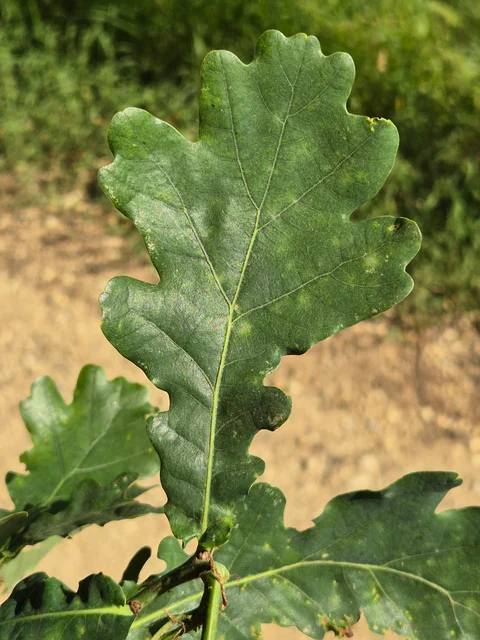
Saint Nicholas · rivers in 1758

Bridges put to the winter test

Crossing the river was part of everyday life.

Includes an activity to try →Explore: Cross, sail or water? →
Read here and view sources

The São Nicolau account of 1758 describes three wooden bridges. It says that winter waters sometimes covered the two higher ones and even swept some bridges away. This is historical testimony about floods and routes, not a way to assess the safety of today’s crossings. The document names Sendim, Cerdeiró and Ponte do Gado: these crossings helped connect the church with settlements in the parish.

The description goes beyond the force of floods. It mentions a watercourse with many falls, difficult to ford and, in some stretches, even difficult to follow along its banks. The bridges answered that challenge of the terrain.

The Sendim bridge lay on the route from the church to that settlement; the Cerdeiró bridge served the direction of Breia. Ponte do Gado was lower than the other two and gave its name to the point where the branches from Bucos entered. These details connect paths with waterways without fixing every structure’s position on a modern map.

Getting to know the parish
Source and context

Basto Land Museum — St Nicholas Parish Memories (1758)

Accessed: . Editorial summary; the date of consultation is not the date of the facts.

Passos · relief and water

A mountain and a river to locate Passos

Wooded hillside and houses in the photograph identified by its author as Passos, Cabeceiras de Basto.
Landscape of Passos · slope and house; the river referred to in the text is not identified in the image.© Elisabeth LEITEⓘ

Two names help you read the municipality’s south-west.

Includes an activity to try →Explore: From landscape to work →
Read here and view sources

The Serra da Orada and River Petimão help locate Passos in south-western Cabeceiras. The municipal description highlights rugged terrain and farming, beside the municipalities of Celorico de Basto and Fafe.

The church of São Sebastião, wayside crosses and alminhas shrines add built landmarks to the landscape. River, mountain and heritage offer complementary clues to this place; they do not form a walking itinerary here or confirm access.

In its description of Passos, the municipality also mentions neighbouring former parishes: Outeiro, Refojos and Alvite. This local scale helps place the mountain and river within a shared territory. Administrative boundaries and landscape features are different ways of reading the same space.

Getting to know the parish See Fact sheet: Passos
Source and context

Municipality — landscape of Alvite e Passos

Accessed: . Editorial summary; the date of consultation is not the date of the facts.

Toasters · Abadim

A village above a thousand metres

In Torrinheiras, the landscape begins at altitude.

Includes an activity to try →
Read here and view sources

The municipality presents Torrinheiras, in Abadim, as its highest settlement, at around 1020 metres. The trail climbs into the hills and reaches 1159 metres. These are two distinct altitude references: the village and a point on the route, not the walk’s cumulative ascent.

The panorama description names Gerês, Alvão, Marão and Barroso. Lower down, it mentions the Busteliberne stream, Porto d’Olho and, on the return, meadows and grazing Barrosã and Maronesa cattle. The mountains therefore tell a story of distances and views, but also of water, villages and work. Visibility and trail conditions need to be assessed when visiting.

Getting to know the parish See Fact sheet: Trilho de Torrinheiras
Source and context

Municipality — Trilho de Torrinheiras, altitude, landmarks and landscape

Accessed: . Editorial summary; the date of consultation is not the date of the facts.

Rio Douro · Parish memories of 1758

Two rivers tell a parish’s story

The 1758 account describes Rio Douro between east and west.

Includes an activity to try →Explore: Water linking villages and works →
Read here and view sources

In the 1758 account, the Vilela river flowed to the east and the Rio Douro river to the west, both from north to south. The parish priest described their origins in small springs and their waters increasing with contributions from the mountains. He said the Vilela entered the Tâmega below Cavez bridge and the other joined the river coming from São Nicolau. These are the names and geographical relationships in that document, not a current navigation map.

Bridges bring that geography closer to village life. The document mentions a wooden crossing between Magusteiro and Teixugueiras and a stone one between Teixugueiras and the church. It also refers to wooden links from Eiró and Rio Douro to the church, and a stone one between Vilela and the church. Water and paths therefore appear in the same portrait of the parish.

The priest describes rivers with rocks, weirs and waterfalls, unsuitable for navigation but useful to mills and fields. They were more than lines separating places: they belonged to work and travel. These references come from the testimony signed on 22 May 1758; they do not confirm the survival of structures or present access to the banks.

There is a clue to imagining the relief: the author describes three parallel mountain ridges extending from Salto, with rivers in the lower spaces. The ridges’ names varied between places. Rather than seeking a single name for each mountain line, the document invites us to connect position, villages and the direction of water.

Words in this story: see explanations →Getting to know the parish
Source and context

Municipality of Cabeceiras de Basto — Parish memories of 1758: Rio Douro

Accessed: . Editorial summary; the date of consultation is not the date of the facts.

Rio Douro · water uses in 1758

In summer, the water took other paths

Irrigation channels linked river flows to work in the fields.

Includes an activity to try →Explore: Water connected jobs and places →
Read here and view sources

The 1758 account describes both Rio Douro rivers flowing all year but reaching the end of their course with little water in summer. The vicar linked this reduction to the many irrigation channels supplying the fields. Weirs, waterfalls and mills formed a landscape of varied work.

Crossings varied too: the account mentions wooden bridges between settlements and the church, as well as stone bridges at Teixugueiras and Vilela. The banks were not just places of production; people needed to cross from one side to the other. This historical list does not identify surviving structures or current access.

The document also explains why boats did not use the rivers: there were rocks, waterfalls and weirs, as well as insufficient flow for navigation. A river could matter to the parish economy without serving as a waterborne transport route.

On cultivated banks, the account mentions oaks supporting vines; beyond the fields, heather scrub. Water therefore helped organise a landscape where cultivation, vegetation and structures met. The response was signed on 22 May 1758: summer is described as a usual seasonal pattern, not a measurement made that summer.

Words in this story: see explanations →Getting to know the parish
Source and context

Municipality of Cabeceiras de Basto — Parish memories of 1758: Rio Douro

Municipality — Parish Memoirs of Rio Douro, António Carneiro da Costa, 22/05/1758

Accessed: . Editorial summary; the date of consultation is not the date of the facts.

Outeiro · hydrographic network

A small river shapes the map too

In Outeiro, the Trutas joins the Peio.

Includes an activity to try →Explore: A tributary and water works →
Read here and view sources

The municipal description identifies the Trutas as a small tributary of the Peio flowing through Outeiro. Knowing this link helps us see waterways as a network beyond the better-known rivers. The name Trutas, meaning trout, does not in itself confirm those fish are present today.

Outeiro’s position also helps locate this network: the parish occupies the municipality’s western edge, beside Fafe. The municipal description presents a gently rolling plateau, with agriculture among the economic activities mentioned. Reading the territory means bringing these scales together: the municipal boundary, the relief and the small watercourse heading towards the Peio.

Try showing these relationships in a simple drawing. You do not need to reproduce an exact map: an arrow can indicate the rivers’ connection and another mark can place Outeiro on the western side of Cabeceiras.

Words in this story: see explanations →Getting to know the parish
Source and context

Municipality — Outeiro, relief and hydrographic network

Accessed: . Editorial summary; the date of consultation is not the date of the facts.

Bucos · 1758 account

Two rivers lost their names

Water connected mountains, mills and fields.

Includes an activity to try →Explore: Follows water of Bucos →
Read here and view sources

In 1758, the vicar of Bucos described two watercourses that eventually lost their names on entering the river of São Nicolau. One was Porto Souto, coming from the Serra da Maçã; the other, called the River Moinhos, had origins described in Carrazedo and Figueiró do Monte.

The account brings water and work together: cultivated banks, mills for cereals and water used in farming. It also mentions small wooden footbridges. Reading these elements together helps us imagine connections between fields, crossings and milling. The names and uses belong to the 1758 document; they do not automatically identify watercourses or structures found on the ground today.

Porto Souto is described as flowing all year despite its low volume, with small falls along its north-to-south course. The other watercourse had a calmer current. The vicar records trout and fish called escalos in both: his attention moves from flowing water to fish and then to cultivated banks. A river need not be large for its importance to parish life to become clear.

The text also compares two scales of crossing: the Casares bridge on a busy road and pedestrian crossings made from a single wooden beam. The author stresses the need to improve the former. The river therefore appears linked both to farmers’ daily work and to travel beyond the parish.

Getting to know the parish
Source and context

Municipality — Parish memories of Bucos (1758)

Accessed: . Editorial summary; the date of consultation is not the date of the facts.

Alvite · 1758 account

Storing water from the hillside

Small springs helped irrigate the fields.

Includes an activity to try →
Read here and view sources

In the 1758 account, the vicar of Alvite described small springs in the Serra da Orada. Residents held this water in pools to benefit east-facing fields. Storing water was a way of dealing with scarcity.

The same document described the parish as dry, particularly in summer, and noted the absence of grain mills and fulling mills. Two olive-oil mills worked with oxen and other animals; to grind cereals, many residents went to neighbouring parishes. The account links natural resources, techniques and journeys without establishing that the same uses or structures survive today.

Getting to know the parish
Source and context

Basto Land Museum — Parish Memories of 1758: Alvite

Accessed: . Editorial summary; the date of consultation is not the date of the facts.

Gondiães and Vilar de Cunhas · memory and landscape

Vilar looks towards the Beça

Houses, hillside and water shape the village landscape.

Includes an activity to try →Explore: From the slope to the paths →
Read here and view sources

The municipal village guide highlights Vilar’s church and thatched buildings on a slope facing the Beça landscape. Its description connects built heritage, farming, livestock and crafts.

Reading that introduction invites you to connect different scales: a house’s roof, the village as a whole and the valley opening before it. This is a way to explore the territory through documented features, not current confirmation of every roof’s condition or access to the river.

The guide grew from a partnership between Cabeceiras de Basto and Vieira do Minho through the Serra da Cabreira Interpretation and Activities Centre. Its introduction seeks to bring visitors closer to the villages and their people. In Vilar, landscape is connected with work: fields, livestock and crafts help us read the place beyond its valley view.

Getting to know the parish
Source and context

Municipality — Village Guide of Serra da Cabreira: landscape, work and heritage

Accessed: . Editorial summary; the date of consultation is not the date of the facts.

São Nicolau · 1758 account

Water irrigated fields and made olive oil

One river, different kinds of work.

Read here and view sources

In 1758, the parish priest of São Nicolau described irrigation channels serving fields and water powering an olive-oil mill at Quinta da Taipa. One channel served Gondarém, Frágua, Penedo and Lamelas. The account helps us imagine the link between river, irrigation and production. It distinguishes three continuous channels: one for those settlements and two for the estates of Bouças and Taipa. It also mentions mills supplied by weirs.

The description includes a smaller watercourse to the west, originating in springs on the hills of Lapela and Celeiró. On this river, the rector mentions mills and a channel serving the fields of Casal. He recalls two others intended for Quinta da Taipa, one of them ruined. The water-use network therefore included structures in use and others that no longer worked as before.

This detail helps us understand water-powered heritage as ongoing work: a channel’s existence in an old account does not guarantee its use in another period. The source also distinguishes settlements’ shared uses from estate channels, allowing comparison of different relationships between water, fields and owners.

Getting to know the parish
Source and context

Basto Land Museum — St Nicholas Parish Memories (1758)

Accessed: . Editorial summary; the date of consultation is not the date of the facts.

Landscape and garden · Painzela

Water shapes the garden at Piellas

Among the clipped shrubs, there are other paths to follow.

Includes an activity to try →Explore: The garden within the landscape →
Read here and view sources

At Piellas, water helps connect garden, woodland and fields. The description published by Revista Jardins places an L-shaped pool beside the wall, near a passage to the Casa do Boal woodland. Another pool, surrounded by bamboo and box, opens towards a cultivated field bordered by woodland. The water continues to the Painzela stream.

The article also describes paths shaded by vine pergolas and a farmyard associated with former maize and wine production. The estate therefore brings together places for leisure and work: its garden of clipped shrubs belongs to a wider landscape.

Try imagining the estate in layers: terraces, paths, vegetation and the water system. The description connects these elements but does not provide a complete map of the water circuit. Piellas is private property; consult the place profile for visiting conditions.

See Fact sheet: Casa de Pielas, jardins e anexos
Source and context

Jardins Magazine — Gardens of Portugal: Route of the Tâmega, section Casa de Piellas

Accessed: . Editorial summary; the date of consultation is not the date of the facts.

Geology and relief of the municipality

Read the mountains in their rocks

Before paths and houses, there was a landscape of rock.

Explore: From rock to field, follow the materials →
Read here and view sources

The municipality’s Archaeological Survey describes large granite outcrops bearing signs of erosion. The terrain descends from the southern edge of Cabreira towards the Tâmega basin in a succession of hilltops. Looking at these shapes helps connect mountain and valley: rock belongs to the territory’s history even when no one has worked it.

A rock can change without moving. This alteration is called weathering: it may involve physical fragmentation, chemical changes in minerals or the action of living things. The British Geological Survey gives simple examples: roots widening cracks, water freezing and expanding in fractures, or rainwater reacting with minerals. These are general mechanisms, not explanations that can be assigned to every block found in Cabreira.

When materials are removed and transported by water, wind or ice, erosion comes into play. The distinction helps us imagine two stages: the rock changes, then some of its material may travel. The stages need not proceed at the same rate, and a fragment need not reach the river directly.

This reading journey ends on the Tâmega’s lowland fields, where the municipal source describes deposits of sand and clay. Between exposed rock and a lowland field, different questions arise: what is the rock made of, how does it change, and where do transported materials end up?

Words in this story: see explanations →
Source and context

Municipality — Archaeological Charter: Orography and geology

British Geological Survey — Weathering: physical, chemical and biological alteration of rocks

Geological Society — Weathering: difference between change and erosion

Accessed: . Editorial summary; the date of consultation is not the date of the facts.

Geology of Vila Nune and Gondiães

Not every rock is granite

Vila Nune and Gondiães reveal another part of the geological map.

Explore: The same landscape, different processes →
Read here and view sources

Among the granites, the Archaeological Survey identifies two areas of Palaeozoic metasedimentary rocks. The Vila Nune area extends north-westwards along the Peio; the Gondiães area flanks the Beça. These references help explain the diversity underground; they are not visitor stops or collecting sites. The landscape gains another layer when we consider what it is made of.

To understand the name, separate two stages. Sediments can accumulate, become buried and consolidate into sedimentary rock. If that rock undergoes metamorphism, it changes under conditions such as high temperature and pressure. The term metasediment records this sedimentary origin followed by transformation.

Metamorphism does not mean melting: the USGS explains that transformation happens without the rock becoming magma. Minerals can reorganise or give way to others. In some rocks, elongated or flattened minerals become aligned and form a layered structure called foliation. Not every metamorphic rock has it.

These are tools for interpreting map terminology. They cannot assign a mineral, exact age or specific process to every stone in Vila Nune or Gondiães from its appearance alone. That requires connecting observation with mapping and geological study.

Words in this story: see explanations →
Source and context

Municipality — Archaeological Charter: Orography and geology

British Geological Survey — Rocks and minerals: rock formation, cooling and exposure

U.S. Geological Survey — What are metamorphic rocks?

Accessed: . Editorial summary; the date of consultation is not the date of the facts.

Municipal hydrographic network

The water here reaches the Douro too

The rivers belong to a larger network.

Includes an activity to try →Explore: The way from the water to the Douro →
Read here and view sources

The Ouro, Beça and Cavez stream enter the Tâmega on its right bank; the Tâmega is a tributary of the Douro. The municipal environmental report traces this connection between rivers: a map of Cabeceiras continues far beyond the municipality’s boundaries.

A river basin includes the land that channels water through streams and rivers to a shared outlet to the sea. It is more than a blue line on a map. The APA also distinguishes a sub-basin, whose drainage converges on a point in a watercourse, such as a confluence.

In this story’s diagram, names show connections between waterways, not the boundaries of their basins. To understand a river, we need to include the land that supplies its water. That connection leads from tributaries to soil erosion and life along the banks.

Words in this story: see explanations →
Source and context

Municipality — Environmental Report of the PDM review, February 2025, p. 56

Portuguese Environment Agency — water resources and associated concepts

Accessed: . Editorial summary; the date of consultation is not the date of the facts.

Relief of the municipality

From mountains to valley, the map changes height

Look at Cabeceiras from north to south.

Includes an activity to try →
Read here and view sources

The 2025 environmental report places most areas above 800 metres in the north. To the south, beside the Tâmega, land lies below 200 metres. This contrast helps us read the relief: the landscape opens from mountain towards valley. The Archaeological Survey describes the hills as a south-facing amphitheatre. It also links the narrow strips of the northern parishes with their sharing of mountain and valley: the lived territory does not end at a single altitude.

These figures describe parts of the municipality, not two uniform levels. The report characterises the relief as becoming gentler southwards towards the Tâmega. On a walk, a village, a hillside and a valley floor can help us ask questions of the map: where does each place lie, and how does it relate to water?

A difference in altitude is not a walking distance either. Saying two points lie at different heights tells us neither how far we walk between them nor the gradient of the whole route. This story helps interpret the territory; route conditions require their own information.

The dominant direction has exceptions too. The Archaeological Survey highlights waters descending the slopes of Senhora da Orada and entering the Peio. A south-facing landscape therefore does not mean every stream follows a parallel line to the Tâmega. Valleys and tributaries are part of that organisation.

Source and context

Municipality — Environmental Report of the PDM review, February 2025, p. 50

Municipal Archaeological Charter — Orography and geology

Accessed: . Editorial summary; the date of consultation is not the date of the facts.

Geology and agriculture · lowlands of the municipality

The river helps explain the fields too

Near the Tâmega, the ground holds another story.

Includes an activity to try →Explore: Same territory, three looks →
Read here and view sources

On low ground near the Tâmega, the Archaeological Survey describes accumulations of sand and clay associated with some of the lowland fields offering the greatest farming potential. The contrast is clear: large granite outcrops dominate the slopes; beside the river, deposited materials help explain another way of farming. The same introduction shows hills descending southwards, with waterways seeking the Tâmega and its tributaries. It is not a soil map of each field, but a key to reading the whole landscape.

Words in this story: see explanations →
Source and context

Municipality — Archaeological Charter: Orography and geology

Accessed: . Editorial summary; the date of consultation is not the date of the facts.

Mineral resources · geological description of the municipality

There is more to a rock than meets the eye

Wolframite and cassiterite are part of Cabeceiras’s geological picture.

Read here and view sources

The municipality’s Archaeological Survey describes a geological setting rich in wolframite and cassiterite. These names add a mineral dimension to the landscape of granite and metasedimentary rocks: they describe the composition underground, beyond the shape of the hills.

Wolframite contains iron, manganese and tungsten. Virtual Microscope, a project involving the Open University and Royal Cornwall Museum, explains its importance as a tungsten ore. Cassiterite is a tin oxide with the formula SnO₂ and an important commercial source of that metal, according to the USGS. They are different minerals associated with different metals.

A mineral is not the same thing as the metal that can be obtained from it. Wolframite is not a piece of metallic tungsten, just as cassiterite is not ready-to-use tin. These names are interesting precisely because they connect matter found in nature with materials transformed by people.

The municipal description confirms the local geological reference. International sources help explain the minerals, but their mining examples belong to other territories. None of these explanations identifies a mine to visit, an active operation or a collecting site here.

Words in this story: see explanations →
Source and context

Municipality — Archaeological Charter: Orography and geology

Open University / Royal Cornwall Museum — Virtual Microscope: Wolframite

USGS — Tin Statistics and Information: cassiterite as a tin source

Accessed: . Editorial summary; the date of consultation is not the date of the facts.

St Nicholas and Painzela · hydrography in the testimony of 1758

Two rivers meet at Ranha

A document lets us follow water between parishes.

Explore: Follow water in document →
Read here and view sources

The 1758 São Nicolau account places the meeting of the river crossing the parish with the one from Painzela at Ponte da Ranha. It then describes their combined flow heading towards the Tâmega near Cavez bridge. This is a historical reading of the water network connecting the territory, not a suggested riverside walk.

Before that meeting, the priest follows São Nicolau’s river from the hill called Víbora. He describes a modest spring receiving other streams, its flow strengthened at Ponte do Gado by two branches from Bucos. He mentions water throughout the year and a particularly strong winter flow.

The text also follows changes of direction: south, then east, then south again. It tells the landscape through the movement of water. Springs, tributaries and confluence explain different stages; the author’s names belong to the testimony signed on 22 May 1758.

Notice the sequence of meetings: the Bucos branches first strengthen São Nicolau’s flow; water from Painzela joins at Ranha; their shared destination is the Tâmega. Drawing these junctions helps distinguish a river’s course from the network of contributions feeding it.

Words in this story: see explanations →
Source and context

Basto Land Museum — St Nicholas Parish Memories (1758)

Accessed: . Editorial summary; the date of consultation is not the date of the facts.

Abadim · intervention in Peio in 2017

Wood, stone and coir on the banks of the Peio

At Ranha, restoring the river also meant choosing materials.

Includes an activity to try →Explore: Taking care of the margins in many ways →
Read here and view sources

At Ranha, the riverbank tells a story of construction too. The work inaugurated on 17 June 2017 combined stone, wood, coir and native plants. According to the municipal news report, it aimed to stabilise the Peio’s banks, restore riverside vegetation and ecologically rehabilitate the leisure area in Abadim.

The work extended to supporting facilities: parking, the building and toilets, the bridge and the road’s retaining wall. Work on the river belonged to a wider project bringing landscape and public use together.

The municipality linked the project to compensation and mitigation measures associated with the Daivões dam, with financial support from Iberdrola. This helps explain the work’s context beyond its visible materials. The report documents 2017; it does not establish that facilities operate today or that the water is suitable for bathing. Consult practical information in Ranha’s place profile.

See Fact sheet: Zona de Banhos da Ranha
Source and context

Municipality — inauguration of the renaturalization of Peio margins, news of 20/06/2017

Accessed: . Editorial summary; the date of consultation is not the date of the facts.

Rio Douro · project announced in April 2025

On the common lands, woodland meets waterways

A Rio Douro project reveals different roles within one landscape.

Includes an activity to try →Explore: The slope meets the river →
Read here and view sources

In April 2025, Antarr announced the start of work agreed with the Comunidade Local dos Baldios de Riodouro, covering around 500 hectares of Cabreira partly affected by the 2016 and 2024 fires. The plan combined forestry production, conservation and the restoration of about 40 hectares of riverside vegetation. It shows that managing a hillside also involves areas beside water. These figures are the promoter’s announced targets, not confirmation of completed work or achieved results.

The April announcement places the start of work in February 2025. For the first phase, it announces around 220 hectares of production species and approximately 80 hectares of varied broadleaved trees and conifers. These areas have different purposes; they are not a record of completed planting.

Relief also enters the project: the promoter describes plateaux, steep slopes and large variations in altitude. Reading the landscape therefore brings together landform, production areas and sensitive zones beside water. There is no complete breakdown of the 500 hectares here from which to draw every plot.

Source and context

Antar — announcement of the start of the Riodouro project, 04/04/2025; objectives announced by the promoter

Accessed: . Editorial summary; the date of consultation is not the date of the facts.

Refojos · opening in 2013 and urban transformation

A stream in the story of Casa do Tempo

Renewing the town centre also involved water.

Includes an activity to try →Explore: Memory, buildings and water →
Read here and view sources

Casa do Tempo opened on 2 August 2013 beside the Monastery of Refojos. In the municipal description, restoring former tenant farmers’ houses belonged to a wider transformation: linking Praça da República with newer parts of town, creating green spaces and improving the banks of the Penoutas stream. The interpretation centre therefore brings two stories together: Cabeceiras’s memory and the changing urban landscape.

The municipality describes acquiring some of the vacant houses and the negotiations preceding the work. Reusing buildings and transforming their surroundings appear as parts of one project rather than separate stories.

The centre’s multimedia component was presented as a way to explore territory, people, nature, customs and everyday practices. The stream is therefore more than scenery: it belongs to the story of how this part of town gained new functions. For planning a visit, the place profile brings together available practical information.

See Fact sheet: Casa do Tempo
Source and context

Municipality — Casa do Tempo: opening in 2013 and requalification of the surroundings

Accessed: . Editorial summary; the date of consultation is not the date of the facts.

Saint Nicholas · environmental history of 1758

Fish that entered the written record

An old document also describes life in the rivers.

Includes an activity to try →Explore: Three Ways to Know a River →
Read here and view sources

The São Nicolau account lists trout and fish called bogas and escalos in the main river, in small numbers. In the smaller watercourse, it mentions small trout. These are names used in the 1758 document, not scientific identifications or confirmation of present populations.

Domingos Camelo de Sousa distinguishes the watercourses before discussing fish. The main one received two branches from Bucos near Ponte do Gado; the smaller one rose in springs on the hills of Lapela and Celeiró and continued to Painzela. This location gives context to the animal names. The account also comments on the fishes’ taste, revealing a view connected with food rather than the method of a biological survey.

Source and context

Basto Land Museum — St Nicholas Parish Memories, 22 May 1758

Accessed: . Editorial summary; the date of consultation is not the date of the facts.

Geological complex of Cabeceiras de Basto · regional study

Granite varies in grain size too

A seemingly uniform rock can reveal differences up close.

Includes an activity to try →
Read here and view sources

In A. Almeida’s study, granite from the Cabeceiras de Basto complex does not have a single grain size. The classification uses three average ranges: 0.5–1 millimetre for fine grain, 2–4 millimetres for medium grain and 5–7 millimetres for coarse grain. In the last group, the author also mentions rare larger crystals measuring 8–10 millimetres.

This distinguishes two observations: the usual grain size and the presence of a few crystals that stand out. The description does not turn every visible point in a photograph into a measurement. Comparing sizes in an image requires a scale; magnification on a screen can make small grains look large.

The study identifies three genetically independent series despite their similar chemical-composition ranges. Appearance is a starting point for investigation, not the entire explanation of origin. In a wall or façade, grains spark curiosity, but do not alone prove where the stone came from.

Words in this story: see explanations →
Source and context

A. Almeida (1998) — Metallurgical specialisation of the peraluminous granites of two micas of the Cabeceiras de Basto complex, IGM 84(1), B-79–B-82; p. 325 of the PDF

Accessed: . Editorial summary; the date of consultation is not the date of the facts.

Geological complex of Cabeceiras de Basto · dating cited in the study

A story millions of years old

A rock’s age and a landscape’s shape are different questions.

Explore: Three questions for the same stone →
Read here and view sources

A. Almeida’s paper refers to dating the Cabeceiras de Basto complex by the uranium–lead method, using zircon and monazite. The cited result is a minimum age of 311 ± 1 million years. This is a geological reference to the rock formation studied: it does not date the construction of a wall or establish when a hillside acquired its present shape.

The article forms part of the proceedings of the fifth National Geology Congress, published in 1998. For this value, Almeida refers to geochronological work with other authors listed in the bibliography. This chain of references explains where the number comes from: a research result, not an age estimated from colour or grain size.

Reading a landscape means separating timescales. The age assigned to a rock complex is one matter, the transformation of the relief another, and the moment a stone was used in a building another still. All three stories can meet in the same wall, but they require different evidence.

Source and context

A. Almeida (1998) — Metallurgical specialisation of the peraluminous granites of two micas of the Cabeceiras de Basto complex, IGM 84(1), B-79–B-82; p. 325 of the PDF

Accessed: . Editorial summary; the date of consultation is not the date of the facts.

Council · Water resources in the 2025 report

There is water beneath the ground too

The map of water resources does not end at the surface.

Includes an activity to try →Explore: Look at the water in different ways →
Read here and view sources

For groundwater, the municipal environmental report of February 2025 identifies units of the Undifferentiated Ancient Massif associated with the Douro, Ave and Cávado basins. In the same document, the municipality’s surface-water bodies belong to the Douro River Basin District. These are different readings of the territory: rivers at the surface and water underground. The reference does not identify wells to visit or assess the water in any spring.

How does water fit inside rock? The USGS explanation points to pores and fractures: spaces between particles and cracks that can contain water. Porosity describes the available spaces; permeability describes how easily water flows through the material. Spaces alone are not enough: the connections between them matter too. This is a general explanation, not a measurement of Cabeceiras’s rocks.

Source and context

Municipality — Environmental Report of the PDM review, February 2025, pp. 56–58: water network and resources

USGS — Water Science School: groundwater, porosity and permeability

Accessed: . Editorial summary; the date of consultation is not the date of the facts.

Refojos and São Nicolau · uses described in 2025

Water brings power and irrigates fields

One landscape brings together different uses.

Explore: From moving water to electricity →
Read here and view sources

The 2025 environmental report connects water resources with electricity production and irrigation. It identifies the Cefra hydroelectric plant in Refojos and the small hydropower plant at São Nicolau. These are documentary references to water uses, without confirmation of public access or current operation. Connect them with the stories of mills and irrigation channels: the relationship between water and work spans different periods.

How does a current become electricity? Water turns a turbine connected to a generator. Flow and height difference influence the available energy, explains the Department of Energy. This is the general principle explored by the diagram, not a description of the specific equipment at either local installation. Irrigating fields, grinding grain and generating electricity are different uses of a resource connected with the landscape.

Words in this story: see explanations →
Source and context

Municipality — Environmental Report of the PDM review, February 2025, pp. 56–58: water network and resources

U.S. Department of Energy — How Hydropower Works: turbine, generator, flow and downgrade

Accessed: . Editorial summary; the date of consultation is not the date of the facts.

Climate of the municipality · characterization in the report of 2025

The landscape follows a rhythm of rain and warmth

The same place tells different stories throughout the year.

Includes an activity to try →Explore: The same landscape, different questions →
Read here and view sources

The 2025 environmental report describes colder, wetter winters, with the most rain in December and January, and warmer, drier summers. July and August stand out for their heat. This describes the climate, not the forecast for your next visit. To get to know a place, compare it in different months: water, leaves and flowers can offer new clues.

How is that picture built? The IPMA explains that climatological normals use 30-year periods. They bring together monthly and annual values for elements such as temperature and precipitation. A single month and a decades-long series therefore answer different questions.

When comparing charts, look for the location and reference period: averages calculated over different intervals need not coincide. Long series allow variations and trends to be studied. Observations on a walk help you know that day and place; they do not replace a climate series or, on their own, describe every altitude in the municipality.

Words in this story: see explanations →
Source and context

Municipality — Environmental Report, February 2025, pp. 50, 55 and 139

IPMA — Climate normals: periods and reference values

Accessed: . Editorial summary; the date of consultation is not the date of the facts.

Abadim · water and grinding in memory 1758

Two streams kept six mills working

Even a little water could keep a landscape moving.

Includes an activity to try →Explore: From water to food →
Read here and view sources

In 1758, the abbot of Abadim describes two streams descending southwards, meeting near Ponte de Pé and continuing to the Tâmega. There was little water, but it flowed all year. The account mentions trout and fish called bogas without identifying species by scientific names.

On the western stream, he notes Ranha’s dressed-stone bridge. Of the various mills on the two waterways, six belonged to the parish. This count identifies neither today’s buildings nor whether they were the same mills as the group now called Moinhos de Rei.

The abbot describes swift currents and neighbouring communities’ free use of the water. Little water and movement were therefore not incompatible in his account. The story gains another dimension beside the fields: the same document distinguishes cereals grown in different settlements. The streams belonged to a landscape of cultivation and processing, although the account does not say which mill received each village’s grain.

Words in this story: see explanations →
Source and context

Municipality — Parish memories of Abadim, José Antunes, 22/05/1758

Accessed: . Editorial summary; the date of consultation is not the date of the facts.

Council · environmental relations described in the report of 2025

A river begins before its banks

What happens on the land can travel with the water.

Includes an activity to try →Explore: Follow water to the surface and underground →
Read here and view sources

Water flowing over the surface can carry soil and nutrients into waterways. The municipal environmental report of February 2025 connects this process with erosion and incorrect use of fertilisers rich in phosphorus and nitrogen. Excessive nutrient enrichment can encourage eutrophication, changing the aquatic environment.

The document also distinguishes groundwater: it notes that excessive use of nitrogen fertilisers can contribute to nitrate accumulation and increased salinity. What happens on the land therefore matters both to the water we see flowing and to water underground.

These are potential pressures described in an environmental assessment. They do not identify a discharge in a particular field or let us assess a river by appearance. To understand the system, connect land, surface runoff and aquifers while keeping general possibilities separate from measurements at a site.

Source and context

Municipality — Environmental Report of the PDM review, February 2025, p. 59: land uses and water resources

Accessed: . Editorial summary; the date of consultation is not the date of the facts.

Gondiães · 2008 municipal inventory

Four pools and a shared irrigation channel

In Gondiães, storing and directing water was collective work.

Includes an activity to try →Explore: Store, drive and distribute →
Read here and view sources

Four pools supplied a shared structure. The municipal record of 20 March 2008 describes the Rego das Poças, also called Levada da Vizinhança, in Gondiães: around two kilometres of channel for irrigation and milling, serving the Tarroeiro mill.

The Poças do Lugar lay at Olheiros. Three were close together and the fourth further away. Up to the village entrance, the channel followed natural ground; within the settlement it became a stone trough. Storing and directing water therefore required different elements and materials.

The inventory identifies collective ownership and operation by the channel’s joint users, or consortes. It records seasonal water turns but leaves the construction period undetermined. The survey date is not the structure’s age. Its recorded use and condition belong to the picture of 2008, without confirming today’s situation or access.

Words in this story: see explanations →
Source and context

Municipality — inventory of levadas, fiche L29: Rego das Poças, withdrawal of 20/03/2008

Accessed: . Editorial summary; the date of consultation is not the date of the facts.

Saint Nicholas · hydraulic heritage inventoryed in 2008

A hollowed log channelled the water’s power

At Quinta de Covas, olive oil’s history meets the story of energy.

Explore: Water changes work →
Read here and view sources

The inventory of 27 February 2008 places the Quinta de Covas mill at Parada, in Cabeceiras de Basto parish. Water came from a channel with a weir on the Peio. Before reaching the horizontal waterwheel, it passed along a trough hollowed from a tree trunk: wood also formed part of this water-powered structure.

The building combined an olive-oil mill, a grain mill and a wine press. The record associates the closure of the grain and olive-oil mills in 1994 with a hydroelectric plant coming into operation and affecting the available motive power. This is the explanation recorded in that survey, not an independent assessment of the plant’s operation.

The document describes private heritage and equipment already lacking the parts needed for grinding. This story indicates neither public access nor present conservation conditions.

Source and context

Municipality — inventory of olive oil mills, record L.A.5, withdrawal of 27/02/2008

Accessed: . Editorial summary; the date of consultation is not the date of the facts.

Cabeceiras de Basto · windmill architecture studied in 2011

Grinding above, movement below

A mill is organised vertically too.

Includes an activity to try →Explore: From the water to the building →
Read here and view sources

The study shared by the Museum in 2011 describes two levels in Cabeceiras’s mills: the grinding equipment above and the driving mechanism below, in the cabouco. The building’s form follows how the machinery works. The survey records rectangular plans of varying sizes, with the exception of one circular-plan watermill.

Granite dominates the walls, but not every stone receives the same treatment. The study highlights points with particular construction demands: corners, doors, windows and parts through which water passes. At the corners, stones help bond the building together; lintels and jambs frame the openings. An irregular-looking wall can therefore coexist with carefully selected pieces.

This description belongs to the historical study, not an inspection of today’s buildings. To read the landscape, start with the water’s route, then ask where the driving force and the grinding work were located.

Words in this story: see explanations →
Source and context

Basto Land Museum — Mills Cabeceiras de Basto: construction form, 04/05/2011

Accessed: . Editorial summary; the date of consultation is not the date of the facts.

A world beneath the leaves

A first look at the fungi. Continue in the gallery to see the local records already documented.

Choose a story · 19
General knowledge · national guide

Gills, pores and other shapes

Not every cap has the same pattern underneath.

Includes an activity to try →Explore: What shape arouses your curiosity? →
Read here and view sources

The guide distinguishes groups with gills, folds, pores or spines. Naturalis describes white gills in Amanita muscaria and tubes with pale pores in Gyroporus cyanescens. These are two different ways of arranging the surface beneath the cap. One feature alone cannot identify a mushroom or establish whether it is safe to eat. Not all have a stem: some caps grow straight from wood. The Australian botanic gardens’ guide also shows cup-shaped forms and thin coverings on wood. Start observing with three questions: what is its outline, what does it grow on, and which surface can you see without disturbing it?

Words in this story: see explanations →
Source and context

DGADR / ICNF — Mushroom Collector's Guide, June 2013
Accessed:

Naturalis Biodiversity Center — Amanita muscaria
Accessed:

Naturalis Biodiversity Center — Gyroporus cyanescens
Accessed:

Australian National Botanic Gardens / Australian National Herbarium — Types of fungal fruiting bodies, Heino Lepp
Accessed:

Editorial summary; the date of consultation is not the date of the facts.

General biology · feeding of fungi

A meal prepared on the outside

Fungi do not need a mouth to obtain food.

Includes an activity to try →Explore: Transform, absorb and distribute →
Read here and view sources

A fungus does not need to swallow a leaf to use its nutrients. The mycelium releases enzymes outside itself; these break organic matter into simpler compounds, which the hyphae then absorb.

The network of threads also grows and branches. Connections between hyphae allow nutrients to travel to other parts of the mycelium. Something that seems motionless may therefore be exploring new spaces and redistributing resources without a mushroom appearing on the surface.

Growth also follows the distribution of food. The Australian National Botanic Gardens describe more branching and slower advance in nutrient-rich areas; where nutrients are scarce, hyphae may lengthen faster and branch less. The network does not always need the same density.

Some fungi form cords of hyphae called rhizomorphs. These can help cross gaps between food sources, such as two separate pieces of wood. On reaching fresh wood, the hyphae may branch and occupy it. This explains growth strategies, not a confirmed description of any thread found on a walk.

Words in this story: see explanations →
Source and context

Australian National Botanic Gardens / Centre for Australian National Biodiversity Research — The mycelium

Accessed: . Editorial summary; the date of consultation is not the date of the facts.

General biology · example of Laetiporus sulphureus

Shelves growing on a trunk

The reproductive structure can project out to the side.

Read here and view sources

In Laetiporus sulphureus, Kew describes yellow reproductive structures arranged like shelves on trees. The fungus acts on dead wood inside trunks and larger branches, contributing to its decomposition. This description explains a growth form; it does not confirm the species in Cabeceiras or allow other fungi to be identified by colour alone.

The yellow belongs to the structure visible outside; the fungus’s activity extends into the wood. Kew describes decay that turns it brown and can leave cavities inside. Looking only at the shelves therefore shows just part of the process. Its presence on a tree does not mean every part of the tree is dead: the text refers to dead wood inside trunks and branches. This description does not assess the stability of individual trees.

Source and context

Royal Botanic Gardens, Kew — In pictures: Fungi spotting season at Kew, Grace Brewer, 24/10/2019

Accessed: . Editorial summary; the date of consultation is not the date of the facts.

Abadim · local record and general biology

A small landscape on stone

A lichen’s raised structures bring relief to the rock.

Includes an activity to try →Explore: Still in the small world →
Read here and view sources

In Pedro Andrade’s photograph from 31 January 2025, a brownish-grey lichen has rounded bumps on a rock. The record is identified as Lasallia pustulata and located in Abadim by checking its public point against CAOP2025.

The University of Évora describes this species as saxicolous, meaning it lives on rock. Its thallus is umbilicate: it attaches to the surface only at its centre. The raised bumps on the upper face are another detail described by the source.

The photograph shows the relief but not the attachment point hidden underneath. Comparing what is visible with what the description explains is a way to learn without lifting or detaching the lichen.

Évora’s profile describes a single lobe that can reach ten centimetres, with small branched structures called isidia along its edges. The surface may have a whitish coating called pruina. Outline, edge and relief are three different observations; no measurement should be estimated from the photograph without a known scale.

Words in this story: see explanations →
Source and context

University of Évora — Biodiversity of Mitra, Lasallia pustulata

Accessed: . Editorial summary; the date of consultation is not the date of the facts.

General knowledge · national guide

The mushroom is only one part

There is a network we do not always see.

Includes an activity to try →Explore: Mushroom, mycelium and spores →
Read here and view sources

A mushroom is a reproductive structure; the body of many fungi is a network of threads called mycelium. Each thread is a hypha. CCRES describes this network colonising living or decaying organic matter, from which the fungus obtains nutrients.

The fruiting body develops from the mycelium and allows spores to disperse. If conditions are favourable, they can give rise to new mycelium. The visible mushroom tells only part of the life cycle; not all fungi produce cap-shaped structures.

When some decomposer species are cultivated, mycelium can develop in inoculated logs. The same log can produce mushrooms for several years while conditions and nutrients remain suitable. This general explanation neither identifies a species nor documents its occurrence in Cabeceiras.

The network can also form cords called rhizomorphs. In certain wood-inhabiting fungi, these help bridge gaps between branches or logs to reach another food source. An outer layer protects the inner hyphae during this exploration.

Another strategy is to form sclerotia: compact masses of hyphae with a resistant covering. They allow fungi to survive unfavourable periods and, when conditions improve, can produce mycelium or reproductive structures. These are forms of growth and survival described by the Australian botanic gardens, not local records.

Words in this story: see explanations →
Source and context

DGADR / ICNF — Mushroom Collector's Guide, June 2013
Accessed:

Centre for Silvestre Resources Skills — production mushrooms
Accessed:

Silvestrian Resource Competence Centre — General Mycology
Accessed:

Australian National Botanic Gardens / Centre for Australian National Biodiversity Research — The mycelium
Accessed:

Editorial summary; the date of consultation is not the date of the facts.

General ecology · decomposition

A fallen leaf still has a journey ahead

In the soil, matter changes hands.

Includes an activity to try →Explore: Three ways to feed a fungus →
Read here and view sources

A fallen leaf can become food for decomposer fungi. They absorb nutrients from dead organic matter and help recycle it. The material matters: some fungi are associated with leaves, wood or humus. Decomposition describes a feeding relationship; the shape of a cap alone does not explain that way of life.

Protecting this underground life also involves how soil is treated. In the Gulbenkian Garden interview, Susana Gonçalves explains that excessive soil disturbance and compaction can damage mycelial networks. This is general conservation guidance, not an assessment of any particular piece of land in the municipality.

Names offer clues to the growing surface too: foliicolous fungi grow on fallen leaves, lignicolous fungi on wood and humicolous fungi in decaying plant remains. These words describe where they live, not species names. In the same landscape, different materials offer different food possibilities; leaving a leaf or branch in place also preserves part of that context.

Words in this story: see explanations →See local fungal records
Source and context

Silvestrian Resource Competence Centre — General Mycology
Accessed:

Gulbenkian Garden — ecology of fungi, with Susana Gonçalves (17/04/2023)
Accessed:

Editorial summary; the date of consultation is not the date of the facts.

General ecology · wood and biodiversity

A log can be a little home

Decaying wood is still full of connections.

Includes an activity to try →Explore: A log opens several stories →
Read here and view sources

A fallen log remains part of woodland life. Fungi break down its wood, which also supports other organisms, including insect larvae. Researcher Susana Gonçalves explains that some tree cavities result from fungal activity and can later shelter animals. A standing tree with cavities and a log on the ground offer different things to observe. In green spaces, retaining veteran trees requires assessment and monitoring of the risk of falling. This ecological explanation does not confirm a connection between the beetle photographed in Cabeceiras and a particular tree.

But wood does not always decay in the same way. In white rot, fungi break down lignin and cellulose; the wood may become pale, fibrous or spongy. In brown rot, decay mainly affects cellulose and hemicellulose, leaving a brownish residue rich in lignin. Wood may become brittle and break into small blocks. The University of California distinguishes these processes by their effects on wood components.

White and brown describe the decay, not the colour of a mushroom cap. They are not species names either. A visible reproductive structure on a trunk reveals only part of the story: decay may extend upwards or downwards and remain hidden. A photograph cannot measure that extent or assess a tree’s stability.

Words in this story: see explanations →See local fungal records
Source and context

Gulbenkian Garden — ecology of fungi, with Susana Gonçalves (17/04/2023)

University of California — Wood Decay Fungi in Landscape Trees (revised August 2019)

Accessed: . Editorial summary; the date of consultation is not the date of the facts.

General biology · reproduction

A journey almost nobody sees

A mushroom can release thousands of spores.

Includes an activity to try →Explore: The exit and journey of spores →
Read here and view sources

The structure we see on the surface helps the fungus reproduce and disperse its spores. When conditions are favourable, these can produce new mycelium. A mushroom’s appearance is therefore one moment in a larger life cycle that continues beyond our sight. Wind and animals can carry spores. Some fungi can also produce independent networks from fragments of their mycelium: not all reproduction depends on spores. A spore is not a miniature seed: the American Phytopathological Society explains that it contains no embryo, although it has reserves for germination.

Words in this story: see explanations →
Source and context

Silvestrian Resource Competence Centre — General Mycology
Accessed:

Royal Botanic Gardens, Kew — Mycelium: Exploring the hidden dimension of fungi, Eddie Johnston and Grace Brewer
Accessed:

American Phytopathological Society — Introduction to Fungi: reproduction and growth
Accessed:

Australian National Botanic Gardens / Australian National Herbarium — Spore release and dispersal, Heino Lepp
Accessed:

Editorial summary; the date of consultation is not the date of the facts.

Knowledge of nature · General biology

A lichen is a partnership

The world of fungi goes far beyond caps.

Includes an activity to try →Explore: From surface to invisible relationships →
Read here and view sources

In a lichen, a fungus associates with an alga or cyanobacterium capable of photosynthesis. The photosynthetic partner provides nutrients; the fungus helps protect it from drying and radiation.

The University of Évora describes crustose, foliose and fruticose forms, among others. This offers a new way to notice surfaces and textures without confusing colour with identification. This story explains lichen biology; it is not an inventory of species confirmed in Cabeceiras.

Reproduction can carry the partnership too: lichen fragments can disperse both partners together. By contrast, the fungus’s spores need to encounter a photosynthetic partner to form a new lichen.

The shapes can resemble a crust, divided leaves or small shrubs. These words describe appearance, with boundaries that are not always rigid. Lichens are not mosses either: mosses are plants, whereas lichens are classified with fungi.

The growing surface deserves attention too: lichens may grow on rocks, bark, soil and artificial surfaces. The University of Évora explains that identification combines appearance with substrate and habitat; sometimes it requires microscopy or other specialist methods. A photograph can record the encounter without resolving the name.

Another aspect is the study of air. Lichens can accumulate compounds from the atmosphere and are used as bioindicators or biomonitors. A patch on a wall cannot, by itself, classify a village’s air quality. That conclusion requires a suitable study, just as assessing a river combines different observations.

Words in this story: see explanations →
Source and context

University of Évora — Biodiversity of Mitra: Lichens

Australian National Botanic Gardens / Australian National Herbarium — What is a lichen?, Heino Lepp

Accessed: . Editorial summary; the date of consultation is not the date of the facts.

Abadim · photographed record and general biology

The marks on a cap can change too

A photograph captures only one moment in a mushroom’s life.

Explore: From hat to hidden life →
Read here and view sources

Naturalis describes Amanita muscaria with white spots that can disappear and a cap whose red colour can fade to paler orange or yellow tones. Its appearance is therefore not always the same. The photographed record from Abadim shows pale spots on a red cap; it does not follow the same specimen’s development. These details help explain the species, not identify mushrooms for consumption.

The shape changes too: Naturalis describes a cap that begins globose and expands until flat. The gills are white. Colour, spots and shape belong to a developing organism, so an image should not be treated as an unchanging template for the species.

There is also a story underground. The source states that Amanita muscaria forms ectomycorrhizas, associations with tree roots. It mentions environments with broadleaved trees and conifers on sandy or peaty soils. The Abadim record documents the mushroom photographed; it identifies neither the partner tree nor that underground connection at that point.

Source and context

Naturalis Biodiversity Center — Amanita muscaria

Accessed: . Editorial summary; the date of consultation is not the date of the facts.

Saint Nicholas · photographed registration and general biology

Blue in the mushroom, straw-coloured spores

In a fungus, colours can tell different stories.

Read here and view sources

For Gyroporus cyanescens, Naturalis describes flesh that turns blue-green when damaged. The spore print, the deposit of spores, is pale straw-coloured. The local photograph shows a blue area on a specimen that had already been cut, but does not show the spores. This compares features in the scientific description; do not cut or taste mushrooms to try to confirm an identification.

Beneath the cap, the description gives pale tubes and pores that can turn blue when damaged. This is a different arrangement from the gills described in Amanita muscaria. Comparing the two stories helps distinguish a structure from its colour without handling new specimens.

Naturalis associates the species with woodland of deciduous trees such as oaks and beeches, on poor, acidic, sandy soils with little leaf litter. It also states that the species forms ectomycorrhizas. These characteristics describe its general ecology; they are neither a soil analysis nor an identification of the tree associated with the São Nicolau record.

Words in this story: see explanations →
Source and context

Naturalis Biodiversity Center — Gyroporus cyanescens

Accessed: . Editorial summary; the date of consultation is not the date of the facts.

Micorrizas · general ecology

Not every root makes a partner

Some associations are more specific.

Includes an activity to try →Explore: From root to landscape →
Read here and view sources

Partnerships are not all alike: some fungi associate with different plants, while others depend on a particular plant species.

Observing vegetation therefore helps us ask questions about what happens below ground. It does not, however, confirm which association is present at a particular point.

The partnership may involve trees, shrubs or herbaceous plants. The plant supplies organic compounds, while the association between roots and mycelium extends the search for water and nutrients. The plant partner is part of the fungus’s ecology, not just scenery around the mushroom.

Consider two different questions: “Which plants grow in this woodland?” and “Which plant does this fungus associate with?” The first can guide observation; answering the second requires knowledge of the association. Even in woodland with several tree types, seeing a mushroom near a trunk does not automatically identify its underground partner.

Source and context

Silvestrian Resource Competence Centre — General Mycology

Accessed: . Editorial summary; the date of consultation is not the date of the facts.

Fungal habitats · general explanation

From tree bark to meadow soil

Bark, leaves, wood or soil: the surface a fungus grows on offers a first clue.

Includes an activity to try →Explore: Start with support →
Read here and view sources

A fallen trunk, a layer of leaves and a pasture offer different environments for fungi. CCRES uses terms that help describe them: corticolous fungi live on tree bark; praticolous fungi grow in the soil of meadows and pastures.

There are other clues in this vocabulary. Lignicolous fungi grow on dead wood, foliicolous fungi on fallen leaves and humicolous fungi on decomposing plant remains. Coprophilous fungi are associated with animal dung. These terms describe a substrate or environment, not individual species.

When observing, start by recording where the visible structure appears: on bark, wood, leaves or soil? Keep this description separate from identification. Knowing where it grows helps us ask questions; it is not enough to identify a fungus, explain how it feeds in each case or establish whether it is edible.

Words in this story: see explanations →
Source and context

Silvestrian Resource Competence Centre — General Mycology

Accessed: . Editorial summary; the date of consultation is not the date of the facts.

General biology of fungi · no local occurrence attributed

A fungus without a cap

The world of fungi also fits beneath a microscope.

Explore: Three scales to discover →
Read here and view sources

Not all fungi form the mushrooms we recognise. Kew describes microfungi, including moulds, that can produce spores directly on their hyphae. Looking only for visible caps therefore leaves out part of this kingdom. This explains biological diversity; it does not identify moulds on food or plants in the municipality.

Even among fungi with larger reproductive structures, not everything appears above ground. Kew uses truffles as an example of underground fruiting and explains the role of animals in spreading their spores. A walk spent looking only for caps on the surface reveals just part of the diversity.

Mycelial networks also meet one another. The source distinguishes competition between incompatible fungi from joining between compatible partners. This is another reason not to imagine soil as a single, uniform network: it contains different organisms and relationships that a photograph of mushrooms cannot reveal.

Source and context

Royal Botanic Gardens, Kew — What in earth? Understanding what fungi really are, Eddie Johnston (07/10/2022)

Accessed: . Editorial summary; the date of consultation is not the date of the facts.

General biology of fungi · no local occurrence attributed

A drop can set spores travelling

Rain plays a part in dispersal too.

Includes an activity to try →Explore: What gets the spores moving? →
Read here and view sources

In certain rounded fungi, mature spores lie inside a sac with an opening. A raindrop compresses the air inside and releases a small cloud of spores. The impact starts the release; the wind can continue the journey.

The Australian source also describes other ways of opening a route out. In Scleroderma, the tough outer layer ruptures and exposes the spores to water and wind. In Calvatia and Pisolithus, the outer covering breaks down. The image of a sac squeezed by a drop therefore does not explain all rounded fungi.

Release and transport are two stages. A fungus may depend on an impact for the first and air currents for the second. In other cases, the reproductive mechanism itself launches the spores. Comparing these processes helps explain why so many forms exist. These are general examples, not records of these genera in Cabeceiras.

Source and context

Australian National Botanic Gardens / Australian National Herbarium — Spore release and dispersal, Heino Lepp

Accessed: . Editorial summary; the date of consultation is not the date of the facts.

General biology of fungi · no local occurrence attributed

Spores hitch a ride with insects

Not every journey starts with the wind.

Includes an activity to try →
Read here and view sources

Some fungi carry their spores in a sticky outer layer with a strong smell. The odour attracts flies that can carry them elsewhere. The Australian source also describes colours that sometimes resemble flesh and attract insects associated with it.

These are examples of dispersal, not a feature of all fungi or flies. They do not identify the species photographed in the municipality.

Release and transport are not necessarily the same step. In passive dispersal, the fungus depends on another agent to remove spores from its reproductive structure. In the fly example, the sticky layer holds the spores and the insect helps transport them. In other fungi, a drop can trigger release and the wind can continue the journey.

A single arrow labelled “wind” would therefore leave part of the story out. Compare the start of the journey, the carrier and the place where a spore arrives. Arrival does not guarantee the formation of new mycelium either: these are different stages of the cycle.

Source and context

Australian National Botanic Gardens / Australian National Herbarium — Spore release and dispersal, Heino Lepp
Accessed:

Silvestrian Resource Competence Centre — General Mycology
Accessed:

Editorial summary; the date of consultation is not the date of the facts.

General biology · no local occurrence assigned

There is life inside a plant too

A healthy leaf can shelter invisible fungi.

Explore: A plant, different relationships →
Read here and view sources

Not all fungi live in plain sight. Endophytes inhabit the inside of living, healthy plants, unlike epiphytes, which grow on their surfaces. The Royal Botanic Garden Edinburgh studies these communities, including those living in conifer needles.

Living inside a plant does not mean always playing the same role. Some relationships are beneficial, others can be harmful, and many remain poorly understood. Certain fungi associate only with particular hosts.

The relationship can also change over time. Some endophytes begin decomposing tissues after they die. Others can cause disease, especially when the plant is under stress. The word endophyte describes where they live at this stage, not a promise of permanent protection.

This is not a story that can be resolved by looking at a leaf: researchers combine laboratory isolation with analysis of genetic material. This general explanation does not identify the fungi in a tree in Cabeceiras.

Source and context

Royal Botanic Garden Edinburgh — Fungal Endophytes

Accessed: . Editorial summary; the date of consultation is not the date of the facts.

Abadim · local record and general biology

Small fans, a life in wood

The upper and lower surfaces tell different stories.

Includes an activity to try →
Read here and view sources

Pedro Andrade photographed these small white fans on 31 January 2025. The record is identified as Schizophyllum commune; its published point was checked against CAOP2025 and places it in Abadim. In the image, the structures emerge sideways from a branch and have a hairy-looking surface.

The Naturalis guide describes an underside with radial folds split lengthwise. This important detail is not visible in this photograph taken from above. The community identification belongs to the full record, which includes other images.

The source describes the fungus as saprophytic and associated with trunks and branches: it obtains food from dead organic matter. The small fans are reproductive structures, not the entirety of the fungus living in the wood.

Words in this story: see explanations →
Source and context

Naturalis — Interactive Guide to Mushrooms and other fungi, Schizophyllum commune

Accessed: . Editorial summary; the date of consultation is not the date of the facts.

Abadim · local record and general biology

It looks like a leaf, but it is a partnership

Among the mosses, a lichen deserves a second look.

Includes an activity to try →Explore: Still in the small world →
Read here and view sources

Pedro Andrade’s record from 31 January 2025 shows Lobarina scrobiculata in Abadim, according to the check of its published point against CAOP2025. Pale lobes and depressions in the surface stand out among green mosses.

The University of Trieste’s ITALIC portal describes a foliose thallus and an association with cyanobacteria of the genus Nostoc. Its leafy appearance does not make it a plant: this lichen is an association between partners.

The source describes colour differences between the dry and wet thallus. A single image cannot show that change over time. Compare visible shapes and surface features without wetting or removing the lichen to experiment.

ITALIC describes the species on old deciduous trees and mossy rocks in damp, open woodland. It also mentions mainly asexual reproduction through soredia. These are general characteristics of the species; the Abadim record documents the published photograph and location, not a study of all these processes at the site.

The broad, rounded lobes contrast with the lichen Lasallia pustulata, also photographed in Abadim. Comparing the two helps show that a leafy appearance does not mean the same shape or the same way of attaching to a surface.

Words in this story: see explanations →
Source and context

University of Trieste — ITALIC 8.0, Lobarina scrobiculata

Accessed: . Editorial summary; the date of consultation is not the date of the facts.

Travel through time

Documents, details and traditions: there is more to discover than a date on a stone.

Choose a story · 67
São Nicolau · archaeological interpretation

The ground held stores too

In Lameiras Chãs, the remains tell more than one story.

Read here and view sources

The municipal inventory interprets part of the group as a residential and storage area with pits. It distinguishes this from funerary monuments and allows for possible old agricultural terraces. The proposed dating points to the second or first millennium BC: an archaeological reading of different marks in the terrain.

The inventory separates several groups. Some correspond to funerary monuments with an earth mound and chamber; another is interpreted as a residential and storage space. A possible area of agricultural terraces forms a third interpretation. Gathering everything under one name does not mean every trace had the same function.

The proposed chronology relies on pottery and comparison with similar groups in the north-west. This brings the remains closer to a period without assigning an exact year. To explore the group, start with three questions: where did people live, where did they store reserves and where did they bury the dead?

Getting to know the parish
Source and context

Municipality — archaeological inventory, interpretations and chronologies

Accessed: . Editorial summary; the date of consultation is not the date of the facts.

Refojos · object documented in 2011

A dish that crossed the centuries

Heritage can fit in a brass object too.

Read here and view sources

A municipal publication from 2011 presented a brass alms dish then displayed at the Núcleo Museológico do Baixo Tâmega. Its production was tentatively dated to the 15th or 16th century. That uncertainty is part of the object’s history: knowing an object does not always mean being able to give it an exact year. The reference to its display belongs to 2011 and does not confirm that it is currently on public view.

See Fact sheet: Núcleo de Arte Sacra
Source and context

Municipality — publication of 2011, page 14, Offer dish

Accessed: . Editorial summary; the date of consultation is not the date of the facts.

Refojos de Basto · photography and biography

From Cancela to portraits of Brazil

A photographer from Refojos left his mark across the Atlantic.

Includes an activity to try →
Read here and view sources

According to the Museu das Terras de Basto, Joaquim Insley Pacheco was born in Cancela, in Refojos de Basto. A photographer and painter, he became a prominent portraitist in 19th-century Brazil. Brazil’s National Library documents his appointment as Photographer to the Imperial Household in 1855. His story connects a place in the municipality with the early days of photography in Brazil.

The National Library’s exhibition adds a link through learning: Pacheco was a pupil of Frederick Walter, who arrived in Fortaleza in 1847 with daguerreotype equipment and also performed as a magician. Photography, teaching and entertainment meet in this story of the early professionals.

The recognition of 1855 places Pacheco in Rio de Janeiro and at the court of Pedro II. Three points help trace his life: his place of origin, his training and his professional recognition. Their connection reveals how a story from Refojos forms part of a wider history of images.

Want to move from biography to an image? A 2016 presentation on the National Library’s official blog shows a portrait of Pedro II, dated 1883 and attributed to Pacheco, from the institution’s collection. Its caption links an artist’s name, a sitter, a date and a collection. It is a concrete example to view in the source and compare with the photographer’s story.

Source and context

Basto Land Museum — Joaquim Insley Pacheco, 27/03/2026

National Library of Brazil Foundation — a photographer, an editor and a zoologist

National Library Foundation — presentation by Joaquim Insley Pacheco and portrait by Pedro II (14/10/2016)

Accessed: . Editorial summary; the date of consultation is not the date of the facts.

Pedraça · residential heritage

Pedraça can be told through its houses too

Beyond the church lies a landscape of homes.

Includes an activity to try →Explore: Houses, persons and work in Pedraça →
Read here and view sources

Pedraça’s history can also be read through its houses. The municipal presentation highlights Casa do Paço, Casa de Parada and the houses of the Baron of Basto and Paço de Vila. It describes Parada as Brazilian in style, while drawing attention to the place name for Casa do Paço. These are different clues: one points to architecture, the other to place naming.

The houses belong to a parish the municipality describes as fertile and rich in water, connected with agriculture and flax growing. Bringing housing together with the working landscape helps us look at heritage beyond religious buildings.

The municipal description gives no construction dates for this group and does not identify who was responsible for each building. The reference to Brazilian taste is also insufficient to reconstruct an owner’s biography. The houses are starting points for learning about the parish; inclusion here does not imply public access.

Words in this story: see explanations →
Source and context

Municipality — parish presentation of Pedraça

Accessed: . Editorial summary; the date of consultation is not the date of the facts.

Arco de Baúlhe and Vila Nune · municipal heritage description

The triangle facing the water

A detail of the Ponte Velha reveals which way the river comes from.

Read here and view sources

At the Ponte Velha in Arco de Baúlhe, a semicircular arch supports the deck over the Ouro River. The municipal description dates construction to the 18th century.

The triangular cutwater stands upstream, facing the incoming water. This detail allows us to read the bridge beyond its outline. The shape of the arch alone does not prove Roman origins.

Words in this story: see explanations →See Fact sheet: Ponte Velha de Arco de Baúlhe
Source and context

Municipality — Cultural heritage, bridges of Arco de Baúlhe and Moimenta

Accessed: . Editorial summary; the date of consultation is not the date of the facts.

São Nicolau · 1758 account

When a chapel shortened the journey

Distance from the church also shaped villages.

Includes an activity to try →Explore: Three Ways to Approach Places →
Read here and view sources

The 1758 account explains the function of three chapels: São Bartolomeu at Celeiró do Monte, Nossa Senhora da Lapa at Lapela and Santa Ana at Busteliberne. They administered sacraments to residents living far from the parish church. A small building answered an everyday difficulty.

Rector Domingos Camelo de Sousa describes high hills between settlements and mentions three villages half a league from the church over rough terrain. Distance was more than a line on a map: relief formed part of the difficulty. The church stood to the east in a place with six households, including the rector’s own house.

According to the account, the three chapels were maintained at the commander’s expense. They were not the only ones, however: the text lists eleven chapels besides the parish church, with different administrations and functions. At Outeiro de Santo António, for example, it notes pilgrimages from neighbouring parishes during the feasts of Santo António and Santa Luzia. The group reveals both worship close to residents and gatherings that attracted people from outside.

Words in this story: see explanations →Getting to know the parish See Fact sheet: Busteliberne See Fact sheet: Igreja de São Nicolau de Cabeceiras
Source and context

Basto Land Museum — St Nicholas Parish Memories (1758)

Accessed: . Editorial summary; the date of consultation is not the date of the facts.

Refojos · sacristy furniture

Wood inside, shine outside

Sacristy furniture combines materials with different roles.

Includes an activity to try →Explore: Materials, appearance and conservation →
Read here and view sources

The municipal report on the 2014 restoration describes two large chests and two cabinets with chestnut structures, rosewood veneer and cut-brass decoration. The municipality identifies Braga woodcarver Agostinho Marques as the maker of this early-18th-century work. The contrast between wood and metal offers a clue for looking more closely at the furniture.

In 2014, restoration separated materials and tasks: the brass elements were removed for treatment, while the wood received work against insects and structural corrections. After cleaning and protection, the metal decoration returned to the furniture. The visible shine results from a series of care measures, not merely adding gold. This is the account of a professional intervention, not a suggestion for treatment at home.

Getting to know the parish See Fact sheet: Núcleo de Arte Sacra
Source and context

Municipality — Restoration of tokers and furniture, 14/11/2014

Accessed: . Editorial summary; the date of consultation is not the date of the facts.

Santa Senhorinha · transmission of religious accounts

A story that reached us in copies

Texts have their own journey through time.

Explore: Three ways to get to know Saint Lady →
Read here and view sources

Odília Alves Gameiro studies three texts on the life and miracles of Saint Senhorinha, preserved in 16th-century copies: two in Latin and one in Portuguese. Their similarities suggest a medieval original, according to the researcher. Reading these versions allows the construction of memory and devotion to be studied. The date of a copy is not necessarily the date of the story it tells.

The two Latin accounts studied come from Coimbra: one from the Colégio da Graça and the other from Santa Cruz. This provenance shows that the memory of a saint connected with Basto travelled beyond the place of worship. Each copy is also an object with a history of preservation and transmission.

Three periods must be distinguished: the life being narrated, the composition of the account and the surviving copy. The research places Senhorinha in the second half of the 10th century, but does not turn the 16th-century texts into accounts written by people who knew her. Similarities and differences between versions are themselves part of the historian’s work.

The study also reads the accounts in the context of a rural community: harvests, food and journeys appear among the concerns represented. Beyond recounting wonders, hagiography offers insight into that imagination and the values the text seeks to convey.

Words in this story: see explanations →
Source and context

Odília Alves Gameiro — The nobiliarchic appropriation of a rural cult: the hagiography of Santa Senhorinha of Basto, Archipelago · History, 2001, pp. 561–562 and 571–572

Accessed: . Editorial summary; the date of consultation is not the date of the facts.

Santa Senhorinha · landscape described in 1758

A valley full of names

In 1758, the parish was described through its settlements too.

Includes an activity to try →
Read here and view sources

The parish account places Santa Senhorinha in a valley between Gatiras and Ladário. It lists settlements including Rendufe, Soutelo, Outeiro Seco, Olela, Devesa and Vila Garcia, among many others. The church is described as standing outside the settlement, in the middle of a field. This portrait evokes a community spread across several clusters, while retaining the names and perspective of the 1758 document rather than serving as a current map.

The author also lists settlements visible from the area, distinguishing the position in the valley from the view from Ladário. Visibility was part of how the territory was presented. A place could be described through its surroundings and what could be seen from higher ground, as well as through boundaries and names.

Source and context

Municipality — Parish Memories of Santa Senhorinha (1758), replies 4 and 6; transcription of José Viriato Chapel (2003)

Accessed: . Editorial summary; the date of consultation is not the date of the facts.

Refojos · medieval origins

A monastery older than certainty

Aerial view of the Monastery of São Miguel and Praça da República in Refojos
The Monastery of Refojos and the square, in a current view.© Vitor Oliveira from Torres Vedras, PORTUGALⓘ

Not every story begins with an exact date.

Explore: A monastery, several stories →
Read here and view sources

The Monastery of Refojos already existed in the early 12th century, but the municipal history does not establish its foundation date. It questions traditional attributions to Hermínio Fafes and Gomes Soeiro.

The source connects medieval patronage with noble families of the region. Keep two questions separate: when we know the monastery existed, and when it was founded. A documented date of existence does not, by itself, answer the second question.

See Fact sheet: Mosteiro de São Miguel de Refojos
Source and context

Municipality — history and art of Mosteiro de São Miguel de Refojos

Accessed: . Editorial summary; the date of consultation is not the date of the facts.

Refojos · art and architecture

Two organs, one of them silent

Organ with tubes and golden cut, on carved figures and decorative faces.
View of the organ and the decoration that sustains it, photographed in 2016. The image does not determine which of the two organs is the mute.
Photography: Joseolgon · CC BY-SA 4.0
About this photograph

Date given at source: . Source consulted in 2026-11-07. EXIF orientation, proportional resizing and WebP conversion; no retouching or clipping of the file.

Request removal or correct the photo credit

See more 2 photos and details
Organ tubes at different heights, surrounded by golden cut and light sculptures.
Details of the tubes, cut and sculptures of the organ in 2016.
Photography: Joseolgon · CC BY-SA 4.0
About this photograph

Date given at source: . Source consulted in 2026-11-07. EXIF orientation, proportional resizing and WebP conversion; no retouching or clipping of the file.

Request removal or correct the photo credit

A figure carved with horns, pointed ears and fur-covered legs between golden elements.
Details of a figure carved under the organ in 2016.
Photography: Joseolgon · CC BY-SA 4.0
About this photograph

Date given at source: . Source consulted in 2026-11-07. EXIF orientation, proportional resizing and WebP conversion; no retouching or clipping of the file.

Request removal or correct the photo credit

An invitation to look beyond the façade.

Includes an activity to try →Explore: The pulpits had more than one step. →
Read here and view sources

The municipal description identifies two side organs, one of them silent. The church’s visual symmetry therefore does not correspond to two sounding instruments. Carved grotesque faces appear near the entrance; further inside, wood creates another surprise.

The two pulpits are chestnut wood painted to imitate marble and partly gilded. The source dates their making to 1777–1780 and their painting and gilding to 1786–1789. Form, material and finish tell different stages of the same work. This heritage description does not confirm the organ’s current operation.

The choir offers another reading of wood: the municipality describes chestnut stalls from 1767–1770, arranged in two tiers in a U shape. There are 45 seats, with the abbot’s place at the centre. The arrangement helps us imagine a gathered community rather than viewing each chair in isolation.

Above, the circular dome is accompanied by internal and external balconies. The description identifies the twelve apostles and Saint Michael at the top. From furniture to silhouette, the scale and viewpoint change. The photographs in this reading show organ details; they do not document every one of these elements.

Words in this story: see explanations →See Fact sheet: Mosteiro de São Miguel de Refojos
Source and context

Municipality — history and art of Mosteiro de São Miguel de Refojos

Accessed: . Editorial summary; the date of consultation is not the date of the facts.

Documentary account · 1758

What was a fogo?

Old figures call for a different way of reading.

Includes an activity to try →
Read here and view sources

A fogo corresponded to a household, not a person. This distinction is also explained in notes to editions of the Parish Memories, such as the one published by the municipality of Ourém. The term’s explanation is general; this story’s figures come from the Passos account.

The 1758 Passos account counts 71 households and 211 people eligible to receive the sacraments. These are parish-record categories: they do not mean 71 inhabitants or a total population measured like a modern census. The source then places Passos within the jurisdiction of Celorico de Basto. The same summary dedicates the parish church to São Sebastião and says its vicar was presented by the abbot of São Clemente de Basto. Population and religious organisation thus appear side by side in the document.

Words in this story: see explanations →Getting to know the parish
Source and context

Municipality — Parish memories of Passos, 1758
Consultations: ,

Municipality of Ourém — Freixianda Parish Memory (1758), note 4: Fires and households
Accessed:

Editorial summary; the date of consultation is not the date of the facts.

Arco de Baúlhe · archaeological interpretation

Before the railway, a hillfort

Arco has a much older history too.

Includes an activity to try →Explore: How did the settlement change? →
Read here and view sources

During Romanisation, the region’s settlements did not all follow the same path. The Archaeological Map suggests that the small hillfort at Arco de Baúlhe may have lost inhabitants while Chacim became more central. It also mentions the expansion of agricultural occupation onto lower land. This interpretation helps us imagine a changing territory, but gives no certain date for the abandonment of Arco’s hillfort.

The Map places these changes within a process beginning in the second half of the 1st century BC. Transformation extended beyond houses: relationships among settlements, fields and centres of power changed too. Chacim appears as a focus for population and renewed spaces, while Arco is presented as a possible example of depopulation.

Material from Mó de Cima, in Chacim, is used to support the agricultural occupation of lower land. Later, the text highlights open farmstead-type settlements such as Abadim. Read together, these clues show a change in territorial organisation; they do not allow a single movement of inhabitants between two points to be traced, or every change to be dated to the same year.

Words in this story: see explanations →Getting to know the parish
Source and context

Archaeological Letter of Cabeceiras de Basto — Protohistory and Romanization

Accessed: . Editorial summary; the date of consultation is not the date of the facts.

Abadim · ancient settlement

From settlement to farmstead

Rome also changed how land was occupied.

Read here and view sources

With Romanisation, the Archaeological Map describes changes in population distribution between mountains and valleys and the agricultural occupation of lower land. In Abadim, it mentions an open farmstead-type settlement. The text suggests that people connected with the honorific inscriptions it mentions may have lived there. The settlement’s existence and the proposed identity of its inhabitants do not carry the same degree of certainty: the latter remains a hypothesis.

Words in this story: see explanations →Getting to know the parish
Source and context

Archaeological Letter of Cabeceiras de Basto — Protohistory and Romanization

Accessed: . Editorial summary; the date of consultation is not the date of the facts.

Bucos · transport in 1758

A small bridge on a long route

Casares lay on many people’s route.

Includes an activity to try →Explore: Paths that served the life of the village →
Read here and view sources

At Casares, a wooden bridge formed part of the royal road to Braga and the connections with Trás-os-Montes, according to the 1758 account. Given the traffic, the vicar argued for rebuilding it in stone. This was a request, not confirmation of completed work.

The source distinguishes that crossing from small pedestrian footbridges made with a wooden beam. Different crossings answered different needs.

The crossing did not serve only the village. The vicar describes a busy public road connecting Braga with the jurisdiction of Basto and Trás-os-Montes. The bridge therefore appears as a local point in a larger network. His recommendation to replace it with dressed stone shows the author assessing a need as well as recording what existed.

In the same rivers, water drove mills and was used by farmers in their fields. Crossing, milling and irrigation appear in the same portrait of the territory. A bridge can be read through what it makes possible: reaching another place, maintaining a connection or bringing work on opposite sides of the water closer together.

Words in this story: see explanations →Getting to know the parish
Source and context

Municipality — Parish memories of Bucos (1758)

Accessed: . Editorial summary; the date of consultation is not the date of the facts.

Santa Senhorinha · celebrations in 1758

When parishes came together

Façade of the Church of Santa Senhorinha de Basto, with its two towers
Igreja de Santa Senhorinha · heritage context of the parish, not a record of the 1758 celebration© Bocacheteⓘ

A celebration could bring the territory together.

Explore: What made a community meet? →
Read here and view sources

In 1758, the Corpus Christi procession brought the municipal council and representatives of nearby parishes together in Santa Senhorinha, with crosses and clergy. The account mentions spending on wax and a sermon: behind the celebration stood preparation, objects and work.

The abbot also describes, separately, the forty-hour triduum, with music and sermons over three days. Distinguishing these references helps explain the religious calendar of that time. The document is testimony from 1758, not the agenda of current celebrations.

Words in this story: see explanations →Getting to know the parish
Source and context

Municipality — Parish Memoirs of Santa Senhorinha (1758)

Accessed: . Editorial summary; the date of consultation is not the date of the facts.

Rio Douro · archaeological interpretation

A castle read through the ground

In Eiró, the circular shape and ditch tell a story.

Includes an activity to try →Explore: The land and documents →
Read here and view sources

The municipal inventory interprets the remains as a fortified residence of motte type, dating from the mid-13th century. It connects them with the castle mentioned in the Inquiries of 1258. The circular form stands on a mound of stone and coarse sand, surrounded by a ditch. The municipality highlights its position above the Rio Douro valley, a connection between Refojos and the Barroso plateau. This reading combines terrain and document without reconstructing the vanished building with certainty.

The 1258 document adds a social dimension to the shape of the ground: according to the municipal interpretation, almost all residents of Santo André de Rio Douro had an annual obligation to go to the castle. The reference connects the fortification with community organisation, although it does not clarify all the associated tasks here.

The inventory compares the construction with examples from Brittany. This is a comparison of forms and techniques, not proof of the builders’ origin. Its position halfway up the hillside helps explain the relationship between defence and movement through the valley.

Getting to know the parish
Source and context

Municipality — archaeological inventory, interpretations and chronologies

Accessed: . Editorial summary; the date of consultation is not the date of the facts.

Abadim · prehistory

Stone preserved drawings too

Marmoirais brings together ancient tombs and engravings.

Includes an activity to try →
Read here and view sources

At Marmoirais in Abadim, burial mounds and engraved granite outcrops form an archaeological group. The inventory proposes the second or first millennium BC, comparing pottery, engraved motifs and similar groups in the north-west. The dating results from that interpretation. The source also connects the name Marmoirais with the place’s burial memory: a landscape can hold clues in both remains and names.

The inventory distinguishes preservation from interpretation: it describes the group as poorly preserved and allows that Mamoa 5 may remain intact. It proposes cist-type burial structures without presenting that hypothesis as confirmed by excavation.

Tombs and engravings are different remains sharing one landscape. Reading pottery and comparing other groups help suggest a chronology, but do not automatically reveal the meaning of each engraved motif.

Words in this story: see explanations →Getting to know the parish
Source and context

Municipality — archaeological inventory, interpretations and chronologies

Accessed: . Editorial summary; the date of consultation is not the date of the facts.

Vilar de Cunhas · pastoral heritage

Two walls and a story of wolves

Uz’s wolf trap records old forms of defensive hunting.

Read here and view sources

The inventory identifies a trap with V-shaped walls in Vilar de Cunhas. Its construction date remains uncertain: it discusses possibilities between the Early Modern period and the 19th century. One detail distinguishes it from other wolf traps: one wall rises towards the pit. The reading of figures on a slab is also uncertain, between 1668 and 1868. That doubt helps explain why the inventory does not settle on a single date.

Getting to know the parish
Source and context

Municipality — archaeological inventory, interpretations and chronologies

Accessed: . Editorial summary; the date of consultation is not the date of the facts.

Alvite · the couto’s administration in 1758

One place, two jurisdictions

In 1758, not every matter was decided by the same authority.

Includes an activity to try →Explore: The territory seen by different rules →
Read here and view sources

The São Pedro de Alvite account distinguishes civil matters, linked with the abbot and convent of Refojos, from criminal matters, assigned to the judge of the municipality of Cabeceiras. The couto therefore had an organisation that cannot be reduced to a line on a map. This is a historical description, with no correspondence to current administration. One important territorial distinction remains: the answer places Petimão in the jurisdiction of Celorico de Basto. The couto’s powers are described for the other settlements, avoiding a reading of the whole parish as a single jurisdiction.

Getting to know the parish
Source and context

Basto Land Museum — Parish Memories of 1758: Alvite

Municipality — Alvite Parish Memories, 1758; transcription of José Viriato Chapel (2003)

Accessed: . Editorial summary; the date of consultation is not the date of the facts.

Built heritage · São Nicolau

Three houses, three details

A chapel, a staircase and a gateway help us read architecture.

Includes an activity to try →
Read here and view sources

Three houses, three details to notice. At Casa da Taipa, the municipal introduction highlights the chapel of Nossa Senhora da Conceição, with its 16th-century design. At Casa da Breia, it describes the staircase with scrolls in the stone handrail, retaining uncertainty over the building’s attribution to the 18th century.

At Casal da Fonte, attention turns to the portal with its coat of arms and late-18th-century Baroque decoration. Comparing chapel, staircase and portal reveals different ways of composing a manor house. These references do not imply access to the properties’ interiors.

Words in this story: see explanations →Getting to know the parish See Fact sheet: Casa da Breia See Fact sheet: Casa da Taipa e Capela da Senhora da Conceição
Source and context

Municipality — Cabeceiras de Basto (São Nicolau)

Accessed: . Editorial summary; the date of consultation is not the date of the facts.

Uz · Gondiães and Vilar de Cunhas

Stone walls, thatched roofs

In Uz, materials also tell the mountains’ story.

Includes an activity to try →Explore: From houses to materials →
Read here and view sources

The municipal introduction describes Uz’s stone houses and some thatched roofs. It also recalls the name Casal da Urzeira, connected with the heather of the hills. These offer two ways to read the link between settlement and landscape: in house materials and in the memory of a name. The same description associates the village with farming, livestock and work in linen and wool. The portrait helps connect houses, fields and crafts. This is a heritage introduction, without confirming how many thatched roofs survive today.

See Fact sheet: Uz
Source and context

Municipality — Village Guide of Serra da Cabreira: landscape, work and heritage

Accessed: . Editorial summary; the date of consultation is not the date of the facts.

Abadim · milling history

Flour brought revenue to the king too

Granite mill supplied by the Levada de Víbora at Moinhos de Rei, with a waterfall and channel in wooded surroundings. Photograph from 2025.
Moinhos de Rei · the place of grinding© Joseolgonⓘ

Moinhos de Rei preserves a story of water, grain and income.

Read here and view sources

In the historical narrative published by the municipality, these communal mills belonged to the Crown and half their income was assigned to the king. The same description mentions a later change to a symbolic tax. The place name thus opens a window onto the economic organisation of milling.

The income mentioned concerns the mill’s economic activity. Without more information, it should not be converted into a rule that each person handed half a sack of grain to the king. The introduction gives no accounts, quantities ground or date for the change to a symbolic tax.

Exploring the history of Moinhos de Rei, you can ask two different questions: how did water reach the machinery, and how were the benefits of milling distributed? The levada helps follow the first; the reference to the Crown opens the second. Technology, organisation and income belong to the same working landscape.

See Fact sheet: Moinhos de Rei
Source and context

Municipality — Moinhos de Rei, historical account of milling and the Crown

Accessed: . Editorial summary; the date of consultation is not the date of the facts.

Chacim · interpreting Romanisation

Settlement shifted between mountain and valley

Romanisation also changed the relationship between mountains and fields.

Explore: What clues do this change tell? →
Read here and view sources

Romanisation did not affect every settlement in the same way. The Archaeological Map places changes in the second half of the 1st century BC: Chacim may have strengthened its central role, while the small hillfort at Arco de Baúlhe seems to have lost inhabitants. The text offers an interpretation of remains, not a census of movements.

In Chacim, material from Mó de Cima is associated with occupation and cultivation of nearby lower land. Later, the description also points to open farming settlements, such as the farmstead identified at Abadim. The story therefore involves more than leaving the heights: it includes new centres and different ways of occupying fields.

The same source connects cultural transformation with warrior sculptures and honorific inscriptions. These are different kinds of clues: one helps us consider social representation; another offers signs of Roman practices. When exploring these stories, always ask which evidence supports each interpretation.

Getting to know the parish
Source and context

Archaeological Letter of Cabeceiras de Basto — Protohistory and Romanization

Municipality — archaeological inventory, interpretations and chronologies

Accessed: . Editorial summary; the date of consultation is not the date of the facts.

Pedraça · medieval documentation

Pedraça once had another written name

The 1258 royal inquiries record it as Pedraços.

Includes an activity to try →
Read here and view sources

The municipal introduction recalls this old form of the name. It opens a small window onto medieval documents: a place we know today may be written differently in the sources. The reference locates Pedraça in the record of 1258 without making that date the settlement’s beginning.

Pedraços and Pedraça are two forms worth placing side by side. A written name is also a clue for finding documents: searching only the current spelling may miss old references. The municipal introduction provides this variant but does not explain here when or why the spelling changed.

The same care applies to house names. At Casa do Paço, the municipal introduction draws attention to place names. A name can open an investigation; alone, it identifies neither a construction date nor the function a building served in every period.

Getting to know the parish
Source and context

Municipality — Pedraça, history and heritage

Accessed: . Editorial summary; the date of consultation is not the date of the facts.

Pedraça · Parish Memories of 1758

A link from Pedraça to Coimbra

In 1758, choosing the parish priest involved a connection beyond the municipality.

Includes an activity to try →Explore: Read a document, ask questions →
Read here and view sources

The parish account describes the church as dedicated to Santa Marinha and says its rector was presented by the rector of the Colégio de São Jerónimo in Coimbra. This historical bond shows how a small parish belonged to relationships extending beyond the Terras de Basto.

The same transcription places Pedraça in the jurisdiction of Cabeceiras de Basto and the comarca of Guimarães. It records 96 households and 322 souls admitted to communion, alongside a stipend of 50 thousand réis for the rector. These are the document’s categories: households are not people, and souls of communion do not automatically equal the total population.

The figures and the connection with Coimbra show two aspects of parish life: the community described and the organisation framing its priest. The municipal version identifies José Viriato Capela’s transcription, published in 2003, from the 1758 Memories.

The municipal page also distinguishes the account from its accompanying references: it points to memory 296 in volume 42 and lists an obligation to the fabric fund of the chapel of Santa Bárbara from 1624, and another connected with the Blessed Sacrament from 1722. These are archive clues. Their presence does not mean the two documents’ full texts are reproduced on the page, nor does it make 1624 the chapel’s construction date.

Words in this story: see explanations →Getting to know the parish See Fact sheet: Igreja paroquial de Pedraça See Fact sheet: Santa Bárbara de Pedraça — capela e miradouro
Source and context

Municipality — Parish Memories of Pedraça (1758), transcript of José Viriato Chapel (2003)
Accessed:

Municipality — Parish Memories of Pedraça, 1758; transcription of José Viriato Chapel (2003)
Accessed:

Editorial summary; the date of consultation is not the date of the facts.

Torrinheiras · reading the territory

Stones marking a boundary

The Marcos do Touro help us read territorial boundaries.

Read here and view sources

In the trail description, the municipality presents these old boundary stones as witnesses to the division between Cabeceiras de Basto and Montalegre, and between Minho and Trás-os-Montes. They offer a tangible way to find in the landscape a boundary we usually see only drawn on a map.

Getting to know the parish See Fact sheet: Trilho de Torrinheiras
Source and context

Municipality — Trilho de Torrinheiras, altitude, landmarks and landscape

Accessed: . Editorial summary; the date of consultation is not the date of the facts.

Cavez · Parish Memories of 1758

A bridge that earned praise

Cavez Bridge over the Tâmega River, with stone arches, a deck and tree-lined banks.
Ponte de Cavez · crossing Tâmega© Joseolgonⓘ

In 1758, Cavez’s Ponte Grande impressed the parish priest.

Explore: Two shores, several stories →
Read here and view sources

In the parish account, the Tâmega crossing is described as a large, well-worked stone bridge. The author even calls it the best on that river. The praise belongs to the writer’s viewpoint: it reveals the importance he gave the structure, without serving as a technical comparison of bridges.

In the same account, the Tâmega appears as a strong current, especially in winter. The document distinguishes crossing the water from using it: it describes mills and explains that the river ran too deep to irrigate the fields along that stretch. The bridge can be read within these relationships among banks, movement and work.

Notice the difference between observing a structure and judging it. The bridge’s existence is information; calling it the best is an assessment. Both tell us about the past, but answer different questions.

Getting to know the parish See Fact sheet: Ponte de Cavez
Source and context

Municipality of Cabeceiras de Basto — Parish memories of 1758: Cavez

Accessed: . Editorial summary; the date of consultation is not the date of the facts.
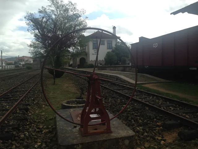
Outeiro · landscape and historical interpretation

The landscape offers a clue to the name

A gently rolling landscape on the municipality’s western edge.

Includes an activity to try →Explore: Read Outeiro by three paths →
Read here and view sources

On the municipality’s western edge, beside Fafe, Outeiro is described by the municipality as a gently rolling plateau. The introduction connects the name with that landscape and notes its proximity to the municipal seat and houses settling along the road.

The municipal page proposes a medieval interpretation of place names and mentions a scarcity of archaeological information. That wording needs to be read alongside the Municipal Master Plan inventory published in 2026, which identifies three archaeological sites in Outeiro. The parish’s name still does not, by itself, provide a foundation date.

Words in this story: see explanations →Getting to know the parish
Source and context

Municipality — Outeiro, relief and hydrographic network

Diary of the Republic — Notice No 16185/2026/2, PDM Cabeceiras de Basto, archaeological inventory AQL34–AQL36, p. 92 (29/06/2026)

Accessed: . Editorial summary; the date of consultation is not the date of the facts.
Painzela · 17th-century heritage

A chapel helps us read a house

In Cimo de Vila, domestic and religious heritage meet.

Read here and view sources

The municipal introduction to Painzela highlights Casa de Cimo de Vila and its chapel of São Gonçalo, dated 1662. The group adds another period to the discovery of the parish, alongside Casa de Pielas and its garden. The heritage reference does not confirm access to the interior.

The municipal text places the group in a mainly farming landscape, in a strip of territory extending east to west towards the boundary with Fafe. The same introduction includes the parish church, roadside devotional shrines and the chapel of São Brás: São Gonçalo’s chapel is one part of a network of places, not the parish’s entire religious history.

The date of 1662 allows a comparison with Pielas, whose house is presented as 18th-century and garden as 19th-century. These are references to distinct periods; they do not prove that all elements visible today belong to the same building campaign.

Getting to know the parish See Fact sheet: Capela de São Gonçalo e cruzeiro de Painzela
Source and context

Municipality — assets of Painzela

Accessed: . Editorial summary; the date of consultation is not the date of the facts.
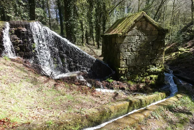
Painzela · reading a document from 1758

How was a parish counted?

In 1758, Painzela’s portrait counted households and people admitted to the sacraments.

Includes an activity to try →Explore: A document opens other questions →
Read here and view sources

The municipal transcription of the Parish Memories records 137 households and 439 souls admitted to the sacraments in Painzela. The wording itself distinguishes domestic units from a religious category of people. The 439 should therefore not be presented as a modern census of all inhabitants. The document also reveals the language used to describe the community.

The same passage identifies Santo André as the parish church’s dedication and connects the vicar’s presentation with the abbot of Santa Senhorinha. The short text thus brings together population, church and ecclesiastical organisation. Rather than reading it as a statistical table, we can ask what the author chose to record about the community.

Another layer lies between the old document and the screen: the municipality explains that the transcription updates spelling and punctuation from José Viriato Capela’s edition, published in 2003. This distinguishes the testimony’s date, 1758, from the date of the edition used to share it. References to chapels appear separately in the documentary note.

Getting to know the parish
Source and context

Municipality — Parish memories of Painzela (1758)

Accessed: . Editorial summary; the date of consultation is not the date of the facts.
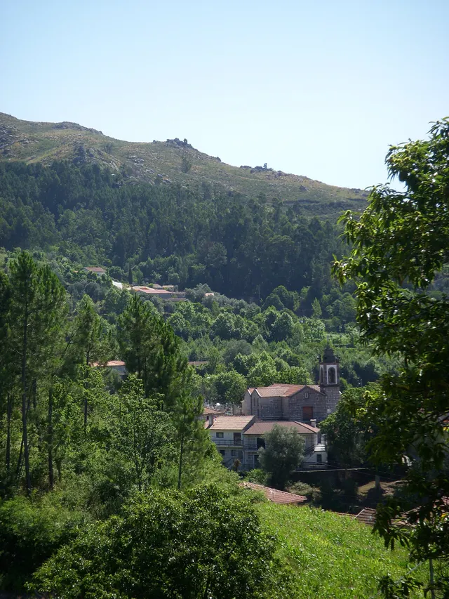
Gondiães and Vilar de Cunhas · memory and landscape

Before Vilar, Vila Seca

Names preserve changes in the territory too.

Explore: Three villages, various ways to know →
Read here and view sources

Vila Seca is the former name of Vilar de Cunhas recalled by the municipality. The introduction brings together three villages: Vilar, Cunhas and Uz.

It also distinguishes plateau and mountain areas associated with farming and pastoralism. One parish name can therefore encompass different settlements and landscapes. The source does not date the change of name.

The municipal introduction places this territory beside Montalegre and Ribeira de Pena. That position helps explain a landscape continuing beyond the administrative boundary: the settlements belong to the municipality, but valleys and connections between places invite us to look at neighbouring territories too.

Getting to know the parish
Source and context

Municipality — Gondiães e Vilar de Cunhas, landscape, heritage and crafts

Accessed: . Editorial summary; the date of consultation is not the date of the facts.
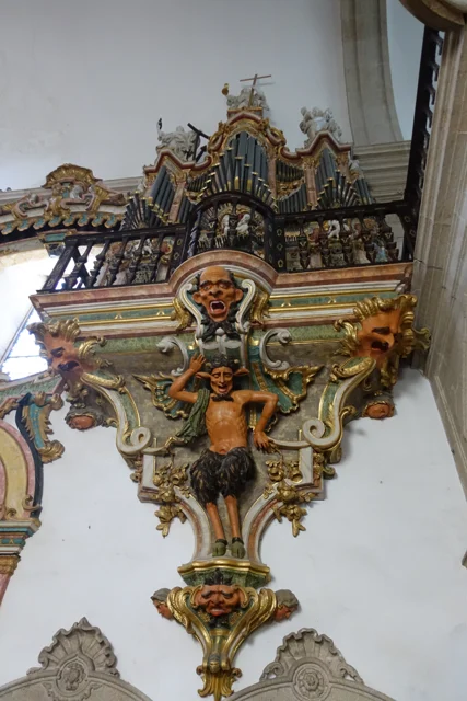
Gondiães and Vilar de Cunhas · memory and landscape

A house with three granaries

In Chouzas, the heritage of homes meets that of harvests.

Includes an activity to try →Explore: The harvest also had architecture →
Read here and view sources

At Casa de Chouzas, three 19th-century granaries stand alongside the manor house highlighted by the municipality. The group connects two functions: living and storing the harvest. Rather than looking only at the main house, it is worth recognising the importance of buildings supporting agriculture.

The introduction to Vilar de Cunhas places this heritage in a landscape of plateau and mountain, shaped by farming and pastoralism. House and granaries can be read in that working context, although the source does not detail each property’s production.

The house’s dating is less firm: the municipality presents it as perhaps 19th-century, while assigning the granaries to the 19th century. That difference should remain visible. The photograph accompanying the reading shows the portal, not the three granaries. The heritage reference does not confirm access to the group.

Words in this story: see explanations →Getting to know the parish See Fact sheet: Casa de Chouzas
Source and context

Municipality — Gondiães e Vilar de Cunhas, landscape, heritage and crafts

Accessed: . Editorial summary; the date of consultation is not the date of the facts.
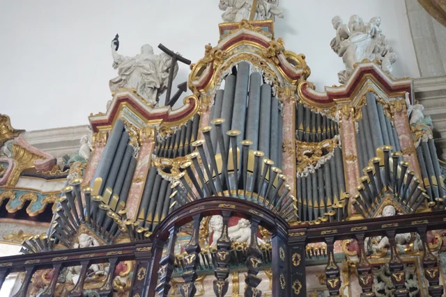
Arco de Baúlhe · railway memories

The tiles arrived before the train

Turntable and tracks at the former Arco de Baúlhe station, with buildings and railway vehicles in the background.
Facade of the station of Arco de Baúlhe, with coating and tile panels visible to the background. View of JP Ribeiro; it is not a detail of the panels of 1940.© JP Ribeiroⓘ

The station can also be read through its walls.

Includes an activity to try →Explore: A station, different spaces →
Read here and view sources

The station’s tile panels were made in 1940 by A. Lopes at the Fábrica de Cerâmica Sant’Anna in Lisbon, according to the publication about the Museu das Terras de Basto. They predate the station’s opening in 1949.

The station comprised spaces with distinct functions. The publication identifies the drivers’ house, staff building, loading and unloading platform and goods warehouse. The two vehicle sheds came to house permanent exhibitions of railway equipment; the warehouse is described as a temporary exhibition space.

Reading the building can begin with these differences: where did people work, where did goods pass and where were vehicles kept? The tiles belong to that built landscape. The description documents the museum arrangement presented in the publication, without confirming each space’s exhibition or access today.

Getting to know the parish See Fact sheet: Núcleo Ferroviário de Arco de Baúlhe
Source and context

Municipality — Land Museum of Basto: a journey through the history of the region, pp. 28–29

Municipality — Núcleo Ferroviário de Arco de Baúlhe

Accessed: . Editorial summary; the date of consultation is not the date of the facts.
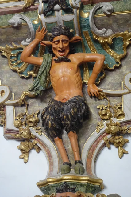
Refojos · woodcarving and artistic attribution

Three sides to a small sculpture

The high altar’s torch stands deserve a closer look.

Read here and view sources

In the 2014 announcement of the restoration of six large candle stands, the municipality describes pyramidal structures with three decorated faces, gold leaf, floral motifs and angel heads. It proposes a likely attribution to Frei José Vilaça and completion between 1764 and 1767. The source presents that authorship as a hypothesis, distinct from the confirmed attribution of the sacristy furniture.

The report also included the high altar’s cross among the pieces undergoing treatment at Oficinas Santa Bárbara in Porto. A patron funded the intervention. This episode connects heritage conservation with specialist work and support from those who cover its costs.

Getting to know the parish See Fact sheet: Mosteiro de São Miguel de Refojos
Source and context

Municipality — Restoration of tokers and furniture, 14/11/2014

Accessed: . Editorial summary; the date of consultation is not the date of the facts.
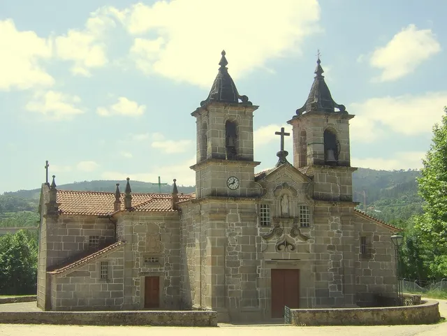
Abadim’s heritage

A star on the pillory

Detail of Abadim’s granite pillory
Details of Pelourinho de Abadim. The star described in the text is not visible on this face.© Joseolgonⓘ

A small monument holds a history of autonomy.

Read here and view sources

Abadim’s pillory looks simple at first: a smooth granite column, a cubic capital and a pear-shaped finial. Yet one face bears a five-pointed star within a four-lobed frame. The Museum connects the monument with the administrative and judicial autonomy of the old couto, abolished in 1836. It places construction near the charter of 1514, but the Cultural Heritage record warns that dating is difficult and the piece may be much later. The star invites a second look at a monument easily overlooked.

The official record describes four faces on the capital: three undecorated and one bearing the star. This explains why a photograph from another side may not show its best-known motif. The record places the monument beside the portal of Casa da Torre do Tronco and documents its designation as a Property of Public Interest in 1933. The protection date is not the construction date.

The charter, the stone’s age and the heritage designation answer distinct questions. Instead of automatically assigning “1514” to the entire monument, compare its described form, proposed dates and the documents that changed its status.

Words in this story: see explanations →See Fact sheet: Pelourinho de Abadim
Source and context

Basto Land Museum / António P. Dinis — Pelourinho de Abadim, 26/01/2018
Accessed:

Cultural heritage — Pelourinho de Abadim, record 341971, historical-artistic note
Accessed:

Editorial summary; the date of consultation is not the date of the facts.

History of Cavez Bridge

Five arches, more than one era

Cavez Bridge over the Tâmega River, with stone arches, a deck and tree-lined banks.
Partial view of the Ponte de Cavez over the Tâmega.© Joseolgonⓘ

An old bridge did not stand still in history.

Includes an activity to try →Explore: A crossing, several seasons →
Read here and view sources

Three central pointed arches and two round arches beside the banks: the Bridge of Cavez brings together different forms and periods. The Museum dates the medieval construction to the second half of the 13th century, serving the road between Braga and Vila Pouca de Aguiar.

The source attributes the round arches to work during Philip II’s reign and mentions a marker from 1599. In the 19th century, the road between Fafe and Vila Pouca de Aguiar brought a widening of the deck. Looking at the bridge means seeking the changes in an old crossing.

According to the Museum, the stone bridge replaced an earlier wooden one that had deteriorated. Construction is attributed to Frei Lourenço Mendes, a Dominican who collected alms for the work; the museum text mentions testamentary bequests supporting that connection. The crossing thus involves materials, routes and ways to fund a shared undertaking.

Words in this story: see explanations →See Fact sheet: Ponte de Cavez
Source and context

Land Museum of Basto — Ponte de Cavez, 27/02/2022

Municipality of Cabeceiras de Basto — Parish memories of 1758: Cavez

Municipality — conclusion of rehabilitation of Ponte de Cavez, 30/04/2019

Accessed: . Editorial summary; the date of consultation is not the date of the facts.
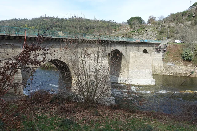
Local legend · Cavez Bridge

The voice that said to build further upstream

Cavez Bridge over the Tâmega River, with stone arches, a deck and tree-lined banks.
Ponte de Cavez on the Tâmega · the monument to which legend refers.© Joseolgonⓘ

Around the bridge, memory imagined its own paths.

Includes an activity to try →
Read here and view sources

The legend shared by the Museum has masons try to build the bridge at Vila Franca and then beside Poço das Laranjeiras. In both places, a supernatural voice told them to move upstream. Tradition attributed it to Saint Bartholomew.

On the third attempt, the narrative places construction beside the chapel. This is a story about the memory of a place, not documentary proof of site selection or an itinerary for finding the episodes.

In another part of the tradition collected by the Museum, feeding the builders receives a miraculous explanation: springs of water, wine and olive oil emerge, and fish appear in the river. The narrative connects building effort with religious protection. Reading it beside the history of the works reveals two different ways of telling the same place.

See Fact sheet: Ponte de Cavez See Fact sheet: Capela de São Bartolomeu de Cavez
Source and context

Land Museum of Basto — Ponte de Cavez, 27/02/2022

Accessed: . Editorial summary; the date of consultation is not the date of the facts.
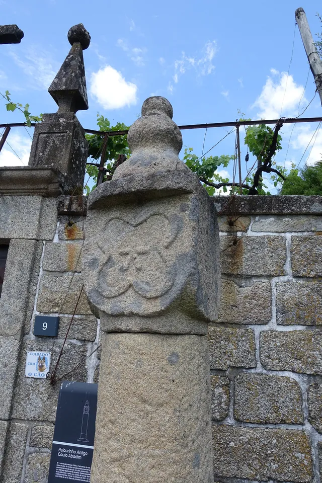
Santa Senhorinha · 1758 account

A church told through images

Before screens, people looked at painted panels.

Includes an activity to try →
Read here and view sources

In the 1758 account, Santa Senhorinha’s church had two naves with different image programmes. One presented panels on the Creation of the World; the nave of the Franciscan Third Order showed saints of that order.

The abbot also described a vaulted chapel closed by iron grilles. Painting, spaces and architectural elements formed a written portrait of the interior. The source allows that description to be studied without guaranteeing that the pieces or arrangement survive today.

The description continues with tombs, presented by the abbot as decorated with painting and gold lettering, and a private chapel dedicated to Nossa Senhora do Pilar. The interior emerges as a group of spaces, images and inscriptions, each with a role in the account.

This allows a layered reading: first the arrangement of the naves, then the painted themes and finally the elements marking memory and devotion. There is no need to imagine a single undifferentiated hall; the document itself distinguishes several settings.

Words in this story: see explanations →See Fact sheet: Igreja de Santa Senhorinha
Source and context

Municipality — Memória de Santa Senhorinha, 23/05/1758; transcript of José Viriato Chapel (2003)

Accessed: . Editorial summary; the date of consultation is not the date of the facts.
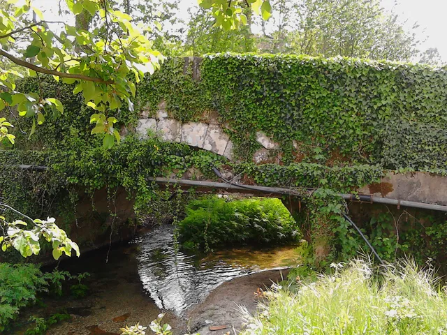
Faia · 1758 account

Five altars to read a church

Devotions also organised space.

Read here and view sources

Faia’s abbot recorded five altars in 1758, mentioning the Name of God, Saint Anthony and Our Lady under the invocation of the Rosary, with its confraternity. The document shows different devotions gathered in one church.

The restoration reported in 2022 belongs to another moment. The two descriptions have different purposes and periods: comparing numbers alone cannot determine which pieces remained or disappeared. The church profile continues the discovery of the building while keeping historical memory separate from visiting information.

The enumeration distinguishes the high altar from four side altars. The reference to the Rosary confraternity adds people to the space: the church appears not only as a group of objects but also in connection with a devotional organisation. The text does not, however, describe that confraternity’s membership or activities in detail.

See Fact sheet: Igreja de São Tiago da Faia
Source and context

Municipality — Memory of Faia, 23/05/1758; transcript of José Viriato Chapel (2003)

Archdiocese of Braga — restoration and reopening of the matrix of Faia, 01/09/2022

Accessed: . Editorial summary; the date of consultation is not the date of the facts.
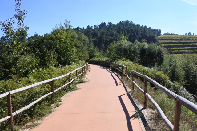
Outeiro’s heritage · account published in 2012

A medieval image found in the earth

Wood can preserve centuries of memory.

Includes an activity to try →Explore: Three moments, different dates →
Read here and view sources

A 2012 municipal report highlights a sculpture of Santa Maria belonging to Outeiro’s church, dated to the 13th or 14th century. The Virgin appears crowned, seated on a throne with the Child on her knees. The account says the piece was found buried at the place known as Mata da Santa and taken to the church by parishioners. The report does not date the discovery. This story traces the image’s journey without confirming where it is currently displayed.

Words in this story: see explanations →See Fact sheet: Igreja de Santa Maria Maior de Outeiro
Source and context

Municipality — Parish of Outeiro exposes acquis No Núcleo de Arte Sacra, 09/10/2012

Accessed: . Editorial summary; the date of consultation is not the date of the facts.
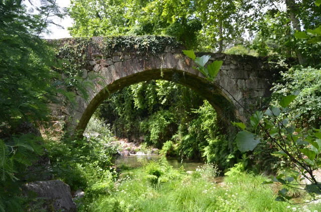
Bucos · heritage described in 1758

Gold and red in the church

The document preserved colours too.

Includes an activity to try →
Read here and view sources

In the church of São João de Bucos described in 1758, the high altar combined gilded reliefs with vermilion backgrounds. The account places Saint John the Baptist and Saint Dominic on opposite sides, with the tabernacle at the centre of the altarpiece. It also mentions altars with Our Lady of the Rosary, Saint Peter and Saint Anthony. This written portrait lets us imagine the arrangement and colours of the old interior without confirming that the pieces or layout survive today.

Words in this story: see explanations →See Fact sheet: Igreja de São João de Bucos
Source and context

Municipality — Parish memories of Bucos (1758)

Accessed: . Editorial summary; the date of consultation is not the date of the facts.

Alvite · written account from 1758

The earthquake entered Alvite’s account

A local memory of a larger event.

Includes an activity to try →
Read here and view sources

Answering the 1758 inquiry, Alvite’s vicar recalled the earthquake of 1755. He said there had been no ruins except that the arms of two crosses at the chapel of Casa da Torre had reportedly twisted northwards. He added that they were already straight again.

The account separates the event from the state observed when writing. This is local testimony, not a measurement of earthquake intensity or confirmation of marks visible today.

Source and context

Municipality — Memory of Alvite, 23/05/1758; transcription of José Viriato Chapel (2003)

Accessed: . Editorial summary; the date of consultation is not the date of the facts.

Painzela · Baltazar Castro’s origins and career

From Painzela to leading monument conservation

Baltazar Castro put his training at the service of heritage.

Explore: A Life Between Training and Heritage →
Read here and view sources

Born in Painzela on 1 May 1891, Baltazar da Silva Castro studied in Porto and began his career in Public Works in 1919. The University of Porto documents his work in the northern monuments services and move to Lisbon in 1936 to take charge of the Monuments directorate. This link between Painzela and restoration history follows a professional life; it does not attribute the parish’s buildings to the architect.

His training combined engineering, architecture, construction and drawing. In 1930 he became acting head of the northern Monuments directorate. Study journeys were also part of his work: the University mentions travel to Spain in 1934 devoted to Visigothic architecture, and across Europe in 1938 focused on military architecture.

He did not work only in restoration. With Rogério de Azevedo, he designed the Garagem do Jornal O Comércio do Porto and the extension and refurbishment of the University of Porto’s Faculty of Medicine. These projects are in Porto; his connection with Painzela lies in his origins, not in their location.

Source and context

University of Porto — Distinguished Students: Baltazar Castro, newsletter Common House No 232, 09/06/2025

Accessed: . Editorial summary; the date of consultation is not the date of the facts.

Cabeceiras de Basto · literary references

Discover Cabeceiras in books too

Camilo and Sá de Miranda offer clues for another journey.

Read here and view sources

The municipality’s historical account associates Cabeceiras with Sá de Miranda’s Carta a D. António Pereira and points to references to the municipality in Camilo Castelo Branco’s A Bruxa de Monte Córdova and Noites de Lamego. These reading clues invite you to explore how a territory enters literature. A literary reference is not equivalent to a documentary account: characters, places and events should be read in the context of each work.

Source and context

Municipality — historical review: literary references

Accessed: . Editorial summary; the date of consultation is not the date of the facts.

Refojos · education and monastic life in the 16th century

Between a monastery and a university

Aerial view of the Monastery of São Miguel and Praça da República in Refojos
Mosteiro de São Miguel de Refojos: the place connected to the abbot Frei Diogo de Murça. Photograph of the set, not of the reported season.© Vitor Oliveira from Torres Vedras, PORTUGALⓘ

Friar Diogo de Murça connects Refojos with academic life in Coimbra.

Explore: A Reconsidered Plan →
Read here and view sources

Abbot of Refojos and rector of the University of Coimbra, Friar Diogo de Murça wanted to use the Monastery’s revenues to establish two colleges in Coimbra: São Bento and São Jerónimo. The plan required the Monastery’s closure. Municipal documentation recounts the monks’ opposition and the abbot’s later reconsideration. This connection shows how decisions about Refojos formed part of a wider history of education and religious institutions.

The municipal account dates Pope Paul IV’s acceptance of the revised request to 1555: to keep the Monastery with twelve monks and a prior, instead of following the initial closure plan. The same source records Friar Diogo’s death in Refojos in 1570 and his burial in the Monastery.

See Fact sheet: Mosteiro de São Miguel de Refojos
Source and context

Municipality — proposal for a heritage registration of the Monastery, pp. 9 and 11; later uses in p. 11 (candidature document, not a UNESCO classification)

Municipality — History of the Monastery: Frei Diogo de Murça and the colleges of Coimbra

Accessed: . Editorial summary; the date of consultation is not the date of the facts.

Pereiras, Refojos · former uses of the town hall

From prison to music

A building can change its role in the community.

Explore: The Pereiras beyond a building →
Read here and view sources

In Pereiras, the former town hall continued to serve as a prison until 1972, according to the Museu das Terras de Basto. After restoration, it became the Casa da Música. A municipal news item from July 2010 already listed it among places to discover in the municipality. The Museum’s article dates the town hall’s move to the Monastery to 1835 and the opening of the Casa da Música to 2003: the building continued changing roles after municipal administration left.

The building’s story begins before the prison preserved in local memory. The Museum’s article attributes the order to build the town hall in 1586 to the magistrate João Gil de Abreu Castelo Branco. It then suggests an 18th-century reconstruction on the site of the earlier building.

Its two storeys divided the functions: prison on the lower level, town council and hearings above. This arrangement brought administration and justice together. When the council left, the prison remained; when the prison closed, the building survived. Opening as the Casa da Música in 2003 added another use to a building with many chapters.

Source and context

Basto Land Museum — The place of the Pereiras of Refojos de Basto, 28/07/2024

Municipality — visits to see the municipality, news of 29/07/2010

Accessed: . Editorial summary; the date of consultation is not the date of the facts.

Refojos · sacred art collection

A painting belongs to a larger story

The Incredulity of Saint Thomas belongs to a group of five works.

Includes an activity to try →
Read here and view sources

In March 2026, the Museu das Terras de Basto presented an iconographic study of the Incredulity of Saint Thomas, celebrated in verse by Saint Thomas Aquinas. It identifies the work as an oil painting on canvas, part of a five-painting Late Mannerist altarpiece group from the early 17th century. Viewing one painting alongside the others reveals how a collection can preserve relationships between images. The announcement documents the work without confirming current visiting arrangements.

See Fact sheet: Núcleo de Arte Sacra
Source and context

Basto Land Museum — Painting of Núcleo de Arte Sacra, 2026-03-13

Accessed: . Editorial summary; the date of consultation is not the date of the facts.

Tâmega Line · object presented by the Museum in June 2024

The last light told a story

A red light showed that the train was complete.

Includes an activity to try →Explore: Two lights, different tasks →
Read here and view sources

The last vehicle of a train carried an important message. The Museum presents a red tail lamp, used at night on the last carriage or wagon to indicate that the train was complete. Its purpose was to signal, not to light the track ahead of the locomotive.

The inscription N.1 E POSTO. DA LIVRAÇÃO links the object to Livração station on the Tâmega Valley line. Reading the object means bringing together three clues: the colour of the light, its position on the train and the inscription connecting it with a place.

This small object shows that railway history also consists of signals and quiet tasks. The Museum’s presentation, published in June 2024, describes its use and the station to which it was assigned; it does not give a manufacturing date.

Words in this story: see explanations →
Source and context

Land Museum of Basto — Taillight “N.1 AND POSTO. FREEDOM”, 2024-06-28

Accessed: . Editorial summary; the date of consultation is not the date of the facts.

Museum collections · railway lighting

A station by lamplight

Before looking at the train, notice the platform’s light.

Includes an activity to try →
Read here and view sources

In February 2024, the Museum described a hexagonal platform lamp intended to light boarding areas. Inside was an oil lamp with a glass chimney and a metal reservoir. The description does not identify the station where this object was used.

The reservoir bore the inscription MD MOVIMENTO. That detail belongs to the object described; it does not, by itself, reveal a station of origin. Compare it with the tail lamp: both produce light, but the platform lamp lights the boarding space while the tail lamp communicates information about the train.

Source and context

Basto Land Museum — Platform lamp, 2024-02-22

Accessed: . Editorial summary; the date of consultation is not the date of the facts.

Faia · religious organisation in 1758

A church linked to the Grand Prior of Crato

A parish’s history also involves distant connections.

Read here and view sources

In his 1758 response, Faia’s abbot wrote that the right to nominate him belonged to Prince Pedro in his capacity as Grand Prior of Crato. He also referred to the involvement of Porto’s ecclesiastical official in his formal appointment. These details show that local religious organisation involved authorities beyond Cabeceiras. The account describes how the post was filled at that time; it does not mean Faia belonged to the municipality of Crato or Porto.

The same response estimated the benefice’s revenue at 450 thousand réis. This figure describes the institution and should not be presented as a current salary or converted directly into today’s prices. Read alongside the altars and chapels, it adds a layer to the story: beyond the building and devotions, there was an organisation of offices and revenues.

Getting to know the parish
Source and context

Municipality of Cabeceiras de Basto — Parish memories of Faia, 23/05/1758, replies 8, 20 and 21

Accessed: . Editorial summary; the date of consultation is not the date of the facts.

Rio Douro · a possible link between archaeological sites

Tombs and settlement: a connection to investigate

At Portela de Asnela, the landscape leaves a question.

Explore: Compare traces, distinguish hypotheses →
Read here and view sources

The municipal inventory describes burial mounds at Portela de Asnela, in Rio Douro, and proposes a connection with the Castelo settlement at Formigueiro, around one kilometre to the north. Proximity supports a hypothesis; it does not by itself prove that both groups of remains were used by the same community.

The entry identifies structures of the antela and cist types within the funerary group. It proposes a date in the second or first millennium BC, based on pottery and comparisons with similar groups in the mountains of the Northwest.

There are therefore two separate questions: when might these monuments have been built, and how might they have related to the nearby settlement? A proposed chronology does not automatically resolve the second question. The inventory presents that connection as a hypothesis, leaving room for future research.

Words in this story: see explanations →
Source and context

Municipality — archaeological inventory, interpretations and chronologies

Accessed: . Editorial summary; the date of consultation is not the date of the facts.

Alvite · church described in 1758

Three altars in one nave

A church can also be portrayed in words.

Includes an activity to try →Explore: From church to places of worship →
Read here and view sources

In 1758, the vicar described Alvite’s church as having three altars: the main altar, associated with Saint Peter, and those of the Name of God and Our Lady of the Rosary. He mentioned a single nave, choir, chancel and sacristy. This is the arrangement recorded at that time, without confirmation that it remains the same.

The document places the church in Cacheina, surrounded by residents. It distinguishes the main altar from the two side altars and mentions a brotherhood associated with the confraternity of the Blessed Sacrament. The portrait of the building thus includes a community: places of worship, people and religious organisation appear in the same answer.

A list of spaces is not enough to reconstruct a floor plan. We can recognise functions and names, but locating each room precisely would require other sources. It is a good opportunity to compare what a text describes with what an exterior photograph can show.

Words in this story: see explanations →
Source and context

Municipality — Alvite Parish Memories, 1758; transcription of José Viriato Chapel (2003)

Accessed: . Editorial summary; the date of consultation is not the date of the facts.

Cabeceiras de Basto · reading the Parish Memories

Three questions for the past: land, mountains and rivers

The Parish Memories began with a questionnaire.

Includes an activity to try →
Read here and view sources

In 1758, a questionnaire sent to parish priests sought to gather information about Portuguese parishes. According to the Museu das Terras de Basto’s presentation, it was organised around three broad themes: land, mountains and rivers. When publishing the texts in 2011, the Museum explained that it had updated their language to make them more accessible to students. Reading a transcription therefore also means recognising the work of those who made the document readable for others.

Source and context

Basto Land Museum — Presentation of Parish Memories, 08/02/2011

Accessed: . Editorial summary; the date of consultation is not the date of the facts.

Arco de Baúlhe · railway memories

The train stopped, the memory stayed

Turntable and tracks at the former Arco de Baúlhe station, with buildings and railway vehicles in the background.
Arco de Baúlhe station and railway equipment. Context photography, not of the closing day.© JP Ribeiroⓘ

The station found another role after the line closed.

Explore: From the last journey to preserved memory →
Read here and view sources

According to the Museum’s retrospective, Arco station ceased operating in January 1990 when the section between Amarante and Arco de Baúlhe closed. On 8 January 2000, an agreement between REFER and the municipality paved the way for the transfer of use of the premises and their development as a museum. The Museum’s opening on 23 May 2004 belongs to that new chapter.

The transfer brought responsibilities: the municipality became responsible for conserving, maintaining and managing the section in collaboration with the Fundação Museu Nacional Ferroviário. The Museum’s April 2025 news item also reports the municipal decision of 14 February that year to classify the complex. The change of use therefore involved agreements and continuing work, beyond opening the doors to the public.

See Fact sheet: Núcleo Ferroviário de Arco de Baúlhe
Source and context

Basto Land Museum — Railway Station Arco de Baúlhe classified as Municipal Interest Set, 02/04/2025

Accessed: . Editorial summary; the date of consultation is not the date of the facts.

Faia · restoration documented in 2022

A year of work, a church reopened

Heritage is also made through recent care.

Explore: The church at different times →
Read here and view sources

The church of São Tiago da Faia reopened on 14 August 2022 after being closed for around a year for building work. The Archdiocese of Braga’s report records the restoration of paintings, religious images and three altars, along with the installation of stained glass depicting episodes from the patron saint’s life and mission. This recent intervention differs from the account of five altars left in 1758: the sources come from different periods, not a directly comparable count of surviving objects.

The report also tells who made the work possible. Parish priest Rui Filipe Marques Araújo credited the community’s involvement; the ceremony brought together association representatives, workers and benefactors. Archbishop José Cordeiro presided. Behind the paintings and stained glass restored or installed lies a story of participation.

Reopening does not necessarily mean that every task was finished: the same report records an appeal to continue completing the restoration. The August date marks the celebration and the return of the space to religious use, without establishing by itself when each intervention ended.

See Fact sheet: Igreja de São Tiago da Faia
Source and context

Archdiocese of Braga — restoration and reopening of the matrix of Faia, 01/09/2022

Accessed: . Editorial summary; the date of consultation is not the date of the facts.

Refojos and Coimbra · the chalice’s historical journey

From Refojos to Coimbra, a story on the move

Objects also pass through institutional changes.

Includes an activity to try →
Read here and view sources

According to the 1995 study, the chalice remained in Refojos until the mid-16th century, then went to the Colégio de São Bento in Coimbra in the context of Friar Diogo de Murça’s activities. After the dissolution of religious orders in 1834, it passed to the Treasury of Coimbra Cathedral. The Museu Machado de Castro’s catalogue documents its present connection with the collection. This journey adds a material history to the relationship between Refojos and Coimbra.

See Fact sheet: Mosteiro de São Miguel de Refojos
Source and context

Portvgalia, new series, volume XVI (1995) — study of medieval goldsmithry, analysis of the cup of Refojos

Machado de Castro National Museum — Cup, collection form at Google Arts & Culture

Accessed: . Editorial summary; the date of consultation is not the date of the facts.

Painzela · heritage identification, without an established chronology

A bridge, a name and a question

Painzela’s stone bridge over a watercourse, surrounded by vegetation
Ponte de Painzela, photographed by Tommasoandrea. The image allows observing the arch and the water line; it does not determine the time of construction.© Tommasoandreaⓘ

Calling it Roman does not settle its age.

Includes an activity to try →
Read here and view sources

The municipal presentation of Painzela includes a photograph labelled Ponte de Painzela and lists a Roman Bridge among the parish’s heritage. That name alone does not establish when the bridge was built. The name helps locate the place; dating would require documents or a study of the structure. It is a useful question to bring to heritage: what do we know from the identification, and what do we still need to investigate?

See Fact sheet: Ponte de Painzela
Source and context

Municipality — parish presentation of Painzela and bridge identification

Accessed: . Editorial summary; the date of consultation is not the date of the facts.

Alvite · heritage and its landscape setting

A chapel against the rock

At Santa Catarina, the building meets the rocky outcrop.

Includes an activity to try →Explore: One chapel, three scales →
Read here and view sources

The municipal presentation highlights a distinctive feature of the chapel of Santa Catarina in Alvite: it is embedded in an outcrop of rock. The meeting of rock and building offers a way to look at heritage beyond the façade.

The source identifies that relationship with the site, but gives no construction date or visiting hours here. The chapel’s listing brings together the available documentary information.

The 1758 account already named Santa Catarina on the hill of that name, among six chapels in the parish. The two sources answer different questions: the old document places it within a network of places of worship; the municipal presentation draws attention to the relationship between building and rock. Its presence in the account does not date the exterior appearance shown in the photograph.

See Fact sheet: Capela de Santa Catarina de Alvite
Source and context

Municipality — landscape of Alvite e Passos

Basto Land Museum — Parish Memories of 1758: Alvite

Accessed: . Editorial summary; the date of consultation is not the date of the facts.

São Nicolau · interior described in 1758

Five altars, many stories

The 1758 account offers a look inside the church.

Includes an activity to try →
Read here and view sources

Rector Domingos Camelo de Sousa described five altars in the church of São Nicolau. At the high altar, he placed Saint Nicholas and Saint Blaise on opposite sides, with Christ Crucified in the centre, within a gilded carved-wood setting.

The other altars were dedicated to Our Lady of the Rosary, the Lord of the Steps of the Passion, Saint Sebastian and the Souls in Purgatory. This is a portrait written in 1758, not confirmation of the current arrangement.

See Fact sheet: Igreja de São Nicolau de Cabeceiras
Source and context

Basto Land Museum — St Nicholas Parish Memories (1758)

Accessed: . Editorial summary; the date of consultation is not the date of the facts.

Gondiães and Vilar de Cunhas · published notes on 1758

Two old portraits, two ways of counting

A short note can open a window onto history too.

Includes an activity to try →
Read here and view sources

The municipal transcription of 1758 presents Gondiães with 55 households and 269 people admitted to communion, alongside the parish church dedicated to Saint Martin. The account of Vilar records 41 households and 141 people admitted to the sacraments, with a church dedicated to Saint Lawrence. Both places are situated within Cabeceiras de Basto’s jurisdiction, in the district of Guimarães.

The source’s terms matter: fogos or vizinhos, meaning households, and almas, meaning souls, are not the same category. These figures should not be added as though they all counted people, nor should people admitted to the sacraments be presented as a modern census of the entire population. The Gondiães text attributes its information to Lima; that reference should accompany the figures.

Source and context

Municipality — Parish Memoirs of Gondiães (1758), transcript published from José Viriato Chapel (2003)

Municipality — Parish Memoirs of Vilar de Cunhas (1758), reference to José Viriato Chapel (2003)

Accessed: . Editorial summary; the date of consultation is not the date of the facts.

Rio Douro · settlements and chapels described in 1758

Fifteen settlements, a network of chapels

Distance from the church also shaped village life.

Includes an activity to try →
Read here and view sources

In Rio Douro’s 1758 account, the vicar lists fifteen settlements and places the church outside the inhabited area. He also mentions fifteen chapels, explaining their relationship with religious care for people living far from the parish church.

Santo Estêvão stood outside Eiró; other dedications accompanied village names, such as Santa Ana in Toninha, São Gonçalo in Vilela and São Frutuoso in Leiradas. The document also distinguishes responsibilities held by monks from Refojos, private individuals and residents. It is a historical network of places, devotions and care, without confirmation of the present condition or accessibility of each building.

Source and context

Municipality — Parish Memoirs of Rio Douro, António Carneiro da Costa, 22/05/1758

Accessed: . Editorial summary; the date of consultation is not the date of the facts.

Gondiães · heritage recorded in an inventory; current access unverified

Three bridges, three stories of passage

A bridge’s name does not tell its whole construction story.

Includes an activity to try →
Read here and view sources

The municipal inventory links the Ponte de Arame de Padroselos to tin mining. Entry Po.27 describes iron, wood and a ruined condition, without supplying the survey date.

Ponte do Freixo, in Torneiro, formed part of the path between Cunhas and Torneiro. Entry Po.28 records granite and an absence of parapets. In Po.29, Ponte de Arames over the Beça appears with a concrete deck supported by five piers. These two entries are dated 20 March 2008.

These are three different references. The inventory reveals the memory of connections but does not confirm present conditions or suggest crossings.

Source and context

Municipality — Inventory of bridges, tokens Po.27–Po.29, PDF pages 28–30; Po.28 and Po.29 raised in 20/03/2008, Po.27 without completed date

Accessed: . Editorial summary; the date of consultation is not the date of the facts.

Arco de Baúlhe and Vila Nune · railway memory and a changing route

New footsteps on the old line

Tâmega rail trail in Arco de Baúlhe e Vila Nune, with reddish paving and wooden railings, photographed in October 2016.
The former railway channel converted to Ecopista in Arco de Baúlhe e Vila Nune. Photo by FF Mira, October 6, 2016; does not document the inauguration of 2013 or the current conditions of the entire route.© FF Miraⓘ

The former railway welcomed walkers and bicycles.

Explore: Three Ways to Guard the Railroad →
Read here and view sources

The Tâmega Line’s corridor continued connecting places after the trains. On 20 April 2013, the municipality’s section of the greenway opened between the Railway Museum in Arco de Baúlhe and Mulher Morta, in Vila Nune. The municipal listing gives this section a length of 5.4 kilometres, within the longer connection to Amarante.

The route’s gradients preserve its railway origins: the municipal description associates the old corridor with a maximum gradient of 3%. This is a published characteristic of the route, not a current check of every entrance or obstacle. To prepare an outing, consult the practical listing and signs on site.

The former station and Vila Nune halt tell different parts of the story. The municipality includes the halt among Vila Nune’s heritage; in Arco, the station became a museum. A route can change use without losing the landmarks that help us recognise its past.

See Fact sheet: Ecopista do Tâmega — troço de Cabeceiras See Fact sheet: Antigo apeadeiro de Vila Nune
Source and context

Municipality — Ecopist of Tâmega: reuse of channel and inauguration of 2013

Municipality — Arco de Baúlhe e Vila Nune: former tenant

Basto Land Museum — Railway Station Arco de Baúlhe classified as Municipal Interest Set, 02/04/2025

Accessed: . Editorial summary; the date of consultation is not the date of the facts.

Vila Nune · settlement described in 1758

One parish, many small settlements

Counting households was not the same as counting people.

Includes an activity to try →Explore: Places, people and paths →
Read here and view sources

In May 1758, Vila Nune’s vicar recorded 55 households and 239 people. He listed fourteen settlements, some with only one resident, and noted uninhabited houses in Serra.

These figures describe different categories in the document. They should not be added together or confused with a current census. The small scale of the settlements evokes dispersed habitation viewed through the parish.

The list allows a closer look: Silva is assigned eight households; Vale and Rossada five each. Fojães and Ribeira da Covilhã appear with just one resident. The church stood in Granja, near Vale. The religious centre was therefore distinct from the place called Vila Nune.

Vicar Domingos Leite de Andrade adds that the households included unmarried women living in poverty and people from other parishes. This is one author’s social description from a particular time; it does not allow every individual life to be reconstructed. By retaining the terms and date, the document offers glimpses of different domestic circumstances within the small settlements.

Source and context

Municipality — Parish Memoirs of Vila Nune, 23/05/1758

Accessed: . Editorial summary; the date of consultation is not the date of the facts.

Outeiro · archaeological inventory published in 2026

Three sites, several layers of the past

Archaeology offers another way to know Outeiro.

Includes an activity to try →
Read here and view sources

The 2026 municipal planning inventory brings together three archaeological references in Outeiro: the medieval graves of Mata Santa, the rock shelter of Serra da Penouta and Outeiro da Pena.

Mata Santa appears as a medieval necropolis. The Penouta shelter is assigned to the Neolithic/Chalcolithic; Outeiro da Pena appears as a shelter/lookout, labelled Prehistory/Medieval. These are the inventory’s categories and periods, not three exact construction dates.

These entries open a history longer than the explanation of the parish’s name. They do not demonstrate continuous occupation between the periods given or establish a connection between the graves and the sculpture of Saint Mary. The documentary reference also does not confirm visiting arrangements.

Words in this story: see explanations →
Source and context

Diary of the Republic — Notice No 16185/2026/2, PDM Cabeceiras de Basto, archaeological inventory AQL34–AQL36, p. 92 (29/06/2026)

Accessed: . Editorial summary; the date of consultation is not the date of the facts.

Cavez · history of Moimenta Bridge; current conditions unverified

Two eras in the same bridge

Moimenta’s old bridge in Cavez: a stone arch over the river, surrounded by vegetation, photographed in June 2020.
Moimenta Bridge, photographed by Pedro at 11 June 2020. A crossing record other than Ponte de Cavez over Tâmega.© Pedroⓘ

In Moimenta, old stone meets work carried out in 1990.

Read here and view sources

An old bridge can keep changing. The municipality attributes medieval origins to Moimenta Bridge in Cavez and describes a single rounded arch.

In 1990, the crossing was widened by around one metre: a concrete structure was added on the downstream side and the parapets were altered. The photograph offers a starting point for observing the crossing; the date of the work comes from the documentary description.

Words in this story: see explanations →See Fact sheet: Ponte antiga de Moimenta
Source and context

Municipality — Cultural heritage, bridges of Arco de Baúlhe and Moimenta

Accessed: . Editorial summary; the date of consultation is not the date of the facts.

YOUR LOCAL GUIDE

What would you like to discover?

Take a closer look.