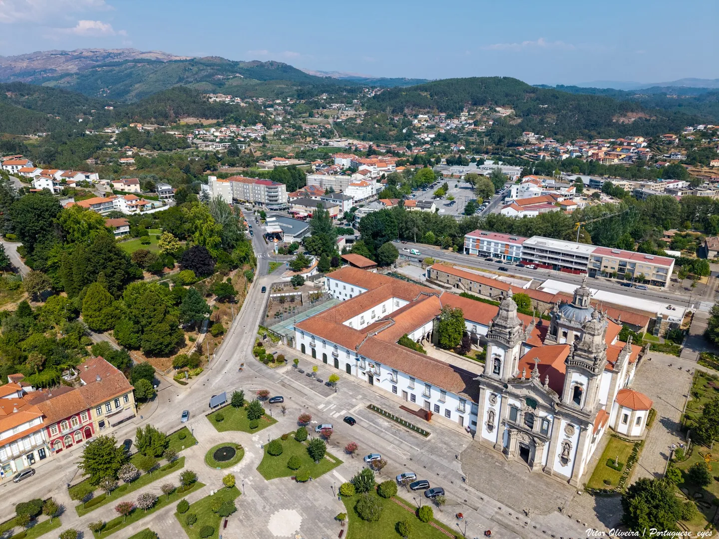

01Between Cabreira and Tâmega
The municipality belongs to the district of Braga and the sub-region of Ave. The identity of the Lands of Basto also connects it to Celorico of Basto, Mondim of Basto and Ribeira de Pena. The mountain slopes, valleys and cultivation grounds help to perceive differences in settlement and lifestyles between parishes.
The Lands of Basto are organized around the middle valley of the Tâmega, in a transition between the Atlantic Northwest and the Transmontan Northeast. Marão and Alvão frame the region at source; Cabreira and Lameira, to the north and west. This regional scale helps to locate Cabeceiras without confusing the historical region with the limits of one municipality.
The village is located in Refojos de Basto. The parish of Cabeceiras de Basto, known as São Nicolau, is another territorial unit. Distinguishing the two names facilitates the reading of scripts, documents and addresses.
Sources: Municipality — location and land of Basto · DGT — Official Administrative Letter of Portugal · Celorico Municipality of Basto — Land History of Basto
02A story prior to the outsiders
Mamoas, engravings, villages and structures of different times witness a long occupation of the territory. Marmoirals, Lameiras Chãs and sites of Rio Douro belong to the set of archaeological references gathered by the municipality. Each site has its own chronology and its interpretation problems.
The antiquity of a toponym or a popular designation is not enough to date a building. Knowing the heritage implies crossing the place, inventory and research, while preserving what is not yet known.
Sources: Municipality — Archaeology
03The monastery, the Coutos and the Forals
The Mosteiro de São Miguel de Refojos is documented in the early 12th century. The foundation has no known date with accuracy. His trust, properties and relations with parishes and manor houses help to understand the role he played in the organization of the region. The Baroque church that is observed today belongs to another phase of this long history.
The forals of 1514 are milestones of the Manueline tax and administrative organization. Cabeceiras de Basto received its to 5 October; Vadym, or Abadim, to 12 October. They are two distinct documents and do not represent the beginning of human settlement in these lands.
The medieval map also changed. The history published by the Municipality of Celorico describes, in the Inquisitions of 1220, a Celorico Land much more extensive than the current municipality, covering the territory of Cabeceiras. In 1258 already appear the judges of Cabeceiras, Celorico and Amarante. They were ways of organizing power and justice; we should not draw their limits from today's administrative map.
Sources: Municipality — History of the Monastery of Refojos · Municipality — fora of 1514 · Celorico Municipality of Basto — Land History of Basto
04The communities seen from within
The Parish Memoirs of 1758 record answers about churches, places, rivers, production and institutions. The transcripts made available by the municipality allow to approximate these descriptions of parishes and toponyms that we still recognize. They are testimonies of their time, produced from the look of their authors.
The relation of Refojos identifies the abbot as lord of the Couto. The one of Passos places the parish in the term of Celorico of Basto. These examples show why the ancient borders and dependencies should not be read as if they were those of today. The numbers of fires and people of sacraments do not equal the concepts of contemporary censuses either.
Sources: Municipality — Parish Memories of Refojos, transcript of 1758 · Municipality — Parish Memories of Passos, transcript of 1758
05Knowing that they are also heritage
The wool and burel of Bucos, weaving, basketry, clogging and other local works link raw material, techniques and family life. Casa da Lã offers an entrance to the textile memory of Bucos and to the work of its women. These themes complement the discovery of churches, bridges and solar.
In Gondiães and Samão, the tradition of the Feast of the Popes of St Sebastian highlights the preparation and community sharing of food. A feast can be read as devotion, collective organization and food memory. The history of tradition is different from the confirmation of a given year's program.
Sources: Municipality — Casa da Lã · Municipality — Gondiães e Vilar de Cunhas, tradition of the Popes
06The railway and new forms of circulation
The construction of the Tâmega Line took place in stages between 1908 and 1949, linking Livração to Arco de Baúlhe. The terminal station marked the mobility and economic relations of the Lands of Basto. The municipal reference places the closure of the Arc station in 1990; this date should not be taken as a simultaneous closure of all sections of the line.
The railway core preserves spaces and materials that allow us to study this experience. Vila Nune’s former camper adds another perspective on the presence of the railway in the municipality.
Sources: Municipality — Núcleo Ferroviário de Arco de Baúlhe
07The Basto, between symbol and legend
The statue of Basto is a symbol of Cabeceiras. Hermígio Romarigues' narrative, which would have defended the monastery, belongs to the legendary tradition. Knowing the legend is part of knowing the local identity; its repetition does not transform the character and the events narrated into facts demonstrated.
The same care applies to the stories of bridges, to the beliefs of pilgrimages and to the attributions of Roman origin. The memory told by communities and the material history of objects can be studied together, maintaining the nature of each testimony.
Sources: Municipality — Refojos, traditional narrative of Basto
08Today's 14 parishes
The organization adopted in this guide corresponds to the geography of 2025.Refojos de Basto, Outeiro and Painzela were once again distinct parishes in the context of the replacement of aggregate parishes.The unions of Alvite e Passos, Arco de Baúlhe e Vila Nune and Gondiães e Vilar de Cunhas are maintained.
The pages of the parishes add a presentation of the landscape, history and traditions, documentary references and links to the sites of the catalog. Population data are from the Censuses of 2021, presented in the geography of 2025; they are not an estimate of the current population.
Sources: Diary of the Republic — Law No 25-A/2025, of 13 March · DGT — Official Administrative Letter of Portugal · INE — Censuses 2021, indicator 0014630, geography 2025
Time Marks
Choose an era and follow the stories. Dates situate events or testimonies; an ancient reference is not necessarily a foundation.
- 12th Century
The monastery in documentation
The Monastery of Refojos is already mentioned in the early 12th century. Its exact date of foundation remains unknown.
Explore this storyMunicipality — History of the Monastery of Refojos · Consultation/review
Choose another time ↑ - 1258
Pedraça in medieval documents
Inquiries record the name Pedraços. The reference documents the settlement; it is not a foundation date.
Explore this storyMunicipality — Pedraça, history and heritage · Consultation/review
Choose another time ↑ - 1514
Two forals manuelinos
Cabeceiras de Basto receives foral on October 5; Vadym, or Abadim, on October 12.
Explore this storyMunicipality — fora of 1514 · Consultation/review
Choose another time ↑ - 1755
An earthquake remembered in Alvite
In the memory written in 1758, the parish priest reports damage on two crosses of the chapel of the House of the Tower caused by the earthquake of 1755.
Explore this storyMunicipality — Memory of Alvite, 23/05/1758; transcription of José Viriato Chapel (2003) · Consultation/review
Choose another time ↑ - 1758
The parishes describe the territory
Parish relations offer portraits of places, institutions and ways of life, now accessible in municipal transcripts.
Explore this storyMunicipality — Parish Memories of Refojos, transcript of 1758 · Consultation/review
Choose another time ↑ - 1834
Change in the uses of the monastery
The extinction of religious orders opens a new phase in the history of the monastic assembly and the village of Refojos.
Municipality — History of the Monastery of Refojos · Consultation/review
Choose another time ↑ - 1891
Baltazar Castro is born in Painzela
May 1 is born the future architect and leader of the services of monuments. His training and career take him to Porto and Lisbon.
Explore this storyUniversity of Porto — Distinguished Students: Baltazar Castro, newsletter Common House No 232, 09/06/2025 · Consultation/review
Choose another time ↑ - 1940
Tiles before arrival of the line
A. Lopes runs the panels of the Arc station at the Sant’Anna Factory in Lisbon. The opening of the station only takes place in 1949.
Explore this storyMunicipality — Land Museum of Basto: a journey through the history of the region, pp. 28–29 · Consultation/review
Choose another time ↑ - 1949
The line reaches the Arc
Step construction of the Tâmega Line completes the connection to Arco de Baúlhe, which becomes terminal station.
Explore this storyMunicipality — Núcleo Ferroviário de Arco de Baúlhe · Consultation/review
Choose another time ↑ - 1990
Close the Arc Station
The closure of the station is a landmark of the local railway memory; the story of the remaining sections of the line has its own dates.
Municipality — Núcleo Ferroviário de Arco de Baúlhe · Consultation/review
Choose another time ↑ - 2025
Refojos, Outeiro and Painzela different
The replacement of the three parishes leads to the framework of 14 territorial units used in this guide.
Diary of the Republic — Law No 25-A/2025, of 13 March · Consultation/review
Choose another time ↑
How we read these stories
The texts are original summaries. The Parish Memories are consulted in the municipal transcripts, with reference to the edition of José Viriato Capela; there was no collation of the original manuscripts. When an identification or date is uncertain, this limitation accompanies the content. Consultation of the sources and conference of the archive: 03/11/2026. Regional framework and medieval organization expanded in 07/11/2026; the remaining sources retain the individual dates of consultation.
Document review: 2026-11-07. Statistical data keep the year and geography indicated.