
Villages and places
ⓘVilela, Rio Douro
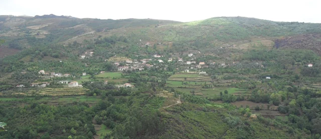
Casario and fields on the slopes of Rio Douro. Vilela is one of the places mentioned in the municipal presentation of the parish.
Rio Douro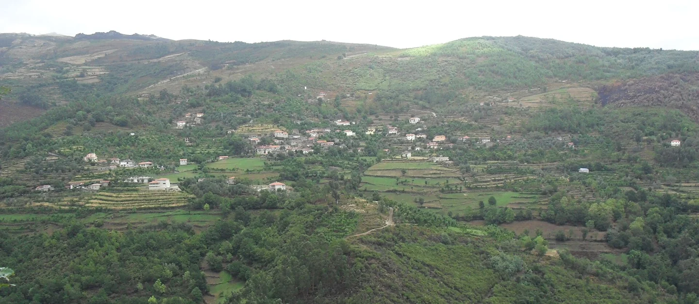
Panoramic view of the place of Vilela, Rio Douro, with houses and agricultural plots on the slopes.
ⓘVillages, valleys and trails: follow the curiosity for Cabreira in Rio Douro.
Administrative name: Rio Douro
A selection of what is documented in the guide. Confirm visiting conditions in the charts.
Slide to see more places →
Casario and fields on the slopes of Rio Douro. Vilela is one of the places mentioned in the municipal presentation of the parish.
Rio DouroFrom Formigueiro to the old fulling mill and Nariz do Mundo: a walk through wool-working heritage, meadows and the stream valley.
Rio DouroThe church mentioned in the core that names the parish of Rio Douro.
Rio DouroOn the slopes of the Cabreira, the courses of Currais and Cavez draw valleys and agricultural land.
The municipal presentation refers to the Inquiries of 1220 and 1258 to study settlement and property.
The church, the manors, the houses of Eira, Reboseira and Leiradas and the chapel of Juguelhe integrate the local references.
Knowledge, landscapes and memories linked to this parish.
Choose from 14 activities here →
2 guides with stories from here → · To follow a story by chapters.
The landscape also chose the pantry.
Trouts, bogas and scallops appear in the Memories of Rio Douro.
The holly holds differences even in its branches.
There are lives that depend on both the shore and the brook.
A list of 1758 mixes encounters, abundances and passages.
mountains houses, a stream and a name that stays in your ear.
A stream helps explain the whole landscape.
The report of 1758 organizes Rio Douro between spring and west.
The levadas linked the flow of rivers to the work of the fields.
A project of Rio Douro helps to read different functions of the same landscape.
Wool and cereals: two works on the same stream.
From wool and linen to São Miguel and Santa Luzia fairs.
In Cambezes, the inter-help reached the pastures.
In Vilela, the walls help to recognize the landscape.
Preserving a trade includes showing it to other people.
In Eiró, the work of the mill was linked to the irrigation of the fields.
In Eiró, the circular shape and moat tell a story.
The traces of the Old Village of Toninha count for another time.
In Rio Douro, guidance helps to interpret the past.
In Monte do Castelo, relief is part of history.
Romanization also changed the relationship between the mountain and the fields.
At Portela de Asnela, the landscape leaves a question.
The distance from the church also shaped the lives of the villages.
Observations of citizen science with location published in this parish, crossed with the limits CAOP2025. They are not visiting points or independent confirmation in the field.
We don't have any revised events here yet. Go back to the schedule to find out the schedule available.
Villages, valleys and trails: follow curiosity for Cabreira in Rio Douro. The parish also appears in the sources as Riodouro. Formigueiro, the valleys of Currals and Cavez and Nariz do Mundo are clues to know the landscape. The church, chapels, manors and traces of old occupations add other layers to local history.
On the slopes of the Cabreira, the courses of Currais and Cavez draw valleys and agricultural land. Rio Douro, also written Riodouro in municipal sources, gathers areas of higher altitude and settlement nuclei with their own identities. The relief is a good thread to know this diversity.
The municipal presentation refers to the Inquiries of 1220 and 1258 to study settlement and property. The archaeological sites inventoried in the territory add testimonies from other times, which should not be reduced to a single chronology. In the parish relationship of 1758, Santo André de Riodouro appears as a parish divided by several places and described among hills oriented north to south.
The church, the manors, the houses of Eira, Reboseira and Leiradas and the chapel of Juguelhe integrate the local references. The Nariz do Mundo is a landscape reference distinct from the homonymous restaurant. The spelling Rio Douro does not mean that the parish is close to rio Douro: the hydrographic framework of the municipality is related to Tâmega and its tributaries.
The relation of 1758 lists fifteen places and describes hermitage that served communities far from the matrix. Among the invocations arise São Gonçalo de Vilela, São Frutuzoso de Leiradas and Santa Eufémia of Rio Douro. It also records cries in which neighboring parishes participated. The network of small chapels allows to study relations between places and religious paths, without assuming that all the practices described continue in the present.
The parish priest distinguishes the productions of the valleys, with corn and wine, from the rye of the mountains. It describes taken for irrigation and watercourses without navigation conditions. This reading brings together settlement, relief and agricultural use of water. The landscape of Vilela photographed in 2009 offers a record dated from one of these places; the declared date of the image is preserved and does not certify the current state of the landscape.
Eiró · Formigueiro · Cambeses · Vilela · Juguelhe · Toninha · Toninha
This list preserves the places referred to in the selected documentation, without constituting a complete census.
Getting to know the history of the municipality
Main source consulted in 04/11/2026.
Publication at that source: Unidentified. Registered documentary verification: 2026-11-04.
Method recorded in that review: Documental review in 04/11/2026 of the municipal pages, historical transcripts and references indicated. Uncollated manuscripts. Archivistic descriptions, studies of oral tradition and dated observations are identified. Visually revised photographs from the Commons file consulted in 03/11/2026; camera position does not equal the survey of the object.
Editorial review: 2026-11-06. The editorial review is neither a visit to the site nor a real-time update. Additional times and sources may have their own consultation dates, indicated in the form.
Did you find any different information? Suggest correction