Discover Cabeceiras de BastoFree independent guide
ViveCabeceirasYOUR GUIDE TO CABECEIRAS
ENEnglish
SearchSaved

Stories of Cabeceiras

Choose a story to start with. You can change the subject or fine tune the search.

145 leituras · Todos os temas · Pesquisa: água

Crafts and memories

In the hands, at the table and in the community: little stories of how one lives and what one transmits.

Escolher uma história · 21
Rural heritage · survey of 2008

Two puddles, shared water

In Beyond Rio, the water also tells a neighborhood story.

Inclui uma atividade para experimentar →
Read here and consult sources

The survey of 2008 describes two pools side by side in Levada do Recoucão, in Bucos. The Puddles of Vilela allowed serving two consorts at the same time. They also received water from Veiga, shared by the entire population. The register helps to understand how the space was organized to share a common resource.

The document adds a change with the seasons: in winter there were two consorts; in summer, many. The levada also fed four mills. Thus, the same infrastructure articulated storage, sharing and work throughout the year.

Source and context

Municipality — inventory of levadas, fiche L8, Recoucão (28/01/2008)

Accessed: . Editorial summary; the date of consultation is not the date of the facts.
Cabeceiras de Basto · hydraulic heritage documented in 2011

Before grinding, it was necessary to store water

Dams and puddles were part of the work of the mill.

Explorar: Quatro perguntas antes de chegar à farinha →
Read here and consult sources

The Museum distinguishes the dams, which dam the current, the prey or pools used to store water when the flow is not enough to move the mill. In the study published in 2011, identified dams associated with 360 mills and puddles in 11 cases. These numbers belong to the published survey: they do not indicate how many mills are in operation today.

Not all dams had the same origin. The description includes forms supported by the rocky outcrops themselves and constructions made with stone and earth. The relief and availability of water helped determine the solution: the mill was part of a system adapted to the terrain.

Source and context

Basto Land Museum — Mills of Cabeceiras de Basto: water capture and conduction, 07/07/2011

Accessed: . Editorial summary; the date of consultation is not the date of the facts.
Cabeceiras de Basto · hydraulic heritage documented in 2011

The water also had a built path

A levada isn't always a stone-cut channel.

Inclui uma atividade para experimentar →
Read here and consult sources

According to the Museum, the levadas lead the water from the dams or from the puddles to the mills. In Cabeceiras, the study describes both granite channels worked as well as streams on firm terrain or dug in the rock. To perceive a mill, it is important to look at the set: building, capture and conduction of the water. It is an explanation of the documented heritage, not an indication of access to the canals.

The materials also tell what has changed. The article of 2011 mentions reconstructions in cement or fiber cement that altered the original configuration of some levadas. Distinguishing the old form of later interventions helps to read this heritage as a history of adaptations, not as a landscape that stood still in time.

Source and context

Basto Land Museum — Mills of Cabeceiras de Basto: water capture and conduction, 07/07/2011

Accessed: . Editorial summary; the date of consultation is not the date of the facts.
Arco de Baúlhe · material culture

A cantar to measure brandy

The same name could accompany different functions and capabilities.

Read here and consult sources

The L19 cantara of the inventory of the Basto Land Museum was a measure of spirits with a capacity of five liters. Made of zinc foil, it is 37 cm tall and 15 in diameter. The record identifies as owner Maria da Conceição Gonçalves de Magalhães, Arco de Baúlhe.

Compare it to the seven-litre cantara used in wine: the name approximates the pieces, but the function and capacity distinguishes them. The numbers belong to these documented objects, not to a universal conversion of the word cantara.

Source and context

Basto Land Museum — Latoaria, Teresa Soeiro text and inventory of pieces

Accessed: . Editorial summary; the date of consultation is not the date of the facts.
Formigueiro · labour assets

Water also worked wool

Wool and cereals: two works on the same stream.

Inclui uma atividade para experimentar →Explorar: A mesma água, trabalhos diferentes →
Read here and consult sources

Next to the brook of Cavez, an old building gathered the work of wool and cereals: there it was trampled — tightened — wool and milled. The municipal description places the ruins at the descent of Formigueiro. The trail allows to know this memory of the work; access to the interior is not confirmed.

It is important to separate operations: treading wool and grinding cereal are different jobs, although the description gathers them in that building. One cannot imagine a single machine producing flour and treating wool without documentation of the mechanism. The municipal presentation refers to traces of artifacts in the ruins, but does not offer an inventory that allows to reconstruct all the pieces.

The same landscape connects work and relief. Formigueiro is above the pison, in a descent that the source describes as accentuated; the Nariz do Mundo corresponds to another element of the route, aimed at reading the valley. Knowing the history of the device and preparing a walk are complementary tasks: distance, difficulty and conditions belong to the track record.

Getting to know the parish See Fact sheet: Trilho do Pisão e Nariz do Mundo
Source and context

Municipality — the former pison near the brook of Cavez

Accessed: . Editorial summary; the date of consultation is not the date of the facts.
Rural heritage · survey of 2008

The water had a calendar.

In the Vessada de Baixo, the week organized the irrigation.

Read here and consult sources

In Santa Senhorinha, the inventory of 2008 registered three consorts in Levada da Vessada de Baixo, fed by Ribeira de Petimão. Casa da Cerca had water from Monday to Wednesday night; Casa do Prado, from then until Sunday. A third consort used it one day for fortnight. It is a historical portrait of the sharing, not a current time.

The third user appears identified by the Minas Lavora. The chart describes an open channel in the field, used all year round. Reading the weekly distribution helps to realize that sharing water also required organizing the time.

Source and context

Municipality — inventory of levadas, record L5, Vessada de Baixo (11/04/2008)

Accessed: . Editorial summary; the date of consultation is not the date of the facts.

Rural heritage · survey of 2008

One water, several jobs

In Eiró, the work of the mill was linked to the irrigation of the fields.

Read here and consult sources

The inventory of February 7, 2008 describes the Lagar da Casa da Portelada, in Eiró, Rio Douro, associated with a mill in the same building, with independent entrance. The water of the Levada de Millos served the equipment before going to the irrigation. This successive use connected food processing and agriculture. Private property registration does not confirm current visiting conditions.

The chart situates the old work of the mill in January and February. It also describes the arrival of water on the west side, through a granite structure, and distinguishes the entrance of the mill, to the north, from the entrance of the mill, to the south. They are clues to read the organization of the building. The document contains contradictory indications about the preserved parts; therefore, it does not allow to state that the set was complete or operational.

Source and context

Municipality — Lagares inventory, LA20 fiche, Portelada House (07/02/2008)

Accessed: . Editorial summary; the date of consultation is not the date of the facts.
Alvite e Passos · irrigation documented in 2008

The water has changed its way

A lance can disappear in sight and remain in memory.

Inclui uma atividade para experimentar →
Read here and consult sources

The municipal record of Poça do Monte, raised in 14 April 2008, describes a transformation into Alvite: the canal in natural land was channeled by the consorts in 2001. It was about a kilometer and used water from the source of Ribeiro Furado.

The record identifies seven consorts and refers to a steep slope in the initial part. This story helps distinguish the old open channel from pipe conduction. The document does not allow to conclude how the network is today nor presents a path to walk.

Source and context

Municipality — inventory of levadas, L2, survey of 14/04/2008

Accessed: . Editorial summary; the date of consultation is not the date of the facts.

Painzela · mill documented in 2008

The stream had the mill working

The Lord's Lagar turned on water and olive processing.

Explorar: Do curso de água à transformação →
Read here and consult sources

In Lagar Velho, in Painzela, the survey of 6 of May 2008 identified the Lagar do Lord as a construction of granite moved by water. A levada of its own led it from the Ribeira do Arejal. The record placed the deactivation in the decade of 1970 and then described the building in ruin, with few elements of grinding. It is documentation about a private property equipment, not a confirmation of the current conditions of visit.

Source and context

Municipality — inventory of mills, Lagar do Senhor (Old), record LA12 (06/05/2008)

Accessed: . Editorial summary; the date of consultation is not the date of the facts.
Pedraça · industrial heritage documented in 2008

Behind the factory, another time

Souto do Rego guardes the passage from water to electricity.

Inclui uma atividade para experimentar →
Read here and consult sources

In Pedraça, the survey of 2008 related two equipments of Souto do Rego. The old mill received water from Levada das Águas Santas; the factory that replaced it had four presses and electric motorization.

The fact sheet placed the decommissioning of the factory in the 1990 decade. It is two moments of olive processing, documented in private properties, without confirmation of current public access.

Source and context

Municipality — Lagares inventory, LA15–LA16, survey of 12/03/2008

Accessed: . Editorial summary; the date of consultation is not the date of the facts.

Alvite · testimony of 1758

When the winepress walked with the animals

Not all force came from the water.

Explorar: De onde vinha a força? →
Read here and consult sources

In 1758, the vicar João Lobo de Sousa described two olive oil mills powered by oxen and beasts. The parish was particularly dry in the summer and had no mills or pisões. Many residents resorted to neighboring parishes to grind cereal and make olive oil.

The same memory refers to small waters coming from the Orada, held in prey to benefit the fields. Watering and grinding did not necessarily depend on the same solution: here, storing water to cultivate coexisted with resorting to the force of the animals in the mill. It is the portrait of a work organization in 1758, not an inventory of current equipment.

Getting to know the parish
Source and context

Basto Land Museum — Parish Memories of 1758: Alvite

Accessed: . Editorial summary; the date of consultation is not the date of the facts.

Faia · memory 1758

A stream with a marked day

Water also kept beliefs and encounters.

Read here and consult sources

In the memory of the Faia of 1758, the abbot describes a stream near the church where many people gathered on St. James’ day. They sought the so-called fags, to whom they associated the cure of diseases. According to the tradition they registered, only that day appeared there. It is a testimony of ancient beliefs and practices, not a confirmation of their effectiveness or an indication to repeat them. The small watercourse thus enters the history of local devotion.

Source and context

Municipality — Memory of Faia, 23/05/1758; transcript of José Viriato Chapel (2003)

Accessed: . Editorial summary; the date of consultation is not the date of the facts.

crafts · Bucos

Wool for mountain life

From raising sheep to making warm clothing: the story of wool.

Inclui uma atividade para experimentar →Explorar: Segue o fio entre lugares e épocas →
Read here and consult sources

A blanket, a blanket and a hood respond to different needs: cover, warm and shelter those who work outdoors. The municipal presentation associates to Bucos Barroso's blankets, shepherd's capuchas and quilts, linking wool to pastoral life and weaving.

The same source places the handicrafts in a daily life in which the nearby resources served to make houses, clothing and utensils. It also refers to the passage of many objects of a mainly utilitarian function for decorative uses. Looking at a piece is asking what it is made of, what it served and what place it has today.

The Casa da Lã, inaugurated in 2012, gives a place of interpretation to this work. The municipal presentation highlights the possibility of monitoring different tasks performed by the Women of Bucos, by marking. It is not just about looking at finished pieces: the gestures and the experience of those who perform them are also part of the heritage. The space file gathers practical information to prepare the visit.

Palavras desta história: ver explicações →See Fact sheet: Casa da Lã
Source and context

Municipality — crafts and services of the parishes

Municipality — Casa da Lã, interpretative centre in Bucos

Accessed: . Editorial summary; the date of consultation is not the date of the facts.

crafts · Pedraça and Abadim

From linen to house

Panos and quilts are also heritage.

Read here and consult sources

Pedraça and Abadim are referred to by the municipality by the weaving of flax. Fabrics take handmade work into the house and to the memory of families.

On 6 July 2024, the Soutinho field, in Pedraça, received an activity of the Lining Cycle: manual plucked from the Galician linen, ripped and wet. The municipal news records the collaboration of the Junta, ANAP and Cultilinho — Fátima Mota. It is an example of sharing this knowledge, not an announcement of future activities.

Before reaching the loom, the plant passes through several hands and operations. The municipal explanation of the cycle distinguishes the removal of the baghan, the passage through the water, the drying and the work that prepares the fiber. The spade and the seireiro help in this transformation. Only then do the spinning: a cloth begins long before there is a thread.

Palavras desta história: ver explicações →
Source and context

Municipality — crafts and services of the parishes

Municipality — Linen Cycle in Pedraça, news of 08/07/2024

Municipality — Linen Cycle in Pedraça, news of 03/04/2024

Accessed: . Editorial summary; the date of consultation is not the date of the facts.

Heritage · Painzela

One house, two centuries in sight

The building and garden don't count exactly the same time.

Explorar: Painzela por camadas →
Read here and consult sources

The House of Pielas and its garden are not presented as a work of one moment. The municipality attributes to the 18th century the architecture of the house and to the 19th century the garden, whose English influence is indicated as hypothesis.

Separating these layers helps to read the set: a building can receive new spaces and new ways to frame it over time. The reference is patrimonial, without confirming current conditions of visiting private property.

Getting to know the parish See Fact sheet: Casa de Pielas, jardins e anexos
Source and context

Municipality — assets of Painzela

Accessed: . Editorial summary; the date of consultation is not the date of the facts.

Arco de Baúlhe and Refojos · history of trade

When the metal sheet was forming

From the workshop came objects to the house, the countryside and the fair.

Explorar: Para que servia o metal? →
Read here and consult sources

João Pacheco, no Arco de Baúlhe, and Luziário Pereira de Magalhães, with their son António, in Refojos, are protagonists in the investigation of the Museum on lattice. The workshop of Luziário and António was in the Beco dos Ofícios; the nearby fair was the main point of sale. Teresa Soeiro relates the decline of craft with the diffusion of aluminum and plastic.

The inventory brings this work closer to everyday gestures: the MTB 241 copper mug served to make coffee, the MTB 240 cantara contained water and the lamps lit. The functions are documented for identified pieces. Knowing the objects helps to understand the workshop, but the collection does not confirm that these craftsmen or establishments continue in activity.

Teresa Soeiro's investigation gave rise to the exhibition The Art of lattice in Cabeceiras de Basto, in the Museum's facilities in Arco de Baúlhe. The work retreated to the artisans who began using white iron, or flander leaf, at the beginning of the Modern Era. The collection of the last professional routes was thus linked to a longer history of materials.

The objects reveal the variety of tasks: lighting a house, transporting wine, watering plants or storing oil for a locomotive. The craft passed through the house, field and transport. Comparing these functions helps to discover metallurgical work in gestures that seem to belong to separate worlds.

Palavras desta história: ver explicações →Getting to know the parish
Source and context

Basto Land Museum — Latoaria, Teresa Soeiro text and inventory of pieces

Accessed: . Editorial summary; the date of consultation is not the date of the facts.

Cambezes · Rio Douro · rural memory

The herd was also a village matter

In Cambezes, the inter-help reached the pastures.

Inclui uma atividade para experimentar →
Read here and consult sources

The municipal guide presents Cambezes through archaeological remains, legends and a life marked by mutual help. It highlights collaboration in tasks and shepherding instead.

This memory invites you to look at the village beyond the houses: also the relationships between people are part of the heritage. The source does not describe the scale of pastors nor confirms a current calendar.

The turner highlights a way to organize shepherding among inhabitants. To understand how it worked in Cambezes, it would be interesting to know the rules, the participation of houses and changes over time. The guide does not provide these details. The collaboration mentioned is a starting point to collect memory, not a ready scale of tasks.

Compare this story with the water shifts of Levada de Víbora: both speak of collective organization, but only the leva survey describes eleven shifts of twenty-four hours. Transporting this rule to Cambezes' flock would invent a similarity that sources do not demonstrate.

Getting to know the parish
Source and context

Municipality — Village Guide of Serra da Cabreira: landscape, work and heritage

Municipality — Extension of water supply network in Cambezes, Riodouro (place of village)

Accessed: . Editorial summary; the date of consultation is not the date of the facts.

Cavez · rural economy in 1758

The mountains also gave coal

In Cavez, the memory of 1758 connects forests to fuel.

Inclui uma atividade para experimentar →Explorar: A paisagem tinha vários trabalhos →
Read here and consult sources

The parish priest of Cavez refers to carqueja, heather and other wood in the mountains and marks the abundant production of coal. In the same portrait, he describes corn, rye and green wine, of which was made brandy. Fields and woods entered into different works and products.

The memory allows to link vegetation to an economic activity, but does not explain how coal trees were built, where they stayed or who worked there. It also does not allow to calculate production. Separate what the text tells of these open questions makes the portrait more faithful: abundance is the appreciation of the author of 1758.

Getting to know the parish
Source and context

Municipality of Cabeceiras de Basto — Parish memories of 1758: Cavez

Accessed: . Editorial summary; the date of consultation is not the date of the facts.

Pedraça and Basto · material culture

Carry and measure in the same container

Two pitchers, two documented capabilities.

Inclui uma atividade para experimentar →Explorar: O nome não diz a capacidade toda →
Read here and consult sources

The inventory of the Museum distinguishes two pieces of zinc foil: the cantaro L 16, Pedraça, 12, and the cantara L 62, Devesa, Basto, with seven. Both measured and transported wine.

The capabilities belong to these objects, not to a universal measure. Comparing them shows why the name of a container is not enough to know how much it takes.

The dimensions add a surprise: the 12 liter cantaro is 46 cm high and 16,7 in diameter; the seven-litre cantara is lower, with 34,5 cm, but it is 23,3 in diameter. A larger width does not in itself mean more capacity.

The inventory associates the first piece to Fátima Magalhães, from Pedraça, and the second to Álvaro Magalhães, from Devesa. They are registered owners, not an attribution of authorship. These names help connect the objects to the people who kept them.

Getting to know the parish
Source and context

Basto Land Museum — Latoaria, Teresa Soeiro text and inventory of pieces

Accessed: . Editorial summary; the date of consultation is not the date of the facts.

Painzela · irrigation documented in 2008

Seven consorts shared the levada

In Terreiros, the watering left a memory on the ground.

Inclui uma atividade para experimentar →Explorar: A água tinha diferentes trabalhos →
Read here and consult sources

The inventory of 3 of May 2008 describes the Levada da Rebouta, in Terreiros, Painzela, as a channel on natural land. It received water from a small tributary of the Ribeira of Painzela, from the Granja, and belonged collectively to seven consorts. The record recorded deactivation in the decade of 1990. This trace helps to read the irrigation organization in the past, without assuming that the channel remains usable or accessible.

Source and context

Municipality — inventory of levadas, Rebouta, fiche L39 (03/05/2008)

Accessed: . Editorial summary; the date of consultation is not the date of the facts.
Collection of the Basto Land Museum · everyday utensils

A blue sprinkler counts work

Taking care of plants also left objects in memory.

Read here and consult sources

The MTB 441 sprinkler is made of zinc plate, is painted in blue and measures 57 cm long. The Basto Land Museum records its function: watering plants. The piece helps connect the history of the canopy to the work with the vegetation, but the plug does not identify the garden or field where it was used.

The inventory also registers 40 cm high and 24 deep. They are external dimensions, not a capacity in liters. The blue color belongs to the description of this concrete piece; it does not define the appearance of all sprinklers made by the canners.

In the same collection, other containers carry liquids for different purposes. The sprinkler allows you to start a comparison: what changes when the destination of the water is a plant, when you measure wine or when you store oil for a machine?

Source and context

Basto Land Museum — Latoaria, inventory of objects

Accessed: . Editorial summary; the date of consultation is not the date of the facts.

Read the landscape through the plants

Trees, forests, vineyards and fields reveal different ways of occupying the territory.

Escolher uma história · 22
General botanical · ecology of the oak-alvarinho

The oak also tells a story of water

The landscape of a tree begins in the soil and climate.

Explorar: Água, sombra ou altitude? →
Read here and consult sources

The Quercus robur subsp. broteroana chart of the University of Évora describes preference for very humid environments, tolerance to soil soaking and difficulty in supporting summer drought. This helps to understand why coals do not distribute at random. It is ecological information about the taxon described at the source, without confirming this subspecies in a copy or in a parish of this guide.

The description adds a preference for siliceous land and places the taxon mainly in the north-west of Portugal. There are, therefore, several pieces to join: the water available, the soil type and the climate. Finding a tree next to water does not allow us to conclude that all the trees in the same family need the same conditions.

Compare with the following reading: both belong to the genus Quercus, but the chips do not give them exactly the same preferences. This comparison turns a walk into a question about the landscape: what changes between a wet shore, a sheltered slope and a high exposed?

Source and context

University of Évora — Quercus robur subsp. broteroana, description by Carlos Vila-Viçosa

Accessed: . Editorial summary; the date of consultation is not the date of the facts.

Wetlands plants · general botany

Some plants prefer water slowly

The long board is connected to wetlands.

Inclui uma atividade para experimentar →Explorar: Três ambientes, diferentes pistas →
Read here and consult sources

Typha latifolia, called the large board in Flora-On, occurs in ditches, ponds, lakes and streams of slow current water. The chart highlights soggy soils for much of the year. To confirm the species, it indicates a characteristic of the flowers: male and female inflorescences are leaning against. This general description does not confirm a population in the municipality nor replaces the identification of a specimen.

Lentic is the term used for standing or slow-moving waters. This clue speaks of the environment; the position of the two flower sets speaks of the plant. Separating the two questions helps to observe better: how is water and what structures can I distinguish? A wet ditch alone does not confirm the species, as an isolated stem does not describe the whole environment.

Flora-On refers to fresh or slightly mineralized waters and preference for substrates rich in bases. It adds that the increase in phosphorus concentration in the water may favor the plant. It is an ecological relationship described for the species; observing a board does not replace the measurement of nutrients nor allows to conclude that there is a discharge.

The comparison with the reed helps to separate environments: the wet meadow and the soaking soil next to slow water are not identical descriptions. The layout of this reading allows you to explore these differences.

Palavras desta história: ver explicações →
Source and context

Portuguese Society of Botany — Flora-On: Typha latifolia

Portuguese Society of Botany — Flora-On: Juncus effususus subsp. effususus

Portuguese Society of Botany — Flora-On, Frangula alnus: names and ecology

Accessed: . Editorial summary; the date of consultation is not the date of the facts.

General botany · alder

Seeds that travel through the water

The alder has a close relationship with the rivers.

Explorar: A árvore, o rio e o ofício →
Read here and consult sources

In the form of the University of Évora, published under the name Alnus glutinous, the seeds of the alder have aired tissues that favor dispersion through water. The tree tolerates prolonged periods with submerged roots. The woods in which it dominates are called amial.

The relationship with the water goes, thus, from the installation next to the banks of the journey of the seeds. There is also a change of names to know: Flora-On uses Alnus Lusitanica for Portuguese native aldermen, citing a study of 2017. Each name keeps the link here to its source; the reading does not identify a concrete tree of the municipality.

The form published as Alnus glutinous describes a caducifólia tree: it loses the foliage in a part of the year. The leaves are alternating, with double-bit margin; the peel, smooth as a young man, becomes darker and split. They are characteristics of different parts of the plant and also of different stages of its life.

The flowering indicated in this source runs from December to February. Male flowers appear in elongated groups, the amentos, while the female groups have another form. Winter can thus offer observations that a visit with the canopy full of leaves does not show. This calendar belongs to the description consulted and may vary with the conditions of the place; it does not announce the flowering of a copy of Cabeceiras.

Palavras desta história: ver explicações →
Source and context

University of Évora — Alnus glutinous, breeding and habitat

Portuguese Society of Botany — Flora-On, Alnus: ecology, symbiosis and taxonomic note

Accessed: . Editorial summary; the date of consultation is not the date of the facts.

Local register · Union of parishes of Gondiães e Vilar de Cunhas · general botany

Blood changes the color of fruits

The shores also have bushes to know.

Inclui uma atividade para experimentar →
Read here and consult sources

The water brine, Frangula alnus, is described by Flora-On in woods and shrubs of the banks, hedges and humid places. The Arouca Geopark plug highlights alternating and deciduous leaves and rounded fruits that go from yellow to red and then black. This change helps to realize that a bush does not always look the same.

The alternating leaves are not born in pairs at the same point in the branch. Dead means they fall at a time of the year: observing in winter can give a different impression of observing with leaves. Besides the margins, Flora-On refers hedges and covered with coals, always in wet conditions. The name “water” does not therefore mean that the bush necessarily lives within the river.

The photograph of João Lima, registered in 2025-07-15, shows this species in the Union of parishes of Gondiães e Vilar de Cunhas. It opens the register to compare the visible details with the botanical description. The observation documents this meeting; it does not indicate that the plant is always visible in the same place.

Source and context

Portuguese Society of Botany — Flora-On, Frangula alnus: names and ecology

Arouca Geopark — Frangula alnus, botanical description

iNaturalist — Frangula alnus, João Lima observation in 2025-07-15

Accessed: . Editorial summary; the date of consultation is not the date of the facts.

Serra da Cabreira · flora and habitat

A carnivorous plant in the mountains

The turtledove is one of Cabreira's little surprises.

Inclui uma atividade para experimentar →Explorar: A humidade liga estas histórias →
Read here and consult sources

Visit Cabeceiras refers Drosera rotundifolia in the flora of the mountain. Flora-On describes its habitat: drenched meadows, bogs and peat with Sphagnum moss, usually in mountain. The reference is to the Cabreira as a whole; it does not identify a point of observation in this guide.

The review of the North American forest service helps to understand this connection to water: it describes continuously wet situations and soils often acid and poor in nutrients. The plant tolerates poorly prolonged dry periods. This explanation refers to the species in general, not a measurement of soils or water in the Cabreira.

Source and context

Visit Cabeceiras — natural heritage of Serra da Cabreira
Accessed:

Portuguese Botany Society — Flora-On, Drosera rotundifolia
Accessed:

USDA Forest Service — Robin F. Matthews, Drosera rotundifolia, February review, 1994
Accessed:

Editorial summary; the date of consultation is not the date of the facts.

Sliding crops · olive trees

One leaf, two faces

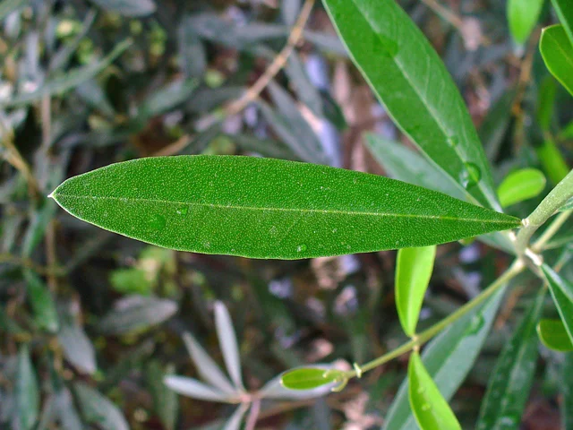
Elongated and green olive leaf, with light central ribbedness and other leaves at the bottom.
Olive leaf photographed in Stutensee, Germany, in 2011. Botanical illustration; it is not a record of Cabeceiras. This frame does not show the two faces of the same leaf.
Photography: H. Zell · CC BY-SA 3.0
About this photograph

Date given at source: . Source consulted in 2026-11-07. EXIF orientation, proportional resizing and WebP conversion; no retouching or clipping of the file.

Request withdrawal or correct authorship

The silver side of the olive tree also tells a story.

Inclui uma atividade para experimentar →Explorar: Da folha ao fruto e ao lagar →
Read here and consult sources

On the half slopes of Cabeceiras, the municipal portrait includes olive trees. The cultivated olive tree has green-gray leaves on top and silver-gray under it, where there are hairs. The small flowers have four white petals joined at the base.

The fruit is olive, an oil-rich drupa. The description of the University of Évora accompanies the change from green to red and dark shades during maturation, but refers to variants that remain green even mature. The color alone does not tell the whole story of the fruit. From tree to olive oil, there is a link that can continue in reading about the Ramil mill.

The record distinguishes the cultivated olive tree from the wild variant, the zambujeiro. In the latter, it describes smaller leaves and fruits and thorny lower branches. The comparison shows why a single characteristic, such as the silvery tone of the leaf, does not solve all the differences.

The olive tree is perennial: it maintains foliage throughout the year. This allows you to return to the same tree at different times and compare leaves, flowers and fruits without expecting all to be present simultaneously.

Palavras desta história: ver explicações →
Source and context

University of Évora — Virtual Museum of Biodiversity, Olea europaea

Municipality — landscape and vegetation

Accessed: . Editorial summary; the date of consultation is not the date of the facts.

Painzela · gardens and knowledge

Plants that take shape

Cameleiras and teixos are also part of the history of the gardens.

Inclui uma atividade para experimentar →Explorar: O jardim também guarda saberes →
Read here and consult sources

Cameleiras e teixos worked on geometric or animal figures: it is the art of the topiaria. The Portuguese Association of Historical Gardens links this tradition to the school of Manuel Joaquim Alves Soares, continued by the son Joaquim. Casa de Piellas, in Painzela, is part of this story. It is a private property; consult the conditions of visit in the form.

The presentation of the Route of Tâmega associates this garden school with the support of the sisters Emilia Ermelinda and Justina Praxedes Pinto Basto. In the mid-19th century, they will have promoted the learning of Manuel Joaquim Alves Soares in Porto and England. The history of plant forms thus includes the circulation of knowledge and transmission between generations.

Looking at a topiary figure is looking at a plant and a human knowledge. Geometric shapes organize lines and volumes; zoomorphs evoke animals. The association places examples of this tradition in several houses of Basto, not only in Piellas.

Palavras desta história: ver explicações →Getting to know the parish See Fact sheet: Casa de Pielas, jardins e anexos
Source and context

Portuguese Association of Historical Gardens — Route Tâmega

Portuguese Association of Historical Gardens — Casa de Piellas, Painzela

Accessed: . Editorial summary; the date of consultation is not the date of the facts.

Vegetation described for the territory

The forest also has a history

Names that are part of the mountain memory.

Inclui uma atividade para experimentar →Explorar: Ler uma árvore por partes →
Read here and consult sources

Carvalhos and chestnut trees are part of the mountain vegetation described by the municipality. The same source counts the partial replacement of this vegetation by pine-bravo. Therefore, a wooded slope also keeps planting choices and changes in land use. Looking only at the green does not arrive: it is worth noticing the species, spots and spaces between trees. This municipal description is not a current survey of each forest.

The publication Forests do Alto Minho distinguishes soutos, oriented to the production of chestnut, candlesticks, for the production of sticks. They are uses of chestnut, not two species of tree. This regional comparison helps to ask questions about the landscape of Cabeceiras; it does not identify the function of a concrete portion of the municipality.

There is still a forest below the canopy. The sub-basket gathers plants that grow under the trees; dead wood can also sustain insects that feed on it and fungi. A forest landscape is not, therefore, limited to the number of living trunks. To observe it, look for different layers — canopy, low vegetation and fallen wood — without concluding that the species cited for another region are present in that area.

Palavras desta história: ver explicações →
Source and context

Municipality — landscape and vegetation

High CIM Minho — High Forests Minho, sours and candlesticks (habitat 9260)

Accessed: . Editorial summary; the date of consultation is not the date of the facts.

Agricultural landscape

Olives, cork oaks and vineyards

From the half slopes to the cultivated floodplains.

Inclui uma atividade para experimentar →
Read here and consult sources

The municipal description accompanies the landscape of the half slopes to the floodplains: olive trees and cork oaks appear alongside the hanged vine, in which other trees serve as a support. The source mentions poplars, plantains and fruit plants, including apple trees, orange trees and pear trees. It also describes slopes transformed into terraces and small plains near the rivers adapted to agriculture. It is a way of observing the relationship between relief, water and cultivation; not an updated inventory of each plot.

Source and context

Municipality — landscape and vegetation

Municipality — Tourist sites: agricultural landscape and vegetation

Accessed: . Editorial summary; the date of consultation is not the date of the facts.

Refojos · monastic landscape

Beyond the church, a cultivated land

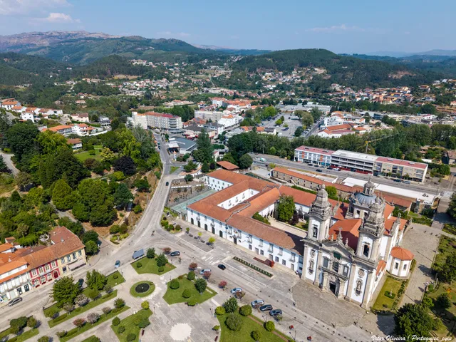
Air view of the Monastery of São Miguel and the Republic Square in Refojos
View of the Monastery of Refojos and the urban surroundings. It is a context image, not a reconstruction of the cultivated fence.© Vitor Oliveira from Torres Vedras, PORTUGALⓘ

Vegetables, orchards and medicinal plants were part of the fence.

Inclui uma atividade para experimentar →Explorar: A cerca continua noutras histórias →
Read here and consult sources

Hortes, orchards, medicinal plants, fields and forests composed the ancient surrounding monastery of Refojos, according to the municipal description of 2021. The botica supplied other Benedictine monasteries, including Tibães. Beyond the church, there was land to cultivate and medicines to prepare. It is a historical portrait of the fence, not an inventory of the current plants.

The same description situates the riverside of Penoutas next to and in the back of the Monastery, next to buildings of agricultural origin however musealized. Water and work buildings help to broaden the look: the history of the set is also told outside the cult space.

The ancient fence is not read today as a single garden intact. The fountain draws attention to scattered traces. Distinguishing what the document describes from what a photograph allows to see is part of the discovery: a view of the square does not reconstitute missing gardens, orchards or medicinal plants.

Palavras desta história: ver explicações →Getting to know the parish See Fact sheet: Mosteiro de São Miguel de Refojos
Source and context

Municipality — historical gardens, news of 21/05/2021

Accessed: . Editorial summary; the date of consultation is not the date of the facts.

General botany · birch

A tree of light bark

The birch attracts attention even before we look at the leaves.

Inclui uma atividade para experimentar →Explorar: Flores discretas, estratégias diferentes →
Read here and consult sources

Betula celtiberica's record describes a deciduous tree, silvery white trunk, and elongated to triangular contour leaves, with bite margins. The species is associated with humid environments, including watercourse margins, and needs plenty of light.

The presentation of the Gulbenkian Garden places flowering in April and May and describes small winged fruits scattered by the wind. The bark, leaves and reproductive structures offer different clues throughout the year. It is information about the species; it does not confirm its presence in a parish nor guarantees the same dates in all locations.

The male and female flowers are found in the same tree, but in different structures. Gulbenkian describes the male ones gathered in yellow-green and the female ones initially erect. The word flower does not always mean large and showy petals: observing a tree can require attention to discrete structures.

The chart also highlights shallow roots, with horizontal development, and the ability to burst from the toilet. The visible trunk is only part of the plant; growing by seed and producing new sprouts are distinct processes. They are characteristics of the sheet of Betula celtiberica, without assigning a copy to Cabeceiras.

Palavras desta história: ver explicações →
Source and context

Calouste Gulbenkian Foundation — Celtic betula, trunk and leaves

Accessed: . Editorial summary; the date of consultation is not the date of the facts.

Botanic of the species · with local registration

A fruit with a wing

In the ash, the shape helps travel.

Inclui uma atividade para experimentar →Explorar: Três formas de continuar a viagem →
Read here and consult sources

The fruit of the ash has a wing and receives the name of samara. There is another detail to discover: the leaf is divided into several narrow folioles. Do not confuse each of these parts with an entire leaf.

Fraxinus angustifolia can grow in forests of shores and slopes. The local photograph documents a copy in Gondiães e Vilar de Cunhas; it does not show a fruit in travel or allows to describe its entire habitat.

The Gulbenkian chart describes leaves with three to eleven folioli, of sawed margins. Angustifolia termination refers precisely to this narrow form. In the fruit, the wing prolongs the part where the seeds are: fruit and seed are not the same structure. The tree loses the leaves seasonally; branches, leaves and fruits offer different clues throughout the year.

The ash binds this form of leaf to the availability of water. Gulbenkian plug refers to tolerance to different temperatures, but sensitivity to dryness, and preference for deep soils. It also describes a high and irregular canopy and a dark trunk, deeply cracked. The leaf is not the only part that helps to know the tree: the bark, the canopy and the environment complete the observation, without a single feature sufficient to identify a specimen.

Palavras desta história: ver explicações →
Source and context

University of Évora — BioMontado, chips Fraxinus angustifolia and Hedera hibernica

Portuguese Society of Botany — Flora-On, Fraxinus angustifolia: ecology

Calouste Gulbenkian Foundation — Straits leaves, fruit and habitat

Accessed: . Editorial summary; the date of consultation is not the date of the facts.

General botany · silva

A blueberry is a small set

In silva, the fruit has more details than it seems.

Inclui uma atividade para experimentar →Explorar: Uma amora, muitos pequenos frutos →
Read here and consult sources

A blackberry gathers numerous small drupas. Rubus ulmifolius has flowers of five petals, white or pink, and fruits that become black when mature. The leaf is also composed: it is divided into three to five folioli, green on the top face and grayish and hairy on the bottom.

The arched stems form dense silvados. The University of Évora associates the plant to forests, hedges, wastelands and water banks, preferring fresh and humid soils. It is a general botanical description; it does not identify a concrete silvado in the municipality.

A composite leaf may look like a small branch. The difference helps to read the plant: in the silva described by the University of Évora, the three to five folioles belong to the same leaf and are arranged in a typed way, as fingers that depart from a base. The greyish appearance of the lower face is due to dense pilosity, called tomento.

The description also refers to purple and pruinous shoots, with a surface cover of waxy appearance. They are distinct details of the thorns of the stems. The plant also appears in soils altered by human activity; a silvado, by itself, does not show when or why a land has ceased to be cultivated.

Palavras desta história: ver explicações →
Source and context

University of Évora — Rubus ulmifolius, leaves and fruits

Accessed: . Editorial summary; the date of consultation is not the date of the facts.

Forest Park · plantation of 2016 and biology of the species

A tree with fan leaves

Ginkgo has an easy signature to search the leaves.

Inclui uma atividade para experimentar →Explorar: Duas árvores, duas formas de olhar →
Read here and consult sources

The leaves of Ginkgo biloba open in fan and can present a central division. In autumn, they become golden before falling, describes the Gulbenkian. The connection to Cabeceiras has a date: the municipal news of 18 March 2016 records the plantation of ginkgo and metasequoia in the Forest Park. The record tells the history of this plantation; it does not confirm the current state of the specimens.

The fan shape also appears in the leaf ribs. Gulbenkian explains that the division into two lobes, when it exists, is at the origin of the bilobe name. It is not necessary that all leaves have an equal cut to belong to the same species.

Ginkgo has male and female individuals. In female trees, seeds are formed with a fleshy cover that can remember a plum, but are not fruits like a plum tree. The interest of this reading is to observe forms and know the reproduction; the municipal news does not identify the sex of the specimen planted in Cabeceiras.

Origin and use are also part of history. Gulbenkian is located at the origin of ginkgo in southeast China and refers to its planting in Portuguese parks, gardens and ruins. It prefers places with sun and soil with water available, but well drained. A garden can therefore gather trees with very different origins: being planted in Cabeceiras does not make a species originally from the municipality.

Palavras desta história: ver explicações →
Source and context

Municipality — World Tree Day, 18/03/2016

Calouste Gulbenkian Foundation — Ginkgo

Accessed: . Editorial summary; the date of consultation is not the date of the facts.

Alvite · written memory in 1758

The Orada changed from high to valley

The same mountain could show different landscapes.

Inclui uma atividade para experimentar →Explorar: O que mudava entre o alto e o vale? →
Read here and consult sources

In the account of 1758, the Orada presents a high boulder, with few trees, described as rough and cold. In the faldas, the scenario changes: chestnut trees, oaks, hanged vine, olive oil and cereals enter the description.

The vicar places the residents in the low areas, next to the valley, and not at the top of the mountain. Altitude, settlement and cultivation help to read the set. It is the written portrait of that year, not a survey of the current vegetation.

Source and context

Municipality — Memory of Alvite, 23/05/1758; transcription of José Viriato Chapel (2003)

Accessed: . Editorial summary; the date of consultation is not the date of the facts.

Forest landscape · pine-bravo botanical

A pine cone has small seed houses

The woody scales hide a detail.

Explorar: Uma árvore, várias pistas →
Read here and consult sources

In the pine-bravo, Pinus pinaster, the pine contains two seeds per scale, according to the description of the University of Évora. The trunk, in turn, has thick bark, red-brown and very split. After recognizing the needles in pairs, it is worth noticing in these other forms. The municipality mentions the pine-bravo in the mountain landscape; these characteristics help to know it without constituting an inventory of the local pine forests.

In the same tree there are different male and female reproductive structures: the species is monoic. The chart describes males as yellowish clusters and females as squamous structures that form cones. Looking only at a mature pine cone leaves, therefore, part of the cycle undiscovered.

The environment also counts. The University of Évora associates pine-bravo with sunny places, with acidic and often sandy soils, also referring to the presence inside on shale substrates. It can form pine forests or integrate mixed forests. This describes preferences and general forms of occurrence; it does not transform all the slopes with these conditions into pine forests.

Palavras desta história: ver explicações →
Source and context

University of Évora — Virtual Museum of Biodiversity, Pinus pinaster

Municipality — landscape and vegetation

Accessed: . Editorial summary; the date of consultation is not the date of the facts.

Ecology of the municipality landscape

A landscape needs connections

Among the green spaces, the interval also counts.

Inclui uma atividade para experimentar →Explorar: Escolhe uma parte da paisagem →
Read here and consult sources

An isolated green space does not tell the whole story. The municipal report of 2025 explains that fragmentation reduces and separates habitats, interrupting ecological processes. The ecological structure seeks to link natural, agricultural and forest spaces, including gardens, alleys and waterbanks in the village. It is a proposal for reading and planning the territory, not confirmation that all these links already work.

Palavras desta história: ver explicações →
Source and context

Municipality — Environmental Report of the PDM review, February 2025, p. 55
Accessed:

Municipality — Environmental Report, February 2025, pp. 50, 55 and 139
Accessed:

Editorial summary; the date of consultation is not the date of the facts.

General biology · moss, no local inventory of species

A little carpet full of life

Mosses ask for a closer look.

Inclui uma atividade para experimentar →Explorar: Pequenas formas, grandes diferenças →
Read here and consult sources

Briophytes are small plants whose life cycle depends heavily on moisture. Diversity is not only in the green: there are different shapes, colors and textures. According to Serralves' scientific presentation, they contribute to the recycling of nutrients and can colonize surfaces where other plants still cannot settle, helping to form the soil. Knowing this group gives new questions for a walk, without having to start examples.

Mosses do not have true roots. Kew describes rhizoids as small filaments whose main function is to attach the plant to rock, bark or soil. The absorbing surface helps to capture water and minerals from the environment. Therefore, contact with moisture is part of their way of living.

They also do not produce flowers: they reproduce by spores. The spaces between small plants help to retain water, helping to keep the soil and the nearby environment moist. These rugs can also offer shelter to small animals.

This does not mean that all mosses need the same conditions. There are species adapted to very different environments, and some go through dry periods in a dormant state. A green spot on a wall does not allow themselves to identify the species or explain its entire cycle.

Palavras desta história: ver explicações →
Source and context

Serralves / MHNC-UP and CIBIO-INBIO — Briophytes, 20 of November 2016

Royal Botanic Gardens, Kew — 7 interesting things about moss, Ellen McHale, 23/05/2020

Accessed: . Editorial summary; the date of consultation is not the date of the facts.

Flora · local name and general ecology of the species

Madresilva finds room on the edge

Between the hedge and the woods, there's another environment to discover.

Inclui uma atividade para experimentar →
Read here and consult sources

The madresilva appears in the municipal description of the mountain vegetation. To know a botanical example associated with this name, Flora-On describes Lonicera periclymenum in silvados, hedges near watercourses and edge of woods, with some shade and preference for acid soils. It is a clue about habitats, not an identification of a plant observed in Cabeceiras: the municipal reference by common name does not allow to determine species or subspecies.

The edge is the meeting zone between the forest and the adjacent space. To observe this transition, compare a shaded path with the opening next door: the arrangement of the branches and the light that reaches the ground can be different, even a few steps away.

The chart presents two subspecies and gives them the same habitat description. This detail is useful: knowing the environment in which a plant usually appears helps to look for information, but does not solve an identification by itself. A photograph, popular name and habitat description answer different questions.

Source and context

Portuguese Society of Botany, Flora-On — Lonicera periclymenum, ecology

Municipality — landscape and vegetation

Accessed: . Editorial summary; the date of consultation is not the date of the facts.

General biology · alders and bacteria

The alder has partners in the roots

A tree doesn't live alone, even under the ground.

Read here and consult sources

Flora-On describes an association between alder roots and Frankia alni, a filamentous bacterium capable of fixing nitrogen. It is a different partnership of mycorrhizae involving fungi. Knowing what happens in the soil adds another dimension to the forest of the shores. It is general biology, without confirmation of this association in a local specimen.

The same portal places the alders in woods on the banks of rivers and streams, humid ravines and permanently humid alluvial land. When they dominate the forest, the names amial or ameal appear. The tree we see above the ground thus belongs to a water environment and a network of underground relations.

There is also a history in scientific names. Flora-On’s taxonomic note refers to a study that distinguishes the native alder from Portugal as Alnus lusitanica, although the page presents information under Alnus glutinous. A name change in a source may reflect research; it does not mean that two different trees have been observed in the same place.

Palavras desta história: ver explicações →
Source and context

Portuguese Society of Botany — Flora-On, Alnus: ecology, symbiosis and taxonomic note

Accessed: . Editorial summary; the date of consultation is not the date of the facts.

General botany · no local occurrence assigned

Rosemary also interests bees

There's more to finding out beyond the scent.

Read here and consult sources

Flora-On describes rosemary as a melliferous plant of early flowering, often planted near apiaries. It prefers exposed, dry and hot places, in open shrubs or tree formations. The record uses Rosmarinus officinalis and indicates Salvia rosmarinus as synonym. It is general information of the species: it does not identify a plant of the Arc site or the composition of a honey produced in Cabeceiras.

The preference for dry places does not limit rosemary to a single type of land. Flora-On describes it in sandy, shale or limestone soils, both acidic and basic. The expression “indifferent edaphic” refers precisely to this tolerance to different soil conditions; it does not mean that light, temperature and water stop importing.

The presence of people also enters this story. According to the chart, the planting with apiaries expanded the distribution of the species in Portugal. Finding a plant does not automatically explain how it arrived at the site: spontaneous occurrence and presence linked to cultivation are different information.

Palavras desta história: ver explicações →
Source and context

Flora-On — Rosmarinus officinalis (alecrim), ecology and observations

Accessed: . Editorial summary; the date of consultation is not the date of the facts.

Wetlands plants · general botany

A reed tells a story of moisture

The unleavened reed finds its place in damp meadows.

Inclui uma atividade para experimentar →Explorar: A humidade tem várias paisagens →
Read here and consult sources

The Flora-On associates Juncus effususus subsp. effususus to reeds and meadows with deep and humid soils. Gaia Biological Park describes the smooth and glossy stems of the junco-effususus and recalls the use of its fibers in weaving carpets. They are clues of ecology and use of the plant, not a record of presence or craftsmanship in Cabeceiras.

The flowers also deserve attention: the Biological Park describes them in branched sets, greenish or whitish shades, and indicates flowering between May and September. The plant is vivacious, remaining for several years. Thus, it does not need a showy flower to exist flowering. The indicated period is a reference of the fiche, not a forecast for a visit to the municipality.

The Gaia plug indicates a height of 50 to 90 cm and includes margins of lakes and tanks between the environments where the reed may occur. It is a dimension reference, not a mandatory height for each plant. To describe a specimen, shape, size and environment should be recorded separately.

Palavras desta história: ver explicações →
Source and context

Portuguese Society of Botany — Flora-On: Juncus effususus subsp. effususus

Gaia Biological Park — Junco-efuso

Accessed: . Editorial summary; the date of consultation is not the date of the facts.

Between rivers and mountains

Water and relief form the municipality. Choose a name and follow the landscape.

Escolher uma história · 40
Landscape and garden · Painzela

The water draws the garden of Piellas

Among the carved bushes, there are other ways to go.

Inclui uma atividade para experimentar →Explorar: O jardim dentro da paisagem →
Read here and consult sources

In Piellas, the water helps to connect garden, forest and fields. The description published by Jardins Magazine places a tank in L next to the wall, close to a passage to the forest of Casa do Boal. Another tank, surrounded by bamboos and buxos, opens for a cultivation field surrounded by forest. The water goes to the stream of Painzela.

The article also describes paths shaded by ramadas and an agricultural courtyard associated with the old production of corn and wine. The farm therefore gathers recreational spaces and work spaces: the garden of carved shrubs is part of a wider landscape.

Try to imagine the fifth in layers: the levels, paths, vegetation and the water system. The description allows to relate these elements, but does not provide a complete map of the hydraulic circuit. Piellas is a private property; the visiting conditions should be consulted on the site's chart.

See Fact sheet: Casa de Pielas, jardins e anexos
Source and context

Jardins Magazine — Gardens of Portugal: Route of the Tâmega, section Casa de Piellas

Accessed: . Editorial summary; the date of consultation is not the date of the facts.

Council · Water resources in the 2025 report

Under the ground there's also water

The water map doesn't end up on the surface.

Inclui uma atividade para experimentar →Explorar: Olhar a água por diferentes caminhos →
Read here and consult sources

The municipal environmental report of February 2025 identifies, in the groundwater, units of the Old Indifferentiated Maciço of the Douro, Ave and Cávado basins. In the same document, the surface water masses of the municipality belong to the Douro Hydrographic Region. They are two distinct readings of the territory: the network of rivers to the surface and the water underground. The reference does not indicate visitable wells nor allows to evaluate the water of a spring.

How does water fit in the rock? The USGS explanation points to pores and fractures: spaces between particles and cracks that may be filled with water. Porosity describes the available spaces; permeability, the ease with which water circulates through the material. Having spaces is not enough: the connection between them also matters. It's a general explanation, not a measurement of the rocks of Cabeceiras.

Source and context

Municipality — Environmental Report of the PDM review, February 2025, pp. 56–58: water network and resources

USGS — Water Science School: groundwater, porosity and permeability

Accessed: . Editorial summary; the date of consultation is not the date of the facts.

Water memory · lifting of 2008

The water had its turn

Sundown to sunset, community rule.

Inclui uma atividade para experimentar →
Read here and consult sources

The survey of 4 March 2008 describes the water of Levada de Víbora divided into eleven shifts of 24 hours, called couples. Each shift began at sunset and ended at sunset. The initial order changed from year to year.

The names came from houses of Abadim: six couples were associated with the Village of the Tower and five to Santo António. The granite gutter led water from the stream of Busteliberne for irrigation and grinding. Thus, the levada had a visible construction and an equally important time organization. These data belong to the inventory of 2008, not to a current watering scale.

Source and context

Municipality — inventory of taken, L1 and L18 forms (uplifts of 2008)

Accessed: . Editorial summary; the date of consultation is not the date of the facts.
Landscape · Abadim

Follow the path of the water

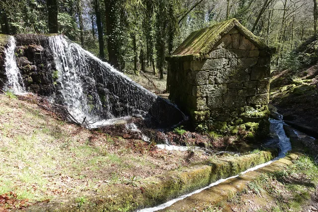
Granite mill served by Levada de Víbora, in all Moinhos de Rei, with waterfall and canal in the wooded surroundings. Register 2025.
A mill and the water channel at Moinhos de Rei.© Joseolgonⓘ

The Levada de Víbora approaches nature and human labor.

Inclui uma atividade para experimentar →
Read here and consult sources

The Levada de Víbora allows you to relate the water path to the grinding work. The municipal presentation of the PR1 BCC connects the beginning to the Oral Dam, in Abadim, to the Moinhos de Rei, to woods and small watercourses. It also highlights the village and viewpoint of Porto d’Olho and Leisure Park of Víbora. Interest is not only in the destination: the channel helps to understand how the water was conducted and used. To choose the walk, see the track record and compare distance and difficulty; this reading does not replace the current conditions of the route.

Palavras desta história: ver explicações →Compare the walks See Fact sheet: Moinhos de Rei See Fact sheet: Trilho da Levada de Víbora See Fact sheet: Área de Lazer do Oural See Fact sheet: Área de Lazer de Víbora
Source and context

Municipality — Trilho da Levada de Víbora, PR1 BCC

Accessed: . Editorial summary; the date of consultation is not the date of the facts.

Rio Douro · water uses in 1758

In summer, the water took other paths

The levadas linked the flow of rivers to the work of the fields.

Inclui uma atividade para experimentar →Explorar: A água ligava trabalhos e lugares →
Read here and consult sources

The memory of 1758 describes the two rivers of Rio Douro running all year round, but arriving at the end of the course with little water in the summer. The vicar linked this decrease to the many levadas that supplied the fields. Dams, waterfalls and mills comprised a landscape of various works.

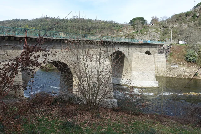
The crossings also varied: the report mentions wooden bridges between places and the church, as well as stone bridges in Teixeiras and Vilela. The margins were not just production spaces; it was necessary to move from one side to the other. This historical enumeration does not identify surviving structures or current accesses.

The document also explains why boats did not circulate: there were stones, waterfalls and dams, and insufficient flow for navigation. A river could be important for the economy of the parish without being a river transport route.

On the cultivated shores, the report mentions vine oaks; outside the fields, urzeira forests. Thus, the water helped to organize a landscape in which cultivation, vegetation and equipment were found. The answer was signed in 22 May 1758: summer is described as usual behavior, not as a measurement carried out this summer.

Palavras desta história: ver explicações →Getting to know the parish
Source and context

Municipality of Cabeceiras de Basto — Parish memories of 1758: Rio Douro

Municipality — Parish Memoirs of Rio Douro, António Carneiro da Costa, 22/05/1758

Accessed: . Editorial summary; the date of consultation is not the date of the facts.

Alvite · testimony of 1758

Store water coming from the hill

Small springs helped water the fields.

Inclui uma atividade para experimentar →
Read here and consult sources

In the ratio of 1758, the vicar of Alvite described little abundant springs in the Serra da Orada. The residents retained these waters in prey to benefit the fields facing the spring. Saving water was a way to cope with its scarcity.

The same document classified the parish as drought, especially in the summer, and referred to the absence of mills and mills. Two olive oil mills worked with oxen and other animals; to grind cereals, many residents sought neighboring parishes. The portrait links natural resources, techniques and displacements, without allowing to conclude that the same uses or structures continue today.

Getting to know the parish
Source and context

Basto Land Museum — Parish Memories of 1758: Alvite

Accessed: . Editorial summary; the date of consultation is not the date of the facts.

Saint Nicholas · testimony of 1758

The water watered and made oil

A river, different jobs.

Read here and consult sources

In 1758, the parish priest of São Nicolau described taken to the fields and water to move an oil mill in Quinta da Taipa. One of the levadas served Gondarem, Fragua, Penedo and Lamelas. The report helps to imagine the link between river, irrigation and production. It distinguishes three continuous levadas: one for the places referred to and two for the farms of Bouças and Taipa. It also mentions mills fed by dams.

The description also includes a smaller water course, the west, originating in the fountains of the hills of Lapela and Celeiró. In this river, the rector mentions mills and a levada that served the fields of the Casal. He recalls two other destined to Quinta da Taipa, one of which was ruined. The water use network had therefore structures in use and others that no longer worked as before.

This detail helps to read the hydraulic heritage as continuous work: the existence of a canal in an old account does not guarantee its use in another time. The source also distinguishes collective uses from places and taken from farms, allowing to compare different relationships between water, fields and owners.

Getting to know the parish
Source and context

Basto Land Museum — St Nicholas Parish Memories (1758)

Accessed: . Editorial summary; the date of consultation is not the date of the facts.

Municipal hydrographic network

The water from here also reaches the Douro

The rivers are part of a larger network.

Inclui uma atividade para experimentar →Explorar: O caminho da água até ao Douro →
Read here and consult sources

Gold, Beça and the Cavez stream enter the right bank of the Tâmega, which is affluent of the Douro. The municipal environmental report allows to follow this link between rivers: a map of Cabeceiras continues far beyond the municipality limits.

A watershed includes the territory that leads water through streams and rivers to a common exit to the sea. It is not only the blue trace of a map. APA also distinguishes the sub-basin, whose flow converges to a point of a watercourse, for example a confluence.

In the scheme of this reading, the names show links between watercourses; they do not draw the boundaries of the respective basins. To perceive the river, it is necessary to include the land that makes it reach water. It is this link that allows to pass from the history of the tributaries to soil erosion and to the life of the banks.

Palavras desta história: ver explicações →
Source and context

Municipality — Environmental Report of the PDM review, February 2025, p. 56

Portuguese Environment Agency — water resources and associated concepts

Accessed: . Editorial summary; the date of consultation is not the date of the facts.

Rio Douro · project announced in April 2025

In the wasteland, the forest finds the water lines

A project of Rio Douro helps to read different functions of the same landscape.

Inclui uma atividade para experimentar →Explorar: A encosta encontra o rio →
Read here and consult sources

In April 2025, Antar announced the start of an intervention agreed with the local wasteland community of Riodouro, in an area of about 500 hectares of Cabreira partially affected by the fires of 2016 and 2024. The plan presented combined forest production, conservation and recovery of about 40 hectares of riverside vegetation. The proposal helps to realize that managing a hillside also involves water spaces. These figures are objectives announced by the promoter, not a confirmation of completed work or results achieved.

The April news places the beginning of the work in February 2025. For the first phase, it announces about 220 hectares of production species and about 80 hectares of diverse leaves and resins. These areas have different purposes; they are not a balance of plantations carried out.

The relief also enters the project: the promoter describes plateaus, steep slopes and great variation of altitude. The reading of the landscape joins, thus, the form of the land, production spaces and sensitive areas next to the water. There is no complete division here of the 500 hectares that allows to draw all the plots.

Source and context

Antar — announcement of the start of the Riodouro project, 04/04/2025; objectives announced by the promoter

Accessed: . Editorial summary; the date of consultation is not the date of the facts.

Refojos and São Nicolau · uses described in 2025

Water also reaches the light and fields

The same landscape brings together different uses.

Explorar: Da água em movimento à eletricidade →
Read here and consult sources

The environmental report of 2025 relates water resources to electricity production and irrigation. It identifies the Cefra Hydropower Plant in Refojos, and the São Nicolau mini-hydric. They are documentary references to water use, without confirmation of public access or current operation. Add to them the stories of mills and levadas: the relationship between water and work goes through different times.

How does it go from current to electricity? Water runs a turbine connected to a generator. Flow and downgrade influence the available energy, explains the Department of Energy. It is the general principle that the scheme allows you to explore; it does not describe the specific equipment of the two local facilities. Thus, watering fields, grinding cereal and producing electricity are different uses of a resource connected to the landscape.

Palavras desta história: ver explicações →
Source and context

Municipality — Environmental Report of the PDM review, February 2025, pp. 56–58: water network and resources

U.S. Department of Energy — How Hydropower Works: turbine, generator, flow and downgrade

Accessed: . Editorial summary; the date of consultation is not the date of the facts.

Saint Nicholas · hydraulic heritage inventoryed in 2008

A log led the force of the water

In Quinta de Covas, the history of olive oil intersects with that of energy.

Explorar: A água muda de trabalho →
Read here and consult sources

The inventory of 27 of February 2008 located the mill of Quinta de Covas in Parada, in the parish of Cabeceiras de Basto. The water came from a levada with a weir in Peio. Before arriving to the castor, it passed through a gutter excavated in a trunk: wood was also part of this hydraulic construction.

The building brought together an olive oil mill, a mill and a wine mill. The form associates the decommissioning of the mill and the mill in 1994 to the entry into operation of a hydroelectric power station, which conditioned the available motor force. It is the explanation recorded in that survey, not an independent evaluation of the operation of the plant.

The document describes private heritage and equipment already without the necessary elements for grinding. This story does not indicate public access or current conditions of conservation.

Source and context

Municipality — inventory of olive oil mills, record L.A.5, withdrawal of 27/02/2008

Accessed: . Editorial summary; the date of consultation is not the date of the facts.

Council · environmental relations described in the report of 2025

The river begins before the shore

What happens on the ground can travel with the water.

Inclui uma atividade para experimentar →Explorar: Segue a água à superfície e no subsolo →
Read here and consult sources

The water flowing to the surface can transport soil and nutrients to the water lines. The municipal environmental report of February 2025 relates this process to erosion and the incorrect use of fertilizers rich in phosphorus and nitrogen. Excessive enrichment in nutrients can favor eutrophication, changing the aquatic environment.

The document also distinguishes groundwater: it states that the excessive use of nitrogen fertilizers can contribute to the accumulation of nitrates and increased salinity; what happens in the field is therefore of interest both to water that we see running and to water that is underground.

They are potential pressures described in an environmental assessment. They do not identify a discharge in a specific field, nor allow assessing a river by appearance. To understand the system, it is worth relating land, surface flow and aquifers, keeping separate general hypotheses and measurements from a location.

Source and context

Municipality — Environmental Report of the PDM review, February 2025, p. 59: land uses and water resources

Accessed: . Editorial summary; the date of consultation is not the date of the facts.

Average-high basin of Tâmega · landscape studied in 2016–2017

The river also has a forest

The trees of the shores are part of the landscape of the water.

Inclui uma atividade para experimentar →Explorar: As três zonas do rio →
Read here and consult sources

The report of 2016–2017 describes riverside forests of the mid-high basin of Tâmega with alders, ash trees and willows, and birch trees in the smaller courses. It mentions often narrow strips, limited by crops. It is a regional description of that study, which covers Cabeceiras and other municipalities.

The margin, the water and the bottom are connected, but offer different conditions. The salamander-lusitan depends on humid environments and reproduces in the water; the young river mussel lives buried in the bed and needs oxygen. The scheme allows to explore these general relationships without representing a place where all these species have been observed together.

Source and context

Biosphere / Iberdrola, APA file — Monitoring of ichthyofauna 2016–2017, February 2018; pp. 5, 35 and 40, station record 22 on p. 175 PDF
Accessed:

Link to Nature Protection — Salamander-lusitan
Accessed:

ICNF — Margaritifera margaritifera, ecology, reproduction and threats, pp. 2–3
Accessed:

Editorial summary; the date of consultation is not the date of the facts.

Landscape and agriculture

Peio, gold and stream Cavez

Water also organizes the work of the fields.

Read here and consult sources

The agricultural landscape is not only explained by the presence of water. The municipal tourist presentation describes two ways of adapting the land: terraces on the slopes and use of small alluvials associated with Tâmega and courses such as Peio, Gold and the brook of Cavez.

On the slopes, the fields accompany constructed steps; next to the rivers, deposit land is used. They are different ways of working the relief. Reading invites to compare the shape of the fields and their relationship with water, without assigning to all the land the same origin or cultivation.

Palavras desta história: ver explicações →
Source and context

Municipality — landscape and vegetation

Accessed: . Editorial summary; the date of consultation is not the date of the facts.

Cavez · landscape described in 1758

A river that moved but did not water

The water nearby was not always accessible water.

Inclui uma atividade para experimentar →
Read here and consult sources

In 1758, the Tâmega was described in Cavez as a caudal river throughout the year, with a particularly strong current in winter. It had dams, canals and cereal mills. On the banks, the report pointed out cultivated areas, olive groves and trees that supported vineyards.

Despite this presence in agricultural life, the vicar said that the river did not water the fields of the parish: it ran too deep to allow levadas. It is an important difference between having water nearby and being able to lead it to a portion. The description shows how the relief conditioned the uses of water at that time; it does not characterize the current irrigation.

Getting to know the parish
Source and context

Municipality of Cabeceiras de Basto — Parish memories of 1758: Cavez

Accessed: . Editorial summary; the date of consultation is not the date of the facts.

Bucos · testimony of 1758

Two rivers lost their name

The water connected the mountains, the mills and the fields.

Inclui uma atividade para experimentar →Explorar: Segue a água de Bucos →
Read here and consult sources

The vicar of Bucos described in 1758 two courses that eventually lost their name when entering the river of São Nicolau. One was Porto Souto, coming from the mountains of the Apple; the other, called the river of Millos, had origins referred to in Carrazedo and Figueiró do Monte.

The report combines water and work: cultivated margins, grain mills and water use in agriculture. It also mentions small wooden frames. Reading these elements together helps to imagine the links between fields, crossings and grinding. The names and uses belong to the document of 1758; they do not automatically identify the courses or structures that are on the ground today.

Porto Souto is described running all year, despite the reduced flow, with small falls on the north to south route. The other course had a more serene current. The vicar registers trouts and escalates in both: his attention passes from the movement of water to the fish and from there to the cultivated shores. It is not necessary to imagine a large river to understand the importance of these water lines in the life of the parish.

The text also allows us to compare two crossing scales: the Casares bridge, on a busy road, and pedestrian passages made with a single wooden beam. The author highlights the need to improve the first one. The river is thus linked both to the daily work of farmers and to the circulation out of the parish.

Getting to know the parish
Source and context

Municipality — Parish memories of Bucos (1758)

Accessed: . Editorial summary; the date of consultation is not the date of the facts.

Gondiães e Vilar de Cunhas · memory and landscape

Vilar looks at Beça

Houses, slopes and water make up the landscape of the village.

Inclui uma atividade para experimentar →Explorar: Da encosta aos caminhos →
Read here and consult sources

The municipal guide of the villages highlights in Vilar the church and the constructions with tops, on a slope facing the landscape of Beça. The description links built heritage, agriculture, livestock and crafts.

Reading this presentation invites to relate scales: the coverage of a house, the whole village and the valley that opens before it. It is a way to know the territory from the documented elements, not the current confirmation of the conservation of each roof or access to the river.

The guide was born from a partnership between Cabeceiras de Basto and Vieira do Minho, within the framework of the Interpretation and Animation Center of Serra da Cabreira. Its presentation seeks to bring the visitor closer to the villages and people. In Vilar, the landscape arises associated with work: fields, animal breeding and handicrafts help to read the place beyond the view over the valley.

Getting to know the parish
Source and context

Municipality — Village Guide of Serra da Cabreira: landscape, work and heritage

Accessed: . Editorial summary; the date of consultation is not the date of the facts.

St Nicholas and Painzela · hydrography in the testimony of 1758

Two rivers, a meeting in the Ranha

A document allows following water between parishes.

Explorar: Seguir a água no documento →
Read here and consult sources

The report of São Nicolau of 1758 places in Ponte da Ranha the encounter of the river that crosses the parish with what comes from Painzela. It then describes the joint current on the way to Tâmega, next to the bridge of Cavez. It is a historical reading of the water network that connects the territory, not a proposal for walking along the banks.

Before this meeting, the parish priest accompanied the river of St. Nicholas from the hill called Víbora. It describes a modest spring that receives other streams and a reinforced flow at the Bridge of the Cattle by two arms coming from Bucos. It refers to water throughout the year and a particularly caudal winter.

The text also follows the direction changes: to the south, then to the spring and again to the south. It is a way of counting the landscape through the movement of the water. Nascents, tributaries and confluence explain different stages; the names used by the author belong to the testimony signed in 22 May 1758.

Note the following encounters: the arms of Bucos first strengthen the current of St. Nicholas; in the Ranha the water coming from Painzela is joined; the common destination is Tâmega. Drawing these junctions helps to distinguish the path of a river from the network of contributions that feeds it.

Palavras desta história: ver explicações →
Source and context

Basto Land Museum — St Nicholas Parish Memories (1758)

Accessed: . Editorial summary; the date of consultation is not the date of the facts.

Refojos · opening in 2013 and urban transformation

A stream in the history of Casa do Tempo

The renovation of the village centre also passed through the water.

Inclui uma atividade para experimentar →Explorar: Memória, edifícios e água →
Read here and consult sources

The Casa do Tempo opened in 2 August 2013 next to the Monastery of Refojos. In the municipal description, the recovery of old housekeeping houses is part of a broader transformation: connecting the Republic Square to the new areas of the village, creating green spaces and treating the banks of the riverside of Penoutas. The interpretive center thus allows to tell two stories together: the memory of Cabeceiras and the change of its urban landscape.

The Municipality describes the acquisition of part of the returned houses and the negotiations that preceded the intervention. Reutilizing the buildings and transforming their surroundings appear as parts of the same project, rather than separate stories.

The multimedia component of the center was presented as a way to know territory, people, nature, uses and customs. Thus, the stream does not appear only as a scenario: it integrates the history of how that village space gained new functions. To plan a visit, the site's file gathers the practical information available.

See Fact sheet: Casa do Tempo
Source and context

Municipality — Casa do Tempo: opening in 2013 and requalification of the surroundings

Accessed: . Editorial summary; the date of consultation is not the date of the facts.

Abadim · water and grinding in memory 1758

Two streams worked six mills

Few water could also keep a landscape moving.

Inclui uma atividade para experimentar →Explorar: Da água ao alimento →
Read here and consult sources

In 1758, the abbot of Abadim described two streams that went down south, were near Ponte de Pé and went to Tâmega. The water was small, but ran all year round. The report mentions trouts and bogs, without identifying species with scientific names.

In the regato a poente, marks the bridge of cantaria da Ranha. Of the several mills existing on the two water lines, six belonged to the parish. This count does not identify the current buildings nor allows to conclude that they were the same as the assembly today called Moinhos de Rei.

The Abbot describes rapid currents and free use of the waters by neighboring peoples. Thus, little water and movement were not incompatible ideas in his portrait. Reading gains another dimension when approaching the fields: the same document distinguishes the cereals produced in the various places. The regattos belonged to a landscape of cultivation and transformation, although memory does not tell which mill received the cereal from each village.

Palavras desta história: ver explicações →
Source and context

Municipality — Parish memories of Abadim, José Antunes, 22/05/1758

Accessed: . Editorial summary; the date of consultation is not the date of the facts.

Gondiães · 2008 municipal inventory

♪ Four puddles, a neighborhood runaway ♪

In Gondiães, water storage and driving was part of the collective work.

Inclui uma atividade para experimentar →Explorar: Guardar, conduzir e repartir →
Read here and consult sources

Four puddles fed a common infrastructure. The March 20 record of 2008 describes the Rego das Poças, also called Levada da Neighbourhood, in Gondiães: about two kilometres of canal for irrigation and milling, serving the mill of the Tarroeiro.

The Puddles of the Place were located in the Scouts. Three were close to each other; the fourth, farther away. Up to the entrance of the village, the canal followed on natural ground; inside the place passed the stone strut. Store and conduct the water required, therefore, different elements and materials.

The inventory identifies collective ownership and exploitation by the levada consorts. It records seasonal shifts of water, but leaves the time of undetermined construction. The date of the survey is not the age of the work. The indication of use and the state of conservation belong to the portrait of 2008, without confirming the current situation or access.

Palavras desta história: ver explicações →
Source and context

Municipality — inventory of levadas, fiche L29: Rego das Poças, withdrawal of 20/03/2008

Accessed: . Editorial summary; the date of consultation is not the date of the facts.

Geographical framework

The Tâmega draws the limit

A river to understand the south of the municipality.

Inclui uma atividade para experimentar →Explorar: Do limite à paisagem →
Read here and consult sources

The Tâmega accompanies much of the south and southeast border of Cabeceiras. To the east, the municipal geographical presentation mentions the Bessa River. The water thus helps to situate the territory, along with the mountains of the north and west.

On the south side, the neighboring municipalities are Celorico and Mondim of Basto; this is Ribeira de Pena. These references allow you to start reading the map before going to the bridges, fields and network of tributaries.

To complete this orientation, it looks to the other sides: Montalegre and Boticas to the north, Vieira from the Minho to the northwest and Fafe to the west. Cabreira and Barroso frame the north; the Serra da Lameira, the west. The administrative limit and the water network are two different ways to read the same territory: it now follows the tributaries to see where the water continues.

Source and context

Municipality — geographical framework

Accessed: . Editorial summary; the date of consultation is not the date of the facts.

Geographical framework

Cabreira, Barroso and Lameira

Three names to guide the look.

Inclui uma atividade para experimentar →Explorar: Da serra ao rio, escolhe o caminho →
Read here and consult sources

The municipal description uses three mountains to frame Cabeceiras: Cabreira and Barroso to the north, Lameira to the west. They are orientation references, not mountains entirely contained in the municipality.

Neighbors help complete the design: Montalegre and Boticas to the north, Vieira from Minho to the northwest and Fafe to the west. Reading the landscape is also to perceive continuities beyond the administrative line. Start with the names and directions; then approach the look of villages and differences of altitude.

Source and context

Municipality — geographical framework

Accessed: . Editorial summary; the date of consultation is not the date of the facts.

Saint Nicholas · hydraulic heritage inventoryed in 2008

Peio also made flour

A river connected fields, dams and mills.

Inclui uma atividade para experimentar →
Read here and consult sources

The Levada do Casal record records water captured at Peio, near Ponte do Gado, in Gondarem. The inventory describes five mills along the canal. It is a portrait of the hydraulic heritage, not a confirmation of current operation or public access.

The survey of 26 of February 2008 identifies a channel in natural land and two consorts: Casa do Casal and Quinta do Boyinho, this one with less watering time. It also describes the layout near the Levada de Bouças and a landmark in Sendim placed to resolve a divergence of enjoyment. The channel carried water, but its use also depended on agreements between people.

Source and context

Municipality — inventory of taken, L1 and L18 forms (uplifts of 2008)

Accessed: . Editorial summary; the date of consultation is not the date of the facts.
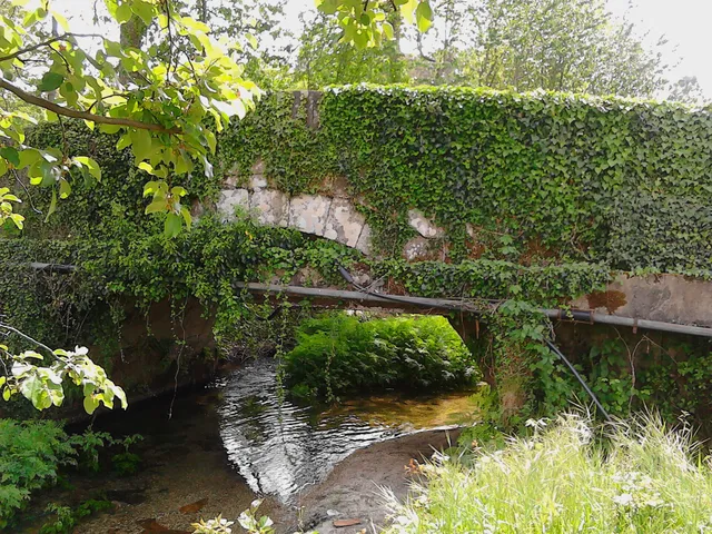
Saint Nicholas · rivers in 1758

Bridges that winter put to the test

The crossing was part of life by the river.

Inclui uma atividade para experimentar →Explorar: Atravessar, navegar ou regar? →
Read here and consult sources

The report of St. Nicholas of 1758 describes three wooden bridges. It says that the winter waters sometimes covered the two highest and even carried some bridges. It is an ancient testimony of the relationship between floods and paths; it does not allow assessing the safety of current crossings. The document names Sendim, Cerdeiró and Ponte do Gado: the crossings helped connect the church to the places of the parish.

The description does not only show the strength of the floods. It refers to a course with many falls of water, difficult to cross the ford and, in some sections, even to follow the banks. The bridges responded to this difficulty of the terrain.

Sendim’s was on the way to the church to this place; Cerdeiró’s served the direction of the Breia. The Bridge of the Cattle was lower than the other two and gave a name to the point where the arms coming from Bucos entered. These details connect the network of roads to the water network, without fixing the position of each structure on the modern map.

Getting to know the parish
Source and context

Basto Land Museum — St Nicholas Parish Memories (1758)

Accessed: . Editorial summary; the date of consultation is not the date of the facts.
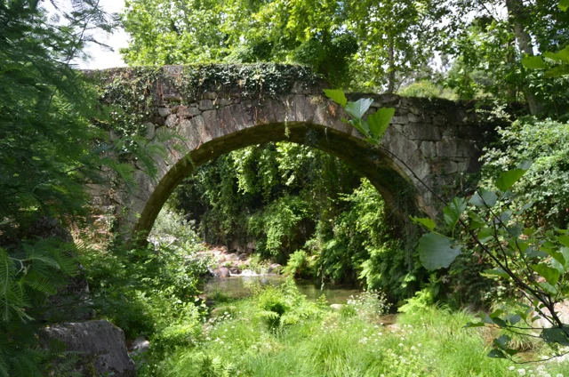
Ribeira de Cavez · water and agriculture

From the spring to the fields

A stream helps explain the whole landscape.

Read here and consult sources

The brook of Cavez is born on the border of the municipality with Montalegre and ends at Tâmega. Between the mountain and the mouth, the municipal description highlights levadas, mills and irrigation mills: buildings and fields that show different ways to enjoy the water.

On the trail beginning in Vilela, Rio Douro, the narrative goes from the descent to the riverside to the levada and the landscape of the lameiros, then following rural paths and the slope. The return to the village brings another material to the history: the granite masonry of the houses. See the route chart to prepare the walk; this reading explains the landscape, without confirming the conditions of the way on the day of the visit.

Getting to know the parish See Fact sheet: Trilho da Ribeira de Cavez See Fact sheet: Vilela, Rio Douro
Source and context

Municipality — stream of Cavez and agricultural landscape

Accessed: . Editorial summary; the date of consultation is not the date of the facts.

Passos · relief and water

A mountains and a river to locate Passos

Wooded edge and house in the photograph identified by the author as Passos, Cabeceiras de Basto.
Landscape of Passos · slope and house; the river referred to in the text is not identified in the image.© Elisabeth LEITEⓘ

Two names help you read southwest of the municipality.

Inclui uma atividade para experimentar →Explorar: Da paisagem ao trabalho →
Read here and consult sources

Serra da Orada and the Petimão River help to locate Passos in the southwest of Cabeceiras. The municipal description highlights the rugged relief and agriculture, along with the municipalities of Celorico of Basto and Fafe.

The church of São Sebastião, the cruises and the alminhas add references built to the reading of the landscape. Rio, Serra and patrimony are complementary clues to know this land; they do not make up a pedestrian itinerary here nor confirm accesses.

In the description of Passos, the municipality also refers to the neighborhood of the old parishes of Outeiro, Refojos and Alvite. This proximity scale helps to situate the mountain and river within a shared territory. Administrative boundaries and landscape elements are different ways of reading the same space.

Getting to know the parish See Fact sheet: Passos
Source and context

Municipality — landscape of Alvite e Passos

Accessed: . Editorial summary; the date of consultation is not the date of the facts.

Toasters · Abadim

A village over a thousand meters

In Torrinheiras, the landscape begins at altitude.

Inclui uma atividade para experimentar →
Read here and consult sources

Torrinheiras, in Abadim, is presented by the Municipality as the highest settlement in the municipality, about 1020 meters. The track climbs the hill and reaches 1159 meters. They are two distinct altitude references: that of the village and that of a point of the route, not a measure of the accumulated climb of the walk.

The description of the panorama names Gerês, Alvão, Marão and Barroso. Further down, it mentions the brook of Busteliberne, Porto d’Olho and, on the return, mills and grazing of barrosan and maronese cattle. Thus, the mountain tells a story of distances and views, but also of water, villages and work. The visibility and state of the track should be evaluated during the visit.

Getting to know the parish See Fact sheet: Trilho de Torrinheiras
Source and context

Municipality — Trilho de Torrinheiras, altitude, landmarks and landscape

Accessed: . Editorial summary; the date of consultation is not the date of the facts.

Rio Douro · Parish memories of 1758

Two rivers to count a parish

The report of 1758 organizes Rio Douro between spring and west.

Inclui uma atividade para experimentar →Explorar: Água que liga aldeias e trabalhos →
Read here and consult sources

In the account of 1758, the Vilela River ran the spring and the river from Rio Douro to the west, both from north to south. The parish priest described origins in small sources and the increase in waters with the contributions of the mountains. He said that Vilela entered the Tâmega below the bridge of Cavez and that the other joined the river coming from São Nicolau. They are geographical names and relations of that document, not a current navigation map.

The bridges bring this geography closer to the life of the villages. The document mentions a wooden crossing between Magusteiro and Teixeiras and a stone one between Teixeiras and the church. It also mentions wooden connections of Eiró and Rio Douro to the church, and another stone between Vilela and the church. Water and paths appear, thus, in the same portrait of the parish.

The parish priest describes rivers with rocks, dams and waterfalls, inadequate to navigation, but useful to mills and fields. They were not only lines to separate places: they were part of work and displacements. These references belong to the testimony signed in 22 May 1758; they do not confirm the conservation of structures or the current access to the margins.

There is a clue to imagine the relief: the author describes three parallel mountains, extended from Salto, with the rivers in the lower spaces. The names of the mountains varied according to the places. Instead of looking for a single name for each mountain line, the document invites to relate position, villages and direction of the water.

Palavras desta história: ver explicações →Getting to know the parish
Source and context

Municipality of Cabeceiras de Basto — Parish memories of 1758: Rio Douro

Accessed: . Editorial summary; the date of consultation is not the date of the facts.

Outeiro · hydrographic network

A small river also draws the map

In Outeiro, Trout connects to Peio.

Inclui uma atividade para experimentar →Explorar: Um afluente e os trabalhos da água →
Read here and consult sources

The municipal description identifies the Trutas River as a small tributary of Peio that bathes Outeiro. Knowing this link helps to look at the watercourses as a network, beyond the best known rivers. The name Trotas, by itself, does not confirm the current presence of these fish.

The position of Outeiro also helps to situate this network: the parish occupies the western bank of the municipality, next to Fafe. The municipal description presents a slightly wavy plateau, with agriculture among the economic activities mentioned. Reading the territory is to join these scales: the border between municipalities, relief and the small water line that follows for Peio.

Try representing these relationships in a simple design. You do not need to reproduce an exact map: an arrow can indicate the connection of the rivers and another mark locate Outeiro on the western side of Cabeceiras.

Palavras desta história: ver explicações →Getting to know the parish
Source and context

Municipality — Outeiro, relief and hydrographic network

Accessed: . Editorial summary; the date of consultation is not the date of the facts.

Holy Lady · memory of 1758

The river entered the life of the fields

A cultivated margin also tells history.

Inclui uma atividade para experimentar →Explorar: Um rio, quatro histórias →
Read here and consult sources

The memory of 1758 describes the river of Santa Senhorinha running all year round, but with little water in summer. The memory describes cultivated shores, fruit trees and wild grove, linking water to irrigation and rural work.

Vila de Lobos and Cainhos had olive oil mills; the mills are referred to in Vila de Lobos and Sestelo. The same description allows following various uses of the river: to cultivate, grind and transform the olive. It does not confirm which of these equipment survive or operate today.

Unlike the precipitated currents described in São Nicolau, the abbot characterizes this river as quiet and oriented from sunset to spring. He begins his journey in Aboim and lists the passage by Várzea Cova, Passos and St Clemente before arriving in Santa Senhorinha. It is the geography reported in the document, not a current demarcation of the course.

The use of water for the fields is presented as free for residents. The relationship was signed on 23 May 1758. This detail is important: the indication of little water in the summer describes a pattern known to the author, not an observation made in the summer of this year.

Palavras desta história: ver explicações →
Source and context

Municipality — Memória de Santa Senhorinha, 23/05/1758; transcript of José Viriato Chapel (2003)

Accessed: . Editorial summary; the date of consultation is not the date of the facts.

Geology and relief of the municipality

The mountains is also read in stone

Before the roads and houses, there is a landscape of rocks.

Explorar: Da rocha ao campo, segue os materiais →
Read here and consult sources

The Municipal Archaeological Charter describes large granite outcrops with erosion marks. The relief descends from the southern periphery of the Cabreira towards the basin of the Tâmega, in a succession of heads. Looking at these forms helps connect the mountain to the valley: the stone is part of the history of the territory, even when it was not worked by anyone.

A rock can change without leaving the place. It is called meteorization to this change: there can be physical fragmentation, chemical transformation of minerals or intervention of living beings. The British Geological Survey gives simple examples: roots that widen cracks, water that freezes and expands in fractures, or rainwater that reacts with minerals. They are general mechanisms; they do not allow to attribute a cause to every block that is in the Cabreira.

When the materials are removed and transported by water, wind or ice, erosion enters the scene. The distinction helps to imagine two steps: the rock changes; part of its materials can then travel. It is not necessary that the two happen at the same rate, nor that a fragment reaches directly into the river.

The reading tour ends in the veigas of the Tâmega, where the municipal source describes deposits of sand and clay. Between the exposed rock and a lowland field there are thus different questions: of what is made the stone, how is changed and where do the transported materials end?

Palavras desta história: ver explicações →
Source and context

Municipality — Archaeological Charter: Orography and geology

British Geological Survey — Weathering: physical, chemical and biological alteration of rocks

Geological Society — Weathering: difference between change and erosion

Accessed: . Editorial summary; the date of consultation is not the date of the facts.

Relief of the municipality

From the mountain to the valley, the map changes height

Look at Cabeceiras north to south.

Inclui uma atividade para experimentar →
Read here and consult sources

The environmental report of 2025 places above 800 meters to the north. To the south, near Tâmega, there are land below 200 meters. This contrast helps to read the relief: the landscape opens up from the mountain towards the valley. The Archaeological Charter describes the heads as an amphitheatre facing the south. It also links the narrow strips of the northern parishes with the sharing between mountain and valley: the lived territory does not end at a single altitude.

These values describe sectors of the municipality, not two uniform levels. The report features a smoothing of the relief to the south, towards the Tâmega. In the walk, a village, a slope and the bottom of the valley can help ask questions to the map: where is each place and how does it relate to the water?

A difference in altitude is also not the distance of a walk. Saying that two points are at different heights does not tell how much walking between them, nor does it reveal the slope of all the way. This reading helps to interpret the territory; the conditions of a path require information of its own.

The dominant direction also has exceptions. The Archaeological Charter highlights the waters that descend from the slopes of the Lady of Orada and launch into Peio. Thus, the idea of a landscape facing south does not mean that each stream follows a parallel line to Tâmega. The valleys and tributaries are part of this organization.

Source and context

Municipality — Environmental Report of the PDM review, February 2025, p. 50

Municipal Archaeological Charter — Orography and geology

Accessed: . Editorial summary; the date of consultation is not the date of the facts.

Geology and agriculture · lowlands of the municipality

The river also helps explain the fields

Near Tâmega, the ground holds another story.

Inclui uma atividade para experimentar →Explorar: O mesmo território, três olhares →
Read here and consult sources

In the lowlands near Tâmega, the Archaeological Charter describes accumulations of sand and clay linked to some of the vegetation with the greatest agricultural potential. The contrast is clear: on the slopes dominate large granite outcrops; by the river, deposited materials help explain another way of cultivating. The same presentation shows a landscape of heads that descend south, with water lines that seek the Tâmega and its tributaries. It is not a soil map of each field, but a key to read the set.

Palavras desta história: ver explicações →
Source and context

Municipality — Archaeological Charter: Orography and geology

Accessed: . Editorial summary; the date of consultation is not the date of the facts.

Abadim · intervention in Peio in 2017

Wood, stone and coconut on the shores of Peio

In Ranha, recovering the river also went by choosing the materials.

Inclui uma atividade para experimentar →Explorar: Cuidar das margens, de várias maneiras →
Read here and consult sources

In Ranha, the margin also tells a history of construction. The intervention inaugurated in 17 June 2017 combined stone, wood, coconut fiber and autochthonous plants. According to the municipal news, sought to stabilize the banks of Peio, recover the riverside vegetation and ecologically rehabilitate the leisure area in Abadim.

The work extended to the support spaces: parking, building and sanitary facilities, bridge and support wall of the road. The intervention in the river was part of a set that articulated the landscape and public use of the place.

The Municipality has framed the project in the compensation and minimization measures associated with the dam of Davões, with financial support from Iberdrola. This link helps to understand the context of the work, in addition to the visible materials. The news documents 2017; it does not prove the current operation of the equipment or the quality of the water for bathing. Consult the practical information in the form of Ranha.

See Fact sheet: Zona de Banhos da Ranha
Source and context

Municipality — inauguration of the renaturalization of Peio margins, news of 20/06/2017

Accessed: . Editorial summary; the date of consultation is not the date of the facts.

Ribeira de Penoutas · reported intervention in August 2026

Clearing a stream is also knowing what stays

In the stream of Penoutas, fetuses are part of history.

Inclui uma atividade para experimentar →Explorar: A água atravessa diferentes histórias →
Read here and consult sources

In August, 2026, the Municipality described an intervention that removed residues from the bed and the margins and controlled part of the vegetation. But it also highlighted what was preserved: herbaceous plants belonging to the margins and wetlands, including fetuses. This choice shows how the maintenance of a stream can reconcile the flow of water with the vegetation that accompanies it. It is the municipal report of that action, without identifying species of fetuses or measuring their ecological results.

The news separates tasks that may seem the same in a quick observation: taking out garbage, controlling forests and preserving plants from the margins. It also refers to the objective of improving the use of that space by the population. Cleaning, disposal and vegetation are therefore three aspects present in the report.

The municipal appeal to the correct disposal of waste links maintenance to daily life. Looking at a stream allows asking not only how water runs, but also how people take care of the space around them.

Source and context

Municipality — cleaning action in the Penoutas River, 07/08/2026

Accessed: . Editorial summary; the date of consultation is not the date of the facts.

Saint Nicholas and Painzela · testimony of 1758

A bridge for loaded cars

Three springs and a crossing connected two parishes.

Inclui uma atividade para experimentar →Explorar: Passar, regar e moer →
Read here and consult sources

In 1758, the parish priest describes a small river born from three sources in the hills of Lapela and Celeiró. It entered in Painzela by Vilarinho, where a wooden bridge supported loaded cars. The testimony does not identify a visitable crossing today.

The same river also moved mills and provided water to one taken to the fields of Casal. The author recalls two other derivations linked to the Taipa farm, one of them already ruined at the time of the report.

This description combines transport, grinding and watering. A bridge allowed to pass; a levada diverted part of the water to another use. They were not equivalent functions, although they participated in the same work landscape. The reference to a ruined structure also shows that the document records changes and losses, in addition to what was in operation.

Palavras desta história: ver explicações →
Source and context

Basto Land Museum — St Nicholas Parish Memories, 22 May 1758

Accessed: . Editorial summary; the date of consultation is not the date of the facts.

Saint Nicholas · environmental history of 1758

The fish that entered the memory

An ancient document also speaks of life in rivers.

Inclui uma atividade para experimentar →Explorar: Três maneiras de conhecer um rio →
Read here and consult sources

The memory of São Nicolau enumerates trouts, bogas and escalos in the main river in little quantity. In the lower course, mentions small trouts. They are names used in the document of 1758, no scientific identifications or confirmation of the current populations.

Domingos Camel de Sousa distinguishes watercourses before talking about fish. The main received two arms coming from Bucos near Ponte do Gado; the smallest was born in fountains of the hills of Lapela and Celeiró and followed to Painzela. This location gives context to the names of the fauna. The memory also comments on the taste of fish, revealing a look connected to food, and not the method of a biological survey.

Source and context

Basto Land Museum — St Nicholas Parish Memories, 22 May 1758

Accessed: . Editorial summary; the date of consultation is not the date of the facts.

Climate of the municipality · characterization in the report of 2025

The landscape has a rhythm of rain and heat

The same place tells different stories throughout the year.

Inclui uma atividade para experimentar →Explorar: A mesma paisagem, diferentes perguntas →
Read here and consult sources

The environmental report of 2025 describes colder and rainy winters, with higher rainfall in December and January, and warmer and drier summers. July and August stand out by the heat. It is a characterization of the weather, not a forecast for the next visit. To know a place, compare it in different months: water, leaves and flowers can offer new clues.

The IPMA explains that climate normals use periods of 30 years. They gather monthly and annual values of elements such as temperature and precipitation. An isolated month and a series of decades therefore answer different questions.

When comparing graphs, look for the location and the reference period: averages calculated for different intervals do not have to match. The long series allow you to study variations and trends. The observations you make on a tour help you get to know that day and that place; they do not replace a climate series and alone describe all the altitudes of the municipality.

Palavras desta história: ver explicações →
Source and context

Municipality — Environmental Report, February 2025, pp. 50, 55 and 139

IPMA — Climate normals: periods and reference values

Accessed: . Editorial summary; the date of consultation is not the date of the facts.

Cabeceiras de Basto · windmill architecture studied in 2011

Above, the grinding; below, the movement

A mill is also organized vertically.

Inclui uma atividade para experimentar →Explorar: Da água ao edifício →
Read here and consult sources

The study published by the Museum in 2011 describes two levels in the mills of Cabeceiras: above is the mill; below, in the cabouco, the motor mechanism. The form of the building accompanies the operation of the mill. The survey records rectangular plants of varied dimensions, with the exception of a circular plant sour.

The granite dominates the walls, but not all the stone receives the same treatment. The study highlights the points subject to constructive requirements: corners, doors, windows and elements through which the water passes. In the wedges, the stones help to lock the construction; pads and shoulder pads frame the spans. An irregular wall can thus coexist with carefully chosen pieces.

This description belongs to the historical study, not to an inspection of the current buildings. To read the landscape, start with the route of the water and then ask where were the motor force and the work of grinding.

Palavras desta história: ver explicações →
Source and context

Basto Land Museum — Mills Cabeceiras de Basto: construction form, 04/05/2011

Accessed: . Editorial summary; the date of consultation is not the date of the facts.

A world under the leaves

A first look at the fungi. Continue in the gallery to see the local records already documented.

Escolher uma história · 4
Fungi · cultivation conditions, general context

More water is not always better

Fungi need certain conditions, not just rain.

Inclui uma atividade para experimentar →Explorar: Da rede invisível ao cogumelo →
Read here and consult sources

When growing saprotrophic mushrooms, moisture in the substrate and air affects development. The Centro de Competências dos Recursos Silvestres explains that dryness can limit mycelium growth and deform mushrooms, while excessive moisture encourages contamination. Temperature, available nutrients and ventilation also matter. This explains cultivation; it does not predict wild mushroom growth or provide guidance on choosing edible species.

It is also important to distinguish two phases: expand the mycelium in the substrate and produce reproductive structures. In the cultivation described by the CCRES, the conditions of temperature and illumination can change from one phase to the other. No photosynthesis does not mean that the light is indifferent: it can influence the shape and coloring of mushrooms.

The substrate is both support and food. Its composition and acidity help explain why one species grows well in a material and another does not. Thus, the same amount of water does not make two substrates equivalent. These factors interact; a rainy afternoon alone does not allow for a fruiting.

Palavras desta história: ver explicações →
Source and context

Centre for Silvestre Resources Skills — production mushrooms

Accessed: . Editorial summary; the date of consultation is not the date of the facts.

General ecology · mycorrhizae

Roots have partners

A trade that happens out of sight.

Inclui uma atividade para experimentar →Explorar: A parceria entre raízes e fungos →
Read here and consult sources

In mycorrhizae, plant and fungus establish a partnership. The plant provides organic compounds; the mycelium associated with roots helps to obtain water and nutrients.

Oaks, chestnut trees and pine trees can participate in these relationships. A nearby tree gives context to observation, but does not itself reveal the name of a mushroom.

The researcher Susana Gonçalves also distinguishes ectomycorrhizes: in these associations, the fungus involves the ends of the roots. The example helps to realize that there are different forms of relationship between plants and fungi, beyond the visible appearance of mushrooms.

The partnership expands the area from which the plant can obtain resources: the roots connect to the network of the fungus. But the relationship does not always have the same participants. There are fungi able to associate with several plants and others with very specific partners. That is why knowing the trees of a place helps to understand the environment, without replacing the identification of the fungus.

Palavras desta história: ver explicações →See local fungal records
Source and context

Silvestrian Resource Competence Centre — General Mycology
Accessed:

Gulbenkian Garden — ecology of fungi, with Susana Gonçalves (17/04/2023)
Accessed:

Editorial summary; the date of consultation is not the date of the facts.

Micorrizas · general ecology

Not all roots are partners

Some associations are more specific.

Inclui uma atividade para experimentar →Explorar: Da raiz à paisagem →
Read here and consult sources

Partnerships are not all the same: some fungi are associated with different plants, while others depend on a plant species.

Therefore, observing vegetation helps to ask questions about what is happening under the ground. It does not confirm, however, what is the association present at that point.

The partnership can involve trees, shrubs or herbaceous plants. The plant provides organic compounds and the association between roots and mycelium expands the exploitation of water and nutrients. The plant partner is part of the ecology of the fungus, not only of the scenario around the mushroom.

Imagine two different questions: “What plants are there in this forest?” and “What plant is this fungus associated with?”. The first can guide observation; answering the second requires knowing the association. Even in a forest with various types of tree, the visual proximity of a mushroom to a trunk does not automatically identify the underground partner.

Source and context

Silvestrian Resource Competence Centre — General Mycology

Accessed: . Editorial summary; the date of consultation is not the date of the facts.

General biology of fungi · no local occurrence attributed

A drop can put spores to travel

Rain also participates in dispersion.

Inclui uma atividade para experimentar →Explorar: O que põe os esporos em movimento? →
Read here and consult sources

In certain rounded fungi, the mature spores remain in a bag with an opening. A drop of rain compresses the air inside and causes a small cloud of spores to come out. The impact starts the release; the wind can continue the transport.

The Australian source also describes other ways of paving the way. In Scleroderma, the resistant outer layer breaks and exposes the spores to water and wind. In Calvatia and Pisolithus, the outer cover disintegrates. The image of a bag compressed by a drop does not therefore explain all the rounded fungi.

Freeing and transporting are two stages. A fungus may depend on an impact for the first and air currents for the second. In other cases, it is the reproductive mechanism itself that launches spores. Comparing these processes helps you realize why there are such different ways. These are general examples, without assigning these genera to Cabeceiras.

Source and context

Australian National Botanic Gardens / Australian National Herbarium — Spore release and dispersal, Heino Lepp

Accessed: . Editorial summary; the date of consultation is not the date of the facts.

The life you don't always see

Knowing animals begins by perceiving the territory and respecting the distance.

Escolher uma história · 32
Serra da Cabreira · life cycle of the species

Before the salamander, a life in the water

The stream is also the place where the transformation begins.

Explorar: Crescer e poder reproduzir-se são momentos diferentes →
Read here and consult sources

The life of the Salamander-lusitan begins with water. LPN often describes eggs attached to the substrate and larvae that remain in quiet areas until metamorphosis, in a development that can last one to two years.

During this phase, they feed on small aquatic animals, including insects, molluscs and crustaceans. Pollution and habitat loss threaten this cycle; water and surrounding vegetation matter together. The reading explains the biology of the species referred to for Cabreira, without locating breeding areas.

Finishing the metamorphosis is not the same as already being able to reproduce. LPN places the sexual maturity of males around three to four years and females between four and five. Transformation of the body and reproductive maturity are therefore distinct moments. The intervals describe the biology of the species; they do not allow for predicting the age of a specimen seen in a photograph.

Palavras desta história: ver explicações →
Source and context

Link to Nature Protection — Salamander-lusitan
Accessed:

Visit Cabeceiras — natural heritage of Serra da Cabreira
Accessed:

Editorial summary; the date of consultation is not the date of the facts.

Species biology · registered at Rio Douro

A small frog, a large water connection

There are lives that depend on both the shore and the brook.

Inclui uma atividade para experimentar →Explorar: Uma fotografia abre outras perguntas →
Read here and consult sources

The Iberian frog lives naturally on the Iberian Peninsula: that is what it means to be an endemic species of this territory. With slender body and pointed snout, it can reach about 5,5 centimeters. Reproduction happens in the water, and the species prefers mountain streams with vegetation on the shores and rocky bottom.

The photograph recorded in Rio Douro opens a window for this discreet life. It does not in itself demonstrate the quality of water: pollution and the change in riverside habitats are among the threats described by the University of Évora.

The description also highlights a dark strip that crosses the eye zone, with a narrower stripe underneath. They are details to enjoy in a photograph, without handling the animal.

Source and context

University of Évora — Virtual Museum of Biodiversity

Accessed: . Editorial summary; the date of consultation is not the date of the facts.

Serra da Cabreira · regional reference and biology of the species

A triton between water and earth

The skin also follows the change of environment.

Inclui uma atividade para experimentar →Explorar: Do ovo à mudança de ambiente →
Read here and consult sources

The orange triton, Lissotriton boscai, has smoother skin in the aquatic phase and more rough in the terrestrial phase. To reproduce it can use ponds, streams of little current and even tanks. Out of water finds refuge in moist places, between roots, stones and trunks. The orange belly helps explain the name.

It is mentioned among the amphibians of the Cabreira by the municipal portal of Vieira do Minho, without an associated observation point.

The description of the University of Évora refers to four fingers on the front legs and five on the back, besides a flattened tail laterally. They are characteristics of the species, not a reason to remove it from the water. The same source indicates a total length up to nine centimeters and females usually larger and more robust than males.

Also the mating season can change the look. The University of Évora describes a small crest on the tail and, in males, a whitish longitudinal strip, more marked next to the end. Compare two images therefore requires attention to sex and the phase of the year, besides the name of the species. Not all visible differences mean animals of different species.

Food follows the change of environment. According to the Charcos with Life project, larvae and aquatic adults capture small invertebrates from the water; on land, adults eat mostly soft-body animals, such as worms and slugs. The female lays eggs individually on aquatic plants or leaves, over several days. The scheme below connects these phases without assigning them dates of occurrence in the Cabreira.

Source and context

University of Évora — Virtual Museum of Biodiversity, Lissotriton boscai

Vieira Tourism of Minho — fauna of Serra da Cabreira, regional reference

Charcoals with Life / CIIMAR — Orange belly triton, life cycle and feeding

Accessed: . Editorial summary; the date of consultation is not the date of the facts.

Serra da Cabreira · regional reference and biology of the species

There are three-thirty people who spend another winter in the water.

In the cold of altitude, development may take longer.

Read here and consult sources

In the palmed triton, or spalmed paw triton, Lissotriton helveticus, mating takes place in the water of ponds. Gaia Biological Park explains that, in higher and colder areas, larvae can cross winter before completing metamorphosis the following year. It feeds on small invertebrates. The municipal description of the Cabreira mentions this species; the cycle here counted is general biology, not the observation of reproduction in a local pond.

Two different times ago. The biological park record indicates about fifteen days to a month between posture and hatching; metamorphosis comes later. hatching is the egg exit, not the completion of larval development. The possibility of crossing another winter in the water shows why a single calendar does not serve all conditions.

Palavras desta história: ver explicações →
Source and context

Gaia Biological Park — Spanked Triton, Lissotriton helveticus

Vieira Tourism of Minho — fauna of Serra da Cabreira, regional reference

Accessed: . Editorial summary; the date of consultation is not the date of the facts.

General biology · aquatic insects, no local inventory of species

Small shelters underwater

Some larvae use sand and plant remains.

Inclui uma atividade para experimentar →
Read here and consult sources

The larvae of the friganiums, or tricopters, live in the water; many build shelters with sand or vegetable fragments. They integrate the food chains of rivers and streams, serving as food for fish, birds and amphibians. Tagis' guide highlights its usefulness as ecological indicators. Finding a copy, however, does not alone certify the quality of the water.

The underwater shelter is only a part of the story. The adult has hair-covered wings, thin antennas and when he lands, he has wings like a small roof over the body. He may remember a butterfly, but these have scales on the wings. The adult friganiums usually fly at nightfall and live near fresh water masses.

Nor does there exist a single menu for all larvae: according to the group, they can consume algae, plants, organic remains or other invertebrates. They are consumers and, at the same time, food from other animals. A food network better describes these relationships than a row with only one food for each species.

Palavras desta história: ver explicações →
Source and context

Tagis — Insects in Order, Odonata, dragonflies, dragonflies and friganiums (pp. 39–43 and 74)

Accessed: . Editorial summary; the date of consultation is not the date of the facts.

Cavez · local register and general biology

A long tail by the water

The grey alveola leads to curiosity to the shore.

Inclui uma atividade para experimentar →Explorar: A margem tem várias histórias →
Read here and consult sources

In the photograph of David Matos, the bird is located next to the water and a rocky surface. The record of 12 August 2024 is located in Cavez, at the intersection of the public point with CAOP2025, and is identified as Motacilla cinerea. The long tail and yellow at the bottom are visible details in this image.

The BTO describes a species mainly linked to rapid watercourses, which also uses slower rivers and shores of lakes and ponds, looking for aquatic insects. The environment is more than a scenario: it can offer food. The local photograph does not show a capture, so it does not allow to say what this bird ate at that meeting.

Compare the watermelon: two birds linked to watercourses may have very different ways of looking for food.

Source and context

British Trust for Ornithology — Grey Wagtail

Accessed: . Editorial summary; the date of consultation is not the date of the facts.

Serra da Cabreira · regional reference and biology of the species

A mole connected to the current

Cold water also has its inhabitants.

Explorar: O rio também é uma despensa →
Read here and consult sources

The water mole, Galemys pyrenaicus, is associated with cold, clear and well-oxygenated waters, often in rapid mountain rivers. The University of Évora also refers to the use of slower waters, such as canals and lakes: preference is not exclusive. Its natural distribution is limited to the Iberian Peninsula and the Pyrenees. In conservation, there are vegetation margins, shelters and habitat continuity; the chart identifies silting and isolation between threats. The municipal description of the fauna of Cabreira mentions the species, but this reading does not have a geolocalized register in the municipality.

The prolonged snout in a small trunk helps to search for larvae of invertebrates underwater, according to the description of the Generalitat of Catalonia. The technical file housed by ICNF highlights the invertebrates from the bottom of the river as a food base, including groups of tricopters, plecopters, ephemeropters and dipteres. The small animals that look like details of the river are part of the feeding of a mammal.

The profile of the ICNF presents a caveat for Portugal: it considers unfavourable the habitats of standing water, such as albufeiras and small lagoons of altitude. We should not turn the general reference to slow waters into an invitation to search for the species in any lake. Adequate habitat also involves food, shelters on the banks and connection to other sections of the river.

Palavras desta história: ver explicações →
Source and context

University of Évora — Virtual Museum of Biodiversity, Galemys pyrenaicus

Vieira Tourism of Minho — fauna of Serra da Cabreira, regional reference

ICNF — Galemys pyrenaicus, ecology and nutrition (historical references)

Generalitat de Catalunya — Iberian Desmán, description of snout and feeding

Accessed: . Editorial summary; the date of consultation is not the date of the facts.

Reptiles · general biology, no local occurrence confirmed in this form

A lizard between the sun and the humidity

Two lizards on stone, one in the foreground and the other in the back, with green coloring and dark spots.
Water lizards photographed in Candelario, Salamanca, Spain, in 2013. Illustration of the species; it is not a record of Cabeceiras.
Photography: David Perez (DPC) · CC BY3.0
About this photograph

Date given at source: . Source consulted in 2026-11-07. EXIF orientation, proportional resize and WebP conversion; no retouching or new clipping of file obtained in Commons.

Request withdrawal or correct authorship

Needing heat doesn't mean living away from the water.

Inclui uma atividade para experimentar →Explorar: Crescer e alimentar-se junto da água →
Read here and consult sources

The water lizard, Lacerta schreiberi, is associated with humid environments, vegetation of the shores, walls and silvados. The description published in the magazine Ambienta explains that it uses the heat of the sun in its activity, but shelters in the hottest hours of summer. The proximity of the water and the choice of a place to warm up are part of the same life.

It feeds mainly on invertebrates, including insects and arachnides. The color also varies: in males, the throat can acquire an intense blue at the breeding season. These general characteristics do not confirm the species in an animal seen as passing through. The source consulted does not constitute a record of Cabeceiras.

Age also changes the space sought. The Charcos with Life project distinguishes adults who need refuges between rocks and dense forests of juveniles associated with herbaceous vegetation. A varied margin can offer different shelters instead of functioning as a uniform strip.

Reproduction takes place between spring and mid-summer, according to the same chart. The females lay between six and seventeen eggs, with an incubation usually two to three months. These intervals describe the species, not an accompanying posture in the municipality.

The lizard hunts small invertebrates as well as serves as food for other animals. The source refers, among its predators, birds of prey, gynet and otter. It is another link between the vegetation of the margin, the water and the food network.

Palavras desta história: ver explicações →
Source and context

Khris Valero — Lacerta schreiberi, magazine Ambienta, January 2004, pp. 61–62; archive of the Spanish Ministry MAPA

Charcoals with Life — Water Lizard, habitat and life cycle

Accessed: . Editorial summary; the date of consultation is not the date of the facts.

Reptiles · general biology, no local occurrence confirmed in this form

A snake can have more than one drawing

Snake with the body wavy to the surface of the water, between blue reflexes and small ripples.
Viperine water snake swimming in Extremadura, Spain, in 2022. Illustration of the species; not a record of Cabeceiras.
Photography: Charles J. Sharp · CC BY-SA 4.0
About this photograph

Date given at source: . Source consulted in 2026-11-07. EXIF orientation, proportional resize and WebP conversion; no retouching or new clipping of file obtained in Commons.

Request withdrawal or correct authorship

In viperine water snake, the back pattern is not always the same.

Inclui uma atividade para experimentar →Explorar: O mesmo ambiente, modos de vida diferentes →
Read here and consult sources

Natrix maura may present a zigzag stripe, but also a pattern of two clear longitudinal lines. The Spanish biodiversity inventory still describes variation in body tones. A single design does not summarize all individuals of the species.

The chart of the Northern Coastal Natural Park explains the connection to rivers, ponds, streams and other aquatic environments, without excluding displacements on land. It is a general context about the species: it is not an observation in Cabeceiras. Reading compares variation and habitat; it is not a key to identifying snakes found in the field.

The Charcos com Vida project describes a feed mainly in water: invertebrates, larvae and adults of amphibians and small fish enter the menu. The aquatic environment is, thus, a feeding space, besides displacement. The same snake can be preyed on birds and mammals; taking the place of predator does not remove it from the food network.

It is usually daytime, but in summer it can maintain activity at dusk or during the night. Behavior also changes before a threat: the record refers to the expansion of the head and other defensive signs that contribute to the similarity with a viper and to the common name. This explanation of the name does not allow to decide the species or safety of a meeting by the shape of the head.

Palavras desta história: ver explicações →
Source and context

Inventory Español del Patrimonio Natural y la Biodiversidad — Natrix maura, description of the species

Co-management of the Northern Coastal Natural Park — Reptiles and amphibians, record of the viperine water snake

Lived Chargings — Viperine Water Cobra, Feeding and Behaviour

Accessed: . Editorial summary; the date of consultation is not the date of the facts.

The occurrence referred to in the environmental document

The bottom of the river is also a house

The river mussel depends on more than surface water.

Read here and consult sources

The municipal environmental document says Margaritifera margaritifera in the municipality. The file of ICNF explains why the fund matters: young people live buried in the substrate and need oxygen. The species prefers running water and avoids poor oxygen conditions.

Feeding is done by filtration of water particles. Protecting this life involves looking at the bed, water and fish associated with reproduction. Municipal reference does not indicate a current point of observation.

There is a difference between having water and having the environment that this animal needs. The plug distinguishes running water from standing water and describes how river change and habitat fragmentation can harm the species. Filtering particles to feed does not make the mussel resistant to pollution: oxygen availability and background conditions remain essential.

Palavras desta história: ver explicações →
Source and context

PDM — Environmental Assessment, p. 50
Accessed:

ICNF — Margaritifera margaritifera, ecology, reproduction and threats, pp. 2–3
Accessed:

Editorial summary; the date of consultation is not the date of the facts.

Species biology · with local registration

A little bird that dives

The blackbird leads bird watching to the current.

Inclui uma atividade para experimentar →Explorar: O ribeiro é mais do que água →
Read here and consult sources

Compact body, short tail and white chest in adults: are clues to recognize Cinclus cinclus. This bird can dive and is associated with rapid stream streams, especially in mountain. The gallery gathers a local record; the photograph shows the bird in the hand, not the diving behavior described here. Poultry of Portugal describes a fast and direct flight and classifies the species as resident: it can remain in breeding sites throughout the year. This general feature does not confirm a continuous presence at the local registration point.

Underwater, the food sought includes small invertebrates. BTO describes the bird entering the stream from rocks or flying low to another land. The stream is thus a feeding space, not just the scenery where the bird appears.

Age also changes the appearance: juveniles are greyer and more knitted than white-breasted adults. This biological comparison does not attribute age to the photographed specimen. A record shows a meeting; knowing what the species does requires joining other observations and sources.

Palavras desta história: ver explicações →
Source and context

Birds of Portugal — Watermelon, identification, habits and distribution

British Trust for Ornithology — BirdFacts: Dipper, Cinclus cinclus

Accessed: . Editorial summary; the date of consultation is not the date of the facts.

Cavez · 2016–2017 registration and general biology

A fish's menu also has insects

Feeding connects life in and out of water.

Inclui uma atividade para experimentar →Explorar: Quem se alimenta de quê? →
Read here and consult sources

The chart of the ICNF describes the embroidery, complex Squalius alburnoids, as a consumer mainly of insect larvae. In summer and early autumn, it refers to higher consumption of terrestrial insects. It is a small link between the river and its margins. The embroidery appears in the study of Cavez of 2016–2017 under the name Iberocypris alburnoides; the local study did not analyze this seasonal change in feeding.

The same chart describes the use of rivers and streams with diverse characteristics, including small and shallow courses with emerging aquatic vegetation. The habitat is not only water: shelters, vegetation and alternation of zones with different current speeds enter history.

Therefore, a margin totally devoid of vegetation changes more than the view. The chart associates the loss of riverside vegetation with the reduction of shade, shelter and feeding sites. These general ecological relationships help to interpret the river; they are not a current evaluation of a section of Cavez. The local record of 2016–2017 and the biological explanation answer different questions: where the fish was documented and how it relates to the environment.

Source and context

ICNF — embroidery, ecology and riverside vegetation, pp. 2–3 (bibliography up to 2005)
Accessed:

Biosphere / Iberdrola, APA file — Monitoring of ichthyofauna 2016–2017, February 2018; pp. 5, 35 and 40, station record 22 on p. 175 PDF
Accessed:

Editorial summary; the date of consultation is not the date of the facts.

Life of the soil · general ecology

Underfoot, a mixed world

The soil also has water and air.

Inclui uma atividade para experimentar →Explorar: Do chão à água, segue as ligações →
Read here and consult sources

The ground is not a compact block: mineral particles and organic matter share space with water, air and organisms. The rock, climate and living beings participate in the formation of the soil.

Looking only at the surface leaves much life undiscovered. This explanation helps to explore gardens and forests, but does not replace a soil analysis of Cabeceiras.

Life is not distributed equally. FAO describes areas of intense activity near the roots, where plant remains accumulate and on the walls of earthworm galleries. The immediate vicinity of a root has a name: rhizosphere. Thinking about these small areas helps to understand why two portions of nearby land can offer different conditions to organisms.

There are inhabitants that we will hardly see on a walk. Bacteria participate in the transformation of organic matter; some are associated with roots and contribute to nitrogen fixation. Fungi also decompose remains and can establish relationships with plants. Not all do the same work: the soil gathers activities that intersect, from the food to the transformation of materials.

A cover of leaves is not only a finish of the forest. It is a matter that can feed this community. In the interview published by Gulbenkian, researchers recommend keeping part of the dead blanket in green spaces and avoiding often moving the soil in depth. They are general conservation guidelines, not an evaluation or recipe for each land of the municipality.

Palavras desta história: ver explicações →
Source and context

Calouste Gulbenkian Foundation / Wilder — Cristina Cruz, Teresa Dias and Silvana Munzi (FCUL), 26/03/2024

FAO — What is soil biodiversity?

Accessed: . Editorial summary; the date of consultation is not the date of the facts.

General ecology · how to study a river

The life of the river also tells a story

It is not enough to look at the transparency of water.

Inclui uma atividade para experimentar →Explorar: Lê o rio por diferentes pistas →
Read here and consult sources

To study a river, it is interesting to know which organisms live in it and in what abundance. The Portuguese Environment Agency includes benthic invertebrates among the elements used in biological evaluation, together with other groups, such as fish and plants.

The evaluation also considers chemical, physicochemical and hydromorphological aspects. It is necessary to combine observations, sampling and analysis: transparent water or a single animal is not enough to classify a river. This explanation does not attribute a current state to watercourses of Cabeceiras.

Palavras desta história: ver explicações →
Source and context

APA — Rivers and albufeiras: benthic invertebrates and biological evaluation

APA — Environmental State Report: Water status assessment

Accessed: . Editorial summary; the date of consultation is not the date of the facts.

Biology of the species · document reference in the municipality

A mussel starts by traveling with a fish

Two lives connected under the surface.

Inclui uma atividade para experimentar →Explorar: A viagem do mexilhão com o peixe →
Read here and consult sources

The larvae of Margaritifera margaritifera, called glochides, are attached to the gills of salmonids, such as trout. The fish is host and transports them as they develop.

After the transformation, they drop and pass to the bottom. The success of this stage also depends on where they fall: dispersing and finding conditions to survive are different things. The scheme summarizes general biology, not a reproduction observed in the municipality.

This journey does not end immediately in an adult able to reproduce. The form of the ICNF places sexual maturity between the ages of seven and twenty and refers to great longevity. They are general values presented at that source, not ages measured in copies of Cabeceiras. The presence of adults and the arrival of new generations are therefore different questions when studying a population.

Palavras desta história: ver explicações →
Source and context

ICNF — Margaritifera margaritifera, ecology, reproduction and threats, pp. 2–3
Accessed:

PDM — Environmental Assessment, p. 50
Accessed:

Editorial summary; the date of consultation is not the date of the facts.

Serra da Cabreira · biology of the species

A tail bigger than the body

The salamander-lusitan lives connected to moisture.

Read here and consult sources

The salamander-lusitânica, Chioglossa lusitanica, is referred by Visit Cabeceiras for the Cabreira Mountains. It has a small body, longer tail than the body and two golden or orange lists on the dark back.

According to LPN, vegetation influences the way it uses space: in agricultural fields and forests of exotic species tend to get closer to the brooks; in indigenous forests it can move further away from the water. The margin is therefore part of the history of this amphibian. It is a biology of the species, not a spotting point.

It is endemic to the Iberian Peninsula and has nocturnal habits. The front legs have four fingers and the back five: details that help to know the species without handling it.

The Gaia Biological Park describes terrestrial habits along streams of water, abundant vegetation and high humidity, and feeding with small invertebrates. Being connected to the stream does not mean spending all your life swimming. When reading the history of eggs and larvae, compare the phase of life with the environment used: the relationship with water changes throughout development.

Source and context

Visit Cabeceiras — natural heritage of Serra da Cabreira
Accessed:

Gaia Biological Park — Chioglossa lusitanica
Accessed:

Link to Nature Protection — Salamander-lusitan
Accessed:

Editorial summary; the date of consultation is not the date of the facts.

Cavez · 2016–2017 monitoring

Six species under the surface

A sample shows a small portrait of the Tâmega in Cavez.

Inclui uma atividade para experimentar →Explorar: Conhece os seis peixes do levantamento →
Read here and consult sources

At station 22, the report of 2016–2017 registered barbo-common, Northern boga-do-north, northern scale, embroidery, gobium and sunroof. The chart places the station in Cavez. These results document that campaign: they are neither a current inventory nor an indication of places to fish.

The six names open six ways to look at the river. The barb leads to migration in fresh water; the boga, the differences between young and adults; the scale, the drawing of scales. The embroidery and the gobium help to explore the food. The sunbath introduces the question of geographical origin. It opens the cards to choose one of these clues and get to the explanation of the species.

Sampling and biological datasheets have different functions.The survey documents the fish registered in that place and period.The datasheets explain the general characteristics of the species, without demonstrating that all these behaviors were observed in Cavez.

Getting to know the parish
Source and context

Biosphere / Iberdrola, APA file — Monitoring of ichthyofauna 2016–2017, February 2018; pp. 5, 35 and 40, station record 22 on p. 175 PDF
Accessed:

Mora Fluviary — Barbo-common, biology of the species
Accessed:

Municipality of Santa Maria da Feira — Northern Boga, fauna catalogue
Accessed:

Arouca Geopark — Northern scale, Squalius carolitertii: description and biology
Accessed:

ICNF — embroidery, ecology and riverside vegetation, pp. 2–3 (bibliography up to 2005)
Accessed:

Gaia Biological Park — Gobio, Gobio lozanoi: habitat, food and size
Accessed:

Águeda River Interpretation Center — Sun Loss
Accessed:

Editorial summary; the date of consultation is not the date of the facts.

Rio Douro · fauna testimony in 1758

The fish of an ancient portrait

Trouts, bogas and scallops appear in the Memories of Rio Douro.

Read here and consult sources

Trouts, bogas and scallops are the names registered by the vicar of Rio Douro in 1758. It highlights trout as more numerous and distinguishes winter fishing from summer. They are assessments of the report, without counting that allow to measure abundance.

The testimony brings fauna closer to the uses of water and the lives of villages. Ancient common names do not equal complete scientific identifications; the practices described also do not establish the current rules of fishing.

Getting to know the parish
Source and context

Municipality of Cabeceiras de Basto — Parish memories of 1758: Rio Douro

Accessed: . Editorial summary; the date of consultation is not the date of the facts.

Serra da Cabreira · regional reference and biology of the species

The otter wears the scuba suit

Otter front view over wood, with snout, mustaches and visible paws.
European otter at the Lüneburg Heath fauna park, Germany, in 2009. Animal in fauna park; it is not a record of Cabeceiras.
Photography: Quartl · CC BY-SA 3.0
About this photograph

Date given at source: . Source consulted in 2026-11-07. EXIF orientation, proportional resizing and WebP conversion of the current version in Commons; no retouching or additional clipping.

Request withdrawal or correct authorship

By the waterproof and paws that help you swim.

Inclui uma atividade para experimentar →Explorar: O corpo e o ambiente →
Read here and consult sources

The European otter, Lutra lutra, has membranes between its fingers and a thick coat that protects it in the water. Its life connects the river to its banks: vegetation offers shelter and roots can hide burrows. It is mainly active at dusk and at night.

The municipal portal of Vieira do Minho includes the otter among the mammals of the Cabreira. This regional reference allows to know the species, but does not indicate a spot of sighting.

The description of the University of Évora also refers to the long tail, tapered at the tip, and the snout with long mustaches. The otter does not depend only on rivers: the species also uses albufeiras, estuaries and, less often, the sea coast. These characteristics help to know the animal without converting the reading into a spot.

Source and context

University of Évora — Virtual Museum of Biodiversity, Lutra lutra; David Germano
Consultations: ,

Vieira Tourism of Minho — fauna of Serra da Cabreira, regional reference
Accessed:

Editorial summary; the date of consultation is not the date of the facts.

Serra da Cabreira · regional reference and biology of the species

The wildcat needs a varied landscape

Woods to shelter, open spaces to hunt.

Read here and consult sources

The wild cat, Felis silvestris, is associated with forests and woods, often close to rocky areas and water lines. It can seek food in undisturbed meadows. The thick tail, with dark rings and rounded tip, is one of its traits described by the University of Évora. The similarity with domestic cats calls for care in identification.

The municipal source refers to the Cabreira, without locating a population in a parish.

The description of the University of Évora adds retractable claws and especially twilight and nighttime activity: the twilight corresponds to the transition between day and night. The source points to the fragmentation of habitats and hybridization with domestic cats between threats. The outer aspect, by itself, does not solve all identification doubts.

Source and context

University of Évora — Virtual Museum of Biodiversity, Felis silvestris; David Germano
Consultations: ,

Vieira Tourism of Minho — fauna of Serra da Cabreira, regional reference
Accessed:

Editorial summary; the date of consultation is not the date of the facts.

Cavez · 2016–2017 registration and general biology

A fish can migrate without going to sea

The common barbeque makes its journey into the river.

Explorar: O mesmo rio, diferentes maneiras de viver →
Read here and consult sources

The Mora Fluviary describes the breeding migration of the common barb, Luciobarbus bocagei, to shallow and well-oxygenated waters, on sand, gravel or gravel. It is a trip in fresh water. It feeds on small animals from the bottom, plant matter and debris. The barb was registered in Cavez in the 2016–2017 campaign; the description of its behavior is general biology, not a migration observed at this point.

The trip does not contradict the preference for areas of weaker current and moderate temperature. The place used to live and feed may differ from the one chosen for reproduction. The Fluviary file places the latter between May and June, as a general description of the species.

The barbo is omnivorous: besides the invertebrates of the bottom and vegetable matter, it can occasionally eat small fish. The same source says it can reach about one meter. It is a possible dimension of the species, not the size measured in the specimens of Cavez.

Palavras desta história: ver explicações →
Source and context

Mora Fluviary — Barbo-common, biology of the species
Accessed:

Biosphere / Iberdrola, APA file — Monitoring of ichthyofauna 2016–2017, February 2018; pp. 5, 35 and 40, station record 22 on p. 175 PDF
Accessed:

Editorial summary; the date of consultation is not the date of the facts.

Cavez · 2016–2017 registration and general biology

The preferred current changes with age

For a young boga, a quiet area can make a difference.

Explorar: O mesmo rio, diferentes maneiras de viver →
Read here and consult sources

The Northern boga, Pseudochondrostoma duriense, is a species of the Iberian Peninsula. Santa Maria da Feira's municipal record describes adults in sections of strong current and juveniles that prefer waters of lower current and thin backgrounds. It also refers to upstream movements before reproduction. The Cavez record of 2016–2017 confirms the species in that sample; it does not describe the age or behavior of the specimens.

There is a clue in the mouth: the lower lip is right and has a well developed corneal blade. The body may have small dark spots. These features complement the history of the habitat; they do not replace a careful identification of the fish.

The municipal source places migrations upstream between March and June and indicates an approximate longevity of six years. Amount means moving towards the spring. The calendar and life span describe the species in general, without dating a shift or determining the age of the fish sampled at Tâmega.

Palavras desta história: ver explicações →
Source and context

Municipality of Santa Maria da Feira — Northern Boga, fauna catalogue
Accessed:

Biosphere / Iberdrola, APA file — Monitoring of ichthyofauna 2016–2017, February 2018; pp. 5, 35 and 40, station record 22 on p. 175 PDF
Accessed:

Editorial summary; the date of consultation is not the date of the facts.

Cavez · 2016–2017 registration and general biology

Not all the fish from the river came from here.

Sunshine tells an introduction story.

Explorar: O mesmo rio, diferentes maneiras de viver →
Read here and consult sources

Sunshine, Lepomis gibbosus, is originally from North America. The Interpretation Center of the River of Águeda describes it as an exotic species, of high body and flattened laterally, which lives in still waters but also in rivers. In breeding season, males may hinder access by juveniles of native species to the shore shelters. It was registered in Cavez in 2016–2017; this record does not measure its local impact.

The bluish bands from the head to the flanks and a dark spot on the tip of the pearl are part of the description. In juveniles, the pattern is simpler, on a greenish or olivaceous background. Age also changes appearance.

The menu includes insects, crustaceans, sea snails, and fish larvae. This diversity helps to realize that food is not limited to a single prey. The chart also distinguishes lentic environments, such as albufeiras, from exotic environments, such as rivers and streams: the species can use both. The geographical origin, presence in a survey and the effect on other species are different information.

Palavras desta história: ver explicações →
Source and context

Águeda River Interpretation Center — Sun Loss
Accessed:

Biosphere / Iberdrola, APA file — Monitoring of ichthyofauna 2016–2017, February 2018; pp. 5, 35 and 40, station record 22 on p. 175 PDF
Accessed:

Editorial summary; the date of consultation is not the date of the facts.

Sardan · general ecology, with historical reference to Gondiães

Sun in sight, shelter nearby

For a freckle, an open space is not enough.

Explorar: Sol, água e formas diferentes →
Read here and consult sources

The form of the University of Évora associates sardão to areas with good sun exposure and refuges: shrubs, stone walls, burrows and other cavities. It also describes the use of agricultural fields and pine clearings. It is the general ecology of the species with a historical record in Gondiães, not an inventory of the animals or shelters that today exist in this parish.

The sardine, Timon lepidus, is also known as the occelated lizard. The description of the University of Évora highlights the blue patches bordered with black on the flanks and the robust head. The total length can reach 80 centimeters, including the tail: it is not 80 centimeters of body only. The tail can exceed twice the body length.

Sun and shelter are two parts of the same habitat. A clearing offers exhibition, but the bushes, cavities and walls introduce refuges into the landscape. This is the combination that the chart describes, not a preference for any ground simply open. The Gondiães register helps connect the species to local natural history; the explanation of the habitat does not transform all the walls of the parish into confirmed presence sites.

Palavras desta história: ver explicações →
Source and context

University of Évora — Virtual Museum of Biodiversity, Timon lepidus; MVBIO / Darío Estradiz López
Accessed:

J. Teixeira et al. — Nuevos datos sobre la distribución de la herpetofauna en Portugal, Boletín AHE 7 (1996), p. 11; PDF sheet 13
Accessed:

Editorial summary; the date of consultation is not the date of the facts.

Saint Lady · fauna mentioned in 1758

Trouts, scallops and berries in river memory

The names of the fish were also written in local history.

Read here and consult sources

In the memory of Santa Senhorinha of 1758, the abbot mentions trouts, echelons and bogas in the river he describes. The text combines observation of water and appreciation of fish as food. These common names are a historical clue: they do not accurately identify all species or prove their current presence. The old reference to fishing also does not define today's rules.

Source and context

Municipality — Memória de Santa Senhorinha, 23/05/1758; transcript of José Viriato Chapel (2003)

Accessed: . Editorial summary; the date of consultation is not the date of the facts.

Amphibians · General biology

A skin that also breathes

In amphibians, the skin does more than coat the body.

Explorar: Do corpo ao ambiente →
Read here and consult sources

The naked and permeable skin of amphibians participates in breathing. The Vasco da Gama Aquarium explains that respiratory changes can also involve gills and lungs, according to the phase of life. This permeability helps to perceive the sensitivity of these animals to changes in the environment. It is general biology to better know the frogs, salamanders and newts presented in this collection.

Body temperature follows the conditions of the environment: they are ectothermal animals. This characteristic is different from the permeability of the skin, although both help to understand the relationship with the place where they live. It is also not enough to protect only water: many species use terrestrial environments in other stages of life.

Palavras desta história: ver explicações →
Source and context

Vasco da Gama Aquarium — Thematic Sheets: Amphibians, 2th cycle, pp. 1–2

Accessed: . Editorial summary; the date of consultation is not the date of the facts.

Badger · general biology

A house under the ground

Badger with gray body and head with light and dark bands, next to the ground.
Badger at the British Wildlife Centre in Newchapel, Surrey, UK, in 2011. Animal in fauna park; not a record of Cabeceiras.
Photography: Peter Trimming · CC BY 2.0
About this photograph

Date given at source: . Source consulted in 2026-11-07. EXIF orientation, proportional resizing and WebP conversion of the current version in Commons; no retouching or additional clipping.

Request withdrawal or correct authorship

Badger spends most of his life out of our sight.

Inclui uma atividade para experimentar →Explorar: Pelo, espinhos e vida na água →
Read here and consult sources

The badger (Meles meles) has mainly nocturnal activity and shelters in extensive underground burrows. The two dark bands on the white head are a striking visual clue; the short legs have strong claws. The Virtual Museum of Biodiversity describes its presence in forests, forests and agricultural landscapes with vegetation. This chart explains the species in mainland Portugal; it does not document an observation in Cabeceiras de Basto. The claws are long and not retractable: they do not collect like those of the cats. The tail is short and clear, another contrast with the fox's long tail. These details help compare descriptions without searching or disturbing burrows.

Source and context

University of Évora — Virtual Museum of Biodiversity: Meles meles

Accessed: . Editorial summary; the date of consultation is not the date of the facts.

Hedgehog · General biology

Winter is not a sleep after

Hedgehog next to a brick wall, with visible thorns and little head exposed.
Goldfish in Kalkar, Germany, in 2025. Illustration of the species; it is not a record of Cabeceiras.
Photography: Pieter Delicaat · CC BY-SA 4.0
About this photograph

Date given at source: . Source consulted in 2026-11-07. EXIF orientation, proportional resizing and WebP conversion of the current version in Commons; no retouching or additional clipping.

Request withdrawal or correct authorship

The hedgehog can return to activity when the temperature rises.

Inclui uma atividade para experimentar →
Read here and consult sources

According to FCT NOVA, the hibernation of the hedgehog (Erinaceus europaeus) can be interrupted for warmer periods. This nocturnal and solitary mammal eats, among other foods, insects, worms, snails and fruit. Faced with a threat, he curls up and exposes the thorns. Woods, hedges, meadows and gardens are part of their habitats. This is general biology: the source does not confirm a register in the municipality. The short legs have five fingers and there is a small tail under the thorns. FCT NOVA also mentions the ability to climb and move in the water. These are general characteristics of the species, not proposed to test the capabilities of an animal found.

Source and context

FCT NOVA — FCT VIVA: Erinaceus europaeus

Accessed: . Editorial summary; the date of consultation is not the date of the facts.

General biology · dragonflies and dragonflies, without confirmed local occurrence

The inn wings give a clue

Dragonflies and dragonflies don't rest the same way.

Inclui uma atividade para experimentar →Explorar: Asas, água e alimento →
Read here and consult sources

The Tagis guide describes dragonflies with two pairs of similar wings, usually closed or slightly open vertically when they land. Dragonflies keep them open horizontally. It is a first observation clue, not a species identification. Dragonflies adults can move away from the watercourses thanks to their flight capacity.

Both groups belong to the Odonata order. The guide highlights the compound eyes, the short antennas and jaws used to capture other animals. Among the prey are flies and mosquitoes: these wings are part of a history of predators, not just colors.

Connection to water also changes with the phase of life. Dragonflies need it to complete the cycle, but adults can hunt in sunny clearings, far from the river where they were born. Seeing an adult on a path does not allow them to locate their breeding point. Compare the position of the wings, behavior and environment without turning an isolated clue into an identification.

Source and context

Tagis — Insects in Order, Odonata, dragonflies, dragonflies and friganiums (pp. 39–43 and 74)

Accessed: . Editorial summary; the date of consultation is not the date of the facts.

Life of the soil · general ecology

Worms also change the landscape

A gallery can put leaves on the road.

Inclui uma atividade para experimentar →Explorar: Uma folha pode seguir vários caminhos →
Read here and consult sources

Many worms eat plant remains or transport them through the galleries they dig. A fallen leaf can thus continue its course below the surface.

By transforming organic matter and modifying the place where they live, these animals are described as engineers of the ecosystem. It is a general function: it does not identify species present in the municipality.

Not all feed in the same place. FAO synthesis distinguishes earthworms that use debris near the surface and others that feed in deeper layers. Also galleries vary: they can be predominantly vertical or horizontal, lasting or temporary shelters under unfavorable conditions.

The material crosses the digestive tube and returns to the soil in wastes that aggregate particles, organic matter and microorganisms. Thus, the work does not boil down to opening a tunnel: there is transport and transformation. The galleries favor aeration, drainage and penetration of roots. A scale activity of a small animal can change the space available for water, air and other living beings.

These differences explain why we should not imagine all earthworms as copies of the same species. Reading describes general functions and ways of life; it does not allow to count populations or measure the fertility of a land only by the presence of an animal.

Source and context

Calouste Gulbenkian Foundation / Wilder — Cristina Cruz, Teresa Dias and Silvana Munzi (FCUL), 26/03/2024

FAO — Earthworms: food, galleries and soil structure

Accessed: . Editorial summary; the date of consultation is not the date of the facts.

Cavez · 2016–2017 registration and general biology

A small fish, many small prey

The gobium links the life of the river to the invertebrates.

Read here and consult sources

The Gaia Biological Park describes Gobio lozanoi as a freshwater river fish that feeds on small invertebrates and usually measures about 12 centimeters. It is a usual dimension indicated in this chart, not the size of all individuals nor a measure collected in Cabeceiras.

In the survey of Cavez of 2016–2017, the gobium is among the six registered species. Adding this evidence to the description of the feed helps to ask a question about the river: which small animals support the fish? The record does not identify the prey consumed at that point or prove a relationship with each insect presented on this site.

Source and context

Gaia Biological Park — Gobio, Gobio lozanoi: habitat, food and size
Accessed:

Biosphere / Iberdrola, APA file — Monitoring of ichthyofauna 2016–2017, February 2018; pp. 5, 35 and 40, station record 22 on p. 175 PDF
Accessed:

Editorial summary; the date of consultation is not the date of the facts.

Big-ferradure bat · biology described in British source

Hunting can also get stopped

A landing could be part of a bat's strategy.

Inclui uma atividade para experimentar →
Read here and consult sources

Not all food demand requires continuous flight. The Bat Conservation Trust describes the large ferrature bat from a habitual landing to catch passing insects. Larger prey can be taken to a feeding landing. The same record refers to capture in flight and occasionally on the ground.

Among the insects consumed, it lists beetles, nocturnal butterflies, tipules and tricopters. The latter group connects history to insects whose larvae can build shelters in the water: the adult form participates in other eating relationships.

The source describes the species in the British context. In Cabeceiras there is a documentary reference to Rhinolophus ferrumequinum, presented in another reading; this does not show that these behaviors have been observed here. The comparison helps to separate two questions: where was the animal mentioned and how can it live?

Source and context

Bat Conservation Trust — Greater horseshoe bat, behavior and feeding

Accessed: . Editorial summary; the date of consultation is not the date of the facts.

Time travel

Documents, details and traditions: there is more to discover than a date on a stone.

Escolher uma história · 8
Arco de Baúlhe e Vila Nune · municipal heritage description

The Triangle Facing Water

A detail of the Old Bridge helps to find out which side the river comes from.

Read here and consult sources

At Ponte Velha de Arco de Baúlhe, a semicircular arch holds the board over the Gold River. The municipal description attributes the construction to the 18th century.

The triangular seak is upstream from where the water comes from. This detail allows you to read the bridge beyond its silhouette. The shape of the arch itself does not prove a Roman origin.

Palavras desta história: ver explicações →See Fact sheet: Ponte Velha de Arco de Baúlhe
Source and context

Municipality — Cultural heritage, bridges of Arco de Baúlhe and Moimenta

Accessed: . Editorial summary; the date of consultation is not the date of the facts.

Abadim · history of grinding

The flour also yielded to the king

Granite mill served by Levada de Víbora, in all Moinhos de Rei, with waterfall and canal in the wooded surroundings. Register 2025.
Moinhos de Rei · the place of grinding© Joseolgonⓘ

Moinhos de Rei keeps a history of water, cereal and income.

Read here and consult sources

In the historical narrative published by the Municipality, these community mills belonged to the Crown and half of the income was destined to the King. The same description refers to the later passage to a symbolic tax. The name of the place thus opens a window on the economic organization of the milling.

The income mentioned concerns the economic activity of the mill. It should not be converted, without further information, into a rule according to which each person delivers half of the cereal bag to the king. The presentation does not indicate accounts, milled quantities or the date of transition to symbolic tax.

When visiting the history of the Moinhos de Rei, you can ask two different questions: how did water reach the mill and how were the benefits of grinding distributed? The lead helps to follow the first; the reference to the Crown opens the second. Technique, organization and income are part of the same work landscape.

See Fact sheet: Moinhos de Rei
Source and context

Municipality — Moinhos de Rei, historical account of milling and the Crown

Accessed: . Editorial summary; the date of consultation is not the date of the facts.

Bucos · transport in 1758

A small bridge, a long way

Married was in the way of a lot of people.

Inclui uma atividade para experimentar →Explorar: Caminhos que serviam a vida da aldeia →
Read here and consult sources

In Casares, a wooden bridge integrated the real road to Braga and communications with Trás-os-Montes, according to the memory of 1758. Before the movement, the vicar defended building it in stone. It was a request, not the confirmation of a work.

The source distinguishes this passage from small walkways made with a wooden beam, for pedestrians. Different paths responded to different uses.

The passage not only served the village. The vicar describes a public road and very frequented, linking Braga to the term of Basto and Trás-os-Montes. The bridge emerges, as a local point of a larger network. The recommendation to replace it by chanting shows the author to assess a need, besides inventing what existed.

In the same rivers, the water moved mills and was used by farmers in the fields. The crossing, grinding and watering appear in the same portrait of the territory. A bridge can be read by what it allows to do: reach another place, maintain a communication or approximate works separated by water.

Palavras desta história: ver explicações →Getting to know the parish
Source and context

Municipality — Parish memories of Bucos (1758)

Accessed: . Editorial summary; the date of consultation is not the date of the facts.

Cavez · Parish memories of 1758

A bridge that deserved praise

Ponte de Cavez on the river Tâmega, with stone arches, board and wooded banks.
Ponte de Cavez · crossing Tâmega© Joseolgonⓘ

In 1758, the Cavez Grand Bridge impressed the parish priest.

Explorar: Duas margens, várias histórias →
Read here and consult sources

In the parochial memory, the crossing of the Tâmega appears described as a great stone bridge, well worked. The author even considers it the best of that river. The praise belongs to the look of those who wrote: it reveals the importance it attributed to the construction, without functioning as a technical comparison between bridges.

In the same memory, the Tâmega appears as a strong current, especially in winter. The document distinguishes the crossing from the use of water: it describes mills and explains that the river was too deep to water the fields in that stretch. The bridge can be read in this set of relations between margins, displacements and work.

Notice the difference between observing a construction and evaluating it. The existence of the bridge is information; considering it the best is an appreciation. The two say something about the past, but answer different questions.

Getting to know the parish See Fact sheet: Ponte de Cavez
Source and context

Municipality of Cabeceiras de Basto — Parish memories of 1758: Cavez

Accessed: . Editorial summary; the date of consultation is not the date of the facts.

Local legend · Ponte de Cavez

The voice that had built above

Ponte de Cavez on the river Tâmega, with stone arches, board and wooded banks.
Ponte de Cavez on the Tâmega · the monument to which legend refers.© Joseolgonⓘ

Around the bridge, memory also invented paths.

Inclui uma atividade para experimentar →
Read here and consult sources

The legend published by the Museum makes the masons try to build the bridge in Vila Franca and then by the Poço das Laranjeiras. In both places, a supernatural voice sent up the river. Tradition attributed it to Saint Bartholomew.

On the third attempt, the narrative places the work next to the chapel. It is a story about the memory of the place, not documentary proof of the choice of the site or an itinerary to look for the episodes.

In another passage of the tradition collected by the Museum, the food of the builders gains a miraculous explanation: there are sources of water, wine and olive oil and fish appear in the river. The narrative associates the effort of construction to religious protection. Reading it alongside the history of the works allows to know two different ways of telling the same place.

See Fact sheet: Ponte de Cavez See Fact sheet: Capela de São Bartolomeu de Cavez
Source and context

Land Museum of Basto — Ponte de Cavez, 27/02/2022

Accessed: . Editorial summary; the date of consultation is not the date of the facts.

Pedraça · housing

Pedraça is also counted by houses

Beyond the church, there is a housing landscape.

Inclui uma atividade para experimentar →Explorar: Casas, pessoas e trabalho em Pedraça →
Read here and consult sources

The history of Pedraça is also read in the houses. The municipal presentation highlights Casa do Paço, Casa de Parada and the houses of the Baron of Basto and Paço de Vila. For Parada, it uses the expression Brazilian taste; for Casa do Paço, it draws attention to the name of the place. They are different clues: one points to architecture, another to the toponymy.

These houses are part of a parish that the Municipality describes as fertile and abundant in water, linked to agriculture and the cultivation of flax. Approaching the housing of the work landscape helps to look at the heritage beyond religious buildings.

The municipal description does not provide construction dates for this set nor identifies those responsible for each work. Nor does the reference to Brazilian taste enough to reconstruct the biography of a owner. The houses are here starting points to know the parish; their inclusion does not presuppose public access.

Palavras desta história: ver explicações →
Source and context

Municipality — parish presentation of Pedraça

Accessed: . Editorial summary; the date of consultation is not the date of the facts.

Painzela · patrimonial identification without chronology demonstrated

A bridge, a name and a question

Stone bridge of Painzela on a water line, surrounded by vegetation
Ponte de Painzela, photographed by Tommasoandrea. The image allows observing the arch and the water line; it does not determine the time of construction.© Tommasoandreaⓘ

Calling him Roman doesn't solve your age.

Inclui uma atividade para experimentar →
Read here and consult sources

The municipal presentation of Painzela includes a photograph identified as Ponte de Painzela and refers to a Roman Bridge among the heritage of the parish. This designation alone does not demonstrate when the bridge was built. The name allows to find the place; dating would require documentation or study of the construction. It is a good question to lead to a reading of the heritage: what do we know by identification and what we still need to investigate?

See Fact sheet: Ponte de Painzela
Source and context

Municipality — parish presentation of Painzela and bridge identification

Accessed: . Editorial summary; the date of consultation is not the date of the facts.

Cavez · history of the bridge of Moimenta; current conditions not verified

Two seasons on the same bridge

Ponte antiga de Moimenta in Cavez: stone arch over the river, surrounded by vegetation, photographed in June 2020.
Moimenta Bridge, photographed by Pedro at 11 June 2020. A crossing record other than Ponte de Cavez over Tâmega.© Pedroⓘ

In Moimenta, the ancient stone coexists with an intervention of 1990.

Read here and consult sources

An ancient bridge can continue to change. The municipality attributes medieval origin to the bridge of Moimenta in Cavez, and describes a single round arch.

In 1990, the passage was extended about one meter: it received a concrete structure on the downstream side and the guards were changed. The photograph allows to begin to observe the crossing; the date of the intervention comes from the documentary description.

Palavras desta história: ver explicações →See Fact sheet: Ponte antiga de Moimenta
Source and context

Municipality — Cultural heritage, bridges of Arco de Baúlhe and Moimenta

Accessed: . Editorial summary; the date of consultation is not the date of the facts.

The flavours of Cabeceiras

From the garden to the pot, from the oven to the table.

Escolher uma história · 18
Local gastronomic tradition

Beans

A winter dish with roots in rural life.

Explorar: Uma cozinha, diferentes momentos →Ver ingredientes e preparação →
Read here and consult sources

Cabeceiras chose beans for the Minho Gastronomic Reference. The description connects kale and yellow beans, also called miller, to the fireplace kitchen. At the fullest meals, the cooking water of pork and sausages enriched the dish. The Museum also retains a family version collected in February 2010: Maria da Conceição Gonçalves Mouta, a native of Cavez and resident in Pedraça, had learned the dish from her grandmother. In this preparation, the cabbages and potatoes used the cooking water of beans and meat; the olive oil was added to the table.

Source and context

Gastronomic Reference of Minho — Cabeceiras, pp. 214–215
Accessed:

Basto Land Museum — food collections, 2010 and 2011
Accessed:

Editorial summary; the date of consultation is not the date of the facts.

Abadim · bread heritage

Before the bread, there was a field

At Casa do Pão, cereal is the beginning of the story.

Inclui uma atividade para experimentar →Explorar: Do campo à próxima fornada →
Read here and consult sources

The bread comes to the table after a lot of work. At Casa do Pão, in Moinhos de Rei, Abadim, agricultural utensils and tailors help to reconstitute the bread cycle and the production of corn and rye. The municipal presentation connects the objects to baking and bread-proof. It is an entrance to understand the path between field, processing of the cereal and oven. Consult the contacts and the conditions of visit in the form before planning a demonstration.

Palavras desta história: ver explicações →Getting to know the parish See Fact sheet: Casa do Pão
Source and context

Visit Cabeceiras — Casa do Pão, Moinhos de Rei

Accessed: . Editorial summary; the date of consultation is not the date of the facts.

Oral memory · March 2011

The bread kept the next batch

A small portion of mass attached one batch to the next.

Inclui uma atividade para experimentar →Explorar: Três maneiras de olhar a mesma massa →
Read here and consult sources

In March 2011, Maria da Conceição recalls the bread cooked every eight days. A portion of the previous mass was in a bowl, with a little salt inside the wooden mass. On the eve of the new batch, warm water and flour were added. The testimony of Recovos, Pedraça, also describes an adaptation: when it started cooking less often, the yeast purchased in the bakery was used.

This change has a family history. Maria da Conceição was a native of Cavez and had learned from her grandmother to make cornbread. When she was interviewed, at the age of 69, she also made mix bread. The collection does not present an immobile tradition: it shows learning, choices and a routine that adapts.

The cooking schedule was also extended to the community. In the testimony of 2011, the batches are associated with the festivals of the year, the longing for homemade bread, the feast of Santa Marinha and the Christmas and defoliated initiatives of the Association D. Nuno Álvares, of Pedraça. Saving pasta for the following week made sense in a weekly routine; cooking only from time to time put other needs. These are remembered uses in this collection, not a current party program.

Palavras desta história: ver explicações →
Source and context

Basto Land Museum — testimony of Maria da Conceição Gonçalves Mouta, collected by Maria de Fátima Carvalho in 2011

Accessed: . Editorial summary; the date of consultation is not the date of the facts.

Oral memory · Cavez and Pedraça

Carnival also went to the pot

A recipe learned from Grandma of Cavez.

Explorar: O Carnaval e os sabores da família →Ver ingredientes e preparação →
Read here and consult sources

Orilheira, gruelos and potatoes composed the carnival meal remembered by Maria da Conceição in February 2011. It is a documented family memory, not a menu available all year round. Potatoes and grells cooked in the water of the meat; the earpiece returned to the container at the end, before serving with olive oil.

The collection allows us to follow the passage between generations: Maria da Conceição was born in Cavez and lived in Recovos, Pedraça; she had learned this dish from her grandmother. In 2011, the gas stove and stainless steel pots were already part of her kitchen, while the fireplace was present on special occasions. The testimony shows a tradition that coexists with changes in utensils.

Source and context

Museum of Lands of Basto — Golden Ear (17/03/2011), Maria da Conceição Gonçalves Mouta; collection of Mary of Fatima Magalhães in February 2011

Accessed: . Editorial summary; the date of consultation is not the date of the facts.

Pedraça · 2011 food memory

Winter fit in a pot

The flour broth took place in January and February.

Inclui uma atividade para experimentar →Explorar: Cereais em três formas →Ver ingredientes e preparação →
Read here and consult sources

In the January collection of 2011, Maria da Conceição Gonçalves Mouta recalls beans, grelos, pork and cornmeal. It is a cooking memory transmitted by the grandmother of Cavez and registered in Recovos, Pedraça. The flour entered close to the end of the cooking, moved continuously to undo the clumps. This gesture helped to body the broth.

The testimony also notes a change in the utensils: the gas stove and the stainless steel pans had entered the everyday, while the fireplace and the three-legged pot remained present in the conoada. The memory does not describe a kitchen stopped in time. In 2011, the informant said to prepare this broth rarely, distinguishing the custom remembered from the frequency of that moment.

Compare this dish with the cabbages with migas from the same informant: the broth receives cornmeal, while the cabbages receive pieces of bread after runoff. One collection is associated with January and February; the other value the tender cabbages of April and May. The cereal connects the dishes, but the gesture and the season distinguish us.

Getting to know the parish
Source and context

Basto Land Museum — testimony of Maria da Conceição Gonçalves Mouta, collected by Maria de Fátima Carvalho in 2011

Accessed: . Editorial summary; the date of consultation is not the date of the facts.

Pedraça · 2011 food memory

The bread also entered the cabbages

The cabbages with migas used the tender leaves of spring.

Explorar: Uma cozinha ao longo do ano →Ver ingredientes e preparação →
Read here and consult sources

Maria da Conceição added broa, beans and sausage to the cabbages. The collection of February 2011 associates the dish to April and May. It is a family testimony, distinct from the cabbages with beans. After the preparation, the broa, garlic and olive oil were added together in an alguidar. The same container went to the table.

The dish accompanies the calendar of the garden: in the memory of Maria da Conceição, April and May brought new and tender cabbages. The recipe also holds gestures — thin cutting, running, involving — and an object of service, the alguidar. Ingredients, time and utensils count different parts of the same memory.

Getting to know the parish
Source and context

Basto Land Museum — testimony of Maria da Conceição Gonçalves Mouta, collected by Maria de Fátima Carvalho in 2011

Accessed: . Editorial summary; the date of consultation is not the date of the facts.

Gondiães · 2012 account

The popes begin before dawn

White corn and ribs in a party kitchen.

Inclui uma atividade para experimentar →Explorar: Uma festa feita por muitas mãos →
Read here and consult sources

In Gondiães, the party begins to be prepared days before reaching the table. In the visit of 2012, the Land Museum of Basto found the bread already ready when, at dawn, the popes were made. First the stump was cooked; then, in the water of this cooking, the white corn flour would enter. The great iron pots gave way to glazed clay malgae, ready to wait for blessing and sharing. It is the report of a collective preparation that year, not a recipe with quantities or sahrabulho popes.

The report also distinguishes two moments of eating: on the morning of the feast there were hot popes for those who arrived with malga and spoon; in the collective distribution they were served cold, firm enough to cut to the cut. The next day, the meeting was intended for the residents and the popes were again served hot. They are moments of the documented visit, not times of a future edition.

Getting to know the parish
Source and context

Basto Land Museum — Visit to the Feast of Popes, published in 22/01/2012

Accessed: . Editorial summary; the date of consultation is not the date of the facts.

Bucos · testimony of 1758

Three cereals in the same landscape

The storeroom of Bucos did not depend on one grain.

Inclui uma atividade para experimentar →Explorar: Do grão ao moinho →
Read here and consult sources

The parish priest of 1758 lists target corn, million and rye, saying that they were produced in similar proportions. He also mentions some wine and little chestnut. It is the agricultural portrait he left in writing, not a description of the current crops.

And where were the grains transformed? In the same memory, António Alves Teixeira describes mills in the two water courses of the parish and farmers that carried the cereal there. The document allows to link the list of crops to the milling, although not detail recipes nor the division of each cereal between food and other uses. The date, 22 May 1758, marks the moment of the report: the proportions mentioned are an appreciation of the vicar, not a weighing of a harvest.

Getting to know the parish
Source and context

Municipality — Parish memories of Bucos (1758)

Accessed: . Editorial summary; the date of consultation is not the date of the facts.

Alvite · written memory in 1758

In the fields, there was more than corn

A crop list opens the landscape of 1758.

Inclui uma atividade para experimentar →Explorar: Segue o cereal, muda de fonte →
Read here and consult sources

The million appears as the most abundant cereal in Alvite’s memory of 1758. But the list continues with rye, target corn, millet, wheat and barley. The parish priest adds beans, hanged wine, olive oil, chestnut, land and fruit.

The enumeration shows a diverse agriculture; it does not give quantities of each harvest. Compare it to Bucos, where the report describes another relationship between cereals. The documents allow to recognize differences without turning impressions of the parish priests into modern statistics.

The same report places part of the parish on the slopes of Senhora da Orada and another part in a more flat zone, accompanying a small course of water. The list of products thus gains a scenario: fields distributed by different positions in the relief. The text does not, however, relate each culture with a concrete portion.

There is also a difference between harvest and meal. Knowing that cereals, beans, wine or olive oil were produced does not reveal the recipe served in a given house. To get to the kitchen, other sources, such as family memories and preparations documented on the site, must be added.

Source and context

Municipality — Memory of Alvite, 23/05/1758; transcription of José Viriato Chapel (2003)

Accessed: . Editorial summary; the date of consultation is not the date of the facts.

Pedraça · testimony collected in March 2011

This bread mix rye and wheat

Not all of the bread's memory begins in corn.

Explorar: A fornada continua noutras histórias →Ver ingredientes e preparação →
Read here and consult sources

In the recipe collected in March 2011 by the Museum of Lands of Basto, Maria da Conceição Gonçalves Mouta, resident in Recovos, Pedraça, combined white rye, dark rye and wheat. The testimony distinguishes the cornbread learned with the grandmother from the mixture bread that she later made. Tradition also changes inside a kitchen. In the same collection, he says that he no longer cooked weekly: he made bread for the parties and when he missed the homemade bread. I also prepared him for Santa Marinha and for Christmas and the defoliation of Association D. Nuno Álvares, Pedraça. The bread connected the kitchen to the community meetings.

The rhythm of the batches also changed the yeast. When it was cooked frequently, the dough of the previous batch was kept; in the preparation described in 2011, the informant resorted to baking leaven prepared on the eve. The change of the ingredients accompanies a change of calendar, between the weekly bread and the bread of the meetings.

Source and context

Basto Land Museum — testimony of Maria da Conceição Gonçalves Mouta, collected by Maria de Fátima Carvalho in 2011

Accessed: . Editorial summary; the date of consultation is not the date of the facts.

Saint Nicholas · agriculture described in 1758

Not all the cereal was the same

Rye, target corn and million appear side by side in the old account.

Inclui uma atividade para experimentar →Explorar: O que sustentava a mesa? →
Read here and consult sources

In 1758, the parish priest of São Nicolau distinguishes rye, target corn and million among the crops. He adds wine, olive oil, chestnuts and other fruits, describing a production to support the growers. In speaking of the fields on the hills, he highlights mainly rye. The variety of words invites to read the agriculture of the past without reducing all the cereals to a single crop.

The report places the fields in the low areas, among mountains that separated the places. The water entered this organization: mentions mills, dams and levadas that served fields and farms. Cultivating was not only choosing a seed; it also depended on the land and access to water.

For the animals of labor, the farmers turned to the hills for part of the year, for lack of pasture in the fields, collecting them at night. Read together, these passages show fields, mountains, animals and water as parts of the same rural life. They are observations of the parish priest in 1758, not quantities of production or current agricultural rules.

Source and context

Basto Land Museum — St Nicholas Parish Memories (1758)

Accessed: . Editorial summary; the date of consultation is not the date of the facts.

Local gastronomy · proposal published in 2025

Next to the post, the grelos also count

An accompaniment connects the garden to the dish.

Explorar: O acompanhamento liga-se à terra →Ver ingredientes e preparação →
Read here and consult sources

In the gastronomic proposal of Cabeceiras published in 2025, the barrosan post is accompanied by rice of grelos. The preparation begins with a brief boiling of the grells; garlic and onion are followed by olive oil, rice and the joint cooking. The attention to the accompaniment helps to know a meal beyond the meat. It is the version of that publication, not a single recipe practiced in all houses.

Source and context

Porto and North Tourism — Gastronomic Weekends 2025, December, Section Cabeceiras de Basto (p. 3 of the PDF)

Accessed: . Editorial summary; the date of consultation is not the date of the facts.

Alvite · mill inventory in 2008

From Petimão to olive oil mill

One carried energy to Ramil's house.

Read here and consult sources

The municipal survey of 2 of March 2008 describes the mill of Casa do Ramil, in Alvite, fed by Levada do Vale do Moinho, with water removed from the riverside of Petimão. A granite cube led the water to the rotation. The building had two presses and the inventory recorded the deactivation in 2005. This portrait documents the connection between water, construction and transformation of the olive. It is a private property: the historical survey does not confirm public access nor the current state of the equipment.

Compare Covas, in Peio: then the inventory describes a wooden gutter. In both cases, it is important to follow the link between the levada and the mechanism, without imagining that all mills used the same solution.

Source and context

Municipality — inventory of olive oil mills, record L.A.1, withdrawal of 02/03/2008

Accessed: . Editorial summary; the date of consultation is not the date of the facts.

Cabeceiras and neighboring municipalities · food memory

Maize with rice size

The millers tell a rural table story.

Inclui uma atividade para experimentar →Explorar: Um cereal, diferentes transformações →Ver ingredientes e preparação →
Read here and consult sources

The Museum describes the millers as crushed corn in the mill until it is in small grains. In daily feeding, beans, sprouts of cabbage or codbones could be added for flavor. Pigmeat appeared on holiday or in the most resourceful houses. Hence the distinction between rich and poor millions. The publication of 2019 places this tradition in Cabeceiras and neighboring municipalities.

In the recipe of rich millers presented by the Museum, intercost, bat, sausage and sausage accompany the cereal. The difference between versions also helps to read the living conditions and occasions of consumption. The same ingredient could sustain a simple meal or integrate a more abundant table.

Palavras desta história: ver explicações →
Source and context

Land Museum of Basto — Millions (2019)

Accessed: . Editorial summary; the date of consultation is not the date of the facts.

Pedraça · testimony collected in 2011

The bread also made the feast

In the scrambled, dessert is born in the pot.

Inclui uma atividade para experimentar →Explorar: Três maneiras de levar pão à festa →Ver ingredientes e preparação →
Read here and consult sources

A dessert of bread for Christmas and New Year, with honey, dried fruits and Port.

Fatima Magalhães collected this version in 2011 from Maria da Conceição Gonçalves Mouta, born in Cavez and residing in Pedraça. The Museum published it in 2016.

The preparation sequence gives the bread a leading role: it enters small pieces, after the dried fruit, and thickens the prepared as it moves. The lemon peel and cinnamon stick join the water and honey at the beginning; the cinnamon powder finishes the sweet in the dish.

This version keeps measurements of different natures: liters, a cup and quantities left to the taste of the cooker. The record keeps that difference. The collection does not provide portions or weights for all ingredients, so the recipe was not converted into an invented precision formula.

Source and context

Land Museum of Basto — Scrambled (2016; collection of 2011)

Accessed: . Editorial summary; the date of consultation is not the date of the facts.

Refojos · kitchen memory collected by the Museum

The hanger was held on Sunday

A recipe of Refojos also holds a weekly habit.

Inclui uma atividade para experimentar →Explorar: À mesa de quem contou a receita →Ver ingredientes e preparação →
Read here and consult sources

On Sunday, the cabidela took place in the kitchen described by Isabel Sousa, a natural and resident in Refojos. In the version she shared, the chicken accompanies the rice; onion, garlic, blonde and parsley enter the seasoning, along with white wine, blood and vinegar. The publication also keeps words of preparation, such as the strut and testus.

Conceição Magalhães collected the recipe in 2013, and the Museum published it in October 2014. The indication of Sunday gives the dish a place in the family calendar, but does not establish a rule for the whole municipality. It is the voice of an identified cook, with an occasion and a way of telling what he was doing.

Palavras desta história: ver explicações →
Source and context

Basto Land Museum — The hanger was held on Sunday, publication of 10/10/2014

Accessed: . Editorial summary; the date of consultation is not the date of the facts.

Arco de Baúlhe · kitchen memory collected by the Museum

The pataniscas also went to lunch

Ana Peneda shared a version of Arco de Baúlhe.

Explorar: Uma merenda também tem contexto →Ver ingredientes e preparação →
Read here and consult sources

In the collection of 2014 made by Conceição Magalhães, Ana Peneda, natural and resident in Arco de Baúlhe, describes cod pataniscas with eggs, wheat flour, parsley and onion. The Museum associates this preparation with meals and records a detail of vocabulary: the sertã was also called tacho. The memory of a recipe holds ingredients, occasions and words.

Palavras desta história: ver explicações →
Source and context

Basto Land Museum — Pataniscas also went to lunch, published in 26/08/2014

Accessed: . Editorial summary; the date of consultation is not the date of the facts.

Refojos · family memory published in 2020

Cassians: small shapes, a long journey

Another Cabeceiras candy stored in Alcina's memory.

Inclui uma atividade para experimentar →Explorar: Uma receita atravessa lugares e gerações →Ver ingredientes e preparação →
Read here and consult sources

Alcina Teixeira shared these small cakes through Mário Teixeira, residing in Refojos. The publication of the Museum, of 2020, links them to the recipes found in a Portuguese magazine during the years in Mozambique.

The Cassians belong to the same set of memories of lemon cookies and honey cake. The source describes the shape in polka dots, but does not explain the origin of the name.

The report identifies a family trip: Alcina, born in Penafiel, went to Vila de Manica, Mozambique, at the age of fifteen. There he met Alexandre Teixeira of Cavez, who worked on the railways. Alcina had a corn mill and a commercial establishment, and made cakes for family parties. The magazine where he found the recipes connected it to the flavors of Cabeceiras before the family came to live for the municipality. History follows the transmission of recipe; it does not establish who created it.

Source and context

Basto Land Museum — Cassians Cabeceiras, 11/12/2020

Accessed: . Editorial summary; the date of consultation is not the date of the facts.

YOUR LOCAL GUIDE

What would you like to discover?

Take a closer look.