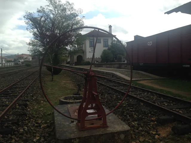
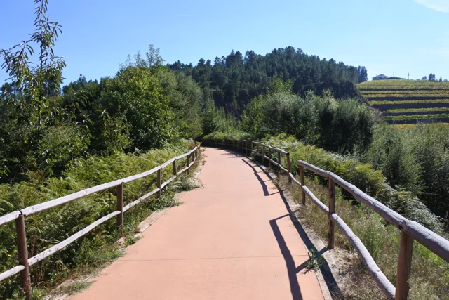
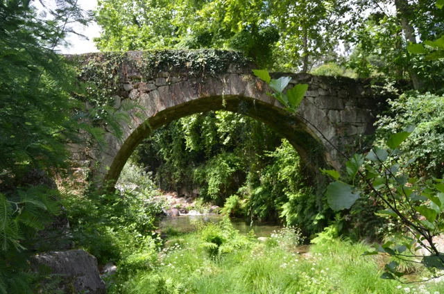
The journey began at Livração, where the Line of Tâmega connected to the Douro Line, and ended at Arco de Baúlhe. According to the Municipality, the construction of this narrow track line extended from 1908 to 1949, along about 52 kilometers. The arrival at the Arc was the result of a link built in stages.
The station had functions beyond the shipment of passengers: the old warehouse of dispatches, today used for temporary exhibitions, also recalls the circulation of goods. Visiting the railway core allows you to look for these different lives of the same space: transporting people, receiving cargoes and preserving stories.
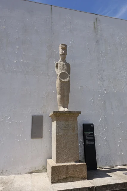
The Basto and the warrior of Santa Comba are presented in the Archaeological Letter as examples of statues of Galaic warriors. Municipal reading relates these figures to the ritual importance of the warrior function during a period of transformation of communities. The Charter also relates this ritual function to gold torques, whose provenance of the area of Cavez presents as hypothesis. In the same table of change, it refers to open agricultural occupations, such as Abadim, and honorary inscriptions. Romanization does not just appear in monuments: it involves settlement, practices and forms of representation.
In the visit to Gondiães January 2012, a stick marked the intervals between the sets of bread, ribs and popes at the tables. Each group then distributed these foods among the participants. Preparation brought together return residents and emigrants.
The piece of bread was called carolo. The account presents the protection of São Sebastião as a legend of origin, without documentation that fixes the beginning of the party.
Manuel I granted the foral of Cabeceiras in 5 October 1514 and that of Vadym, today Abadim, in 12 October. Seven days separate the documents: the administrative history of the territory goes through more than one place.
But what was the point of reviewing the outsiders? The Tombo Tower exhibition explains the general context: there were complaints about outdated charges, coins and weights and old texts difficult to interpret. Manueline reform sought to review these documents. Local dates of 1514 belong to this broader movement; it does not mean that the settlements began to exist that year.
The work also required registration and preservation. The same exhibition describes the preparation in triplicate: one copy for the chamber, one for the landlord of the rights and another for the Tower of the Tombo. This general explanation helps to understand why an administrative document could have several copies. It does not identify here the whereabouts of each copy of the two local forals.
In 5 October 2024, Casa do Tempo received a tertulia over the 510 years of the foral, with José Viriato Chapel and Porfirio Correia. The municipal news recalls the two documents and their importance for the administrative organization. The celebration is a gateway to history; it does not replace the reading of the forals themselves.
The Monastery of Refojos already existed in the early 12th century, but the municipal review does not fix the foundation. It questions the traditional assignments to Hermínio Fafes and Gomes Soeiro.
The source links the medieval patronate to noble families in the region. Separate two questions: when we know the monastery existed and when it was founded. A documented date of existence does not solve the second question by itself.
Date given at source: . Source consulted in 2026-11-07. EXIF orientation, proportional resizing and WebP conversion; no retouching or clipping of the file.
Date given at source: . Source consulted in 2026-11-07. EXIF orientation, proportional resizing and WebP conversion; no retouching or clipping of the file.
Date given at source: . Source consulted in 2026-11-07. EXIF orientation, proportional resizing and WebP conversion; no retouching or clipping of the file.
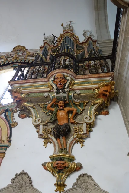
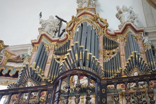
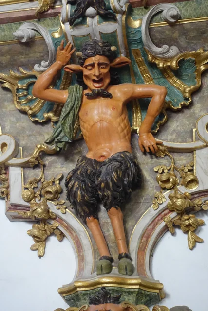
The municipal description identifies two lateral organs, being a mute. The visual symmetry of the church does not correspond, therefore, to two sound instruments. Next to the entrance appear frowns; later, the wood creates another surprise effect.
The two pulpits are painted brown to imitate marble and partially golden. The fountain places the execution in 1777–1780 and the painting and browning in 1786–1789. Shape, material and finishing count different stages of the same work. This patrimonial description does not confirm the current functioning of the organ.
The choir adds another reading of the wood: the Municipality describes a brown chair, of 1767–1770, organized in two levels and in the shape of U. São 45 seats, with the place of the abbot to the center. The disposition helps imagine a community gathered, instead of looking at each chair separately.
At the top, the circular zimbarium is accompanied by interior and exterior balconies. The description identifies the twelve apostles and, on the top, St. Michael. From furniture to silhouette, they change the scale and the observation point. The photographs of this reading show details of the organ; they do not document all these elements.
A fire corresponded to a household, not to a person. It is the distinction also explained in the notes of editions of the Parish Memories, as published by the Municipality of Ourém. The explanation of the term is general; the numbers of this story come from the memory of Passos.
The memory of Passos of 1758 counts 71 fireworks and 211 sacramental persons. They are categories of the parish register: they do not equal 71 inhabitants or a total population measured as in the current censuses. The source then places Passos in the term of Celorico of Basto. The same summary dedicates the matrix to St. Sebastian and indicates that the vicar was presented by the Abbot of St. Clement of Basto. Population and religious organization appear, thus side by side in the document.
In the relationship of Santa Senhorinha of 1758, Olela appears as a place of fairs in December, February and March. The parish priest refers payments for settlement and rights. It is a window on local exchanges of that time, not the calendar of markets today. The text specifies the days: 14 and 15 December, 24 and 25 February and 27 March. The dates belong to the account of 1758.
During the Romanization, the villages of the region did not all follow the same path. The Archaeological Letter suggests that the small castro of the Arco de Baúlhe had lost inhabitants, while Chacim gained centrality. It also refers to the expansion of the agricultural occupation to lowlands. This reading helps to imagine a changing territory, but does not provide a certain date for the abandonment of the castro of the Arc.
The Charter situates these changes in the process begun in the second half of the first century before Christ. The transformation was not limited to houses: it also changed the relationship between settlements, fields and centers of power. Chacim appears as a place of population concentration and renewal of spaces, while the Arc is presented as a possible example of emptying.
The Mó de Cima materials in Chacim are used to support the agricultural occupation of the lowlands. Later, the text highlights open facilities of the couple type, such as Abadim. Read together, these clues show a change in the organization of the territory; they do not allow to draw a single displacement of inhabitants between two points, nor date all changes in the same year.
With the Romanization, the Archaeological Charter describes changes in the distribution of populations between mountain and valley and the agricultural occupation of lower lands. In Abadim, it refers to an open agrarian settlement of the couple type. The text suggests that there could have lived people linked to the mentioned honorific inscriptions. The existence of the occupation and the identity proposed for the inhabitants do not have the same degree of certainty: the second remains a hypothesis.
In Casares, a wooden bridge integrated the real road to Braga and communications with Trás-os-Montes, according to the memory of 1758. Before the movement, the vicar defended building it in stone. It was a request, not the confirmation of a work.
The source distinguishes this passage from small walkways made with a wooden beam, for pedestrians. Different paths responded to different uses.
The passage not only served the village. The vicar describes a public road and very frequented, linking Braga to the term of Basto and Trás-os-Montes. The bridge emerges, as a local point of a larger network. The recommendation to replace it by chanting shows the author to assess a need, besides inventing what existed.
In the same rivers, the water moved mills and was used by farmers in the fields. The crossing, grinding and watering appear in the same portrait of the territory. A bridge can be read by what it allows to do: reach another place, maintain a communication or approximate works separated by water.
In 1758, the procession of the Body of God gathered in Santa Senhorinha the Chamber and representatives of the nearby parishes, with crosses and ecclesiastics. The memory mentions expenses with wax and sermon: behind the celebration there was preparation, objects and work.
The Abbot also describes separately the triduum of the forty hours, with music and sermons for three days. Distinguishing the two references helps to realize the religious calendar of that time. The document is a testimony of 1758, not the agenda of the current feasts.
The news of Painzela published in the Parish Memories identifies Saint Andrew as a dedication of the matrix and attributes to the Abbot of Santa Senhorinha of Basto the presentation of the parish priest. The register shows an institutional link between two parishes.
The vicar assigns a congruity of 100.000 réis. The value documents the remuneration then indicated; it does not allow a direct comparison with current wages. The municipal transcript updates the spelling and score from the edition of José Viriato Chapel, published in 2003.
The municipal inventory interprets the vestiges as a fortified motorcycle-type residence from the middle of the 13th century. It relates it to the castle referred to in the 1258 Inquisitions. The circular shape rests on a stone and gravel landfill, surrounded by a moat. The municipality highlights the position over the valley of Rio Douro, link between Refojos and the plateau Barrosão. The reading combines ground and document, without reconstructing the missing building for sure.
The document of 1258 adds a social dimension to the form of the land: according to the municipal interpretation, almost all residents of Santo André of Rio Douro had an annual obligation to move to the castle. The reference links fortification to the community organization, although it does not clarify here all the associated tasks.
The inventory compares construction with examples from Brittany. It is a comparison of forms and techniques, not a proof of the origin of its builders. The location in the middle of the hillside helps to understand the relationship between defense and passage through the valley.
In Marmoirais, Abadim, mammoths and granite outcrops with engravings form an archaeological set. The inventory proposes the second or first millennium before Christ, comparing ceramics, engraved motifs and similar sets of the Northwest. Dating results from this interpretation. The name Marmoirais is also related in the source with the tumular memory of the place: the landscape can keep clues in the vestiges and names.
The inventory distinguishes conservation and interpretation: it describes the whole as poorly preserved and admits that the Mamoa 5 can remain intact. It proposes cyst-type funeral structures, without presenting this hypothesis as a confirmed excavation.
The tombs and engravings are different traces, gathered in the same landscape. Reading ceramic materials and comparison with other sets help to propose chronology, but do not automatically reveal the meaning of each recorded motif.
The inventory identifies a V-wall trap in Vilar de Cunhas. The date of construction remains uncertain: it discusses hypotheses between the Modern Era and the 19th century. One detail distinguishes it from other fires: one of the walls rises towards the well. The reading of digits on a slab is also uncertain, between 1668 and 1868. Doubt helps to understand why inventory does not set a single date.
In the Old Village of Toninha, the municipal inventory proposes occupation between the 13th and 16th centuries. It compares the constructive remains with other serran settlements, including examples in Lindoso and the abandoned village of Juriz in Montalegre. Already the plague that would have caused the people to leave belongs to the popular tradition. They are different paths to know the place: comparing buildings and collecting memories.
There is a third clue: the Investigations of 1258. The inventory proposes that the village may correspond to one of the ten couples then assigned to Juguelhe. It is a probable identification presented by the author, not an equivalence demonstrated. Comparisons with other places help to formulate this interpretation.
Imagine three cards on the table: the buildings, the document of 1258 and the narrative of the plague. Each opens a different question. What forms are repeated in other villages? What places appear in the document? What explanation conveyed the tradition? The discovery begins by crossing these clues without confusing them.
The account of St. Pedro of Alvite distinguishes the civil subjects, linked to the Abbot and the convent of Refojos, from the criminals, attributed to the municipality judge of Cabeceiras. The Couto thus had an organization that is not limited to a line on the map. It's a historical description, no correspondence with the current administration. There is an important territorial distinction: the answer places Petimão in the term of Celorico of Basto. The skills of the Couto are described for other places, avoiding reading the entire parish as a single jurisdiction.
In the religious narrative studied by Odília Alves Gameiro, the coax of the frogs disturbed the nuns when they were preparing for a craft. Little lady would have stopped the noise. The municipality includes this episode among the miracles attributed to the saint. It is a history of devotional tradition, told to know the imaginary linked to their worship, without presenting it as an event demonstrated.
Three houses, three details to repair. In Casa da Taipa, the municipal presentation highlights the chapel of Nossa Senhora da Conceição, a quintentist moth. In Casa da Breia, it describes the staircase with volutes on the stone rail, maintaining as uncertain the nineteenth century attribution of the building.
In Casal da Fonte, the highlight goes to the portal with coat of arms and baroque decoration of the late 18th century. Compare chapel, staircase and portal helps to discover different ways to compose a solarenga house. These references do not presuppose access to the interior of the properties.
The municipal presentation of the village describes stone houses and some stalk covers. It also recalls the name Casal da Urzeira, associated with the heather of the hills. There are two ways to read the connection between the village and the landscape: in the materials of the houses and in the memory of the name. The same description associates the village with agriculture, animal husbandry and the work of flax and wool. The portrait helps relate houses, fields and crafts. It's an asset presentation, without confirming how many hives remain today.
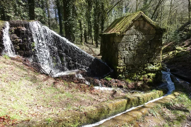
In the historical narrative published by the Municipality, these community mills belonged to the Crown and half of the income was destined to the King. The same description refers to the later passage to a symbolic tax. The name of the place thus opens a window on the economic organization of the milling.
The income mentioned concerns the economic activity of the mill. It should not be converted, without further information, into a rule according to which each person delivers half of the cereal bag to the king. The presentation does not indicate accounts, milled quantities or the date of transition to symbolic tax.
When visiting the history of the Moinhos de Rei, you can ask two different questions: how did water reach the mill and how were the benefits of grinding distributed? The lead helps to follow the first; the reference to the Crown opens the second. Technique, organization and income are part of the same work landscape.
The municipal inventory interprets part of the set as an area of housing and storage with fossas. It distinguishes it from the funeral monuments and admits possible old agricultural terraces. The proposed dating points to the second or first millennium before Christ: an archaeological reading of different marks on the ground.
The inventory separates several cores. Some correspond to funeral monuments with an elevation of land and a chamber; another is interpreted as housing and storage space. The possible area of agricultural terraces is still a third reading. Gathering everything under a single name does not mean that each brand had the same function.
The chronological proposal is based on ceramics and the comparison with similar sets of the Northwest. It is a way of approaching the remains of a period without giving them an exact year. To explore the set, it begins with three questions: where was it inhabited, where was it kept reserves and where was it buried?
In the Moira Camps, the Municipality describes two oriented graves from east to west. It includes them in the Christian funeral practices of the Northwest and presents a broad chronology between the 9th and 13th centuries. The name of the place and the interpretation of traces are different clues, which should be read together.
The record uses the term inhumation: it is about burying the body. The east–west direction and general configuration are elements of the interpretation presented, while the 9th to 13th centuries delimit an interval of several centuries, not an exact date.
Compare these graves with Asnela's mammoths helps to avoid a unique reading of all that is ancient. Both are funeral testimonies, but the inventory proposes periods and types of different structures. The name of a site does not replace the analysis of its traces.
The municipal inventory proposes the existence of a small fortified village of the first millennium before Christ. The interpretation is based on the platforms of the land and on the position over an irrigated area. It is not necessary to imagine a medieval castle: here, the word of the toponym accompanies traces of another era.
The small elevation and regular platforms are two clues used in the interpretation. The position allows mastering an irrigated floor extending north. The argument thus combines the form of the land with the relationship between the village and the surrounding area; the toponym alone does not solve dating.
Romanization did not have the same effect on all villages. The Archaeological Letter places changes in the second half of the 1st century before Christ: Chacim will have strengthened its centrality, while the small castre of Arco de Baúlhe seems to have lost inhabitants. The text presents an interpretation of traces, not a census of movements.
In Chacim, Mó de Cima’s materials are associated with the occupation and cultivation of nearby lowlands. Later, the description also points to open agricultural establishments, such as the couple identified in Abadim. History is therefore not limited to abandoning the highlands: it involves new centers and different ways of occupying the fields.
The same source relates cultural transformation to sculptures of warriors and honorific inscriptions. They are clues of different natures: one helps to think about social representation, another allows to read signs of Roman practices. When exploring these stories, it is worth asking whenever trace supports each interpretation.
The municipal presentation recovers this ancient form of the name. It is a small window on medieval documents: the land we know today may appear otherwise written in the sources. The reference allows to situate Pedraça in the registry of 1258, without transforming this date at the beginning of the settlement.
Pedraços and Pedraça are two forms that are worth putting side by side. A written name is also a clue to look for documents: if we search only the current spelling, we can let old references slip away. The municipal presentation provides this variant, but it does not explain here when or why the spelling changed.
The same care applies to the names of the houses. In Casa do Paço, the municipal presentation draws attention to the toponymy. The name can open an investigation; alone, it does not identify a construction date or the function that a building had in all times.
The parish memory describes the matrix dedicated to Santa Marinha and states that the rector was presented by the rector of the College of São Jerónimo de Coimbra. This historical link shows how a small parish was part of relations that surpassed the lands of Basto.
The same transcript places Pedraça at the end of Cabeceiras de Basto and in the district of Guimarães. It records 96 fires and 322 souls of communion, in addition to a congruity of 50 thousand réis for the rector. They are categories of the document: fires are not people, and souls of communion do not automatically equal the total inhabitants.
The numbers and connection to Coimbra show two plans of parish life: the community described and the organization that framed his parish priest. The municipal version identifies the transcription of José Viriato Chapel, published in 2003, from the Memórias of 1758.
The municipal page also distinguishes the account from the references that accompany it: it refers to the memory 296 of the volume 42 and lists an obligation to the Santa Bárbara hermitage factory, of 1624, and another linked to the Blessed Sacrament, of 1722. They are archive clues. The existence of these references does not mean that the full text of the two documents is reproduced on the page, nor transforms 1624 on a date of construction of the chapel.
In 1758, the abbot of Faia placed Our Lady of Amparo on a hill and associated her with the captain-in-chief Manuel Baltasar de Abreu de Lima. Saint Anthony of Covilhã was presented as a chapel of the village itself, out of place. Santo António da Ribeira appeared next to the house of Leandro Machado, and Nossa Senhora da Piedade next to the house of Francisco de Moura Coimbra. The account adds that these chapels had no right pilgrimages. More than enumerating buildings, it distinguishes relationships between devotion, families and community. It is a portrait of that year, without indicating property, parties or current access conditions.
In the description of the trail, the Municipality presents these ancient landmarks as testimonies of the division between Cabeceiras de Basto and Montalegre, and between Minho and Trás-os-Montes. They are a concrete way to find in the landscape a border that we usually see only drawn on the map.
In the parochial memory, the crossing of the Tâmega appears described as a great stone bridge, well worked. The author even considers it the best of that river. The praise belongs to the look of those who wrote: it reveals the importance it attributed to the construction, without functioning as a technical comparison between bridges.
In the same memory, the Tâmega appears as a strong current, especially in winter. The document distinguishes the crossing from the use of water: it describes mills and explains that the river was too deep to water the fields in that stretch. The bridge can be read in this set of relations between margins, displacements and work.
Notice the difference between observing a construction and evaluating it. The existence of the bridge is information; considering it the best is an appreciation. The two say something about the past, but answer different questions.
On the western bank of the municipality, next to Fafe, Outeiro is described by the Municipality as a softly wavy relief plateau. The presentation relates the name to this landscape and points to the proximity of the headquarters and the fixing of houses along the road.
The municipal page proposes a medieval interpretation of the names of the places and refers to the scarcity of archaeological data. This formulation needs to be dealt with with the inventory of the PDM published in 2026, which identifies three archaeological sites in Outeiro. The name of the parish still does not itself provide a date of foundation.
The municipal presentation of Painzela highlights the Casa de Cimo de Vila and its chapel of São Gonçalo, dated 1662. The set adds another time to the discovery of the parish, besides the Casa de Pielas and its garden. The heritage reference does not confirm access to the interior.
The municipal text places the set in a landscape mainly agricultural, in a range of territory that stretches from east to west to the limit with Fafe. In the same presentation arise the matrix, alminhas and the chapel of São Brás: the chapel of São Gonçalo is a piece of a network of places, not the whole religious history of the parish.
The date of 1662 allows a comparison with Pielas, whose house is presented as 19th century and the garden as 19th century. They are references of different times; they do not prove that all the elements visible today are from the same construction campaign.
The municipal transcription of the Parish Memories records 137 fires and 439 sacramental souls in Painzela. The formulation itself distinguishes domestic units from a religious category of people. Therefore, the 439 should not be presented as a modern census of all inhabitants. The document also allows to know the language used to describe the community.
The same passage identifies Saint Andrew as a dedication of the matrix and connects the presentation of the vicar to the abbot of Santa Senhorinha. The small text therefore gathers population, church and ecclesiastical organization. Instead of reading it as a statistical table, we can ask what the author chose to record about the community.
There is also a layer between the old document and the screen: the municipality informs that the transcript updates the spelling and the score from the edition of José Viriato Chapel, published in 2003. This indication helps to distinguish the date of the testimony, 1758, from the date of the edition used to disseminate it. The references to the chapels appear separately, in the documentary note.
In the memory of 22 May 1758, the chapel of Santa Maria, in Casares, served to administer the sacraments to the residents, far from the parish church. The distance helped explain the distribution of places of worship.
The vicar António Alves Teixeira also mentions Santa Ana, in Carrazedo, administered by Manuel Gomes Martins. They are references of the document, without confirmation of access or current status.
The parish church was located in the place of Bucos, which the vicar presented as the most populous of the parish. In addition, he named Vila Boa, Carrazedo and Casares. This set of places helps to understand why a single church did not respond in the same way to the needs of all residents.
The document also distinguishes who administered each chapel: in Casares, the commander; in Carrazedo, Father Manuel Gomes Martins. Place, invocation and administration are three different clues. The function of administering sacraments because of the distance is explained to Casares; it should not be automatically attributed to all the chapels mentioned.
The memory of Alvite enumerates six chapels in 1758. Saint Antonino belonged to the house and fifth with that name; Good Order was next to the House of Alvimento; the Holy Family, next to the House of the Tower. These three are presented as private.
The others were São Mamede, in Petimão, Santa Catarina, on the homonymous hill, and São Sebastião, in place of the Chão. The text assigns burdens to the customers, but saves St Mamede: there were the convent of Refojos and the abbot of St Clement as midwives. The word factory arises linked to these maintenance responsibilities, not to an industrial installation. These are 1758 bonds, without establishing current property or access.
Vila Seca is the former designation of Vilar de Cunhas remembered by the Municipality. The presentation gathers three villages: Vilar, Cunhas and Uz.
It also distinguishes plateau and mountain areas, associated with agriculture and pastoral care. A parish name can therefore cover different settlements and landscapes. The source does not date the change of designation.
The municipal presentation places this territory near Montalegre and Ribeira de Pena. This position helps to understand a landscape that continues beyond the administrative limit: the villages belong to the municipality, but the valleys and relations between places invite also to look at the neighboring territories.
In Casa de Chouzas, three 19th-century granaries join the solarengo building highlighted by the Municipality. The set approximates two functions: inhabit and guard the harvest. Instead of looking only at the main house, it is also worth recognizing the importance of agricultural support constructions.
The presentation of Vilar de Cunhas frame this heritage in a plateau and mountain landscape, marked by agriculture and pastoral care. The house and the willows can be read in this work context, without the source detail the production of each property.
The dating of the house is less firm: the municipality presents it as perhaps nineteenth century, while it attributes the granaries to the nineteenth century. This difference must remain visible. The photograph that accompanies the reading shows the portal; it does not show the three granaries. The heritage reference does not confirm access to the set.
The memory of 1758 explains the function of three chapels: Saint Bartholomew, in Celeiró do Monte; Our Lady of Lapa, in Lapela; and Saint Anne, in Busteliberne. They served to administer sacraments to the residents who lived far from the matrix. A small building responded to a daily difficulty.
The dean Domingos Camel de Sousa describes high hills between the places and refers three settlements away half league from the church, in rough terrain. The distance was not only a line on the map: relief was part of the difficulty. The church was to spring, in a place with six neighbors, counting the house of the rector himself.
The three chapels were kept at the expense of the commendator, according to the report. But they were not the only ones: the text lists eleven chapels beyond the matrix, with different administrations and functions. In the Outeiro of Santo António, for example, it marks pilgrimages of neighboring parishes in the feasts of Santo António and Santa Luzia. The set reveals both the cult close to the residents and meetings that attracted people from outside.
The station panels were executed in 1940 by A. Lopes, at the Sant’Anna Ceramic Factory in Lisbon, according to the publication of the Basto Land Museum. They are prior to the opening of the station in 1949.
The station was a set of spaces with different functions. The publication identifies the driver's house, the staff building, the loading and unloading dock and the dispatch warehouse. The two stalls started to host permanent exhibitions of railway equipment; the warehouse is described as temporary exhibition space.
Reading the building can begin with these differences: where were they working, where were goods passing and where were they stored? The tiles are part of this built landscape. The description documents the museological organization presented in the publication, without confirming the exhibition or access of each space today.
The ME5 motor vehicle carried a petrol engine to the rails. The publication on the museum located its construction in the Santa Apolónia workshops in 1948. In the same collection, it describes a steam locomotive manufactured in Germany in 1908.
The dates are forty years and allow comparing two technologies. They are dates of construction of vehicles, not of arrival at the station. The collection gathers pieces from various origins; being in the museum does not show, by itself, where each one circulated.
The Basto Land Museum identifies the engine as Chevrolet and describes the passenger space: 11 first-class seats, 16 third-class and other 16 standing, as well as sanitary facilities. The 27 seating positions shall not be confused with all available positions.
The National Railway Museum explains that a single motor vehicle sought to reduce the costs of operation in lines of low traffic, bringing together functions that required a composition. The project, directed by the engineer Vasco Viana, took advantage of characteristics of road transport. The same record says that the use of gasoline proved costly and led to temporary or extraordinary uses.
The inventory adds a link to the local history: this ME5 will have circulated in the Line of Tâmega. The formulation is prudent and so remains. It is a specific documentary track, different from deducing the circulation just because the vehicle is in the collection today.
The Visit Cabeceiras portal highlights a third-class British carriage of 1876 at the Railway Nucleus. The class number and date help to locate the object: it is a 19th-century piece, long before the line arrived at Arco de Baúlhe. The presence in the collection does not mean that it was built for this station.
The municipal publication identifies this piece as Cefv 79 and presents it as the oldest carriage in the collection described there. In the same stall, it refers to a passenger carriage built in Belgium in 1908.
The inventory mark helps distinguish the object; the class refers to its function in passenger transport. The origin of manufacture, service provided and arrival at the museum are separate questions: these sources do not reconstitute all carriage trips.
The municipal news about the restoration of 2014 describes two arches and two counters with brown structure, jacaranda coating and cut brass decoration. The municipality identifies Agostinho Marques, notchmaker of Braga, as the author of this work of the early 18th century. The contrast between wood and metal is a clue to look at these furniture more closely.
In 2014, the restoration separated materials and tasks: the brass elements were removed for treatment, while the wood received intervention against insects and structural corrections. After cleaning and protecting, the metallic decoration returned to the furniture. The visible brightness results from a set of care, not just adding gold. It is the report of a professional intervention, not a proposal for home treatment.
In the announcement of the restoration of six tocheiros, in 2014, the Municipality describes pyramidal structures with three decorated faces, gold leaf, floral motifs and heads of angels. It proposes a probable assignment to Frei José Vilaça and a conclusion between 1764 and 1767. The source presents this authorship as hypothesis, distinct from the confirmed assignment of the furniture of the sacristy.
The news also included the cross of the main altar between the pieces under treatment at the Santa Bárbara Workshops in Porto. The intervention was financed by a patron. This episode links the conservation of the heritage to the specialized work and the support of those who assume its costs.
The conservation report of the Adoration of Pastors, published by the museum in 2013, says that the frame hid parts of the composition. The intervention recovered these areas and adjusted the frame and support structure. The description of the scene also highlights a musician with bagpipes among the figures: a detail to look for in reading this painting, whose history also includes the conservation work.
The work included the recovery of nine paintings on canvas, including two double-sided procedural flags, awarded in 2012 to the Santa Barbara Workshops. The report also describes aged varnishes that altered the reading of colors, showing that preserving requires studying both the image and its materials.
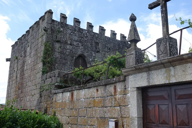
The Tower of Abadim has battlements at the top and gargoyles with animal shapes in the corners. António P. Dinis highlights the settery, the broken arch doors and, inside, conversationals next to the windows. It proposes a construction of the sixteenth century, perhaps from the foral period, without setting an exact date.
The memory of 1758 places the tower in the middle of the Village of the Tower and states that it did not suffer ruin in the earthquake of 1755. The same document describes Abadim with ordinary judge and Chamber, in an organization proper to the former Couto. Reading architecture and administration together helps to understand the importance of the building; the interior description does not confirm current access.
The text of António P. Dinis distinguishes the probable place of the medieval manor from the quintentist construction described today. It is not necessarily the same building preserved without change. The designation Casa do Tronco accompanies the hypothesis that here the justice and the chain of trust functioned.
In the memory of 1758, the election of the ordinary judge and of the House was presided over by the donate. The document also refers to the intervention of the Guimarães magistrate in correction or new scope. Thus, the existence of own organs should not be confused with an administration without relations with other authorities.
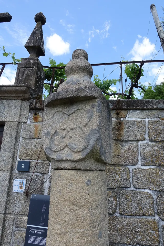
The pillory of Abadim seems simple at first glance: a smooth column of granite, a cubic capite and a pear-shaped shot. But on one side you find a five-pointed star inside a four-lobe frame. The Museum links the monument to the administrative and judicial autonomy of the former Couto, extinguished in 1836. The Museum brings its construction closer to the foral of 1514, but the record of the Cultural Heritage warns that dating is difficult and that the piece can be quite later. The detail of the star invites you to look again at a piece that would easily go unnoticed.
The official record describes four faces on the capital: three undecorated and one with the star. This helps to understand why a photograph from another side may not show the best known reason. The record places the monument next to the portal of the House of Tower of Tronco and documents the classification as Public Interest Property in 1933. The date of protection is not the date of construction.
The foral, the stone age and the patrimonial classification answer different questions. Instead of automatically assigning ‘1514’ to the entire monument, compare the described form, the proposals for dating and the documents that changed its status.
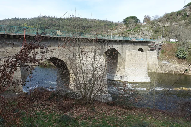
Three broken central arches and two perfect back, next to the banks: the Ponte de Cavez brings together different shapes and times. The Museum located the medieval construction in the second half of the 13th century, at the service of the road between Braga and Vila Pouca de Aguiar.
The source attributes the round arches to the works of Philip II's reign and mentions a landmark of 1599. In the 19th century, the road between Fafe and Vila Pouca de Aguiar brought the enlargement of the board. Watching the bridge is looking for changes to an ancient crossing.
According to the Museum, the stone bridge replaced a previous wooden, then degraded. The construction is attributed to Frei Lourenço Mendes, Dominican who gathered alms for the work; the museological text mentions testimonial legacies as support of this connection. The crossing thus involves materials, paths and ways to finance a collective work.
The legend published by the Museum makes the masons try to build the bridge in Vila Franca and then by the Poço das Laranjeiras. In both places, a supernatural voice sent up the river. Tradition attributed it to Saint Bartholomew.
On the third attempt, the narrative places the work next to the chapel. It is a story about the memory of the place, not documentary proof of the choice of the site or an itinerary to look for the episodes.
In another passage of the tradition collected by the Museum, the food of the builders gains a miraculous explanation: there are sources of water, wine and olive oil and fish appear in the river. The narrative associates the effort of construction to religious protection. Reading it alongside the history of the works allows to know two different ways of telling the same place.
The memory of 1758 lists three wooden bridges in the parish: Vagalhafos, in Quinta de Vila de Lobos; Santa Senhorinha, near the church; and Olela. Names approach the crossings of the farms, the place of worship and the inhabited places.
The same report mentions singing bridges in São Clemente and São Martinho do Arco de Baúlhe. Wood and stone appear, thus, in a single description of the river. The enumeration does not provide construction dates nor proves the survival of structures.
In the memory of 1758, the church of Santa Senhorinha had two ships with programs of different images. One presented panels on the Creation of the World; the third Franciscan showed saints of this order.
The abbot also described a vaulted chapel, closed with iron railings. Painting, spaces and architectural elements composed a written portrait of the interior. The source allows to study this description, without ensuring that the pieces or layout are preserved today.
The description continues by the tombs, which the Abbot presents decorated with painting and golden letters, and by a particular chapel dedicated to Our Lady of the Pilar. The interior appears as a set of spaces, images and inscriptions, each with its function in the account.
This allows a layer reading: first the organization of the ships, then the painted themes and, finally, the elements that marked memory and devotion. It is not necessary to imagine a single undifferentiated hall; the document itself distinguishes various environments.
The Abbot of Faia recorded five altars in 1758, mentioning the Name of God, Saint Anthony and Our Lady, with the invocation of the Rosary and its brotherhood. The document shows different devotions gathered in the same church.
The restoration reported in 2022 belongs to another time. The two descriptions have different objectives and times: it is not enough to compare numbers to determine which pieces remained or disappeared. The church record allows to continue the discovery of the building, keeping separate historical memory and visit information.
The enumeration distinguishes the larger altar from the four collaterals. The reference to the brotherhood of the Rosary adds people to space: the church appears not only as a set of pieces, but also linked to a devotional organization. However, the text does not describe the composition of this brotherhood or its activities in detail.
A municipal report of 2012 highlights a sculpture of Santa Maria belonging to the church of Outeiro, dating from the 13th or 14th century. The Virgin appears crowned, seated on a throne, with the Child on his knees. The account says that the play was found buried in the place known as Mata da Santa and taken by parishioners to church. The news doesn't date the discovery. This story allows to know the path of the image, without confirming where it is currently exposed.
In the church of St John of Bucos described in 1758, the main altar combined golden reliefs and vermilion backgrounds. The account places St John the Baptist and St Dominic on opposite sides and the sacrary in the center of the altarpiece. He also mentions altars with Our Lady of the Rosary, Saints Pedro and Saint Anthony. This written portrait allows you to imagine the organization and colors of the ancient interior, without confirming that the pieces or disposition are preserved today.
The references that accompany the memory of Painzela mention an obligation linked to the chapel of Nossa Senhora da Conceição, of 1656. Another, of 1735, refers to the institution of the chapel of São Gonçalo and an obligation to its factory.
These dates belong to documents. The municipal heritage presentation assigns 1662 to the chapel of São Gonçalo da Casa de Cimo de Vila: they are information of a different nature, which should not be merged into a single construction date. The reading of the sources also involves asking what each record is actually dating.
In reply to the 1758 survey, the vicar of Alvite recalled the earthquake of 1755. He said there had been no ruins, except for the arms of two crosses of the chapel of the House of the Tower, which would have been twisted north. He added that they were already straight.
The report separates the event from the state observed when it was written. It is a local testimony, not a measurement of the intensity of the earthquake nor a confirmation of visible marks today.
Before reaching Cabeceiras, the line had to cross the valley of the river of Veade. The bridge of Matamá is in the Union of the Freguesies of Veade, Gagos and Molares, in Celorico of Basto. According to the Museum, its six granite arches form a structure about 190 meters long and 52 meters high.
The report distinguishes two moments: the opening of the bridge in 5 June 1936, and the entry into railway use in 15 January 1949, with the opening of the Celorico section of Basto–Arco de Baúlhe. Having the bridge built did not immediately mean having trains arriving at the Arc. This regional history helps to realize the time needed to complete the connection.
The report of the Museum attributes the responsibility of the work to engineers Jorge Vieira Bastian and Manuel Gonçalves Costa. The dimension of the structure helps to realize the challenge of taking the railway through the valley; the chronology allows to separate this work from the entry into service of the complete connection.
In memory of 23 May 1758, the abbot João de Lima Lobo de Noronha enumerates sixteen places. The enumeration includes Covilhã, Augueiros, Presas, Nogueira, Candedo, Ribeiro, Outeiro, Porcarice, Faia, Togais, Souto, Ribeira, Tuesdays, Breia, Casa Nova and Joio. Situa the church out of place and describes the parish on a northern slope.
The list helps to think of a territory distributed by small cores, and not just around the matrix. Names belong to historical transcription; they are not a current administrative list or allow to draw the boundaries of each place by themselves.
The same testimony presents two counts: 99 neighbors and 418 people. The document separates them; they should not add or read “neighbours” as another total of inhabitants. It also distinguishes scales: when speaking of the municipality, the abbot refers to eighteen parishes, but declares not knowing the number of its neighbors. Knowing what the author did not tell is as useful as knowing the numbers he left.
Ribeiro and Ribeira appear as different entries. Outeiro is here in the list of places of Faia: the coincidence with the name of another parish does not authorize to shift this reference on the map. The complete list allows to compare names, while chapels help to perceive some relations between places and houses.
Born in Painzela, where he was born in 1 May 1891, Baltazar da Silva Castro studied in Porto and began his career in Public Works in 1919. The University of Porto documents his passage through the services of monuments of the North and the move to Lisbon in 1936, to take over the direction of the Monuments. This connection of Painzela to the history of the restoration accompanies a professional life; it does not attribute to the architect the authorship of the buildings of the parish.
His training brought together engineering, architecture, construction and design. In 1930 he took on the direction of the Northern Monuments. Study trips were also part of the work: the University refers to a trip to Spain in 1934, dedicated to Visigothic architecture, and another to Europe in 1938, centered on military architecture.
Not only did he work in the restoration. With Rogério de Azevedo, he designed the Garagem do Jornal O Comércio do Porto and the expansion and reform of the Faculty of Medicine of the University of Porto. They are works in Porto; the link to Painzela is in its origin, not in the location of these projects.
In the reply of 1758, the abbot of Faia notes that the mail arrived on Tuesday and left on Thursday. A brief information reveals the pace of communications in a rural community. The document does not identify here the building where the letters were received; these days belong to the old account, not to the current postal services. The abbot placed Braga at eight leagues and Lisbon at sixty. The recorded distances, without conversion to current kilometers, add scale waiting for the news.
The answer is inserted in a questionnaire that also asked for distances, fairs and aspects of local life. In the same memory, the abbot distinguishes the São Miguel fair from the Olela fairs and the monthly fair in the head of the municipality. Mail and fair are two examples of rhythms that help to perceive a community; the text does not say that the letters were delivered in these markets.
Julio Augusto Henriques was born in 1838 in Arco de Baúlhe and excelled in Botany. In June 2013, the Municipality honored him by naming the library of the Basic School of Arc. The news recalls the departure to Coimbra at the age of sixteen and its dedication to science. Knowing the patron transforms a name at the school door into a link between the homeland, study and collective memory. This is the school library, distinct from the Municipal Library Dr. Antonio Teixeira de Carvalho.
The Biblioteca Municipal Dr. António Teixeira de Carvalho was inaugurated in 2005, at the Arco de Baúlhe Basic School. The municipal presentation describes two reading rooms and an auditorium, as well as work and meeting spaces. It also recalls activities such as the time of the tale, workshops, literary contests, cinema and exhibitions. The history of the equipment shows how the reading intersects with other forms of cultural participation. To plan a visit, see the site chart.
The review of Santa Casa places its constitution in September 1877, with the purpose of supporting poor people who needed health care. The first statutes were approved in January 1879. In 1896 opened a hospital, replaced in the years 1950 by the Hospital Professor Julio Henriques. The institution highlights the contribution of the population to this new unit. These dates help follow a history of assistance and cooperation; they do not describe the health services available today.
Joaquim Insley Pacheco was born in the place of Cancela, in Refojos de Basto, according to the Museum of Lands of Basto. Photographer and painter, became one of Brazil's outstanding portraitists. The Brazilian National Library documents his appointment as Photographer of the Imperial House in 1855. History thus links a place of the municipality to the early days of photography in Brazil.
The exhibition of the National Library adds a learning link: Pacheco was a student of Frederick Walter, who arrived in Fortaleza in 1847 with daguerreotype equipment and also acted as a magician. Photography, teaching and show intersect in this story of the first professionals.
The recognition of 1855 places Pacheco in Rio de Janeiro and in the court of D. Pedro II. It is three points to follow the biography: the place of origin, learning and professional recognition. The relationship between them helps to discover how a history of Refojos participates in a broader history of the image.
Do you want to move from biography to image? The presentation of 2016 on the official blog of the National Library shows a portrait of D. Pedro II, dated 1883 and attributed to Pacheco, from the collection of the institution. The legend allows to connect an author name, a person portrayed, a date and a collection. It is a concrete example to observe at the source and compare with the photographer's history.
The Basto Land Museum opened to the public in 23 May 2004, located at the station of Arco de Baúlhe. Its presentation of the Documentation Center distinguishes two funds: the municipal and the Railway Center, belonging to the National Railway Museum Foundation and kept by the local museum.
Books, journals, photographs, maps and archive documents help to investigate the region. The description recalls the organization of the collection in 2011; it is not a confirmation of current consultation conditions.
In February 2011, the Museum also announced the conference and inventory of railway objects, based on the inventory of CP technicians included in the 2000 protocol.
In 30 April 2019, the Municipality announced the completion of the works at Ponte de Cavez initiated in October 2018 by the Infrastructures of Portugal. The intervention strengthened foundations of the pillars and treated the board: pavement, waterproofing, body guard and drainage. The bridge, classified as National Monument since 1910, thus continued to receive care long after its construction. This report documents that work; it does not evaluate the current state of the structure.
The announcement distinguishes two parts of an intervention: the support of the bridge, through the foundations of the pillars, and the surface of passage, with pavement, waterproofing and drainage. The painting of the bodyguards was only a portion of the works. A general photograph shows the bridge in the landscape, but not enough to document the reinforcement made in the foundations.
Compare this news with the chronology: the nineteenth century enlargement and the 2018–2019 undertaking are distinct interventions. Store a monument also produces new documentation, which must keep the date and scope of the work described.
In the memory signed in 23 May 1758, the Abbot of Faia declared that there was no ruin caused by the earthquake. It is a counterpoint to the testimony of Alvite, who described damage to the crosses of a chapel. The absence of ruins in the account does not demonstrate that the earthquake was not felt: it shows what was recorded in that answer. Reading the two documents brings the general history of local experiences closer.
It is useful to notice who writes and when: the answer is from João de Lima Lobo de Noronha, abbot of Faia, and arises in a set of questions that also covers places, crops, fairs and mail. The earthquake is one of the subjects of this local portrait. The signature of 1758 dates the testimony, not the event that he recalls.
The municipal historical review associates Cabeceiras to the Letter to D. António Pereira, from Sá de Miranda, and points references to the municipality in The Witch of Monte Córdova and Nights of Lamego, from Camilo Castelo Branco. They are reading clues to search for how a territory enters the literature. A literary reference does not equal a documentary report: characters, places and events should be read in the context of each work.
Abbot of Refojos and rector of the University of Coimbra, Frei Diogo de Murça wanted to apply the rents of the Monastery to the foundation of two colleges in Coimbra: São Bento and São Jerónimo. The plan meant to extinguish the monastery. The municipal documentation reports the opposition of the religious and the subsequent reconsideration of the Abbot himself. This link shows how decisions on Refojos participated in a broader history of teaching and religious institutions.
The municipal review is in 1555 the acceptance of the new request by Paul IV: keep the Monastery with twelve religious and a prior, rather than follow the first plan of extinction. The same source records the death of Frei Diogo in Refojos, in 1570, and his grave in the Monastery.
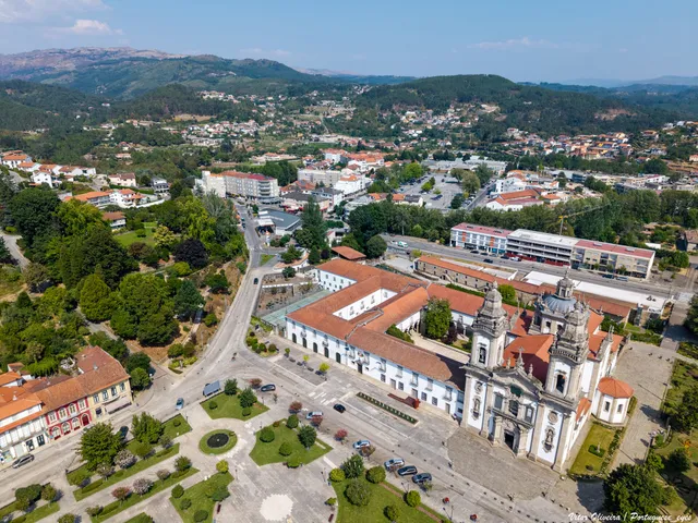
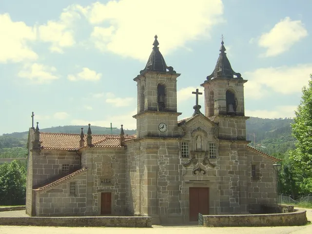
The extinction of religious orders, in 1834, changed the fate of the set of Refojos, keeping the church in the religious function. According to the municipal proposal of patrimonial candidacy, João António Fernandes Basto acquired the Monastery in public haste between 1838 and 1842. In the nineteenth century, the assembly also welcomed municipal services; in 1944, another part received a college with boarding school. Looking at the whole is also to discover how ancient buildings were adapted to administration and teaching.
The document places around 1855 the installation of the city services in the part of the cloisters. For the school area, it registers a new change of ownership in 1959, for the Conciliar Seminary of Braga. The group therefore did not have a single destination after 1834: different parts followed their own stories. The heritage proposal is here a historical source; it does not demonstrate a UNESCO classification nor confirms the current uses of each space.
In June 2020, the Municipality announced the assignment of names to ruins of the village to remember figures of the history of the Monastery. Among them were the Abbot Diogo of Murça, the notchmaker Vilaça and Gueda Mendes, associated with the offer of the medieval chalice. The same decision recovered ancient toponyms from places of Refojos. The toponym thus approximates two memories: people who marked the heritage and names that the inhabitants used to recognize their places.
In the Pereiras, the building of the former House of the House continued to serve as a chain until 1972, according to the Museum of Lands of Basto. After recovered, received Casa da Música. A municipal news of July 2010 already included it among the spaces proposed to know the municipality. The Museum article needs the change from the House to the Monastery in 1835 and the inauguration of the Casa da Música in 2003: the building continued to change its function after not receiving the municipal administration.
The story of the building begins before the chain that remained in memory. The article of the Museum assigns the editor João Gil de Abreu Castelo Branco the order to build the House of the House in 1586. It then admits a reconstruction in the 18th century, in place of the previous building.
The two floors shared functions: jail in the first, Chamber and hearings in the second. This organization gathered administration and justice in the same space. When the House left, the prison remained; when it closed, the building did not disappear. The inauguration as Casa da Música, in 2003, added another use to a construction with several chapters.
In Pereiras, the memory of the municipality also passes through football. The Basto Land Museum identifies the field inaugurated in 1925 as the first of Cabeceiras de Basto. It served from home to different sports communities, linking the place to the practice of the game and the meetings of those who accompanied it.
In 1982, the construction of the National Road 311 led to the move of the countryside to another location. A sports equipment can thus help count the transformation of a settlement: space changes, but memory preserves the connection to the previous place.
The Museum article, published in July 2024, places the field in a place that had trade, school and fairs. The bibliography includes The Journal of Cabeceiras, of 20 September 1925, and Ecos of Cabeceiras, of 15 August of that year. They are references indicated by the Museum, without reproducing here the contents of these newspapers.
Numa publicação de agosto de 2025, o Museu recorda o serviço de mercadorias que circulava à quarta-feira na Linha do Tâmega, em 1984. Era associado à locomotiva E 165, fabricada pela Henschel & Sohn em 1908. A imagem postal usada pelo Museu foi feita em Celorico de Basto: documenta a linha, não a estação do Arco.
The support is a postcard from the Portuguese Association of Friends of the Iron Paths, dated 1984. There are three times to distinguish: the construction of the machine, the service remembered in the postcard and the publication of the Museum. The document does not describe the load of each trip.
In March 2026, the Basto Museum of Land presented an iconographic study of the Incredulity of São Tomé, sung by Saint Thomas Aquinas. It identifies it as oil painting on canvas, integrated into a retabular set of five late-mannerist works of the early 17th century. Looking at a painting together with the others helps to realize that a collection can keep relationships between images. The news documents the work, without confirming current conditions of visit.
A municipal publication of 2011 presented a plate of offerings in brass then exhibited in the Museological Center of the Bass Tâmega. Its production was located, with reservation, between the 15th and 16th centuries. This uncertainty is part of the story of the piece: knowing an object does not always allow setting a year. The reference to the exhibition belongs to 2011 and does not confirm that the piece is currently visible to the public.
The last vehicle of the train carried important information. The Museum features a red-light taillight, used at night in the last carriage or wagon to indicate that the composition was complete. Its function was to signal, not to illuminate the path ahead of the locomotive.
The registration N.1 AND POST. OF THE BOOK connects the object to the station of Livração, in the line of the Valley of Tâmega. Reading the piece implies joining three clues: the color of the light, the position on the train and the inscription associating it to a place.
This small object shows that the railway history is also made of discrete signs and tasks. The presentation of the Museum, published in June 2024, describes the use and station to which the lighthouse was affected; it does not indicate a date of manufacture for the piece.
In February 2024, the Museum described a hexagonal platform lamp, intended to light docks. Inside it had an oil lamp, with glass chimney and metallic reservoir. The description does not identify the station where this piece was used.
The reservoir had the inscription MD MOVING. This detail belongs to the object described; it does not provide, alone, a station of origin. Compare it to the taillight: both produce light, but the lamp illuminates the embarkation space and the lighthouse communicates information about the composition.
In 1758, the parochial memory was Passos in the term Celoric of Basto. The history published by the Câmara de Celorico explains the change: in the administrative reforms of the decades of 1830 and 1840, Passos passed to Cabeceiras. The source frames the process in this period, without indicating a specific year for this transfer. Compare the two reports helps to understand why ancient documents of the same land may refer to different counties.
The change does not appear isolated in Celorico's account: the same reorganization took other parishes to Amarante, Felgueiras and Mondim. Passos should therefore be read in the context of the liberal reforms of the nineteenth century. Changing the municipality is changing the administrative link; it does not imply that the houses have changed places. When searching for a family or property, the time of the document matters as much as the name of the land.
In the reply of 1758, the abbot of the Faia writes that his presentation belonged to the infant D. Pedro, as Grand Prior of Crato. He also refers to the intervention of the provisor of the city of Porto in its collation. These details show that the local religious organization involved authorities beyond Cabeceiras. The account describes the form of provision of the office at that time; it does not mean that the Faia belonged to the municipality of Crato or Porto.
The same answer estimated the income of the benefit in 450 réis. This value belongs to the description of the institution and should not be presented as a current salary or converted directly into a price today. Dealing with the altars and chapels, adds a layer to the history: besides the building and the devotions, there was an organization of positions and incomes.
The municipal inventory describes mamoas in Portela de Asnela, in Rio Douro, and proposes a relationship with the village of Castelo, in Formigueiro, about a kilometer north. Proximity supports a hypothesis; it does not in itself prove that the two sets were used by the same community.
The fiche identifies structures of the anther and cyst type within the funerary assembly. It proposes a dating in the second or first millennium before Christ, supported by ceramic materials and in comparison with similar sets of the Northwest mountains.
There are therefore two distinct questions: when will these monuments have been built and what connection could they have had with the nearby village? A proposal for chronology does not automatically solve the second. The inventory presents this connection as a hypothesis, preserving space for future research.
In 1758, the vicar described the church of Alvite with three altars: the principal, associated with St Pedro, and those of the Name of God and the Lady of the Rosary. He referred to a single body, choir, main chapel and sacristy. It is the provision registered at that time, without confirmation that it remains the same.
The document situates the church in Cacheina, surrounded by residents. It distinguishes the main altar of the two collaterals and mentions a brotherhood associated with the brotherhood of the Blessed Sacrament. The portrait of the building thus includes a community: places of worship, people and religious organization appear in the same response.
A list of spaces is not enough to reconstruct a plant. We can recognize functions and names, but the exact position of each dependency would require other sources. It is a good occasion to compare what a text describes with what an external photograph can show.
In 1758, an inquiry to the parish priests sought to gather information about the Portuguese parishes. According to the presentation of the Museum of Lands of Basto, it was organized in three major themes: land, mountains and river. By disseminating the texts in 2011, the Museum explained that it had updated the language to make them more accessible to students. Reading a transcript is therefore also to know the work of who made the document readable to other readers.
Built in Belgium in 1908, the van DE.FV 506 is presented by the Museum as a narrow-track vehicle for goods, parcels and postal mail. It had plate coating, electric lighting and a toilet for the employee, accessible from the outside. The acquisition by the Company of Guimarães Railways appears as hypothesis. The description of the collection, published in 2011, does not confirm the current exhibition of the piece.
The gauge indicated by the Museum is one meter. In comparison with the car, the function changes: ME5 was intended for passengers, while this van gathered cargo, parcels and mail. Traveling on the same network could mean transporting people, news or goods.
According to the retrospective of the Museum, the Arc station ceased to operate in January 1990, with the closure of the section between Amarante and Arco de Baúlhe. In 8 January 2000, a protocol between REFER and the Municipality opened the way for the provision of facilities and the museological dynamics. The opening of the Museum, in 23 May 2004, belongs to this new life of space.
The compromise brought responsibilities: the Municipality was responsible for preserving, maintaining and managing the section, in collaboration with the National Railway Museum Foundation. The news of the Museum of April 2025 also reports the municipal decision of February 14 of that year to classify the whole. The change of use involved, therefore, agreements and continued work, in addition to the opening of doors to the public.
The history of Pedraça is also read in the houses. The municipal presentation highlights Casa do Paço, Casa de Parada and the houses of the Baron of Basto and Paço de Vila. For Parada, it uses the expression Brazilian taste; for Casa do Paço, it draws attention to the name of the place. They are different clues: one points to architecture, another to the toponymy.
These houses are part of a parish that the Municipality describes as fertile and abundant in water, linked to agriculture and the cultivation of flax. Approaching the housing of the work landscape helps to look at the heritage beyond religious buildings.
The municipal description does not provide construction dates for this set nor identifies those responsible for each work. Nor does the reference to Brazilian taste enough to reconstruct the biography of a owner. The houses are here starting points to know the parish; their inclusion does not presuppose public access.
The Municipality presents as a tradition the narrative of a pickpocket next to the Casa de Pedraça, associated with D. Nuno Álvares Pereira, and the nuptials passed there after the wedding with D. Leonor de Alvim. It is a memory linked to the place; the formulation of the source itself does not transform it into a demonstrated event. Distinguishing the two plans helps to know history without erasing the local imaginary.
The municipal monograph of 2013 reads the Casa da Tojeira as a building marked by various times. Its analysis relates the six-century origin with the architectural expression of the eighteenth century and with interventions of eight hundred, including the balcony, staircase and the relationship with the road. Instead of summarizing everything to a single date, it proposes looking at the house as a construction that was being adapted. Historical reading does not confirm current conditions of visit.
The church of São Tiago of Faia reopened in 14 August 2022, after about a year closed for works. The news of the Archdiocese of Braga records the recovery of paintings, images and three altars, besides the placement of stained glass with episodes of the life and mission of the patron. It is a recent intervention, different from the portrait of five altars left in 1758: they are sources of distinct times, not a directly comparable count of surviving pieces.
The news also tells who made the intervention possible. Pastor Rui Filipe Marques Araújo attributed the realization of the works to the involvement of the community; the ceremony brought together associative representatives, workers and benefactors. Archbishop José Cordeiro presided. Behind the paintings and the recovered or placed stained glass is thus a history of participation.
Reopening does not necessarily mean that all works were completed: the same news records an appeal to continue the completion of the restoration. The August date marks the celebration and return of space to religious use, without allowing the end of each intervention to be established.
The Machado de Castro National Museum identifies this 12th century chalice as an offer by D. Gueda Mendes to Mosteiro de São Miguel de Refojos. The decoration invites to look at parts: in the cup are Christ and the Apostles, under round arches; at the base appear the symbols of the four evangelists. The form indicates unknown authorship and locates the piece in Coimbra. Knowing its provenance allows discovering heritage linked to Cabeceiras which is outside the municipality.
The study published in Portvgalia magazine in 1995 explains an old confusion: D. Gueda Mendes was taken by goldsmiths, when the inscription should be understood as a reference to who ordered the play. The chalice is associated with 1152, but the study does not confirm whether the donor still lived on that date or whether the order fulfilled a testamentary disposition. The story of the object therefore includes certainties and open questions.
According to the study of 1995, the chalice remained in Refojos until the mid-16th century and went to the College of São Bento de Coimbra, in the context of the work of Frei Diogo de Murça. After the extinction of religious orders in 1834, he passed to the Treasure of the Sé de Coimbra. The record of the Machado de Castro Museum documents its current connection to the collection. This journey adds a material history to the relationship between Refojos and Coimbra.
Odília Alves Gameiro studies three texts on the life and miracles of Santa Senhorinha, preserved in copies of the 16th century: two in Latin and one in Portuguese. The similarities between them suggest, according to the researcher, a medieval original. Reading these versions allows you to study the construction of memory and worship. The time of a copy is not necessarily the time of the story that tells.
The two Latin testimonies studied come from Coimbra: one from the College of Grace and another from Santa Cruz. This provenance helps to realize that the memory of a saint linked to Basto circulated beyond the place of worship. Each copy is also an object with a history of conservation and transmission.
There are three times to be separated: that of the life narrated, that of the composition of the account and that of the copy that came to us. The investigation situates Little Lady in the second half of the 10th century, but does not transform the five hundredth-century texts into testimonies written by those who knew her. The similarities and differences between versions are precisely part of the historical work.
The study also reads the reports in the context of a rural community: crops, food and trips appear among the concerns represented. Hagiography allows to know this imaginary and the values that the text seeks to transmit, besides counting wonders.
The municipal presentation records the popular designation Sé of Basto for the church of Santa Senhorinha, associating it with the idea of antiquity. In the manor houses, it highlights buildings from the 17th and 18th centuries, some with coats and chapels. Paço, Castelo, Mozes and Vila Garcia were already mentioned in 1726. This reference helps to read the heritage of the parish, without assuming that the houses are visitable or that all the old elements are preserved today.
The municipal portrait does not end in the four houses mentioned in 1726. It includes Carcavelos, Cainhos, Casa do Oven, Eirões and Olela, extending the look to several places. In religious architecture, mentions the chapel of Calvary, also called Senhora do Ó, in Olela, and that of Santo António. They are references to know the diversity of the heritage, without assigning to all buildings the same date.
The Sé designation of Basto belongs to the popular use described by the Municipality. In this reading, it acts as a clue to the importance attributed to the church; it has not been converted into an affirmation of cathedral status. Compare this name with the memory of the painted panels allows you to look at the building through words of different times and purposes.
The parish report places Santa Senhorinha in a valley between the Gatiras and the Ladario. It lists places such as Rendufe, Soutelo, Outeiro Seco, Olela, Devesa and Vila Garcia, among many others. The church is described outside the village, in the middle of a field. This portrait allows you to imagine a community distributed across several cores, but retains the names and perspective of the document of 1758, without functioning as a current map.
The author also lists villages that were seen, distinguishing the position in the valley of the look from the Ladário. Visibility was part of the way of presenting the territory. A place could be described by what surrounded it and by what could be seen from a higher point, beyond its limits and names.
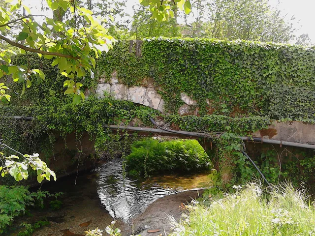
The municipal presentation of Painzela includes a photograph identified as Ponte de Painzela and refers to a Roman Bridge among the heritage of the parish. This designation alone does not demonstrate when the bridge was built. The name allows to find the place; dating would require documentation or study of the construction. It is a good question to lead to a reading of the heritage: what do we know by identification and what we still need to investigate?
The municipal presentation highlights a particularity of the chapel of Santa Catarina de Alvite: it is encrusted in a penedia. The encounter between rock and construction gives a clue to look at the heritage beyond the facade.
The source identifies this relationship with the place, but does not provide here a construction date or a visiting time. The chapel form gathers the available documentary information.
The memory of 1758 already named Santa Catarina in the hill with this name, among six chapels of the parish. The two sources answer different questions: the old document places it in a network of places of worship; the municipal presentation draws attention to the relationship between construction and rock. This presence in the report does not date the external form that the photograph shows.
The Rector Domingos Camel de Sousa described five altars in the church of St. Nicholas. On the main altar, he placed St. Nicholas and St. Brás on opposite sides and Christ Crucified to the center, in a golden tribune.
The remaining altars were dedicated to the Lady of the Rosary, to the Lord of the Passos, to Saint Sebastian and to the Souls of Purgatory. It is a portrait written in 1758, not a confirmation of the current disposition.
The municipal transcription of 1758 presents Gondiães with 55 fireworks and 269 souls of communion, together with the matrix dedicated to Saint Martin. Vilar mentions 41 neighbors and 141 sacramental souls, with the church dedicated to St. Lawrence. Both places are located at the end of Cabeceiras de Basto, in the district of Guimarães.
It is important to keep the words of the source: fires or neighbors and souls are not the same category. These numbers should not be added as if they all counted people, nor presented sacrament souls as a modern census of the total population. The text of Gondiães gives the information to Lima; the reference should accompany the reading of these numbers.
The municipal guide of the villages highlights in Cunhas a nucleus of concentrated old houses and the manor of Teixeiras Pereiras. It is a reference to the architecture of the village, without indication of access to the interior of the building.
The same guide tells two legends: one associates the name of Cunhas to a soldier called Cunha de Pau, linked to the fight against the Moors; another says that Santa Senhorinha had house in the locality. They are narratives of popular memory. The publication does not present them as proven events nor allows to locate a house of the saint.
In the memory of Rio Douro of 1758, the vicar lists fifteen places and places the church outside the village. He also refers to fifteen hermits, explaining their relationship with religious assistance to people living far from the home.
St. Stephen stayed outside Eiró; other invocations accompanied names of villages, such as Santa Ana in Toninha, São Gonçalo in Vilela and São Frutuoso in Leiradas. The document also distinguishes religious responsibilities from Refojos, private and residents. It is a historical network of places, devotions and care, without confirming the conservation or current access to each building.
In 25 of May 1758, the vicar Manuel Pacheco da Cunha numbered eight places: Cavez, Vila Franca, Ponte, Arosa, Rabiçais, Moimenta, Revorça and Parada. He located the church in the middle of the parish and described six chapels. Names help to recognize a hammock; they are not a current list of administrative places.
São Gregório, in Vila Franca, São Mamede, in Arosa, and Santa Maria Magdalena, in Moimenta, were attributed to the abbot of Pombeiro, with its maintenance linked to the Benedictine congregation of Tibães. São Bartolomeu, on the Bridge, had as patron João Correia, of Guimarães. In São Caetano, in Raviceis at the passage of the chapels, and Santa Luzia, in Revorça, the charge was for the residents. The transcription itself uses the variants Rabiçais and Raviceais.
The report also describes five altars in the matrix and a brotherhood of the Souls. The parish appears as a space of worship and collective organization, with distinct responsibilities. The pilgrimage of São Bartolomeu is mentioned for 23 and 24 of August; they are dates of historical testimony, without functioning as current agenda.
The parish links went beyond the chapels. The vicar wrote that Cavez did not have their own mail and resorted to Raposeira, which was located to a league. He also indicated the absence of fair in the parish. They are clues to think where news arrived and where services were concentrated at that time; they do not describe the current offer nor allow automatically to convert the league into a road distance.
The municipal inventory links the Arame Bridge of Padroselos to the tin exploration. The form Po.27 describes iron, wood and ruin, without filling the date of survey.
The Freixo Bridge, no Torneiro, integrated the path between Cunhas and Torneiro. The record Po.28 records granite and no guards. In Po.29, the Arames Bridge over the Beça appears with a concrete board supported by five pillars. These two chips are 20 March 2008.
There are three different references. The inventory allows to know the memory of the connections, but does not confirm current conditions or propose crossings.
The Tâmega Line channel retained a connecting function after trains. In 20 of April 2013 was inaugurated the section of the Ecopista in the municipality, between the Railway Center of Arco de Baúlhe and Dead Woman, in Vila Nune. The municipal record indicates 5,4 kilometers in this section, within the most extensive link to Amarante.
The relief of the route holds the railway origin: the municipal description relates the old channel with a maximum inclination of 3%. It is a published feature of the layout, not a current check of each entry or obstacle. To prepare an exit, see the practical form and the on-site indications.
The old station and the villager of Vila Nune tell different parts of this story. The municipality identifies the camper among the heritage of Vila Nune; in the Arc, the station passed the museological core. A path can change its use without losing the references that help to recognize its past.
António P. Dinis highlights, in Abadim, the Casa da Ramada, with an armoriated portal, a thorn, a threshing floor and a porch. Refers 1678 in a baker's house and 1828 in the baker's house of another door. From these marks, he proposes an initial structure of six hundred and improvements in the first half of the nineteenth century.
An inscription is a clue, not the birth certificate of all walls. The two dates help to think of a transformed house: housing and work spaces can gather elements from various times. The source does not confirm current conditions of access.
In May 1758, the vicar of Vila Nune registered 55 neighbors and 239 people. He numbered fourteen places, some with only one resident, and marked uninhabited houses in the place of Serra.
These numbers describe different categories of the document. They should not be added or confused with a current census. The small scale of the places helps imagine a scattered settlement, observed from the parish.
The enumeration allows to approach the look: Silva assigns eight neighbors; to Vale and Rossada, five to each. Fojães and Ribeira da Covilhã appear with one resident. The church was in Granja, near the Valley. The religious center was not confused, therefore, with the place called Vila Nune.
The vicar Domingos Leite de Andrade adds that there were unmarried women in poverty between neighbors and people from other parishes. It is the social description of an author and of a time, without allowing the life of each person to be reconstructed. By preserving the terms and date, the document allows different domestic conditions to be observed within the small places.
In describing the Tâmega in 1758, the vicar refers mills that worked in the summer, in front of the parish, in the limits of São Pedro de Atei. He also recalls traces of attempts to build levadas and dams in the neighborhoods.
The reference shows how the report crosses the river. The mentioned mills are on the bank of Atei: this reading does not transform them into patrimony located in Cabeceiras or confirms traces visitable today.
Odília Alves Gameiro identifies in the narratives wheat fields and vineyards, fear of losing crops in a storm and episodes of insufficient food for the community. The author relates the reference to white bread with the social position of the nuns.
Reading these passages allows you to know the themes and values of religious texts: sustenance, dependence on natural cycles and social differences. It is not equivalent to proving the miracles narrated or reconstructing a menu. To compare with another type of source, follow the crops described by the abbot in 1758.
The PDM inventory of 2026 brings together three archaeological references in Outeiro: the Medieval Sepulturas da Mata Santa, the Shelter of the Serra da Penouta and Outeiro of Pena.
The Santa Forest appears as a medieval necropolis. Penouta shelter is attributed to Neolithic/Calcolithic; Outeiro of Pena appears as shelter/atalaya, with the indication Prehistory/Media. These are categories and periods of inventory, not three exact dates of construction.
These entries open a longer story than the explanation of the name of the parish. They do not demonstrate continuous occupation between the indicated periods, nor do they establish a link between the graves and the sculpture of Santa Maria. The documentary reference also does not confirm conditions of visit.
At Ponte Velha de Arco de Baúlhe, a semicircular arch holds the board over the Gold River. The municipal description attributes the construction to the 18th century.
The triangular seak is upstream from where the water comes from. This detail allows you to read the bridge beyond its silhouette. The shape of the arch itself does not prove a Roman origin.
An ancient bridge can continue to change. The municipality attributes medieval origin to the bridge of Moimenta in Cavez, and describes a single round arch.
In 1990, the passage was extended about one meter: it received a concrete structure on the downstream side and the guards were changed. The photograph allows to begin to observe the crossing; the date of the intervention comes from the documentary description.