The municipal inventory interprets part of the group as a residential and storage area with pits. It distinguishes this from funerary monuments and allows for possible old agricultural terraces. The proposed dating points to the second or first millennium BC: an archaeological reading of different marks in the terrain.
The inventory separates several groups. Some correspond to funerary monuments with an earth mound and chamber; another is interpreted as a residential and storage space. A possible area of agricultural terraces forms a third interpretation. Gathering everything under one name does not mean every trace had the same function.
The proposed chronology relies on pottery and comparison with similar groups in the north-west. This brings the remains closer to a period without assigning an exact year. To explore the group, start with three questions: where did people live, where did they store reserves and where did they bury the dead?
A municipal publication from 2011 presented a brass alms dish then displayed at the Núcleo Museológico do Baixo Tâmega. Its production was tentatively dated to the 15th or 16th century. That uncertainty is part of the object’s history: knowing an object does not always mean being able to give it an exact year. The reference to its display belongs to 2011 and does not confirm that it is currently on public view.
According to the Museu das Terras de Basto, Joaquim Insley Pacheco was born in Cancela, in Refojos de Basto. A photographer and painter, he became a prominent portraitist in 19th-century Brazil. Brazil’s National Library documents his appointment as Photographer to the Imperial Household in 1855. His story connects a place in the municipality with the early days of photography in Brazil.
The National Library’s exhibition adds a link through learning: Pacheco was a pupil of Frederick Walter, who arrived in Fortaleza in 1847 with daguerreotype equipment and also performed as a magician. Photography, teaching and entertainment meet in this story of the early professionals.
The recognition of 1855 places Pacheco in Rio de Janeiro and at the court of Pedro II. Three points help trace his life: his place of origin, his training and his professional recognition. Their connection reveals how a story from Refojos forms part of a wider history of images.
Want to move from biography to an image? A 2016 presentation on the National Library’s official blog shows a portrait of Pedro II, dated 1883 and attributed to Pacheco, from the institution’s collection. Its caption links an artist’s name, a sitter, a date and a collection. It is a concrete example to view in the source and compare with the photographer’s story.
Pedraça’s history can also be read through its houses. The municipal presentation highlights Casa do Paço, Casa de Parada and the houses of the Baron of Basto and Paço de Vila. It describes Parada as Brazilian in style, while drawing attention to the place name for Casa do Paço. These are different clues: one points to architecture, the other to place naming.
The houses belong to a parish the municipality describes as fertile and rich in water, connected with agriculture and flax growing. Bringing housing together with the working landscape helps us look at heritage beyond religious buildings.
The municipal description gives no construction dates for this group and does not identify who was responsible for each building. The reference to Brazilian taste is also insufficient to reconstruct an owner’s biography. The houses are starting points for learning about the parish; inclusion here does not imply public access.
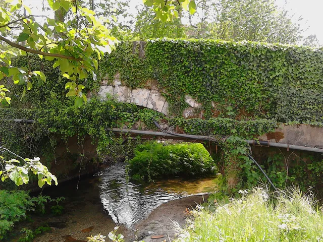
At the Ponte Velha in Arco de Baúlhe, a semicircular arch supports the deck over the Ouro River. The municipal description dates construction to the 18th century.
The triangular cutwater stands upstream, facing the incoming water. This detail allows us to read the bridge beyond its outline. The shape of the arch alone does not prove Roman origins.
The 1758 account explains the function of three chapels: São Bartolomeu at Celeiró do Monte, Nossa Senhora da Lapa at Lapela and Santa Ana at Busteliberne. They administered sacraments to residents living far from the parish church. A small building answered an everyday difficulty.
Rector Domingos Camelo de Sousa describes high hills between settlements and mentions three villages half a league from the church over rough terrain. Distance was more than a line on a map: relief formed part of the difficulty. The church stood to the east in a place with six households, including the rector’s own house.
According to the account, the three chapels were maintained at the commander’s expense. They were not the only ones, however: the text lists eleven chapels besides the parish church, with different administrations and functions. At Outeiro de Santo António, for example, it notes pilgrimages from neighbouring parishes during the feasts of Santo António and Santa Luzia. The group reveals both worship close to residents and gatherings that attracted people from outside.
The municipal report on the 2014 restoration describes two large chests and two cabinets with chestnut structures, rosewood veneer and cut-brass decoration. The municipality identifies Braga woodcarver Agostinho Marques as the maker of this early-18th-century work. The contrast between wood and metal offers a clue for looking more closely at the furniture.
In 2014, restoration separated materials and tasks: the brass elements were removed for treatment, while the wood received work against insects and structural corrections. After cleaning and protection, the metal decoration returned to the furniture. The visible shine results from a series of care measures, not merely adding gold. This is the account of a professional intervention, not a suggestion for treatment at home.
Odília Alves Gameiro studies three texts on the life and miracles of Saint Senhorinha, preserved in 16th-century copies: two in Latin and one in Portuguese. Their similarities suggest a medieval original, according to the researcher. Reading these versions allows the construction of memory and devotion to be studied. The date of a copy is not necessarily the date of the story it tells.
The two Latin accounts studied come from Coimbra: one from the Colégio da Graça and the other from Santa Cruz. This provenance shows that the memory of a saint connected with Basto travelled beyond the place of worship. Each copy is also an object with a history of preservation and transmission.
Three periods must be distinguished: the life being narrated, the composition of the account and the surviving copy. The research places Senhorinha in the second half of the 10th century, but does not turn the 16th-century texts into accounts written by people who knew her. Similarities and differences between versions are themselves part of the historian’s work.
The study also reads the accounts in the context of a rural community: harvests, food and journeys appear among the concerns represented. Beyond recounting wonders, hagiography offers insight into that imagination and the values the text seeks to convey.
The parish account places Santa Senhorinha in a valley between Gatiras and Ladário. It lists settlements including Rendufe, Soutelo, Outeiro Seco, Olela, Devesa and Vila Garcia, among many others. The church is described as standing outside the settlement, in the middle of a field. This portrait evokes a community spread across several clusters, while retaining the names and perspective of the 1758 document rather than serving as a current map.
The author also lists settlements visible from the area, distinguishing the position in the valley from the view from Ladário. Visibility was part of how the territory was presented. A place could be described through its surroundings and what could be seen from higher ground, as well as through boundaries and names.
The Monastery of Refojos already existed in the early 12th century, but the municipal history does not establish its foundation date. It questions traditional attributions to Hermínio Fafes and Gomes Soeiro.
The source connects medieval patronage with noble families of the region. Keep two questions separate: when we know the monastery existed, and when it was founded. A documented date of existence does not, by itself, answer the second question.
Date given at source: . Source consulted in 2026-11-07. EXIF orientation, proportional resizing and WebP conversion; no retouching or clipping of the file.
Date given at source: . Source consulted in 2026-11-07. EXIF orientation, proportional resizing and WebP conversion; no retouching or clipping of the file.
Date given at source: . Source consulted in 2026-11-07. EXIF orientation, proportional resizing and WebP conversion; no retouching or clipping of the file.
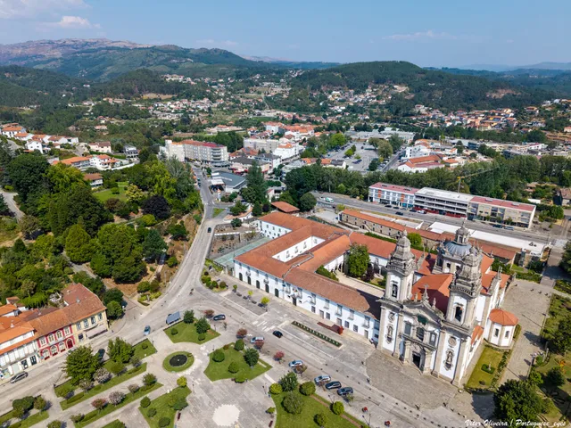
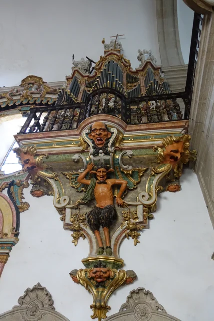
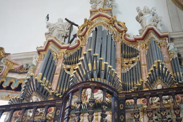
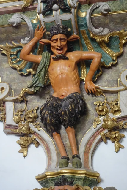
The municipal description identifies two side organs, one of them silent. The church’s visual symmetry therefore does not correspond to two sounding instruments. Carved grotesque faces appear near the entrance; further inside, wood creates another surprise.
The two pulpits are chestnut wood painted to imitate marble and partly gilded. The source dates their making to 1777–1780 and their painting and gilding to 1786–1789. Form, material and finish tell different stages of the same work. This heritage description does not confirm the organ’s current operation.
The choir offers another reading of wood: the municipality describes chestnut stalls from 1767–1770, arranged in two tiers in a U shape. There are 45 seats, with the abbot’s place at the centre. The arrangement helps us imagine a gathered community rather than viewing each chair in isolation.
Above, the circular dome is accompanied by internal and external balconies. The description identifies the twelve apostles and Saint Michael at the top. From furniture to silhouette, the scale and viewpoint change. The photographs in this reading show organ details; they do not document every one of these elements.
A fogo corresponded to a household, not a person. This distinction is also explained in notes to editions of the Parish Memories, such as the one published by the municipality of Ourém. The term’s explanation is general; this story’s figures come from the Passos account.
The 1758 Passos account counts 71 households and 211 people eligible to receive the sacraments. These are parish-record categories: they do not mean 71 inhabitants or a total population measured like a modern census. The source then places Passos within the jurisdiction of Celorico de Basto. The same summary dedicates the parish church to São Sebastião and says its vicar was presented by the abbot of São Clemente de Basto. Population and religious organisation thus appear side by side in the document.
During Romanisation, the region’s settlements did not all follow the same path. The Archaeological Map suggests that the small hillfort at Arco de Baúlhe may have lost inhabitants while Chacim became more central. It also mentions the expansion of agricultural occupation onto lower land. This interpretation helps us imagine a changing territory, but gives no certain date for the abandonment of Arco’s hillfort.
The Map places these changes within a process beginning in the second half of the 1st century BC. Transformation extended beyond houses: relationships among settlements, fields and centres of power changed too. Chacim appears as a focus for population and renewed spaces, while Arco is presented as a possible example of depopulation.
Material from Mó de Cima, in Chacim, is used to support the agricultural occupation of lower land. Later, the text highlights open farmstead-type settlements such as Abadim. Read together, these clues show a change in territorial organisation; they do not allow a single movement of inhabitants between two points to be traced, or every change to be dated to the same year.
With Romanisation, the Archaeological Map describes changes in population distribution between mountains and valleys and the agricultural occupation of lower land. In Abadim, it mentions an open farmstead-type settlement. The text suggests that people connected with the honorific inscriptions it mentions may have lived there. The settlement’s existence and the proposed identity of its inhabitants do not carry the same degree of certainty: the latter remains a hypothesis.
At Casares, a wooden bridge formed part of the royal road to Braga and the connections with Trás-os-Montes, according to the 1758 account. Given the traffic, the vicar argued for rebuilding it in stone. This was a request, not confirmation of completed work.
The source distinguishes that crossing from small pedestrian footbridges made with a wooden beam. Different crossings answered different needs.
The crossing did not serve only the village. The vicar describes a busy public road connecting Braga with the jurisdiction of Basto and Trás-os-Montes. The bridge therefore appears as a local point in a larger network. His recommendation to replace it with dressed stone shows the author assessing a need as well as recording what existed.
In the same rivers, water drove mills and was used by farmers in their fields. Crossing, milling and irrigation appear in the same portrait of the territory. A bridge can be read through what it makes possible: reaching another place, maintaining a connection or bringing work on opposite sides of the water closer together.
In 1758, the Corpus Christi procession brought the municipal council and representatives of nearby parishes together in Santa Senhorinha, with crosses and clergy. The account mentions spending on wax and a sermon: behind the celebration stood preparation, objects and work.
The abbot also describes, separately, the forty-hour triduum, with music and sermons over three days. Distinguishing these references helps explain the religious calendar of that time. The document is testimony from 1758, not the agenda of current celebrations.
The municipal inventory interprets the remains as a fortified residence of motte type, dating from the mid-13th century. It connects them with the castle mentioned in the Inquiries of 1258. The circular form stands on a mound of stone and coarse sand, surrounded by a ditch. The municipality highlights its position above the Rio Douro valley, a connection between Refojos and the Barroso plateau. This reading combines terrain and document without reconstructing the vanished building with certainty.
The 1258 document adds a social dimension to the shape of the ground: according to the municipal interpretation, almost all residents of Santo André de Rio Douro had an annual obligation to go to the castle. The reference connects the fortification with community organisation, although it does not clarify all the associated tasks here.
The inventory compares the construction with examples from Brittany. This is a comparison of forms and techniques, not proof of the builders’ origin. Its position halfway up the hillside helps explain the relationship between defence and movement through the valley.
At Marmoirais in Abadim, burial mounds and engraved granite outcrops form an archaeological group. The inventory proposes the second or first millennium BC, comparing pottery, engraved motifs and similar groups in the north-west. The dating results from that interpretation. The source also connects the name Marmoirais with the place’s burial memory: a landscape can hold clues in both remains and names.
The inventory distinguishes preservation from interpretation: it describes the group as poorly preserved and allows that Mamoa 5 may remain intact. It proposes cist-type burial structures without presenting that hypothesis as confirmed by excavation.
Tombs and engravings are different remains sharing one landscape. Reading pottery and comparing other groups help suggest a chronology, but do not automatically reveal the meaning of each engraved motif.
The inventory identifies a trap with V-shaped walls in Vilar de Cunhas. Its construction date remains uncertain: it discusses possibilities between the Early Modern period and the 19th century. One detail distinguishes it from other wolf traps: one wall rises towards the pit. The reading of figures on a slab is also uncertain, between 1668 and 1868. That doubt helps explain why the inventory does not settle on a single date.
The São Pedro de Alvite account distinguishes civil matters, linked with the abbot and convent of Refojos, from criminal matters, assigned to the judge of the municipality of Cabeceiras. The couto therefore had an organisation that cannot be reduced to a line on a map. This is a historical description, with no correspondence to current administration. One important territorial distinction remains: the answer places Petimão in the jurisdiction of Celorico de Basto. The couto’s powers are described for the other settlements, avoiding a reading of the whole parish as a single jurisdiction.
Three houses, three details to notice. At Casa da Taipa, the municipal introduction highlights the chapel of Nossa Senhora da Conceição, with its 16th-century design. At Casa da Breia, it describes the staircase with scrolls in the stone handrail, retaining uncertainty over the building’s attribution to the 18th century.
At Casal da Fonte, attention turns to the portal with its coat of arms and late-18th-century Baroque decoration. Comparing chapel, staircase and portal reveals different ways of composing a manor house. These references do not imply access to the properties’ interiors.
The municipal introduction describes Uz’s stone houses and some thatched roofs. It also recalls the name Casal da Urzeira, connected with the heather of the hills. These offer two ways to read the link between settlement and landscape: in house materials and in the memory of a name. The same description associates the village with farming, livestock and work in linen and wool. The portrait helps connect houses, fields and crafts. This is a heritage introduction, without confirming how many thatched roofs survive today.
In the historical narrative published by the municipality, these communal mills belonged to the Crown and half their income was assigned to the king. The same description mentions a later change to a symbolic tax. The place name thus opens a window onto the economic organisation of milling.
The income mentioned concerns the mill’s economic activity. Without more information, it should not be converted into a rule that each person handed half a sack of grain to the king. The introduction gives no accounts, quantities ground or date for the change to a symbolic tax.
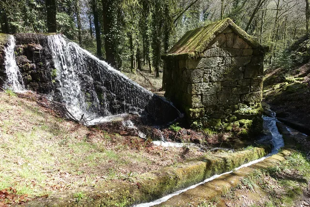
Exploring the history of Moinhos de Rei, you can ask two different questions: how did water reach the machinery, and how were the benefits of milling distributed? The levada helps follow the first; the reference to the Crown opens the second. Technology, organisation and income belong to the same working landscape.
Romanisation did not affect every settlement in the same way. The Archaeological Map places changes in the second half of the 1st century BC: Chacim may have strengthened its central role, while the small hillfort at Arco de Baúlhe seems to have lost inhabitants. The text offers an interpretation of remains, not a census of movements.
In Chacim, material from Mó de Cima is associated with occupation and cultivation of nearby lower land. Later, the description also points to open farming settlements, such as the farmstead identified at Abadim. The story therefore involves more than leaving the heights: it includes new centres and different ways of occupying fields.
The same source connects cultural transformation with warrior sculptures and honorific inscriptions. These are different kinds of clues: one helps us consider social representation; another offers signs of Roman practices. When exploring these stories, always ask which evidence supports each interpretation.
The municipal introduction recalls this old form of the name. It opens a small window onto medieval documents: a place we know today may be written differently in the sources. The reference locates Pedraça in the record of 1258 without making that date the settlement’s beginning.
Pedraços and Pedraça are two forms worth placing side by side. A written name is also a clue for finding documents: searching only the current spelling may miss old references. The municipal introduction provides this variant but does not explain here when or why the spelling changed.
The same care applies to house names. At Casa do Paço, the municipal introduction draws attention to place names. A name can open an investigation; alone, it identifies neither a construction date nor the function a building served in every period.
The parish account describes the church as dedicated to Santa Marinha and says its rector was presented by the rector of the Colégio de São Jerónimo in Coimbra. This historical bond shows how a small parish belonged to relationships extending beyond the Terras de Basto.
The same transcription places Pedraça in the jurisdiction of Cabeceiras de Basto and the comarca of Guimarães. It records 96 households and 322 souls admitted to communion, alongside a stipend of 50 thousand réis for the rector. These are the document’s categories: households are not people, and souls of communion do not automatically equal the total population.
The figures and the connection with Coimbra show two aspects of parish life: the community described and the organisation framing its priest. The municipal version identifies José Viriato Capela’s transcription, published in 2003, from the 1758 Memories.
The municipal page also distinguishes the account from its accompanying references: it points to memory 296 in volume 42 and lists an obligation to the fabric fund of the chapel of Santa Bárbara from 1624, and another connected with the Blessed Sacrament from 1722. These are archive clues. Their presence does not mean the two documents’ full texts are reproduced on the page, nor does it make 1624 the chapel’s construction date.
In the trail description, the municipality presents these old boundary stones as witnesses to the division between Cabeceiras de Basto and Montalegre, and between Minho and Trás-os-Montes. They offer a tangible way to find in the landscape a boundary we usually see only drawn on a map.
In the parish account, the Tâmega crossing is described as a large, well-worked stone bridge. The author even calls it the best on that river. The praise belongs to the writer’s viewpoint: it reveals the importance he gave the structure, without serving as a technical comparison of bridges.
In the same account, the Tâmega appears as a strong current, especially in winter. The document distinguishes crossing the water from using it: it describes mills and explains that the river ran too deep to irrigate the fields along that stretch. The bridge can be read within these relationships among banks, movement and work.
Notice the difference between observing a structure and judging it. The bridge’s existence is information; calling it the best is an assessment. Both tell us about the past, but answer different questions.
On the municipality’s western edge, beside Fafe, Outeiro is described by the municipality as a gently rolling plateau. The introduction connects the name with that landscape and notes its proximity to the municipal seat and houses settling along the road.
The municipal page proposes a medieval interpretation of place names and mentions a scarcity of archaeological information. That wording needs to be read alongside the Municipal Master Plan inventory published in 2026, which identifies three archaeological sites in Outeiro. The parish’s name still does not, by itself, provide a foundation date.
The municipal introduction to Painzela highlights Casa de Cimo de Vila and its chapel of São Gonçalo, dated 1662. The group adds another period to the discovery of the parish, alongside Casa de Pielas and its garden. The heritage reference does not confirm access to the interior.
The municipal text places the group in a mainly farming landscape, in a strip of territory extending east to west towards the boundary with Fafe. The same introduction includes the parish church, roadside devotional shrines and the chapel of São Brás: São Gonçalo’s chapel is one part of a network of places, not the parish’s entire religious history.
The date of 1662 allows a comparison with Pielas, whose house is presented as 18th-century and garden as 19th-century. These are references to distinct periods; they do not prove that all elements visible today belong to the same building campaign.
The municipal transcription of the Parish Memories records 137 households and 439 souls admitted to the sacraments in Painzela. The wording itself distinguishes domestic units from a religious category of people. The 439 should therefore not be presented as a modern census of all inhabitants. The document also reveals the language used to describe the community.
The same passage identifies Santo André as the parish church’s dedication and connects the vicar’s presentation with the abbot of Santa Senhorinha. The short text thus brings together population, church and ecclesiastical organisation. Rather than reading it as a statistical table, we can ask what the author chose to record about the community.
Another layer lies between the old document and the screen: the municipality explains that the transcription updates spelling and punctuation from José Viriato Capela’s edition, published in 2003. This distinguishes the testimony’s date, 1758, from the date of the edition used to share it. References to chapels appear separately in the documentary note.
Vila Seca is the former name of Vilar de Cunhas recalled by the municipality. The introduction brings together three villages: Vilar, Cunhas and Uz.
It also distinguishes plateau and mountain areas associated with farming and pastoralism. One parish name can therefore encompass different settlements and landscapes. The source does not date the change of name.
The municipal introduction places this territory beside Montalegre and Ribeira de Pena. That position helps explain a landscape continuing beyond the administrative boundary: the settlements belong to the municipality, but valleys and connections between places invite us to look at neighbouring territories too.
At Casa de Chouzas, three 19th-century granaries stand alongside the manor house highlighted by the municipality. The group connects two functions: living and storing the harvest. Rather than looking only at the main house, it is worth recognising the importance of buildings supporting agriculture.
The introduction to Vilar de Cunhas places this heritage in a landscape of plateau and mountain, shaped by farming and pastoralism. House and granaries can be read in that working context, although the source does not detail each property’s production.
The house’s dating is less firm: the municipality presents it as perhaps 19th-century, while assigning the granaries to the 19th century. That difference should remain visible. The photograph accompanying the reading shows the portal, not the three granaries. The heritage reference does not confirm access to the group.
The station’s tile panels were made in 1940 by A. Lopes at the Fábrica de Cerâmica Sant’Anna in Lisbon, according to the publication about the Museu das Terras de Basto. They predate the station’s opening in 1949.
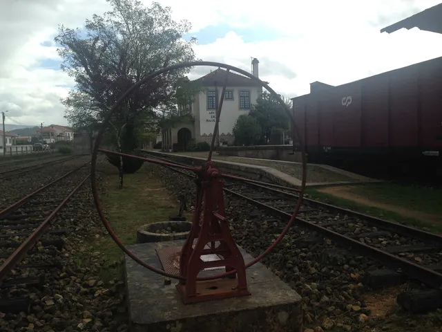
The station comprised spaces with distinct functions. The publication identifies the drivers’ house, staff building, loading and unloading platform and goods warehouse. The two vehicle sheds came to house permanent exhibitions of railway equipment; the warehouse is described as a temporary exhibition space.
Reading the building can begin with these differences: where did people work, where did goods pass and where were vehicles kept? The tiles belong to that built landscape. The description documents the museum arrangement presented in the publication, without confirming each space’s exhibition or access today.
In the 2014 announcement of the restoration of six large candle stands, the municipality describes pyramidal structures with three decorated faces, gold leaf, floral motifs and angel heads. It proposes a likely attribution to Frei José Vilaça and completion between 1764 and 1767. The source presents that authorship as a hypothesis, distinct from the confirmed attribution of the sacristy furniture.
The report also included the high altar’s cross among the pieces undergoing treatment at Oficinas Santa Bárbara in Porto. A patron funded the intervention. This episode connects heritage conservation with specialist work and support from those who cover its costs.
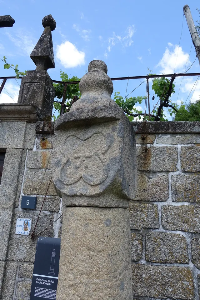
Abadim’s pillory looks simple at first: a smooth granite column, a cubic capital and a pear-shaped finial. Yet one face bears a five-pointed star within a four-lobed frame. The Museum connects the monument with the administrative and judicial autonomy of the old couto, abolished in 1836. It places construction near the charter of 1514, but the Cultural Heritage record warns that dating is difficult and the piece may be much later. The star invites a second look at a monument easily overlooked.
The official record describes four faces on the capital: three undecorated and one bearing the star. This explains why a photograph from another side may not show its best-known motif. The record places the monument beside the portal of Casa da Torre do Tronco and documents its designation as a Property of Public Interest in 1933. The protection date is not the construction date.
The charter, the stone’s age and the heritage designation answer distinct questions. Instead of automatically assigning “1514” to the entire monument, compare its described form, proposed dates and the documents that changed its status.
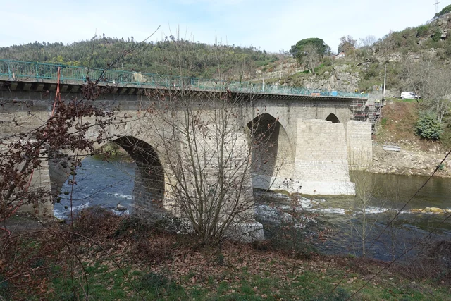
Three central pointed arches and two round arches beside the banks: the Bridge of Cavez brings together different forms and periods. The Museum dates the medieval construction to the second half of the 13th century, serving the road between Braga and Vila Pouca de Aguiar.
The source attributes the round arches to work during Philip II’s reign and mentions a marker from 1599. In the 19th century, the road between Fafe and Vila Pouca de Aguiar brought a widening of the deck. Looking at the bridge means seeking the changes in an old crossing.
According to the Museum, the stone bridge replaced an earlier wooden one that had deteriorated. Construction is attributed to Frei Lourenço Mendes, a Dominican who collected alms for the work; the museum text mentions testamentary bequests supporting that connection. The crossing thus involves materials, routes and ways to fund a shared undertaking.
The legend shared by the Museum has masons try to build the bridge at Vila Franca and then beside Poço das Laranjeiras. In both places, a supernatural voice told them to move upstream. Tradition attributed it to Saint Bartholomew.
On the third attempt, the narrative places construction beside the chapel. This is a story about the memory of a place, not documentary proof of site selection or an itinerary for finding the episodes.
In another part of the tradition collected by the Museum, feeding the builders receives a miraculous explanation: springs of water, wine and olive oil emerge, and fish appear in the river. The narrative connects building effort with religious protection. Reading it beside the history of the works reveals two different ways of telling the same place.
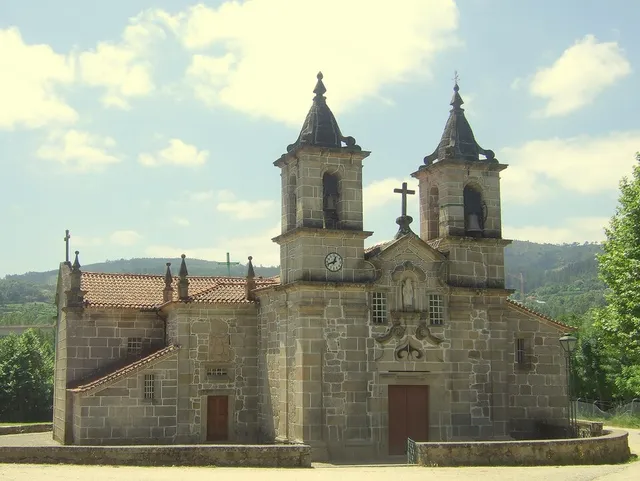
In the 1758 account, Santa Senhorinha’s church had two naves with different image programmes. One presented panels on the Creation of the World; the nave of the Franciscan Third Order showed saints of that order.
The abbot also described a vaulted chapel closed by iron grilles. Painting, spaces and architectural elements formed a written portrait of the interior. The source allows that description to be studied without guaranteeing that the pieces or arrangement survive today.
The description continues with tombs, presented by the abbot as decorated with painting and gold lettering, and a private chapel dedicated to Nossa Senhora do Pilar. The interior emerges as a group of spaces, images and inscriptions, each with a role in the account.
This allows a layered reading: first the arrangement of the naves, then the painted themes and finally the elements marking memory and devotion. There is no need to imagine a single undifferentiated hall; the document itself distinguishes several settings.
Faia’s abbot recorded five altars in 1758, mentioning the Name of God, Saint Anthony and Our Lady under the invocation of the Rosary, with its confraternity. The document shows different devotions gathered in one church.
The restoration reported in 2022 belongs to another moment. The two descriptions have different purposes and periods: comparing numbers alone cannot determine which pieces remained or disappeared. The church profile continues the discovery of the building while keeping historical memory separate from visiting information.
The enumeration distinguishes the high altar from four side altars. The reference to the Rosary confraternity adds people to the space: the church appears not only as a group of objects but also in connection with a devotional organisation. The text does not, however, describe that confraternity’s membership or activities in detail.
A 2012 municipal report highlights a sculpture of Santa Maria belonging to Outeiro’s church, dated to the 13th or 14th century. The Virgin appears crowned, seated on a throne with the Child on her knees. The account says the piece was found buried at the place known as Mata da Santa and taken to the church by parishioners. The report does not date the discovery. This story traces the image’s journey without confirming where it is currently displayed.
In the church of São João de Bucos described in 1758, the high altar combined gilded reliefs with vermilion backgrounds. The account places Saint John the Baptist and Saint Dominic on opposite sides, with the tabernacle at the centre of the altarpiece. It also mentions altars with Our Lady of the Rosary, Saint Peter and Saint Anthony. This written portrait lets us imagine the arrangement and colours of the old interior without confirming that the pieces or layout survive today.
Answering the 1758 inquiry, Alvite’s vicar recalled the earthquake of 1755. He said there had been no ruins except that the arms of two crosses at the chapel of Casa da Torre had reportedly twisted northwards. He added that they were already straight again.
The account separates the event from the state observed when writing. This is local testimony, not a measurement of earthquake intensity or confirmation of marks visible today.
Born in Painzela on 1 May 1891, Baltazar da Silva Castro studied in Porto and began his career in Public Works in 1919. The University of Porto documents his work in the northern monuments services and move to Lisbon in 1936 to take charge of the Monuments directorate. This link between Painzela and restoration history follows a professional life; it does not attribute the parish’s buildings to the architect.
His training combined engineering, architecture, construction and drawing. In 1930 he became acting head of the northern Monuments directorate. Study journeys were also part of his work: the University mentions travel to Spain in 1934 devoted to Visigothic architecture, and across Europe in 1938 focused on military architecture.
He did not work only in restoration. With Rogério de Azevedo, he designed the Garagem do Jornal O Comércio do Porto and the extension and refurbishment of the University of Porto’s Faculty of Medicine. These projects are in Porto; his connection with Painzela lies in his origins, not in their location.
The municipality’s historical account associates Cabeceiras with Sá de Miranda’s Carta a D. António Pereira and points to references to the municipality in Camilo Castelo Branco’s A Bruxa de Monte Córdova and Noites de Lamego. These reading clues invite you to explore how a territory enters literature. A literary reference is not equivalent to a documentary account: characters, places and events should be read in the context of each work.
Abbot of Refojos and rector of the University of Coimbra, Friar Diogo de Murça wanted to use the Monastery’s revenues to establish two colleges in Coimbra: São Bento and São Jerónimo. The plan required the Monastery’s closure. Municipal documentation recounts the monks’ opposition and the abbot’s later reconsideration. This connection shows how decisions about Refojos formed part of a wider history of education and religious institutions.
The municipal account dates Pope Paul IV’s acceptance of the revised request to 1555: to keep the Monastery with twelve monks and a prior, instead of following the initial closure plan. The same source records Friar Diogo’s death in Refojos in 1570 and his burial in the Monastery.
In Pereiras, the former town hall continued to serve as a prison until 1972, according to the Museu das Terras de Basto. After restoration, it became the Casa da Música. A municipal news item from July 2010 already listed it among places to discover in the municipality. The Museum’s article dates the town hall’s move to the Monastery to 1835 and the opening of the Casa da Música to 2003: the building continued changing roles after municipal administration left.
The building’s story begins before the prison preserved in local memory. The Museum’s article attributes the order to build the town hall in 1586 to the magistrate João Gil de Abreu Castelo Branco. It then suggests an 18th-century reconstruction on the site of the earlier building.
Its two storeys divided the functions: prison on the lower level, town council and hearings above. This arrangement brought administration and justice together. When the council left, the prison remained; when the prison closed, the building survived. Opening as the Casa da Música in 2003 added another use to a building with many chapters.
In March 2026, the Museu das Terras de Basto presented an iconographic study of the Incredulity of Saint Thomas, celebrated in verse by Saint Thomas Aquinas. It identifies the work as an oil painting on canvas, part of a five-painting Late Mannerist altarpiece group from the early 17th century. Viewing one painting alongside the others reveals how a collection can preserve relationships between images. The announcement documents the work without confirming current visiting arrangements.
The last vehicle of a train carried an important message. The Museum presents a red tail lamp, used at night on the last carriage or wagon to indicate that the train was complete. Its purpose was to signal, not to light the track ahead of the locomotive.
The inscription N.1 E POSTO. DA LIVRAÇÃO links the object to Livração station on the Tâmega Valley line. Reading the object means bringing together three clues: the colour of the light, its position on the train and the inscription connecting it with a place.
This small object shows that railway history also consists of signals and quiet tasks. The Museum’s presentation, published in June 2024, describes its use and the station to which it was assigned; it does not give a manufacturing date.
In February 2024, the Museum described a hexagonal platform lamp intended to light boarding areas. Inside was an oil lamp with a glass chimney and a metal reservoir. The description does not identify the station where this object was used.
The reservoir bore the inscription MD MOVIMENTO. That detail belongs to the object described; it does not, by itself, reveal a station of origin. Compare it with the tail lamp: both produce light, but the platform lamp lights the boarding space while the tail lamp communicates information about the train.
In his 1758 response, Faia’s abbot wrote that the right to nominate him belonged to Prince Pedro in his capacity as Grand Prior of Crato. He also referred to the involvement of Porto’s ecclesiastical official in his formal appointment. These details show that local religious organisation involved authorities beyond Cabeceiras. The account describes how the post was filled at that time; it does not mean Faia belonged to the municipality of Crato or Porto.
The same response estimated the benefice’s revenue at 450 thousand réis. This figure describes the institution and should not be presented as a current salary or converted directly into today’s prices. Read alongside the altars and chapels, it adds a layer to the story: beyond the building and devotions, there was an organisation of offices and revenues.
The municipal inventory describes burial mounds at Portela de Asnela, in Rio Douro, and proposes a connection with the Castelo settlement at Formigueiro, around one kilometre to the north. Proximity supports a hypothesis; it does not by itself prove that both groups of remains were used by the same community.
The entry identifies structures of the antela and cist types within the funerary group. It proposes a date in the second or first millennium BC, based on pottery and comparisons with similar groups in the mountains of the Northwest.
There are therefore two separate questions: when might these monuments have been built, and how might they have related to the nearby settlement? A proposed chronology does not automatically resolve the second question. The inventory presents that connection as a hypothesis, leaving room for future research.
In 1758, the vicar described Alvite’s church as having three altars: the main altar, associated with Saint Peter, and those of the Name of God and Our Lady of the Rosary. He mentioned a single nave, choir, chancel and sacristy. This is the arrangement recorded at that time, without confirmation that it remains the same.
The document places the church in Cacheina, surrounded by residents. It distinguishes the main altar from the two side altars and mentions a brotherhood associated with the confraternity of the Blessed Sacrament. The portrait of the building thus includes a community: places of worship, people and religious organisation appear in the same answer.
A list of spaces is not enough to reconstruct a floor plan. We can recognise functions and names, but locating each room precisely would require other sources. It is a good opportunity to compare what a text describes with what an exterior photograph can show.
In 1758, a questionnaire sent to parish priests sought to gather information about Portuguese parishes. According to the Museu das Terras de Basto’s presentation, it was organised around three broad themes: land, mountains and rivers. When publishing the texts in 2011, the Museum explained that it had updated their language to make them more accessible to students. Reading a transcription therefore also means recognising the work of those who made the document readable for others.
According to the Museum’s retrospective, Arco station ceased operating in January 1990 when the section between Amarante and Arco de Baúlhe closed. On 8 January 2000, an agreement between REFER and the municipality paved the way for the transfer of use of the premises and their development as a museum. The Museum’s opening on 23 May 2004 belongs to that new chapter.
The transfer brought responsibilities: the municipality became responsible for conserving, maintaining and managing the section in collaboration with the Fundação Museu Nacional Ferroviário. The Museum’s April 2025 news item also reports the municipal decision of 14 February that year to classify the complex. The change of use therefore involved agreements and continuing work, beyond opening the doors to the public.
The church of São Tiago da Faia reopened on 14 August 2022 after being closed for around a year for building work. The Archdiocese of Braga’s report records the restoration of paintings, religious images and three altars, along with the installation of stained glass depicting episodes from the patron saint’s life and mission. This recent intervention differs from the account of five altars left in 1758: the sources come from different periods, not a directly comparable count of surviving objects.
The report also tells who made the work possible. Parish priest Rui Filipe Marques Araújo credited the community’s involvement; the ceremony brought together association representatives, workers and benefactors. Archbishop José Cordeiro presided. Behind the paintings and stained glass restored or installed lies a story of participation.
Reopening does not necessarily mean that every task was finished: the same report records an appeal to continue completing the restoration. The August date marks the celebration and the return of the space to religious use, without establishing by itself when each intervention ended.
According to the 1995 study, the chalice remained in Refojos until the mid-16th century, then went to the Colégio de São Bento in Coimbra in the context of Friar Diogo de Murça’s activities. After the dissolution of religious orders in 1834, it passed to the Treasury of Coimbra Cathedral. The Museu Machado de Castro’s catalogue documents its present connection with the collection. This journey adds a material history to the relationship between Refojos and Coimbra.
The municipal presentation of Painzela includes a photograph labelled Ponte de Painzela and lists a Roman Bridge among the parish’s heritage. That name alone does not establish when the bridge was built. The name helps locate the place; dating would require documents or a study of the structure. It is a useful question to bring to heritage: what do we know from the identification, and what do we still need to investigate?
The municipal presentation highlights a distinctive feature of the chapel of Santa Catarina in Alvite: it is embedded in an outcrop of rock. The meeting of rock and building offers a way to look at heritage beyond the façade.
The source identifies that relationship with the site, but gives no construction date or visiting hours here. The chapel’s listing brings together the available documentary information.
The 1758 account already named Santa Catarina on the hill of that name, among six chapels in the parish. The two sources answer different questions: the old document places it within a network of places of worship; the municipal presentation draws attention to the relationship between building and rock. Its presence in the account does not date the exterior appearance shown in the photograph.
Rector Domingos Camelo de Sousa described five altars in the church of São Nicolau. At the high altar, he placed Saint Nicholas and Saint Blaise on opposite sides, with Christ Crucified in the centre, within a gilded carved-wood setting.
The other altars were dedicated to Our Lady of the Rosary, the Lord of the Steps of the Passion, Saint Sebastian and the Souls in Purgatory. This is a portrait written in 1758, not confirmation of the current arrangement.
The municipal transcription of 1758 presents Gondiães with 55 households and 269 people admitted to communion, alongside the parish church dedicated to Saint Martin. The account of Vilar records 41 households and 141 people admitted to the sacraments, with a church dedicated to Saint Lawrence. Both places are situated within Cabeceiras de Basto’s jurisdiction, in the district of Guimarães.
The source’s terms matter: fogos or vizinhos, meaning households, and almas, meaning souls, are not the same category. These figures should not be added as though they all counted people, nor should people admitted to the sacraments be presented as a modern census of the entire population. The Gondiães text attributes its information to Lima; that reference should accompany the figures.
In Rio Douro’s 1758 account, the vicar lists fifteen settlements and places the church outside the inhabited area. He also mentions fifteen chapels, explaining their relationship with religious care for people living far from the parish church.
Santo Estêvão stood outside Eiró; other dedications accompanied village names, such as Santa Ana in Toninha, São Gonçalo in Vilela and São Frutuoso in Leiradas. The document also distinguishes responsibilities held by monks from Refojos, private individuals and residents. It is a historical network of places, devotions and care, without confirmation of the present condition or accessibility of each building.
The municipal inventory links the Ponte de Arame de Padroselos to tin mining. Entry Po.27 describes iron, wood and a ruined condition, without supplying the survey date.
Ponte do Freixo, in Torneiro, formed part of the path between Cunhas and Torneiro. Entry Po.28 records granite and an absence of parapets. In Po.29, Ponte de Arames over the Beça appears with a concrete deck supported by five piers. These two entries are dated 20 March 2008.
These are three different references. The inventory reveals the memory of connections but does not confirm present conditions or suggest crossings.
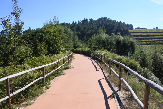
The Tâmega Line’s corridor continued connecting places after the trains. On 20 April 2013, the municipality’s section of the greenway opened between the Railway Museum in Arco de Baúlhe and Mulher Morta, in Vila Nune. The municipal listing gives this section a length of 5.4 kilometres, within the longer connection to Amarante.
The route’s gradients preserve its railway origins: the municipal description associates the old corridor with a maximum gradient of 3%. This is a published characteristic of the route, not a current check of every entrance or obstacle. To prepare an outing, consult the practical listing and signs on site.
The former station and Vila Nune halt tell different parts of the story. The municipality includes the halt among Vila Nune’s heritage; in Arco, the station became a museum. A route can change use without losing the landmarks that help us recognise its past.
In May 1758, Vila Nune’s vicar recorded 55 households and 239 people. He listed fourteen settlements, some with only one resident, and noted uninhabited houses in Serra.
These figures describe different categories in the document. They should not be added together or confused with a current census. The small scale of the settlements evokes dispersed habitation viewed through the parish.
The list allows a closer look: Silva is assigned eight households; Vale and Rossada five each. Fojães and Ribeira da Covilhã appear with just one resident. The church stood in Granja, near Vale. The religious centre was therefore distinct from the place called Vila Nune.
Vicar Domingos Leite de Andrade adds that the households included unmarried women living in poverty and people from other parishes. This is one author’s social description from a particular time; it does not allow every individual life to be reconstructed. By retaining the terms and date, the document offers glimpses of different domestic circumstances within the small settlements.
The 2026 municipal planning inventory brings together three archaeological references in Outeiro: the medieval graves of Mata Santa, the rock shelter of Serra da Penouta and Outeiro da Pena.
Mata Santa appears as a medieval necropolis. The Penouta shelter is assigned to the Neolithic/Chalcolithic; Outeiro da Pena appears as a shelter/lookout, labelled Prehistory/Medieval. These are the inventory’s categories and periods, not three exact construction dates.
These entries open a history longer than the explanation of the parish’s name. They do not demonstrate continuous occupation between the periods given or establish a connection between the graves and the sculpture of Saint Mary. The documentary reference also does not confirm visiting arrangements.
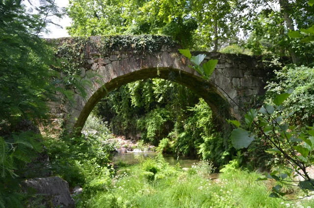
An old bridge can keep changing. The municipality attributes medieval origins to Moimenta Bridge in Cavez and describes a single rounded arch.
In 1990, the crossing was widened by around one metre: a concrete structure was added on the downstream side and the parapets were altered. The photograph offers a starting point for observing the crossing; the date of the work comes from the documentary description.