Discover Cabeceiras de BastoFree independent guide
ViveCabeceirasYOUR GUIDE TO CABECEIRAS
ENEnglish
SearchSaved
11 STORIES · CONTINUOUS READING

Riodouro: from mountain to water

Eleven readings between villages, chapels, watering, animals and work. Compares the portrait of 1758, knows the pison and ends in the memory of collective shepherding of Cambezes. Reports maintain their time and do not define current conditions of visit.

All stories in the order of the route. You can print this page by the browser; sources and credits follow the reading.

Things to try8 activities · 4 interactive explorations · 3 questions
Landscape · Rio Douro

Moscoso looks out over the valley
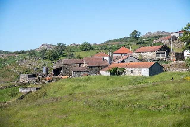
Landscape at Moscoso.
Houses and fields of Moscoso.ⓘ

Mountain houses, a stream and a name that stays with you.

Visit Cabeceiras presents Moscoso, in Rio Douro parish, as a preserved group of rustic houses in the Serra da Cabreira. The village faces the valley of the Cavez stream, where the description places Nariz do Mundo. It also mentions the nearby Poço das Relvas waterfall.

To read this landscape, try separating three elements: the houses, the valley and the hills beyond. Then bring them together again: the village gains context when it becomes more than a collection of buildings. The place profiles help you continue exploring; this description does not define a route between them.

Imagine a view with a foreground, middle distance and background. Where would you place the houses and the hills? A different viewpoint changes the relationship between them without changing the village. You can use an identified photograph of Moscoso for this exercise; there is no need to approach a slope or waterfall.

See Fact sheet: Moscoso See Fact sheet: Nariz do Mundo
Source and context

Visit Cabeceiras — village Moscoso

Accessed: . Editorial summary; the date of consultation is not the date of the facts.

Back to index ↑
Rio Douro · settlements and chapels described in 1758

Fifteen settlements, a network of chapels

Distance from the church also shaped village life.

In Rio Douro’s 1758 account, the vicar lists fifteen settlements and places the church outside the inhabited area. He also mentions fifteen chapels, explaining their relationship with religious care for people living far from the parish church.

Santo Estêvão stood outside Eiró; other dedications accompanied village names, such as Santa Ana in Toninha, São Gonçalo in Vilela and São Frutuoso in Leiradas. The document also distinguishes responsibilities held by monks from Refojos, private individuals and residents. It is a historical network of places, devotions and care, without confirmation of the present condition or accessibility of each building.

Source and context

Municipality — Parish Memoirs of Rio Douro, António Carneiro da Costa, 22/05/1758

Accessed: . Editorial summary; the date of consultation is not the date of the facts.

Back to index ↑
Ribeira de Cavez · water and agriculture

From spring to fields

Landscape at Trilho da Ribeira de Cavez.
Photography presented by the Municipality for the Trilho da Ribeira de Cavez · path and vegetation.ⓘ

A stream helps explain an entire landscape.

The Cavez stream rises on the municipality’s boundary with Montalegre and ends in the Tâmega. Between mountain and mouth, the municipal description highlights irrigation channels, mills and watered meadows: structures and fields showing different ways of using water.

On the trail starting in Vilela, Rio Douro, the account moves from the descent to the stream towards the irrigation channel and meadow landscape, then along rural tracks and the hillside. Returning to the village brings another material into the story: the granite masonry of its houses. Consult the route profile to prepare your walk; this story explains the landscape without confirming the path’s condition on the day of your visit.

The municipal description presents the section along the channel to Reboriça as gently sloping; the hillside climb is the most demanding part. Water does not tell the whole story of effort: the return matters too.

Try reading a photograph of this landscape in three layers: water, fields and houses. Look for a line carrying water, a plot depending on it and a building material. Can you explain how the three relate? This observation exercise can also be done at home.

Getting to know the parish See Fact sheet: Trilho da Ribeira de Cavez See Fact sheet: Vilela, Rio Douro
Source and context

Municipality — stream of Cavez and agricultural landscape
Consultations: ,

Editorial summary; the date of consultation is not the date of the facts.

Back to index ↑
Rio Douro · Parish memories of 1758

Two rivers tell a parish’s story

The 1758 account describes Rio Douro between east and west.

In the 1758 account, the Vilela river flowed to the east and the Rio Douro river to the west, both from north to south. The parish priest described their origins in small springs and their waters increasing with contributions from the mountains. He said the Vilela entered the Tâmega below Cavez bridge and the other joined the river coming from São Nicolau. These are the names and geographical relationships in that document, not a current navigation map.

Bridges bring that geography closer to village life. The document mentions a wooden crossing between Magusteiro and Teixugueiras and a stone one between Teixugueiras and the church. It also refers to wooden links from Eiró and Rio Douro to the church, and a stone one between Vilela and the church. Water and paths therefore appear in the same portrait of the parish.

The priest describes rivers with rocks, weirs and waterfalls, unsuitable for navigation but useful to mills and fields. They were more than lines separating places: they belonged to work and travel. These references come from the testimony signed on 22 May 1758; they do not confirm the survival of structures or present access to the banks.

There is a clue to imagining the relief: the author describes three parallel mountain ridges extending from Salto, with rivers in the lower spaces. The ridges’ names varied between places. Rather than seeking a single name for each mountain line, the document invites us to connect position, villages and the direction of water.

Water linking villages and works

Open an option and choose the story.

  1. The flow in summer and watering

    The levadas diverted water to the fields; in summer, the author describes less water at the end of the rivers.

    In summer, the water took other paths →
  2. The crossings of St. Nicholas

    Another account of the same date shows how floods affected bridges and links between places.

    Bridges winter tested →
  3. From water to fields and oil

    The derivations to fields and farms reveal several water-dependent works.

    Water watered and made oil →
It compares the testimonies of 1758 without using them as guidance on the ground.
Getting to know the parish
Source and context

Municipality of Cabeceiras de Basto — Parish memories of 1758: Rio Douro

Accessed: . Editorial summary; the date of consultation is not the date of the facts.

Back to index ↑
Rio Douro · water uses in 1758

In summer, the water took other paths

Irrigation channels linked river flows to work in the fields.

The 1758 account describes both Rio Douro rivers flowing all year but reaching the end of their course with little water in summer. The vicar linked this reduction to the many irrigation channels supplying the fields. Weirs, waterfalls and mills formed a landscape of varied work.

Crossings varied too: the account mentions wooden bridges between settlements and the church, as well as stone bridges at Teixugueiras and Vilela. The banks were not just places of production; people needed to cross from one side to the other. This historical list does not identify surviving structures or current access.

The document also explains why boats did not use the rivers: there were rocks, waterfalls and weirs, as well as insufficient flow for navigation. A river could matter to the parish economy without serving as a waterborne transport route.

On cultivated banks, the account mentions oaks supporting vines; beyond the fields, heather scrub. Water therefore helped organise a landscape where cultivation, vegetation and structures met. The response was signed on 22 May 1758: summer is described as a usual seasonal pattern, not a measurement made that summer.

Water connected jobs and places

Open an option and choose the story.

  1. What grew by the rivers?From the valley to the hill, the harvest changed →
  2. What places were connected to the church?Fifteen places, a network of chapels →
  3. How did the water participate in the work?Water also worked wool →
It explores the irrigation, harvesting and network of villages described in the territory.
Getting to know the parish
Source and context

Municipality of Cabeceiras de Basto — Parish memories of 1758: Rio Douro

Municipality — Parish Memoirs of Rio Douro, António Carneiro da Costa, 22/05/1758

Accessed: . Editorial summary; the date of consultation is not the date of the facts.

Back to index ↑
Rio Douro · an account of fauna from 1758

Fish in an old portrait

Trout and other freshwater fish appear in Rio Douro’s historical accounts.

Trout, bogas and escalos are the fish names recorded by the vicar of Rio Douro in 1758. He describes trout as the most numerous and distinguishes winter from summer fishing. These are impressions from the account, without counts that would allow abundance to be measured.

The testimony connects fauna with water use and village life. Old common names do not amount to complete scientific identifications; the practices described do not establish today’s fishing rules either.

Getting to know the parish
Source and context

Municipality of Cabeceiras de Basto — Parish memories of 1758: Rio Douro

Accessed: . Editorial summary; the date of consultation is not the date of the facts.

Back to index ↑
Rio Douro · animals mentioned in 1758

Animals remembered in the mountains

A list from 1758 combines encounters, abundance and passing visitors.

The vicar of Rio Douro names rabbits, hares, partridges, wolves, foxes and badgers when describing the mountains in 1758. He adds wild boar passing through and places partridges in only some areas. These differences in wording are part of the testimony and deserve to be retained.

The account describes cold, windy mountains with snow in winter. It connects animals with landscape but provides no counts, observation methods or scientific inventory. It cannot establish that every species mentioned still occupies the same places today.

Source and context

Municipality — Parish Memoirs of Rio Douro, António Carneiro da Costa, 22/05/1758

Accessed: . Editorial summary; the date of consultation is not the date of the facts.

Back to index ↑
Formigueiro · working heritage

Water worked the wool too

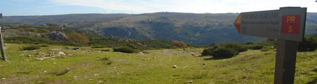
Landscape at Trilho do Pisão e Nariz do Mundo.
Landscape and signaling of the Trilho do Pisão e Nariz do Mundo, in the form Visit Cabeceiras. The image frames the route; it does not show the device or confirms current conditions of access.ⓘ

Wool and grain: two tasks beside one stream.

Beside the Cavez stream, an old building brought wool and grain work together: wool was fulled — compacted — there, and grain was ground. The municipal description places the ruins on the descent from Formigueiro. The trail offers a way to discover this memory of work; access to the interior is not confirmed.

The operations need to be kept separate: fulling wool and grinding grain are different tasks, even though the description brings them together in that building. We should not imagine a single machine making flour and treating wool without documentation of its mechanism. The municipal introduction mentions remains of equipment in the ruins, but provides no inventory from which to reconstruct all the parts.

The same landscape connects work with relief. Formigueiro lies above the fulling mill, on a descent the source describes as steep; Nariz do Mundo is another part of the route, offering a view over the valley. Understanding the mill’s history and preparing a walk complement each other: distance, difficulty and conditions belong in the trail profile.

Same water, different jobs

Open an option and choose the story.

  1. Turning cereal into flourPeio also made flour →
  2. Knowing gestures of wool workThe wool of Bucos also travels by the hands of those who teach →
  3. Organize access to waterThe water had its turn →
Comparing documented uses and places, without assuming that everyone used the same mechanism.
Getting to know the parish See Fact sheet: Trilho do Pisão e Nariz do Mundo
Source and context

Municipality — the former pison near the brook of Cavez

Accessed: . Editorial summary; the date of consultation is not the date of the facts.

Back to index ↑
Vilela · Rio Douro

Granite shapes the village too

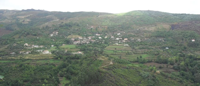
Panoramic view of Vilela, Rio Douro, with houses and agricultural plots on the slopes.
Vilela · architecture and landscape of Rio Douro© Ambcruzⓘ

In Vilela, the walls help you recognise the landscape.

The municipal introduction to the Cavez stream trail highlights granite masonry in the old streets of Vilela, in Rio Douro. After irrigation channels and meadows, the reading of the territory continues through its houses: the region’s material also helps shape the settlement.

The municipal text presents a sequence linking buildings with farming: channels, mills and irrigated meadows precede the description of the village streets. Vernacular architecture here means building connected with local materials and practices. Granite is not only a rock in the landscape; it enters the walls and the settlement’s visual character.

To explore this relationship, compare the photograph of Vilela with the reading about granite’s grains. A village view shows volumes and surfaces; a close look at the rock reveals another scale. The municipal description neither dates each house nor allows us to conclude that every wall has the same history.

Getting to know the parish See Fact sheet: Vilela, Rio Douro See Fact sheet: Trilho da Ribeira de Cavez
Source and context

Municipality — stream of Cavez and agricultural landscape

Accessed: . Editorial summary; the date of consultation is not the date of the facts.

Back to index ↑
Rio Douro · archaeology and oral tradition

The village that remained in memory

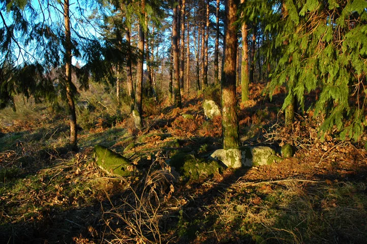
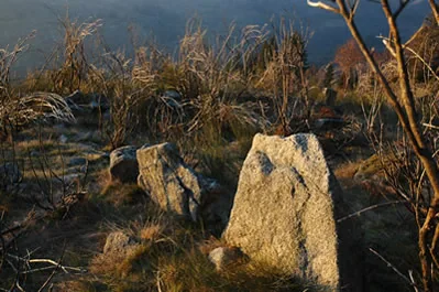
Remains of Aldeia Velha de Toninha.
ⓘ

Remains of Aldeia Velha de Toninha.

Source: Carta Arqueológica de Cabeceiras de Basto

View source

Photograph date not stated.

Autoria da fotografia e licença de reutilização não identificadas na fonte.

Request removal or correct the photo credit

Remains of Aldeia Velha de Toninha.
ⓘ

Remains of Aldeia Velha de Toninha.

Source: Carta Arqueológica de Cabeceiras de Basto

View source

Photograph date not stated.

Autoria da fotografia e licença de reutilização não identificadas na fonte.

Request removal or correct the photo credit

The remains of Toninha’s Aldeia Velha tell of another time.

At Aldeia Velha de Toninha, the municipal inventory proposes occupation between the 13th and 16th centuries. It compares the building remains with other mountain settlements, including examples at Lindoso and the abandoned village of Juriz in Montalegre. The plague said to have driven residents away, however, belongs to popular tradition. These are different ways of understanding the place: comparing buildings and collecting memories.

A third clue is the Inquiries of 1258. The inventory suggests that the settlement may correspond to one of the ten farmsteads then attributed to Juguelhe. This is a probable identification presented by the author, not a demonstrated equivalence. Comparisons with other places help formulate that interpretation.

Imagine three cards on a table: the buildings, the 1258 document and the plague story. Each opens a different question. Which forms recur in other settlements? Which places appear in the document? What explanation did tradition pass down? Discovery begins by connecting those clues without confusing them.

Other clues in the territory

Open an option and choose the story.

  1. Another story of settlementBefore Vilar, Vila Seca →
  2. Marks on the stoneThe stone also kept drawings →
  3. When tradition tells a storyThe voice he had built above →
Compare different ways of interpreting traces and memories. They are reading links, not a route of access to sites.
Getting to know the parish
Source and context

Municipality — Old village of Toninha: proposed chronology, parallels and inquiries of 1258
Accessed:

Carta Arqueológica de Cabeceiras de Basto — 15.19
Accessed:

Editorial summary; the date of consultation is not the date of the facts.

Back to index ↑
Cambezes · Rio Douro · rural memory

The herd was the village’s concern too

In Cambezes, mutual help reached the pastures.

The municipal guide presents Cambezes through its archaeological remains, legends and a way of life shaped by mutual help. It highlights shared tasks and communal herding known as vezeira.

This memory invites us to look beyond the village’s houses: relationships between people are also part of its heritage. The source neither describes the herders’ rota nor confirms a current timetable.

The vezeira highlights a way of organising herding among residents. To understand how it worked in Cambezes, we would need to know the rules, the households’ involvement and changes over time. The guide does not provide these details. The cooperation it mentions is a starting point for gathering memories, not a ready-made task rota.

Compare this story with the water turns at the Levada de Víbora: both concern collective organisation, but only the levada survey describes eleven turns of twenty-four hours. Applying that rule to Cambezes’s herd would invent a similarity the sources do not demonstrate.

Getting to know the parish
Source and context

Municipality — Village Guide of Serra da Cabreira: landscape, work and heritage

Municipality — Extension of water supply network in Cambezes, Riodouro (place of village)

Accessed: . Editorial summary; the date of consultation is not the date of the facts.

Back to index ↑
YOUR LOCAL GUIDE

What would you like to discover?

Take a closer look.