Discover Cabeceiras de BastoFree independent guide
ViveCabeceirasYOUR GUIDE TO CABECEIRAS
ENEnglish
SearchSaved

Rivers and mountains

Choose a story to start with. You can change the subject or fine tune the search.

19 stories · Between rivers and mountains · Search: forma

Between rivers and mountains

Water and relief form the municipality. Choose a name and follow the landscape.

Choose a story · 19
Geological complex of Cabeceiras de Basto · dating cited in the study

A story with millions of years

The rock age and landscape shape are not the same question.

Explore: Three questions for the same stone →
Read here and view sources

The work of A. Almeida refers to a dating of the complex of Cabeceiras de Basto by the uranium-chumbo method, using the minerals zircon and monazite. The result cited is a minimum age of 311 ± 1 million years. It is a geological reference to the rock formation studied: it does not date the construction of a wall, nor establishes when a hillside has acquired the form that we see today.

The article integrates the minutes of the V National Congress of Geology, published in 1998. Upon reaching the value, Almeida refers to a work of geochronology with other authors, indicated in the bibliography. This chain of references allows us to understand where the number comes from: it is a result of investigation, not an age estimated by the color or size of the grains.

Reading a landscape forces you to separate time scales. One thing is the age attributed to the rocky complex; another, the transformation of relief; another, the moment when a stone was used in a construction. The three stories can cross on the same wall, but need different evidence.

Source and context

A. Almeida (1998) — Metallurgical specialisation of the peraluminous granites of two micas of the Cabeceiras de Basto complex, IGM 84(1), B-79–B-82; p. 325 of the PDF

Accessed: . Editorial summary; the date of consultation is not the date of the facts.
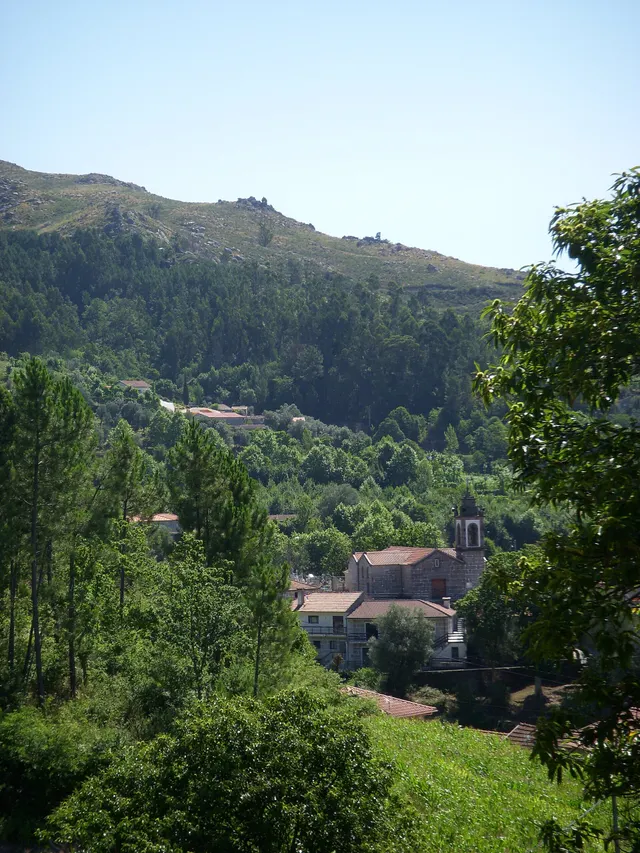
Geographical framework

The Tâmega draws the limit

A river to understand the south of the municipality.

Includes an activity to try →Explore: From limit to landscape →
Read here and view sources

The Tâmega accompanies much of the south and southeast border of Cabeceiras. To the east, the municipal geographical presentation mentions the Bessa River. The water thus helps to situate the territory, along with the mountains of the north and west.

On the south side, the neighboring municipalities are Celorico and Mondim of Basto; this is Ribeira de Pena. These references allow you to start reading the map before going to the bridges, fields and network of tributaries.

To complete this orientation, it looks to the other sides: Montalegre and Boticas to the north, Vieira from the Minho to the northwest and Fafe to the west. Cabreira and Barroso frame the north; the Serra da Lameira, the west. The administrative limit and the water network are two different ways to read the same territory: it now follows the tributaries to see where the water continues.

Source and context

Municipality — geographical framework

Accessed: . Editorial summary; the date of consultation is not the date of the facts.

Geographical framework

Cabreira, Barroso and Lameira

Three names to guide the look.

Includes an activity to try →Explore: From the mountain to the river, choose the path →
Read here and view sources

The municipal description uses three mountains to frame Cabeceiras: Cabreira and Barroso to the north, Lameira to the west. They are orientation references, not mountains entirely contained in the municipality.

Neighbors help complete the design: Montalegre and Boticas to the north, Vieira from Minho to the northwest and Fafe to the west. Reading the landscape is also to perceive continuities beyond the administrative line. Start with the names and directions; then approach the look of villages and differences of altitude.

Source and context

Municipality — geographical framework

Accessed: . Editorial summary; the date of consultation is not the date of the facts.

Landscape and agriculture

Peio, gold and stream Cavez

Water also organizes the work of the fields.

Read here and view sources

The agricultural landscape is not only explained by the presence of water. The municipal tourist presentation describes two ways of adapting the land: terraces on the slopes and use of small alluvials associated with Tâmega and courses such as Peio, Gold and the brook of Cavez.

On the slopes, the fields accompany constructed steps; next to the rivers, deposit land is used. They are different ways of working the relief. Reading invites to compare the shape of the fields and their relationship with water, without assigning to all the land the same origin or cultivation.

Words in this story: see explanations →
Source and context

Municipality — landscape and vegetation

Accessed: . Editorial summary; the date of consultation is not the date of the facts.

Cavez · landscape described in 1758

A river that moved but did not water

The water nearby was not always accessible water.

Includes an activity to try →
Read here and view sources

In 1758, the Tâmega was described in Cavez as a caudal river throughout the year, with a particularly strong current in winter. It had dams, canals and cereal mills. On the banks, the report pointed out cultivated areas, olive groves and trees that supported vineyards.

Despite this presence in agricultural life, the vicar said that the river did not water the fields of the parish: it ran too deep to allow levadas. It is an important difference between having water nearby and being able to lead it to a portion. The description shows how the relief conditioned the uses of water at that time; it does not characterize the current irrigation.

Getting to know the parish
Source and context

Municipality of Cabeceiras de Basto — Parish memories of 1758: Cavez

Accessed: . Editorial summary; the date of consultation is not the date of the facts.

Saint Nicholas · rivers in 1758

Bridges that winter put to the test

The crossing was part of life by the river.

Includes an activity to try →Explore: Cross, sail or water? →
Read here and view sources

The report of St. Nicholas of 1758 describes three wooden bridges. It says that the winter waters sometimes covered the two highest and even carried some bridges. It is an ancient testimony of the relationship between floods and paths; it does not allow assessing the safety of current crossings. The document names Sendim, Cerdeiró and Ponte do Gado: the crossings helped connect the church to the places of the parish.

The description does not only show the strength of the floods. It refers to a course with many falls of water, difficult to cross the ford and, in some sections, even to follow the banks. The bridges responded to this difficulty of the terrain.

Sendim’s was on the way to the church to this place; Cerdeiró’s served the direction of the Breia. The Bridge of the Cattle was lower than the other two and gave a name to the point where the arms coming from Bucos entered. These details connect the network of roads to the water network, without fixing the position of each structure on the modern map.

Getting to know the parish
Source and context

Basto Land Museum — St Nicholas Parish Memories (1758)

Accessed: . Editorial summary; the date of consultation is not the date of the facts.

Ribeira de Cavez · water and agriculture

From the spring to the fields

A stream helps explain the whole landscape.

Read here and view sources

The brook of Cavez is born on the border of the municipality with Montalegre and ends at Tâmega. Between the mountain and the mouth, the municipal description highlights levadas, mills and irrigation mills: buildings and fields that show different ways to enjoy the water.

On the trail beginning in Vilela, Rio Douro, the narrative goes from the descent to the riverside to the levada and the landscape of the lameiros, then following rural paths and the slope. The return to the village brings another material to the history: the granite masonry of the houses. See the route chart to prepare the walk; this reading explains the landscape, without confirming the conditions of the way on the day of the visit.

Getting to know the parish See Fact sheet: Trilho da Ribeira de Cavez See Fact sheet: Vilela, Rio Douro
Source and context

Municipality — stream of Cavez and agricultural landscape

Accessed: . Editorial summary; the date of consultation is not the date of the facts.

Passos · relief and water

A mountains and a river to locate Passos

Wooded edge and house in the photograph identified by the author as Passos, Cabeceiras de Basto.
Landscape of Passos · slope and house; the river referred to in the text is not identified in the image.© Elisabeth LEITEⓘ

Two names help you read southwest of the municipality.

Includes an activity to try →Explore: From landscape to work →
Read here and view sources

Serra da Orada and the Petimão River help to locate Passos in the southwest of Cabeceiras. The municipal description highlights the rugged relief and agriculture, along with the municipalities of Celorico of Basto and Fafe.

The church of São Sebastião, the cruises and the alminhas add references built to the reading of the landscape. Rio, Serra and patrimony are complementary clues to know this land; they do not make up a pedestrian itinerary here nor confirm accesses.

In the description of Passos, the municipality also refers to the neighborhood of the old parishes of Outeiro, Refojos and Alvite. This proximity scale helps to situate the mountain and river within a shared territory. Administrative boundaries and landscape elements are different ways of reading the same space.

Getting to know the parish See Fact sheet: Passos
Source and context

Municipality — landscape of Alvite e Passos

Accessed: . Editorial summary; the date of consultation is not the date of the facts.

Alvite · testimony of 1758

Store water coming from the hill

Small springs helped water the fields.

Includes an activity to try →
Read here and view sources

In the ratio of 1758, the vicar of Alvite described little abundant springs in the Serra da Orada. The residents retained these waters in prey to benefit the fields facing the spring. Saving water was a way to cope with its scarcity.

The same document classified the parish as drought, especially in the summer, and referred to the absence of mills and mills. Two olive oil mills worked with oxen and other animals; to grind cereals, many residents sought neighboring parishes. The portrait links natural resources, techniques and displacements, without allowing to conclude that the same uses or structures continue today.

Getting to know the parish
Source and context

Basto Land Museum — Parish Memories of 1758: Alvite

Accessed: . Editorial summary; the date of consultation is not the date of the facts.

Landscape and garden · Painzela

The water draws the garden of Piellas

Among the carved bushes, there are other ways to go.

Includes an activity to try →Explore: The garden within the landscape →
Read here and view sources

In Piellas, the water helps to connect garden, forest and fields. The description published by Jardins Magazine places a tank in L next to the wall, close to a passage to the forest of Casa do Boal. Another tank, surrounded by bamboos and buxos, opens for a cultivation field surrounded by forest. The water goes to the stream of Painzela.

The article also describes paths shaded by ramadas and an agricultural courtyard associated with the old production of corn and wine. The farm therefore gathers recreational spaces and work spaces: the garden of carved shrubs is part of a wider landscape.

Try to imagine the fifth in layers: the levels, paths, vegetation and the water system. The description allows to relate these elements, but does not provide a complete map of the hydraulic circuit. Piellas is a private property; the visiting conditions should be consulted on the site's chart.

See Fact sheet: Casa de Pielas, jardins e anexos
Source and context

Jardins Magazine — Gardens of Portugal: Route of the Tâmega, section Casa de Piellas

Accessed: . Editorial summary; the date of consultation is not the date of the facts.

Geology and relief of the municipality

The mountains is also read in stone

Before the roads and houses, there is a landscape of rocks.

Explore: From rock to field, follow the materials →
Read here and view sources

The Municipal Archaeological Charter describes large granite outcrops with erosion marks. The relief descends from the southern periphery of the Cabreira towards the basin of the Tâmega, in a succession of heads. Looking at these forms helps connect the mountain to the valley: the stone is part of the history of the territory, even when it was not worked by anyone.

A rock can change without leaving the place. It is called meteorization to this change: there can be physical fragmentation, chemical transformation of minerals or intervention of living beings. The British Geological Survey gives simple examples: roots that widen cracks, water that freezes and expands in fractures, or rainwater that reacts with minerals. They are general mechanisms; they do not allow to attribute a cause to every block that is in the Cabreira.

When the materials are removed and transported by water, wind or ice, erosion enters the scene. The distinction helps to imagine two steps: the rock changes; part of its materials can then travel. It is not necessary that the two happen at the same rate, nor that a fragment reaches directly into the river.

The reading tour ends in the veigas of the Tâmega, where the municipal source describes deposits of sand and clay. Between the exposed rock and a lowland field there are thus different questions: of what is made the stone, how is changed and where do the transported materials end?

Words in this story: see explanations →
Source and context

Municipality — Archaeological Charter: Orography and geology

British Geological Survey — Weathering: physical, chemical and biological alteration of rocks

Geological Society — Weathering: difference between change and erosion

Accessed: . Editorial summary; the date of consultation is not the date of the facts.

Geology and agriculture · lowlands of the municipality

The river also helps explain the fields

Near Tâmega, the ground holds another story.

Includes an activity to try →Explore: Same territory, three looks →
Read here and view sources

In the lowlands near Tâmega, the Archaeological Charter describes accumulations of sand and clay linked to some of the vegetation with the greatest agricultural potential. The contrast is clear: on the slopes dominate large granite outcrops; by the river, deposited materials help explain another way of cultivating. The same presentation shows a landscape of heads that descend south, with water lines that seek the Tâmega and its tributaries. It is not a soil map of each field, but a key to read the set.

Words in this story: see explanations →
Source and context

Municipality — Archaeological Charter: Orography and geology

Accessed: . Editorial summary; the date of consultation is not the date of the facts.

Mineral resources · geological description of the municipality

There's more to the stone than you can see

Volframite and cassitis enter the geological portrait of Cabeceiras.

Read here and view sources

The Municipal Archaeological Charter refers to a geological environment rich in volframite and cassiterite. The two names add a mineral dimension to the landscape of granites and metasediments: they talk about the composition of the subsoil, beyond the form of the hills.

The volframite contains iron, manganese and tungsten. Virtual Microscope, a project with participation from Open University and the Royal Cornwall Museum, explains its importance as tungsten ore. Cassitis is a tin oxide with a formula SnO2, and is an important commercial source of this metal, according to USGS. They're two different minerals, associated with different metals.

A mineral and the metal you can get from it are not the same thing. Volframite is not a piece of metal tungsten, as cassiterite is not ready to use. The interest of these names is precisely in this connection between the matter found in nature and the materials transformed by people.

The municipal description confirms the local geological reference. International sources help explain the minerals, but their examples of exploitation belong to other territories. None of these explanations identify here a visitable mine, an active farm or a collection site.

Words in this story: see explanations →
Source and context

Municipality — Archaeological Charter: Orography and geology

Open University / Royal Cornwall Museum — Virtual Microscope: Wolframite

USGS — Tin Statistics and Information: cassiterite as a tin source

Accessed: . Editorial summary; the date of consultation is not the date of the facts.

Rio Douro · project announced in April 2025

In the wasteland, the forest finds the water lines

A project of Rio Douro helps to read different functions of the same landscape.

Includes an activity to try →Explore: The slope meets the river →
Read here and view sources

In April 2025, Antar announced the start of an intervention agreed with the local wasteland community of Riodouro, in an area of about 500 hectares of Cabreira partially affected by the fires of 2016 and 2024. The plan presented combined forest production, conservation and recovery of about 40 hectares of riverside vegetation. The proposal helps to realize that managing a hillside also involves water spaces. These figures are objectives announced by the promoter, not a confirmation of completed work or results achieved.

The April news places the beginning of the work in February 2025. For the first phase, it announces about 220 hectares of production species and about 80 hectares of diverse leaves and resins. These areas have different purposes; they are not a balance of plantations carried out.

The relief also enters the project: the promoter describes plateaus, steep slopes and great variation of altitude. The reading of the landscape joins, thus, the form of the land, production spaces and sensitive areas next to the water. There is no complete division here of the 500 hectares that allows to draw all the plots.

Source and context

Antar — announcement of the start of the Riodouro project, 04/04/2025; objectives announced by the promoter

Accessed: . Editorial summary; the date of consultation is not the date of the facts.

Refojos · opening in 2013 and urban transformation

A stream in the history of Casa do Tempo

The renovation of the village centre also passed through the water.

Includes an activity to try →Explore: Memory, buildings and water →
Read here and view sources

The Casa do Tempo opened in 2 August 2013 next to the Monastery of Refojos. In the municipal description, the recovery of old housekeeping houses is part of a broader transformation: connecting the Republic Square to the new areas of the village, creating green spaces and treating the banks of the riverside of Penoutas. The interpretive center thus allows to tell two stories together: the memory of Cabeceiras and the change of its urban landscape.

The Municipality describes the acquisition of part of the returned houses and the negotiations that preceded the intervention. Reutilizing the buildings and transforming their surroundings appear as parts of the same project, rather than separate stories.

The multimedia component of the center was presented as a way to know territory, people, nature, uses and customs. Thus, the stream does not appear only as a scenario: it integrates the history of how that village space gained new functions. To plan a visit, the site's file gathers the practical information available.

See Fact sheet: Casa do Tempo
Source and context

Municipality — Casa do Tempo: opening in 2013 and requalification of the surroundings

Accessed: . Editorial summary; the date of consultation is not the date of the facts.

Faia · municipal description of the settlement

A road helps to read the Faia

Not all villages are organized around a single center.

Includes an activity to try →
Read here and view sources

In the south of the municipality, along the limit with Celorico from Basto, the Faia is described by the municipality through the proximity to Arco de Baúlhe and the distribution of the settlement along the EN206. The road helps to understand an occupation that is not limited to a single center.

The presentation brings accessibility, agriculture, viticulture and crafts such as tannaria and manual manufacture of footwear. To discover the parish, it is worth crossing the houses and paths with these working memories. This reading of the municipal source does not replace current cartography or identifies open workshops.

Source and context

Municipality — presentation of Faia: settlement and traditional activities

Accessed: . Editorial summary; the date of consultation is not the date of the facts.

General geology · reading of granite texture

The small grains tell how the rock cooled

Granite holds minerals that can be distinguished by the eye.

Includes an activity to try →
Read here and view sources

The tutor of Adam Mendes, of the Portuguese Association of Professors of Biology and Geology, relates the granular texture of granite to the slow cooling of magma in depth. Among its characteristic minerals are quartz and feldspates; there may also exist mica. This general explanation helps to look at the stone more carefully, but recognizing colors and grains is not enough to identify the origin of a sample.

If granite has formed in depth, how do we see it in an outcrop? The British Geological Survey relates the exposure of these rocks to the survey of land, erosion and change over millions of years. The history of formation and the history of surface exposure are different stages.

It is also convenient to distinguish rock and mineral. In granite, different minerals appear associated in crystals that fit. Recognizing this combination is different from observing a single isolated mineral. The relative sizes of the crystals and their disposition help to describe the texture; an isolated color does not tell the whole story of the rock.

Source and context

Adam Mendes / APPBG — Characterize basalt, gabro, andesite, diorite, riolite and granite; RTP Teach, 2020

British Geological Survey — Rocks and minerals: rock formation, cooling and exposure

Accessed: . Editorial summary; the date of consultation is not the date of the facts.

Climate of the municipality · characterization in the report of 2025

The landscape has a rhythm of rain and heat

The same place tells different stories throughout the year.

Includes an activity to try →Explore: The same landscape, different questions →
Read here and view sources

The environmental report of 2025 describes colder and rainy winters, with higher rainfall in December and January, and warmer and drier summers. July and August stand out by the heat. It is a characterization of the weather, not a forecast for the next visit. To know a place, compare it in different months: water, leaves and flowers can offer new clues.

The IPMA explains that climate normals use periods of 30 years. They gather monthly and annual values of elements such as temperature and precipitation. An isolated month and a series of decades therefore answer different questions.

When comparing graphs, look for the location and the reference period: averages calculated for different intervals do not have to match. The long series allow you to study variations and trends. The observations you make on a tour help you get to know that day and that place; they do not replace a climate series and alone describe all the altitudes of the municipality.

Words in this story: see explanations →
Source and context

Municipality — Environmental Report, February 2025, pp. 50, 55 and 139

IPMA — Climate normals: periods and reference values

Accessed: . Editorial summary; the date of consultation is not the date of the facts.

Cabeceiras de Basto · windmill architecture studied in 2011

Above, the grinding; below, the movement

A mill is also organized vertically.

Includes an activity to try →Explore: From the water to the building →
Read here and view sources

The study published by the Museum in 2011 describes two levels in the mills of Cabeceiras: above is the mill; below, in the cabouco, the motor mechanism. The form of the building accompanies the operation of the mill. The survey records rectangular plants of varied dimensions, with the exception of a circular plant sour.

The granite dominates the walls, but not all the stone receives the same treatment. The study highlights the points subject to constructive requirements: corners, doors, windows and elements through which the water passes. In the wedges, the stones help to lock the construction; pads and shoulder pads frame the spans. An irregular wall can thus coexist with carefully chosen pieces.

This description belongs to the historical study, not to an inspection of the current buildings. To read the landscape, start with the route of the water and then ask where were the motor force and the work of grinding.

Words in this story: see explanations →
Source and context

Basto Land Museum — Mills Cabeceiras de Basto: construction form, 04/05/2011

Accessed: . Editorial summary; the date of consultation is not the date of the facts.

YOUR LOCAL GUIDE

What would you like to discover?

Take a closer look.