Discover Cabeceiras de BastoFree independent guide
ViveCabeceirasYOUR GUIDE TO CABECEIRAS
ENEnglish
SearchSaved
9 STORIES · CONTINUOUS READING

From the mountain to the river: read the landscape

Nine stories to situate Cabeceiras: mountains, altitudes, villages, rivers and fields. It runs through Passos and Outeiro, opens the trout–Peio scheme and then follows the network to Douro. They are relationships to explore in reading, without indicating distances or an itinerary on the ground.

All stories in the order of the route. You can print this page by the browser; sources and credits follow the reading.

Things to try8 activities · 6 interactive explorations · 5 questions
Geographical framework

Cabreira, Barroso and Lameira
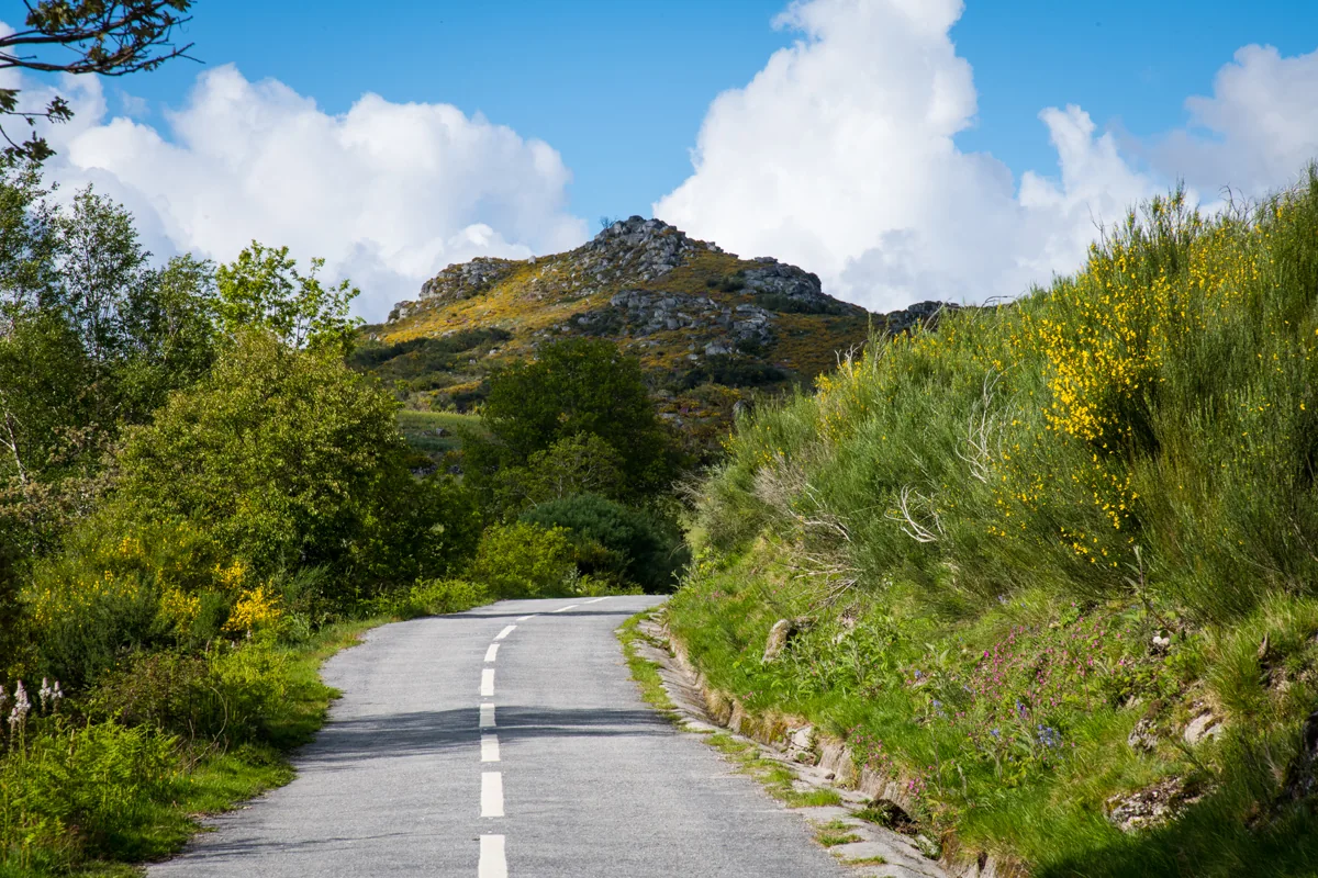
Road and mountain landscape in Serra da Cabreira.
ⓘ

Road and mountain landscape in Serra da Cabreira.

Source: Visit Cabeceiras

View source

Photograph date not stated.

Individual photographer and reuse licence not stated by the source.
Request removal or correct the photo credit

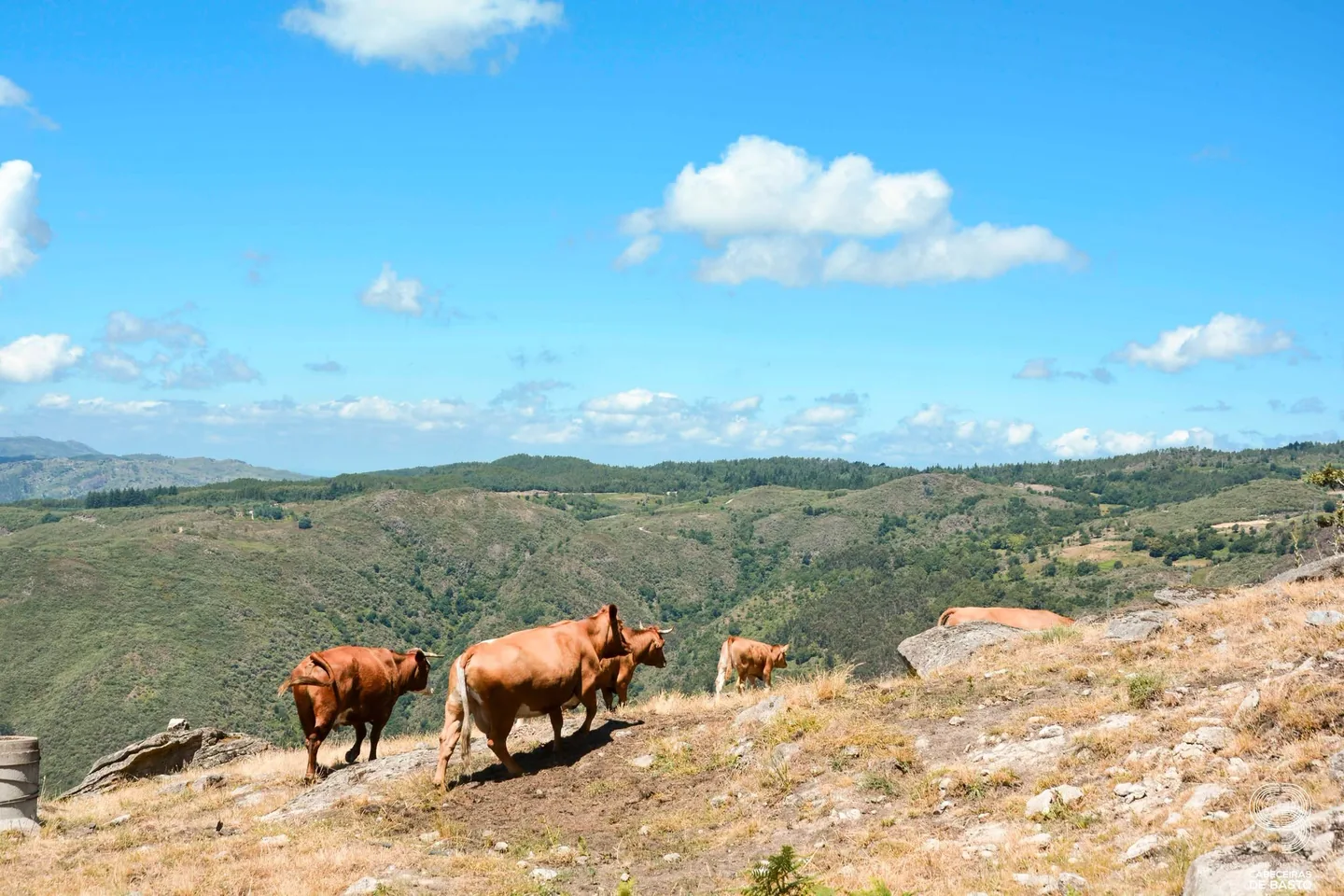
Cattle in the mountain landscape during the 2026 heritage visit.
ⓘ

Cattle in the mountain landscape during the 2026 heritage visit.

Source: Museu das Terras de Basto

View source

Photograph date not stated.

Autoria da fotografia e licença de reutilização não identificadas na fonte.
Request removal or correct the photo credit

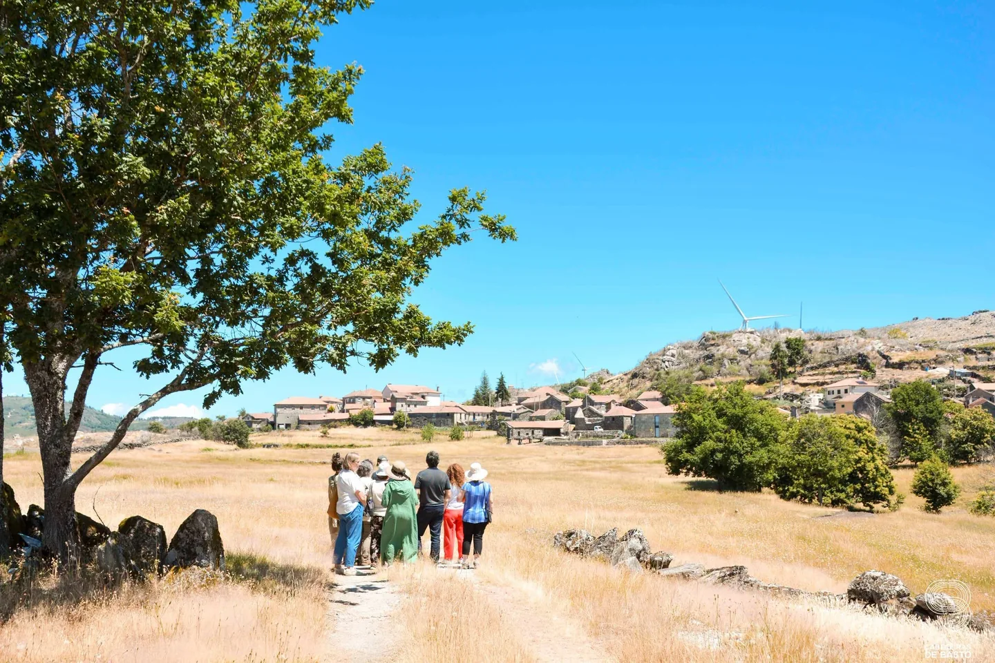
Fields and landscape in Cabeceiras during the 2026 heritage visit.
ⓘ

Fields and landscape in Cabeceiras during the 2026 heritage visit.

Source: Museu das Terras de Basto

View source

Photograph date not stated.

Autoria da fotografia e licença de reutilização não identificadas na fonte.
Request removal or correct the photo credit

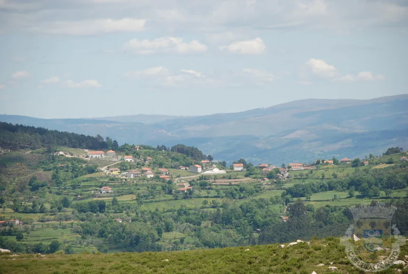
Cabreira landscape with fields and settlement. Archive photograph; date unidentified.
ⓘ

Cabreira landscape with fields and settlement. Archive photograph; date unidentified.

Source: Municipality of Cabeceiras de Basto

View source

Photograph date not stated.

Autoria individual e licença de reutilização não identificadas na página consultada. A fonte não equivale ao autor.
Request removal or correct the photo credit

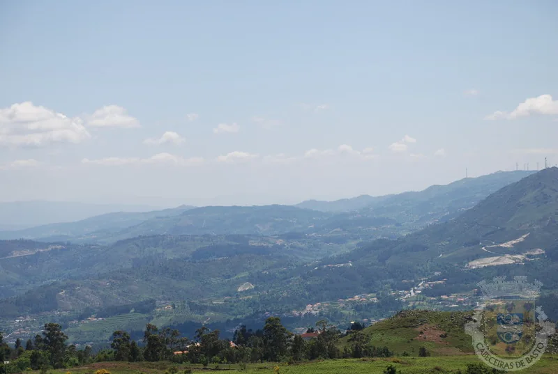
Mountains and valleys of Cabreira. Archive photograph; date unidentified.
ⓘ

Mountains and valleys of Cabreira. Archive photograph; date unidentified.

Source: Municipality of Cabeceiras de Basto

View source

Photograph date not stated.

Autoria individual e licença de reutilização não identificadas na página consultada. A fonte não equivale ao autor.

Request removal or correct the photo credit

Three names to help you read the landscape.

The municipal description uses three mountain ranges to frame Cabeceiras: Cabreira and Barroso to the north, Lameira to the west. These are orientation points, not mountains entirely contained within the municipality.

The neighbours complete the picture: Montalegre and Boticas to the north, Vieira do Minho to the north-west and Fafe to the west. Reading the landscape also means recognising continuity beyond administrative boundaries. Start with names and directions, then look more closely at the villages and changes in altitude.

From the mountain to the river, choose the path

Open an option and choose the story.

  1. Realize height differencesFrom the mountains to the valley, the map changes height →
  2. Meet an altitude villageA village above the thousand meters →
  3. Find the limits drawn by the waterThe Tâmega draws the limit →
  4. Read the shape of the fieldsPeio, Gold and stream Cavez →
A guide by stories: relief, villages, boundaries and fields. It is not a pedestrian route.
Source and context

Municipality — geographical framework
Accessed:

Município — galeria de paisagens, fotografias sem data identificada
Accessed:

Editorial summary; the date of consultation is not the date of the facts.

Back to index ↑
Relief of the municipality

From mountains to valley, the map changes height

Look at Cabeceiras from north to south.

The 2025 environmental report places most areas above 800 metres in the north. To the south, beside the Tâmega, land lies below 200 metres. This contrast helps us read the relief: the landscape opens from mountain towards valley. The Archaeological Survey describes the hills as a south-facing amphitheatre. It also links the narrow strips of the northern parishes with their sharing of mountain and valley: the lived territory does not end at a single altitude.

These figures describe parts of the municipality, not two uniform levels. The report characterises the relief as becoming gentler southwards towards the Tâmega. On a walk, a village, a hillside and a valley floor can help us ask questions of the map: where does each place lie, and how does it relate to water?

A difference in altitude is not a walking distance either. Saying two points lie at different heights tells us neither how far we walk between them nor the gradient of the whole route. This story helps interpret the territory; route conditions require their own information.

The dominant direction has exceptions too. The Archaeological Survey highlights waters descending the slopes of Senhora da Orada and entering the Peio. A south-facing landscape therefore does not mean every stream follows a parallel line to the Tâmega. Valleys and tributaries are part of that organisation.

Source and context

Municipality — Environmental Report of the PDM review, February 2025, p. 50

Municipal Archaeological Charter — Orography and geology

Accessed: . Editorial summary; the date of consultation is not the date of the facts.

Back to index ↑
Toasters · Abadim

A village above a thousand metres

Landscape at Trilho de Torrinheiras.
Landscape of Trilho de Torrinheiras© Ze Nunoⓘ

In Torrinheiras, the landscape begins at altitude.

The municipality presents Torrinheiras, in Abadim, as its highest settlement, at around 1020 metres. The trail climbs into the hills and reaches 1159 metres. These are two distinct altitude references: the village and a point on the route, not the walk’s cumulative ascent.

The panorama description names Gerês, Alvão, Marão and Barroso. Lower down, it mentions the Busteliberne stream, Porto d’Olho and, on the return, meadows and grazing Barrosã and Maronesa cattle. The mountains therefore tell a story of distances and views, but also of water, villages and work. Visibility and trail conditions need to be assessed when visiting.

The mountain can also be read close up. Alongside the distant panorama, the description mentions meadows and livestock: clues to land use, not merely decorative details. In a drawing, separate the horizon from the worked land. A simple next question is: which parts of this landscape depend on people’s work?

Getting to know the parish See Fact sheet: Trilho de Torrinheiras
Source and context

Municipality — Trilho de Torrinheiras, altitude, landmarks and landscape

Accessed: . Editorial summary; the date of consultation is not the date of the facts.

Back to index ↑
Passos · relief and water

A mountain and a river to locate Passos

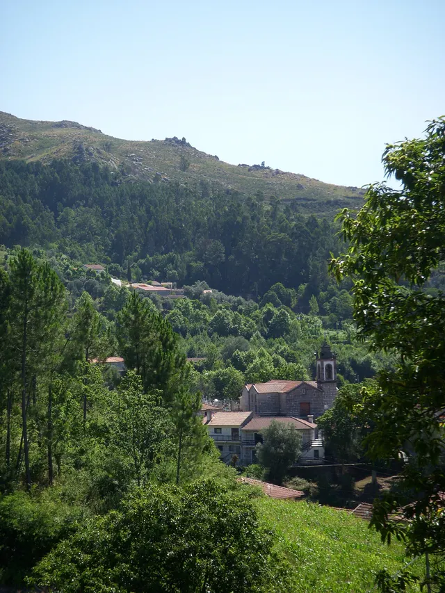
Wooded hillside and houses in the photograph identified by its author as Passos, Cabeceiras de Basto.
Landscape of Passos · slope and house; the river referred to in the text is not identified in the image.© Elisabeth LEITEⓘ

Two names help you read the municipality’s south-west.

The Serra da Orada and River Petimão help locate Passos in south-western Cabeceiras. The municipal description highlights rugged terrain and farming, beside the municipalities of Celorico de Basto and Fafe.

The church of São Sebastião, wayside crosses and alminhas shrines add built landmarks to the landscape. River, mountain and heritage offer complementary clues to this place; they do not form a walking itinerary here or confirm access.

In its description of Passos, the municipality also mentions neighbouring former parishes: Outeiro, Refojos and Alvite. This local scale helps place the mountain and river within a shared territory. Administrative boundaries and landscape features are different ways of reading the same space.

From landscape to work

Open an option and choose the story.

  1. The Petimão and the Ramil millFrom Petimão to olive oil press →
  2. A transformative levityThe water changed its way →
  3. Another small river, another linkA small river also draws the map →
  4. The harvests in the report of 1758In the fields, there was more than corn →
It continues in stories of Alvite e Passos and the neighbor Outeiro.
Getting to know the parish See Fact sheet: Passos
Source and context

Municipality — landscape of Alvite e Passos

Accessed: . Editorial summary; the date of consultation is not the date of the facts.

Back to index ↑
Geographical framework

The Tâmega traces the boundary

A river that helps explain the south of the municipality.

The Tâmega follows much of Cabeceiras’s southern and south-eastern boundary. To the east, the municipality’s geographical introduction mentions the River Bessa. Water therefore helps locate the territory, alongside the mountains to the north and west.

The neighbouring municipalities to the south are Celorico de Basto and Mondim de Basto; Ribeira de Pena lies to the east. These references offer a starting point for reading the map before moving on to bridges, fields and the tributary network.

Complete the picture by looking to the other sides: Montalegre and Boticas to the north, Vieira do Minho to the north-west and Fafe to the west. Cabreira and Barroso frame the north; the Serra da Lameira frames the west. Administrative boundaries and the water network are two different ways to read the same territory: follow the tributaries next to see where the water goes.

From limit to landscape

Open an option and choose the story.

  1. Where does the water follow?

    The Tâmega receives tributaries and connects this territory to the Douro. The scheme shows the network, without reproducing the limits of the municipality.

    The water from here also reaches the Douro →
  2. What's north?

    The mountains help to situate the landscape above the valleys.

    Cabreira, Barroso and Lameira →
  3. What changes by the river?

    It goes from orientation on the map to deposits and fields of the lowlands.

    The river also helps explain the fields →
Choose the scale you want to explore.
Source and context

Municipality — geographical framework

Accessed: . Editorial summary; the date of consultation is not the date of the facts.

Back to index ↑
Outeiro · hydrographic network

A small river shapes the map too

In Outeiro, the Trutas joins the Peio.

The municipal description identifies the Trutas as a small tributary of the Peio flowing through Outeiro. Knowing this link helps us see waterways as a network beyond the better-known rivers. The name Trutas, meaning trout, does not in itself confirm those fish are present today.

Outeiro’s position also helps locate this network: the parish occupies the municipality’s western edge, beside Fafe. The municipal description presents a gently rolling plateau, with agriculture among the economic activities mentioned. Reading the territory means bringing these scales together: the municipal boundary, the relief and the small watercourse heading towards the Peio.

Try showing these relationships in a simple drawing. You do not need to reproduce an exact map: an arrow can indicate the rivers’ connection and another mark can place Outeiro on the western side of Cabeceiras.

A CALL IN OUTEIRO

Trout River

It is affluent of

Peio River → know the uses of water
What this arrow explains

The municipal description identifies the Trouts as a tributary of Peio. The arrow represents this relationship, without indicating the exact location of the confluence.

Another story, another source

Peio's reading uses an inventory of 2008 on levadas and mills. The connection allows us to continue the discovery; it does not claim that these equipment is in Outeiro.

Relationship scheme, no scale or distances. It is neither a visit map nor confirms access to the margins.
Getting to know the parish
Source and context

Municipality — Outeiro, relief and hydrographic network

Accessed: . Editorial summary; the date of consultation is not the date of the facts.

Back to index ↑
Municipal hydrographic network

The water here reaches the Douro too

The rivers belong to a larger network.

The Ouro, Beça and Cavez stream enter the Tâmega on its right bank; the Tâmega is a tributary of the Douro. The municipal environmental report traces this connection between rivers: a map of Cabeceiras continues far beyond the municipality’s boundaries.

A river basin includes the land that channels water through streams and rivers to a shared outlet to the sea. It is more than a blue line on a map. The APA also distinguishes a sub-basin, whose drainage converges on a point in a watercourse, such as a confluence.

In this story’s diagram, names show connections between waterways, not the boundaries of their basins. To understand a river, we need to include the land that supplies its water. That connection leads from tributaries to soil erosion and life along the banks.

FOLLOW THE WATER WAY

Unwater in

Rio Tâmega → read the story

That flows into the

Rio Douro

Choose a name to open a story. Simplified scheme of links described in the municipal report; does not represent distances, geographical positions or all tributaries.
Source and context

Municipality — Environmental Report of the PDM review, February 2025, p. 56

Portuguese Environment Agency — water resources and associated concepts

Accessed: . Editorial summary; the date of consultation is not the date of the facts.

Back to index ↑
Landscape and agriculture

Peio, Ouro and the Cavez stream

Water also shapes work in the fields.

The farming landscape cannot be explained by the presence of water alone. The municipality’s tourism introduction describes two ways of adapting the land: terraces on hillsides and the use of small alluvial deposits associated with the Tâmega and waterways such as the Peio, Ouro and Cavez stream.

On the slopes, fields follow constructed steps; beside rivers, deposited ground is used. These are different ways of working with the terrain. Compare the shape of the fields and their relationship with water without assuming that every plot has the same origin or crop.

Source and context

Municipality — landscape and vegetation

Accessed: . Editorial summary; the date of consultation is not the date of the facts.

Back to index ↑
Geology and agriculture · lowlands of the municipality

The river helps explain the fields too

Near the Tâmega, the ground holds another story.

On low ground near the Tâmega, the Archaeological Survey describes accumulations of sand and clay associated with some of the lowland fields offering the greatest farming potential. The contrast is clear: large granite outcrops dominate the slopes; beside the river, deposited materials help explain another way of farming. The same introduction shows hills descending southwards, with waterways seeking the Tâmega and its tributaries. It is not a soil map of each field, but a key to reading the whole landscape.

Same territory, three looks

Open an option and choose the story.

  1. From the mountain to the bottom of the valleyFrom the mountains to the valley, the map changes height →
  2. What water carriesThe river begins before the bank →
  3. How fields are organized on the slopesOlives, cork oaks and vineyards →
It connects the shape of the relief to the transported materials and the cultivation of the slopes.
Source and context

Municipality — Archaeological Charter: Orography and geology

Accessed: . Editorial summary; the date of consultation is not the date of the facts.

Back to index ↑
YOUR LOCAL GUIDE

What would you like to discover?

Take a closer look.