Discover Cabeceiras de BastoFree independent guide
ViveCabeceirasYOUR GUIDE TO CABECEIRAS
ENEnglish
SearchSaved
4 STORIES · CONTINUOUS READING

Bridges and rails: paths that change

Four stories to discover the shape of the bridges, the works that transform them and the old line that gained new steps. A path of reading between Cavez and Arco de Baúlhe e Vila Nune, without indicating a pedestrian itinerary.

All stories in the order of the route. You can print this page by the browser; sources and credits follow the reading.

Things to try2 interactive explorations · 4 questions
Arco de Baúlhe and Vila Nune · municipal heritage description

The triangle facing the water
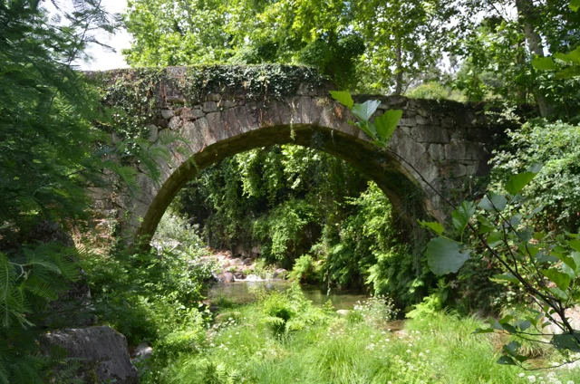
Ponte Velha in Arco de Baúlhe among vegetation.
ⓘ

Ponte Velha in Arco de Baúlhe among vegetation.

Source: Visit Cabeceiras — Município de Cabeceiras de Basto

View source

Photograph date not stated.

Individual photographer and reuse licence not stated by the source.

Request removal or correct the photo credit

A detail of the Ponte Velha reveals which way the river comes from.

At the Ponte Velha in Arco de Baúlhe, a semicircular arch supports the deck over the Ouro River. The municipal description dates construction to the 18th century.

The triangular cutwater stands upstream, facing the incoming water. This detail allows us to read the bridge beyond its outline. The shape of the arch alone does not prove Roman origins.

To understand “upstream”, draw the river with an arrow showing the flow and place the bridge across it. The described cutwater faces the approaching water. A technical term becomes a relationship that is easy to picture, without going down into the riverbed to inspect the structure.

See Fact sheet: Ponte Velha de Arco de Baúlhe
Source and context

Municipality — Cultural heritage, bridges of Arco de Baúlhe and Moimenta

Accessed: . Editorial summary; the date of consultation is not the date of the facts.

Back to index ↑
Cavez · history of Moimenta Bridge; current conditions unverified

Two eras in the same bridge

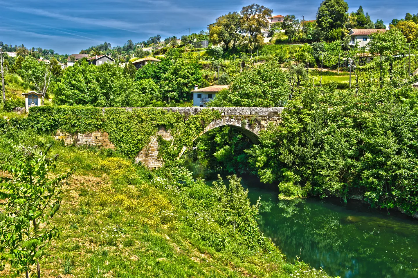
Moimenta’s old bridge in Cavez: a stone arch over the river, surrounded by vegetation, photographed in June 2020.
Moimenta Bridge, photographed by Pedro at 11 June 2020. A crossing record other than Ponte de Cavez over Tâmega.© Pedroⓘ

In Moimenta, old stone meets work carried out in 1990.

An old bridge can keep changing. The municipality attributes medieval origins to Moimenta Bridge in Cavez and describes a single rounded arch.

In 1990, the crossing was widened by around one metre: a concrete structure was added on the downstream side and the parapets were altered. The photograph offers a starting point for observing the crossing; the date of the work comes from the documentary description.

See Fact sheet: Ponte antiga de Moimenta
Source and context

Municipality — Cultural heritage, bridges of Arco de Baúlhe and Moimenta

Accessed: . Editorial summary; the date of consultation is not the date of the facts.

Back to index ↑
Cavez · Parish Memories of 1758

A bridge that earned praise

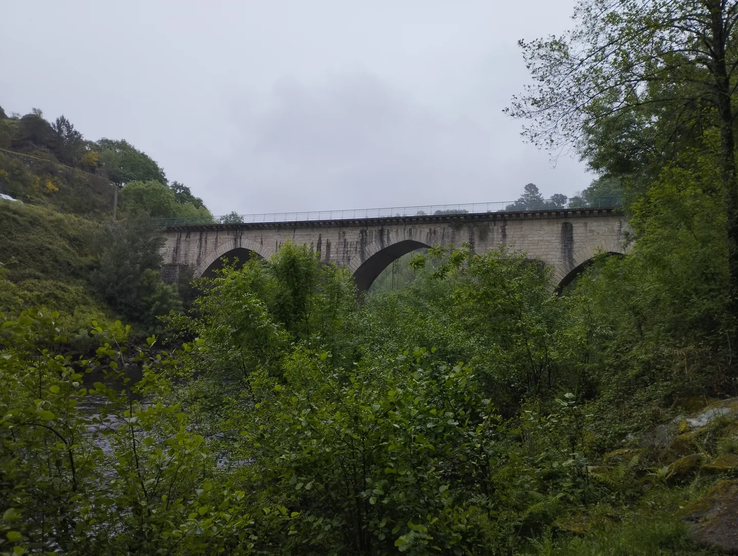
Arches of Ponte de Cavez seen from the riverbed.
ⓘ

Arches of Ponte de Cavez seen from the riverbed.

Source: Museu das Terras de Basto

View source

Photograph date not stated.

Individual photographer and reuse licence not stated by the source.

Request removal or correct the photo credit

In 1758, Cavez’s Ponte Grande impressed the parish priest.

In the parish account, the Tâmega crossing is described as a large, well-worked stone bridge. The author even calls it the best on that river. The praise belongs to the writer’s viewpoint: it reveals the importance he gave the structure, without serving as a technical comparison of bridges.

In the same account, the Tâmega appears as a strong current, especially in winter. The document distinguishes crossing the water from using it: it describes mills and explains that the river ran too deep to irrigate the fields along that stretch. The bridge can be read within these relationships among banks, movement and work.

Notice the difference between observing a structure and judging it. The bridge’s existence is information; calling it the best is an assessment. Both tell us about the past, but answer different questions.

Two shores, several stories

Open an option and choose the story.

  1. Water to move millsA river that moved but did not water →
  2. The look at the shore of AteiThe work was seen on the other margin →
  3. The bridge over timeFive arches, more than one time →
Compares the reports of Cavez and Vila Nune without confusing the locations described.
Getting to know the parish See Fact sheet: Ponte de Cavez
Source and context

Municipality of Cabeceiras de Basto — Parish memories of 1758: Cavez

Accessed: . Editorial summary; the date of consultation is not the date of the facts.

Back to index ↑
Arco de Baúlhe and Vila Nune · railway memory and a changing route

New footsteps on the old line

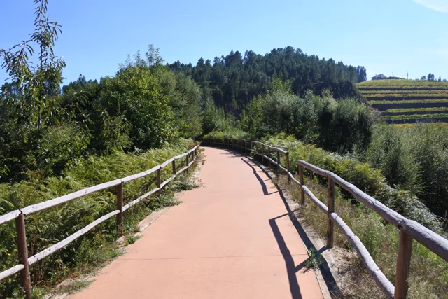
Tâmega rail trail in Arco de Baúlhe e Vila Nune, with reddish paving and wooden railings, photographed in October 2016.
The former railway channel converted to Ecopista in Arco de Baúlhe e Vila Nune. Photo by FF Mira, October 6, 2016; does not document the inauguration of 2013 or the current conditions of the entire route.© FF Miraⓘ

The former railway welcomed walkers and bicycles.

The Tâmega Line’s corridor continued connecting places after the trains. On 20 April 2013, the municipality’s section of the greenway opened between the Railway Museum in Arco de Baúlhe and Mulher Morta, in Vila Nune. The municipal listing gives this section a length of 5.4 kilometres, within the longer connection to Amarante.

The route’s gradients preserve its railway origins: the municipal description associates the old corridor with a maximum gradient of 3%. This is a published characteristic of the route, not a current check of every entrance or obstacle. To prepare an outing, consult the practical listing and signs on site.

The former station and Vila Nune halt tell different parts of the story. The municipality includes the halt among Vila Nune’s heritage; in Arco, the station became a museum. A route can change use without losing the landmarks that help us recognise its past.

Three Ways to Guard the Railroad

Open an option and choose the story.

  1. The station that won a museum lifeThe train stopped, memory stayed →
  2. A carriage and its passengersA place in the third class →
  3. Documents that preserve memoryThe station also keeps documents →
Discover the transformation of spaces, vehicles and documents. They are reading links, not steps of a pedestrian route.
See Fact sheet: Ecopista do Tâmega — troço de Cabeceiras See Fact sheet: Antigo apeadeiro de Vila Nune
Source and context

Municipality — Ecopist of Tâmega: reuse of channel and inauguration of 2013

Municipality — Arco de Baúlhe e Vila Nune: former tenant

Basto Land Museum — Railway Station Arco de Baúlhe classified as Municipal Interest Set, 02/04/2025

Accessed: . Editorial summary; the date of consultation is not the date of the facts.

Back to index ↑
YOUR LOCAL GUIDE

What would you like to discover?

Take a closer look.