Discover Cabeceiras de BastoFree independent guide
ViveCabeceirasYOUR GUIDE TO CABECEIRAS
ENEnglish
SearchSaved
4 STORIES · CONTINUOUS READING

Four ways to look at a stone

Natural shapes, old boundaries, carvings and a reused stone.

All stories in the order of the route. You can print this page by the browser; sources and credits follow the reading.

Things to try1 atividade
Abadim

Stones that marked a territory
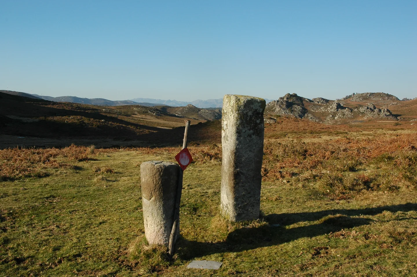
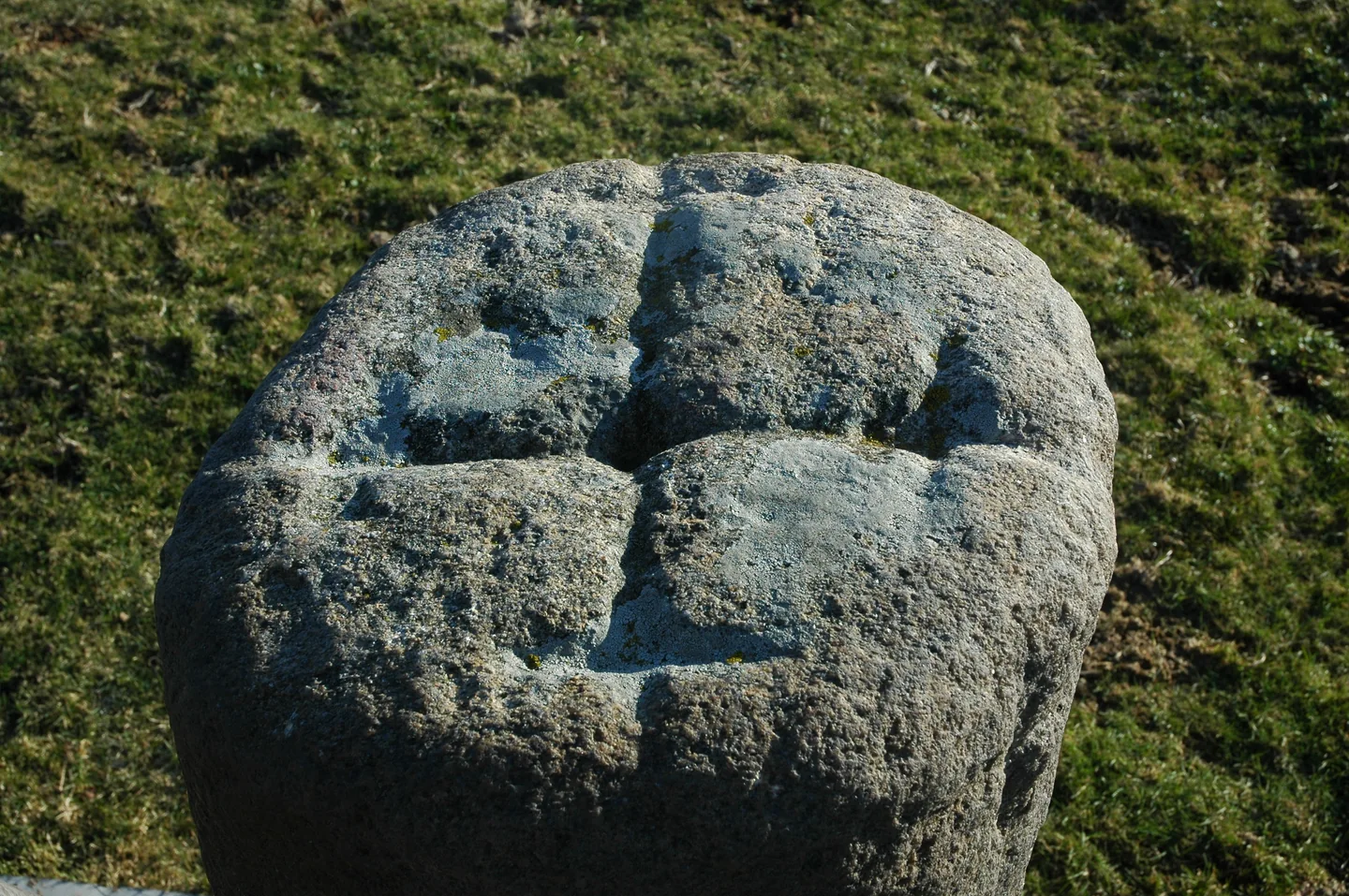
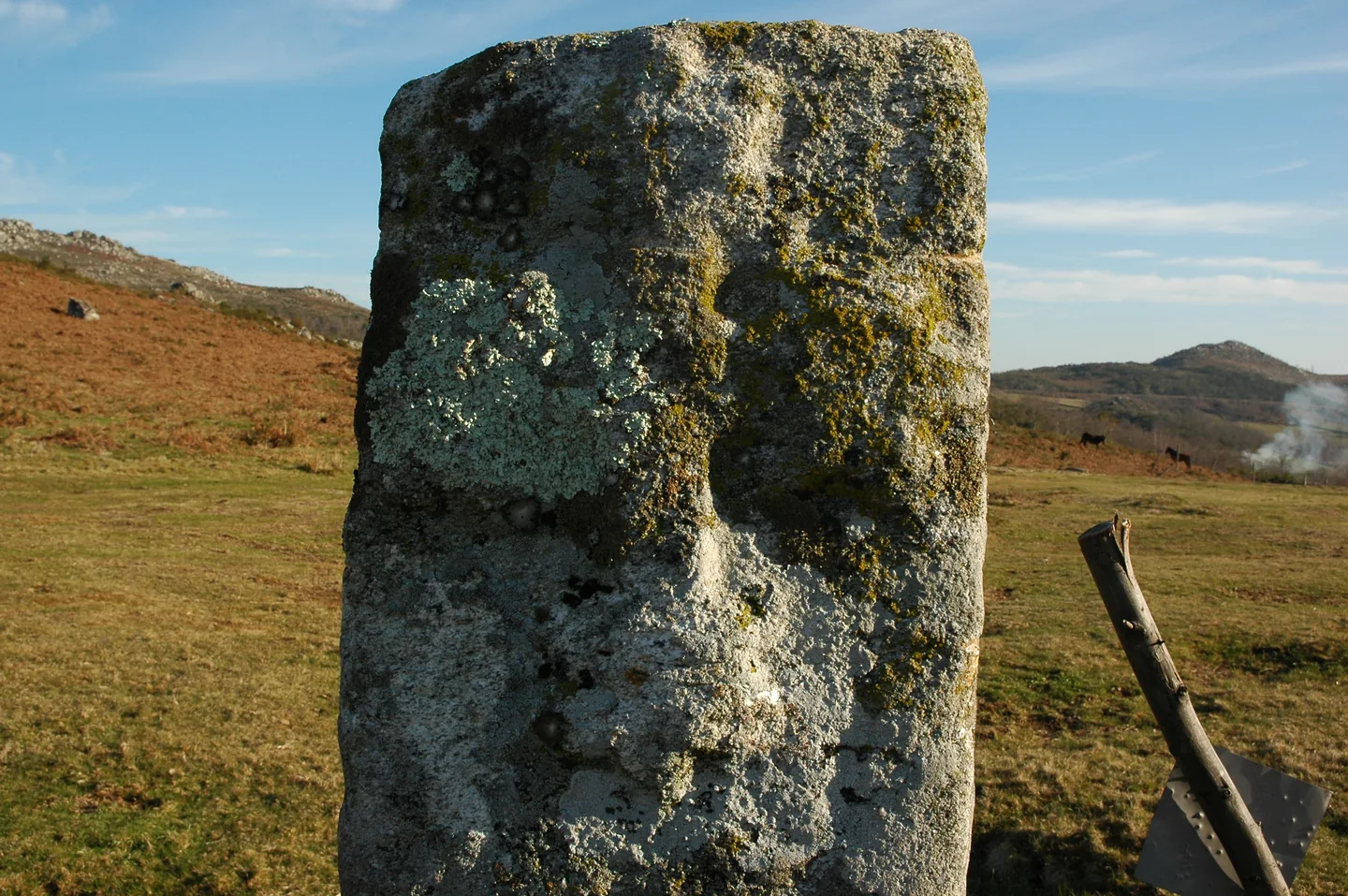
Outeiro dos Touros boundary stones in Torrinheiras.
ⓘ

Outeiro dos Touros boundary stones in Torrinheiras.

Source: Carta Arqueológica de Cabeceiras de Basto

View source

Photograph date not stated.

Autoria da fotografia e licença de reutilização não identificadas na fonte.
Request removal or correct the photo credit

Outeiro dos Touros boundary stones in Torrinheiras.
ⓘ

Outeiro dos Touros boundary stones in Torrinheiras.

Source: Carta Arqueológica de Cabeceiras de Basto

View source

Photograph date not stated.

Autoria da fotografia e licença de reutilização não identificadas na fonte.
Request removal or correct the photo credit

Outeiro dos Touros boundary stones in Torrinheiras.
ⓘ

Outeiro dos Touros boundary stones in Torrinheiras.

Source: Carta Arqueológica de Cabeceiras de Basto

View source

Photograph date not stated.

Autoria da fotografia e licença de reutilização não identificadas na fonte.

Request removal or correct the photo credit

Two boundary stones, two shapes and several clues carved in stone.

In the mountain pastures of Torrinheiras, two granite boundary stones stand out for their different shapes: one is cylindrical, the other has flat faces. They bear carved crosses and, on one of them, a very simplified human figure. The stones stand near a meeting of paths.

The Archaeological Inventory connects them with boundaries and the religious dimension of the territory, suggesting a medieval origin linked to the Couto de Abadim. This is an interpretation, rather than an inscribed date. Their size, careful shaping and worn edges provide clues. Compare the photographs: the shape of each stone and its carvings tell different parts of the story.

Getting to know the parish
Source and context

Carta Arqueológica de Cabeceiras de Basto — 01.04

Accessed: . Editorial summary; the date of consultation is not the date of the facts.

Back to index ↑
Abadim

A granite giant

Penedo Longo in Torrinheiras.
ⓘ

Penedo Longo in Torrinheiras.

Source: Carta Arqueológica de Cabeceiras de Basto

View source

Photograph date not stated.

Autoria da fotografia e licença de reutilização não identificadas na fonte.

Request removal or correct the photo credit

Penedo Longo in Torrinheiras.
ⓘ

Penedo Longo in Torrinheiras.

Source: Carta Arqueológica de Cabeceiras de Basto

View source

Photograph date not stated.

Autoria da fotografia e licença de reutilização não identificadas na fonte.

Request removal or correct the photo credit

Penedo Longo invites a second look.

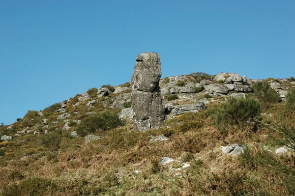
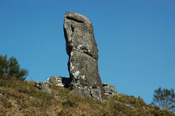
Rising in the Torrinheiras landscape, Penedo Longo looks like a huge stone set upright. Its archaeological record describes a monolith about seven metres high, near the paths towards Abadim and Outeiro dos Touros.

It was long described as a possible standing stone. Examining its base and the surrounding outcrop, the authors of the Archaeological Inventory proposed another explanation: granite naturally breaking into vertical blocks. The shape is striking, but does not by itself prove human construction. Looking at what surrounds the base can change the way we understand the whole stone.

Getting to know the parish
Source and context

Carta Arqueológica de Cabeceiras de Basto — 01.05

Accessed: . Editorial summary; the date of consultation is not the date of the facts.

Back to index ↑
Abadim

A stone found a new life

Wayside cross and base in Torrinheiras.
ⓘ

Wayside cross and base in Torrinheiras.

Source: Carta Arqueológica de Cabeceiras de Basto

View source

Photograph date not stated.

Autoria da fotografia e licença de reutilização não identificadas na fonte.

Request removal or correct the photo credit

Wayside cross and base in Torrinheiras.
ⓘ

Wayside cross and base in Torrinheiras.

Source: Carta Arqueológica de Cabeceiras de Basto

View source

Photograph date not stated.

Autoria da fotografia e licença de reutilização não identificadas na fonte.

Request removal or correct the photo credit

At the Torrinheiras cross, it is worth looking down.

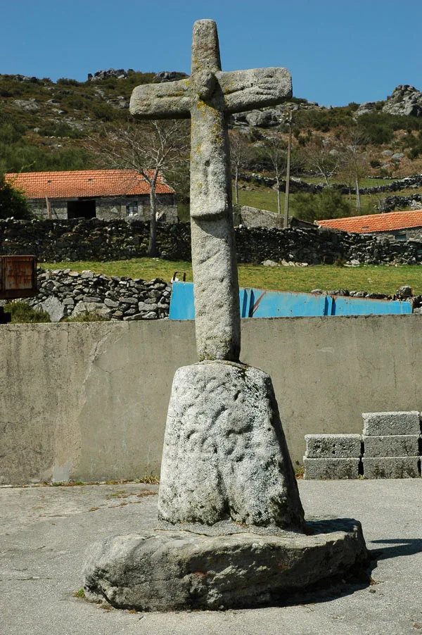
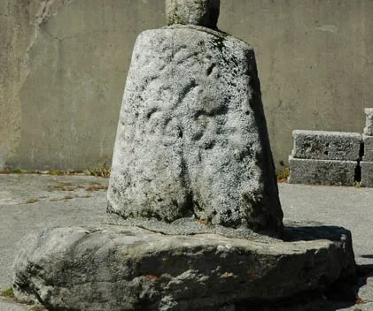
The Torrinheiras wayside cross stands on a granite base bearing carvings. The cross draws the eye, but the stone supporting it holds details: small hollows, grid-like lines and cross-shaped signs. The archaeological record also mentions a possible reading of the Christian monogram IHS.

The marks need not all be the same age. The authors consider many to be associated with the stone’s use as a base, while others may be earlier. Reuse helps explain how an object can acquire new meanings. In the photographs, compare the full view with the close-up of the base: one story is at eye level and another is close to the ground.

Getting to know the parish
Source and context

Carta Arqueológica de Cabeceiras de Basto — 01.07

Accessed: . Editorial summary; the date of consultation is not the date of the facts.

Back to index ↑
Abadim · prehistory

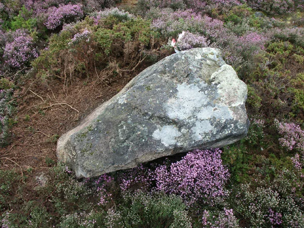
Stone preserved drawings too

Engraved rock in the Marmoirais complex.
ⓘ

Engraved rock in the Marmoirais complex.

Source: Carta Arqueológica de Cabeceiras de Basto

View source

Photograph date not stated.

Autoria da fotografia e licença de reutilização não identificadas na fonte.

Request removal or correct the photo credit

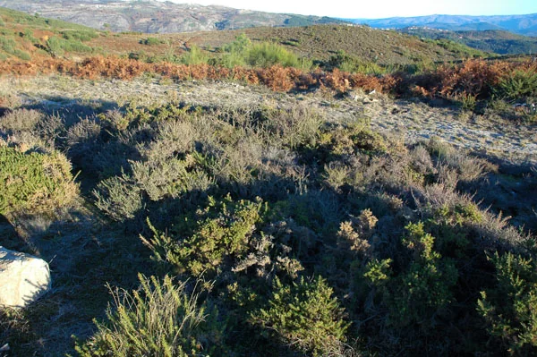
Area of the Marmoirais burial mounds.
ⓘ

Area of the Marmoirais burial mounds.

Source: Carta Arqueológica de Cabeceiras de Basto

View source

Photograph date not stated.

Autoria da fotografia e licença de reutilização não identificadas na fonte.

Request removal or correct the photo credit

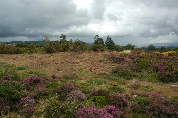
Area of the Marmoirais burial mounds.
ⓘ

Area of the Marmoirais burial mounds.

Source: Carta Arqueológica de Cabeceiras de Basto

View source

Photograph date not stated.

Autoria da fotografia e licença de reutilização não identificadas na fonte.

Request removal or correct the photo credit

Marmoirais brings together ancient tombs and engravings.

At Marmoirais in Abadim, burial mounds and engraved granite outcrops form an archaeological group. The inventory proposes the second or first millennium BC, comparing pottery, engraved motifs and similar groups in the north-west. The dating results from that interpretation. The source also connects the name Marmoirais with the place’s burial memory: a landscape can hold clues in both remains and names.

The inventory distinguishes preservation from interpretation: it describes the group as poorly preserved and allows that Mamoa 5 may remain intact. It proposes cist-type burial structures without presenting that hypothesis as confirmed by excavation.

Tombs and engravings are different remains sharing one landscape. Reading pottery and comparing other groups help suggest a chronology, but do not automatically reveal the meaning of each engraved motif.

Getting to know the parish Ver ficha: Marmoirais — necrópole e arte rupestre
Source and context

Municipality — archaeological inventory, interpretations and chronologies
Accessed:

Carta Arqueológica de Cabeceiras de Basto — 01.08
Accessed:

Carta Arqueológica de Cabeceiras de Basto — 01.09
Accessed:

Editorial summary; the date of consultation is not the date of the facts.

Back to index ↑
YOUR LOCAL GUIDE

What would you like to discover?

Take a closer look.