Discover Cabeceiras de BastoFree independent guide
ViveCabeceirasYOUR GUIDE TO CABECEIRAS
ENEnglish
SearchSaved
6 STORIES · CONTINUOUS READING

Painzela, by the way of water

Six readings on water and transformation in Painzela: watering, moving a mill, going to electricity and drawing a garden. Comparing documents and representing the connections. It is a reading route, without displacements.

All stories in the order of the route. You can print this page by the browser; sources and credits follow the reading.

Things to try3 activities · 5 interactive explorations · 4 questions
Painzela · irrigation documented in 2008

Seven users shared the channel

In Terreiros, irrigation left a trace in the ground.

The inventory of 3 May 2008 describes the Levada da Rebouta in Terreiros, Painzela, as a channel in natural ground. It received water from a small tributary of the Painzela stream, starting at Granja, and belonged collectively to seven shared users. The record noted that it had fallen out of use in the 1990s. This trace helps explain past irrigation arrangements, without assuming that the channel remains usable or accessible.

The water had different jobs

Open an option and choose the story.

  1. Move a millThe stream put the mill to work →
  2. Draw a gardenThe water draws the garden of Piellas →
  3. Organize water useThe water had its turn →
Choose a link to continue reading. Each story distinguishes its time and available sources.
Source and context

Municipality — inventory of levadas, Rebouta, fiche L39 (03/05/2008)

Accessed: . Editorial summary; the date of consultation is not the date of the facts.

Back to index ↑
Painzela · oil mill documented in 2008

The stream powered the oil mill

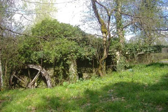
Painzela’s old olive press — photograph from the 2008 municipal inventory.
Painzela’s old olive press
ⓘ

Painzela’s old olive press — photograph from the 2008 municipal inventory.

Source: Municipality of Cabeceiras de Basto

View source

Photograph date not stated.

Individual photographer and reuse licence not stated by the source.

Request removal or correct the photo credit

Lagar do Senhor connected water with olive processing.

At Lagar Velho in Painzela, the survey of 6 May 2008 identified the Lagar do Senhor as a water-powered granite building. Its own channel brought water from the Arejal stream. The record placed its closure in the 1970s and described the building as ruined at the time, with few milling components. This documents privately owned equipment; it does not confirm present visiting conditions.

From watercourse to processing

Open an option and choose the story.

  1. Continue in the 20th centuryWhen the mill changed energy →
  2. Compare with a lance of irrigationSeven consorts shared the levada →
  3. Meet another documented wineryFrom Petimão to olive oil press →
  4. Discover two uses of water strengthOne water, several works →
Choose a link to continue reading. Each story distinguishes its time and available sources.
Source and context

Municipality — inventory of mills, Lagar do Senhor (Old), record LA12 (06/05/2008)

Accessed: . Editorial summary; the date of consultation is not the date of the facts.

Back to index ↑
Painzela · changing oil mills in the 20th century

When the oil mill changed its power source

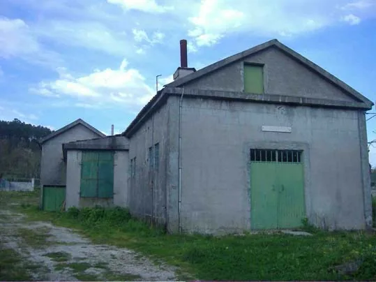
Lagar do Senhor Novo in Painzela — photograph from the 2008 municipal inventory.
Lagar do Senhor Novo in Painzela
ⓘ

Lagar do Senhor Novo in Painzela — photograph from the 2008 municipal inventory.

Source: Municipality of Cabeceiras de Basto

View source

Photograph date not stated.

Individual photographer and reuse licence not stated by the source.

Request removal or correct the photo credit

In Painzela, the story continued beyond the water channel.

The 2008 municipal inventory describes the Lagar do Senhor Novo in Igreja as the successor to the Lagar Velho. Built in 1971, it used electric motors. It was restored in 2001 and taken out of use shortly afterwards.

The change lets us compare two ways of powering an oil mill in the same parish. The survey is historical and confirms neither current operation nor visits.

Source and context

Municipality — Lagares inventory, LA13, survey of 06/05/2008

Accessed: . Editorial summary; the date of consultation is not the date of the facts.

Back to index ↑
Landscape and garden · Painzela

Water shapes the garden at Piellas

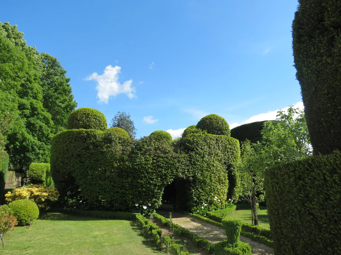
Topiary shapes in the Pielas garden.
ⓘ

Topiary shapes in the Pielas garden.

Source: Museu das Terras de Basto

View source

Photograph date not stated.

Individual photographer and reuse licence not stated by the source.

Request removal or correct the photo credit

Among the clipped shrubs, there are other paths to follow.

At Piellas, water helps connect garden, woodland and fields. The description published by Revista Jardins places an L-shaped pool beside the wall, near a passage to the Casa do Boal woodland. Another pool, surrounded by bamboo and box, opens towards a cultivated field bordered by woodland. The water continues to the Painzela stream.

The article also describes paths shaded by vine pergolas and a farmyard associated with former maize and wine production. The estate therefore brings together places for leisure and work: its garden of clipped shrubs belongs to a wider landscape.

Try imagining the estate in layers: terraces, paths, vegetation and the water system. The description connects these elements but does not provide a complete map of the water circuit. Piellas is private property; consult the place profile for visiting conditions.

The garden within the landscape

Open an option and choose the story.

  1. The bushes that take shapePlants that gain forms →
  2. The different seasons of the fifthOne house, two centuries in sight →
  3. Another water story in PainzelaSeven consorts shared the levada →
It relates plants, history and uses of water.
See Fact sheet: Casa de Pielas, jardins e anexos
Source and context

Jardins Magazine — Gardens of Portugal: Route of the Tâmega, section Casa de Piellas

Accessed: . Editorial summary; the date of consultation is not the date of the facts.

Back to index ↑
Heritage · Painzela

One house, two centuries in view

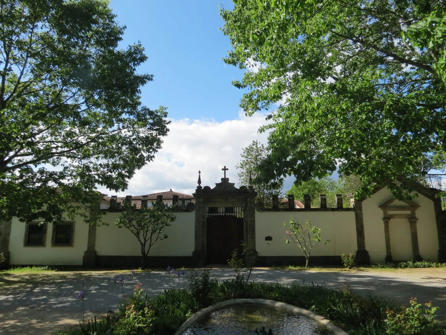
Casa de Pielas and garden.
ⓘ

Casa de Pielas and garden.

Source: Museu das Terras de Basto

View source

Photograph date not stated.

Individual photographer and reuse licence not stated by the source.

Request removal or correct the photo credit

The building and garden tell different chapters.

Casa de Pielas and its garden are not presented as the work of a single period. The municipality dates the house’s architecture to the 18th century and the garden to the 19th, suggesting English influence as a possibility.

Separating these layers helps you read the whole: a building can gain new spaces and new ways of being framed over time. This is a heritage reference, without confirmation of current visiting arrangements for the private property.

Painzela per layer

Open an option and choose the story.

  1. Living shapes in the gardenPlants that gain forms →
  2. Water and working spacesThe water draws the garden of Piellas →
  3. A 17th century chapelA chapel helps to read the house →
  4. What was left in the fileA chapel leaves a trail in the archive →
Links between heritage readings. Dates and access conditions are explained in each story.
Getting to know the parish See Fact sheet: Casa de Pielas, jardins e anexos
Source and context

Municipality — assets of Painzela

Accessed: . Editorial summary; the date of consultation is not the date of the facts.

Back to index ↑
St Nicholas and Painzela · hydrography in the testimony of 1758

Two rivers meet at Ranha

A document lets us follow water between parishes.

The 1758 São Nicolau account places the meeting of the river crossing the parish with the one from Painzela at Ponte da Ranha. It then describes their combined flow heading towards the Tâmega near Cavez bridge. This is a historical reading of the water network connecting the territory, not a suggested riverside walk.

Before that meeting, the priest follows São Nicolau’s river from the hill called Víbora. He describes a modest spring receiving other streams, its flow strengthened at Ponte do Gado by two branches from Bucos. He mentions water throughout the year and a particularly strong winter flow.

The text also follows changes of direction: south, then east, then south again. It tells the landscape through the movement of water. Springs, tributaries and confluence explain different stages; the author’s names belong to the testimony signed on 22 May 1758.

Notice the sequence of meetings: the Bucos branches first strengthen São Nicolau’s flow; water from Painzela joins at Ranha; their shared destination is the Tâmega. Drawing these junctions helps distinguish a river’s course from the network of contributions feeding it.

Follow water in document

Open an option and choose the story.

  1. Cross a river with floods

    Sendim, Cerdeiró and Ponte do Gado appear in an account where winter could interrupt crossings.

    Bridges winter tested →
  2. The other river, coming from Lapela and Celeiró

    It follows the smallest course from three fountains to the wooden bridge of Vilarinho.

    A bridge for loaded cars →
  3. Use water in levadas and mills

    Find out which places and Thursdays the document describes water channels.

    Water watered and made oil →
  4. The Cavez bridge in another story

    It changes from the river network to the history of a crossing of the Tâmega.

    Five arches, more than one time →
Historical relationships, without route tracing or confirmation of current access.
Source and context

Basto Land Museum — St Nicholas Parish Memories (1758)

Accessed: . Editorial summary; the date of consultation is not the date of the facts.

Back to index ↑
YOUR LOCAL GUIDE

What would you like to discover?

Take a closer look.