A castle read through the ground
ⓘ
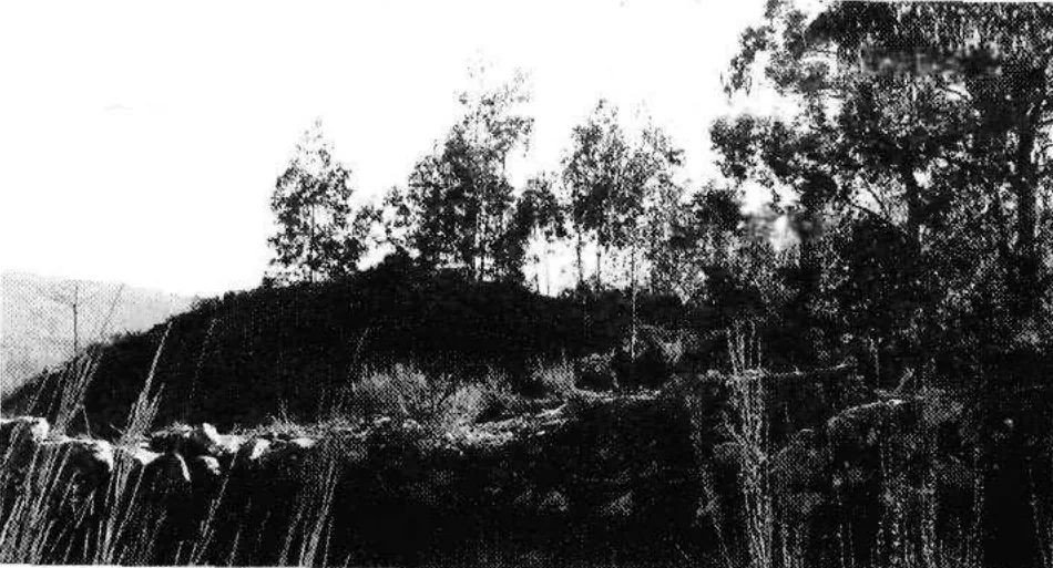
Mota de Eiró from the northeast. Archival photograph published in 1999.
Source: FLUP · Luís Fontes
Photograph date not stated.
Autoria da fotografia e licença de reutilização não indicadas na publicação. Luís Fontes é o autor do artigo.
ⓘ
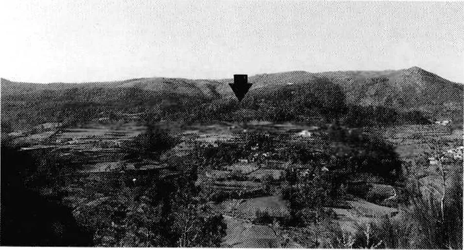
Rio Douro valley. The arrow marking Mota de Eiró is part of the figure published in 1999.
Source: FLUP · Luís Fontes
Photograph date not stated.
Autoria da fotografia e licença de reutilização não indicadas na publicação. Luís Fontes é o autor do artigo.
In Eiró, the circular shape and ditch tell a story.
The municipal inventory interprets the remains as a fortified residence of motte type, dating from the mid-13th century. It connects them with the castle mentioned in the Inquiries of 1258. The circular form stands on a mound of stone and coarse sand, surrounded by a ditch. The municipality highlights its position above the Rio Douro valley, a connection between Refojos and the Barroso plateau. This reading combines terrain and document without reconstructing the vanished building with certainty.
The 1258 document adds a social dimension to the shape of the ground: according to the municipal interpretation, almost all residents of Santo André de Rio Douro had an annual obligation to go to the castle. The reference connects the fortification with community organisation, although it does not clarify all the associated tasks here.
The inventory compares the construction with examples from Brittany. This is a comparison of forms and techniques, not proof of the builders’ origin. Its position halfway up the hillside helps explain the relationship between defence and movement through the valley.
In 1999 the archaeologist Luís Fontes published two photographs that show the site at different scales. From the northeast, the low mound stands out among the trees. In the panorama, an arrow added in the original publication marks it partway up the hillside. The 2026 municipal master plan inventory lists Mota de Eiró as a medieval archaeological site.
The land and documents
Open an option and choose the story.
Another village, another chronology
A village drawn on the slope →What do the documents say about Pedraça
Pedraça already had another name written →Funeral traces and engravings in Abadim
The stone also kept drawings →
Source and context
Municipality — archaeological inventory, interpretations and chronologies
Accessed:
Luís Fontes, archaeological study of Mota de Eiró, 1999
Accessed:
Diário da República, municipal master plan inventory, 2026
Accessed:
Editorial summary; the date of consultation is not the date of the facts.
One bookmark per reading journey, saved in this browser.