Discover Cabeceiras de BastoFree independent guide
ViveCabeceirasYOUR GUIDE TO CABECEIRAS
ENEnglish
SearchSaved
6 STORIES · CONTINUOUS READING

From irrigation channel to tap

Follow the water from mills and gardens to the front door. Along the way, discover what the church bell told irrigators.

All stories in the order of the route. You can print this page by the browser; sources and credits follow the reading.

Things to try2 atividades · 1 exploração interativa · 1 pergunta
Landscape · Abadim

Follow the water’s path
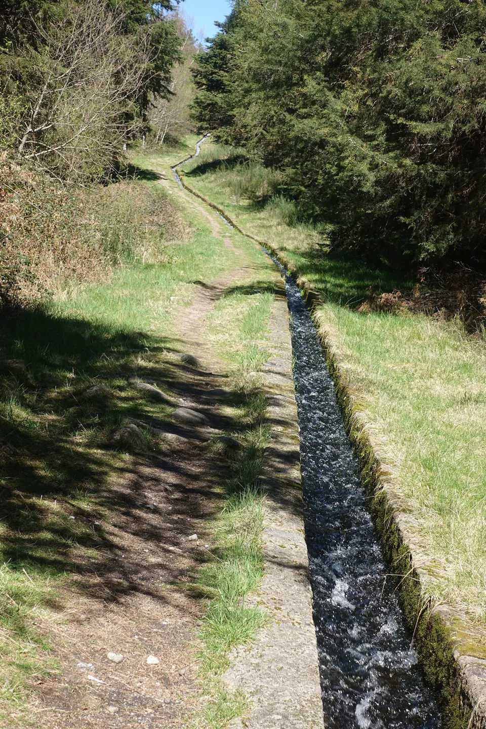
The Levada de Víbora channel follows the terrain through woodland.
Joseolgon
ⓘ

The Levada de Víbora channel follows the terrain through woodland.

Photography: Joseolgon · CC BY 4.0

View source

Date given at source: .

Author, licence and file identity checked against the Wikimedia Commons API on 15/11/2026.

Request removal or correct the photo credit

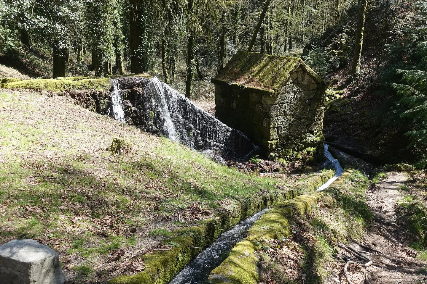
Granite mill, water channel and waterfall at Moinhos de Rei.
Joseolgon
ⓘ

Granite mill, water channel and waterfall at Moinhos de Rei.

Photography: Joseolgon · CC BY 4.0

View source

Date given at source: .

Author, licence and file identity checked against the Wikimedia Commons API on 15/11/2026.

Request removal or correct the photo credit

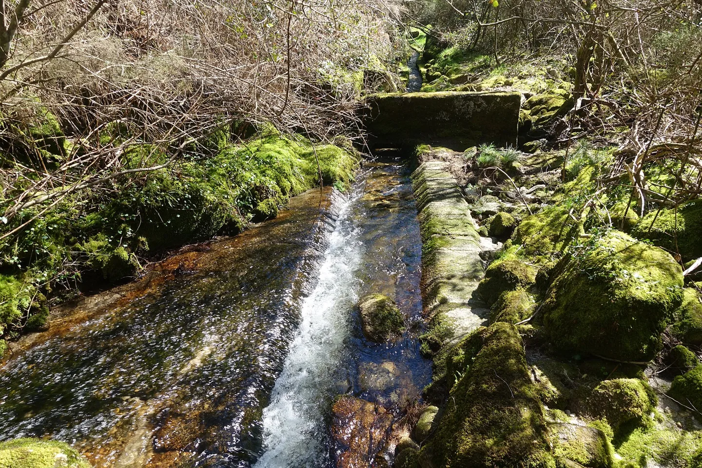
Flowing water and a stone crossing in the Levada de Víbora photographic series.
Joseolgon
ⓘ

Flowing water and a stone crossing in the Levada de Víbora photographic series.

Photography: Joseolgon · CC BY 4.0

View source

Date given at source: .

Author, licence and file identity checked against the Wikimedia Commons API on 15/11/2026.

Request removal or correct the photo credit

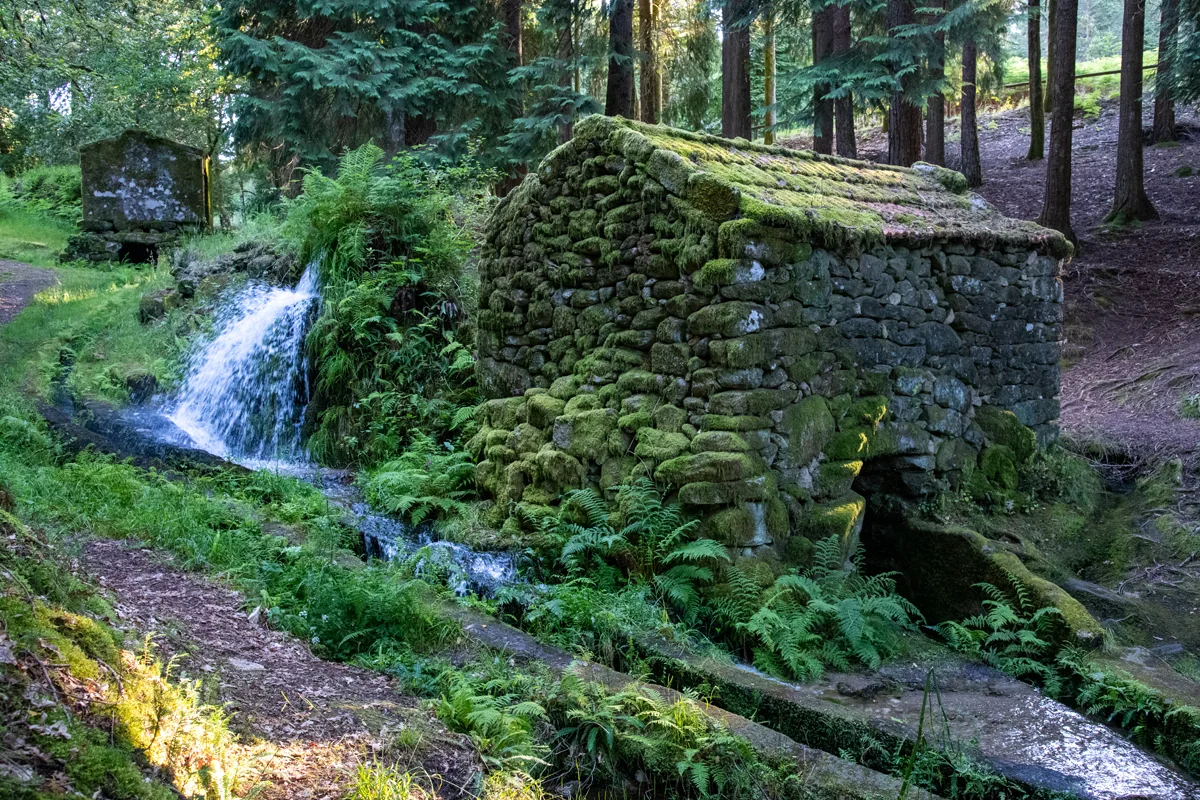
Moinhos de Rei among trees and water.
ⓘ

Moinhos de Rei among trees and water.

Source: Visit Cabeceiras

View source

Photograph date not stated.

Individual photographer and reuse licence not stated by the source.

Request removal or correct the photo credit

The Levada de Víbora brings nature and human work together.

The Levada de Víbora connects the water’s path with the work of milling. The municipal description of PR1 CBC links its start beside the Oural dam in Abadim to the Moinhos de Rei, woodland and small waterways. It also highlights the village and viewpoint of Porto d’Olho and the Víbora leisure park. The destination is only part of the appeal: the channel helps explain how water was directed and used. To choose the walk, consult the trail profile and compare distance and difficulty; this story does not replace up-to-date information about the route’s condition.

Compare the walks See Fact sheet: Moinhos de Rei See Fact sheet: Trilho da Levada de Víbora See Fact sheet: Área de Lazer do Oural See Fact sheet: Área de Lazer de Víbora
Source and context

Municipality — Trilho da Levada de Víbora, PR1 BCC

Accessed: . Editorial summary; the date of consultation is not the date of the facts.

Back to index ↑
Abadim · study published in 2003

When the bell marked watering time

In Abadim, watering time could be determined by a clock, the position of the sun or the ringing of the church bell.

At the Levada de Víbora, knowing when the water would arrive was part of knowing how to irrigate. In a study published in 2003, Emmanuel Salesse describes water rights timed by the clock or by events such as sunset. He records how some irrigators took their cue from the church bell. Some would give the sacristan a coin to ring it outside the regular hours.

The order of irrigators within each turn was called an andada. When the water came back to the same group, those who had irrigated at night often took a daytime slot. The study found groups with one, two or four sequences. Where there were four, the same sequence came round again only after 44 days. The system distributed time as well as water.

Source and context

Emmanuel Salesse — Study of the Víbora irrigation system, Etnográfica, 2003, pp. 40–44

Accessed: . Editorial summary; the date of consultation is not the date of the facts.

Back to index ↑
Gondiães · 2008 municipal inventory

Four pools and a shared irrigation channel

In Gondiães, storing and directing water was collective work.

Four pools supplied a shared structure. The municipal record of 20 March 2008 describes the Rego das Poças, also called Levada da Vizinhança, in Gondiães: around two kilometres of channel for irrigation and milling, serving the Tarroeiro mill.

The Poças do Lugar lay at Olheiros. Three were close together and the fourth further away. Up to the village entrance, the channel followed natural ground; within the settlement it became a stone trough. Storing and directing water therefore required different elements and materials.

The inventory identifies collective ownership and operation by the channel’s joint users, or consortes. It records seasonal water turns but leaves the construction period undetermined. The survey date is not the structure’s age. Its recorded use and condition belong to the picture of 2008, without confirming today’s situation or access.

Store, drive and distribute

Open an option and choose the story.

  1. Two puddles and other usesTwo puddles, shared water →
  2. The water also had a given timeThe water had its turn →
  3. When the water put the mills to workPeio also made flour →
Compares different documented solutions in the municipality.
Source and context

Municipality — inventory of levadas, fiche L29: Rego das Poças, withdrawal of 20/03/2008

Accessed: . Editorial summary; the date of consultation is not the date of the facts.

Back to index ↑
Bucos, Vilar de Cunhas and Rio Douro · 2009 budget

When village water networks passed to the municipality

The 2009 budget records a change in Bucos, Vilar de Cunhas and Rio Douro.

A tap at home depends on work that usually happens out of sight. For a time, some of that work fell to the parish councils. In its 2009 plan and budget, the municipality reported that it had finished upgrading networks transferred from the parishes.

The document names Bucos, the hamlet of Vilar in Vilar de Cunhas, and Cambeses and Eiró in Rio Douro. These were upgrades to existing networks. The same publication lists improvements in the hamlet of Cunhas as planned work. Vilar and Cunhas appear at different stages in the history of the water supply.

Source and context

Municipality of Cabeceiras de Basto — 2009 Municipal Plan and Budget, Water and Sanitation

Accessed: . Editorial summary; the date of consultation is not the date of the facts.

Back to index ↑
Abadim · 2019 to 2023

The water beneath Rua das Lameiras

A stretch of work around 150 metres long tells part of the story of Abadim’s changing water supply.

According to the municipality, two new reservoirs came into service in Abadim in 2019. The following year, it reported finishing an extension of around 150 metres to the water main on Rua das Lameiras and installing new service pipes. Those pipes allow houses to connect to the main in the street.

In July 2023, another project brought a new water source into use in the upper part of Abadim. Reports from the time show how water was sourced and stored before reaching people’s doors.

Source and context

Municipality of Cabeceiras de Basto — Water network extension on Rua das Lameiras, 2020

Municipality of Cabeceiras de Basto — New water source for Abadim, 2023

Accessed: . Editorial summary; the date of consultation is not the date of the facts.

Back to index ↑
Gondiães, Samão, Torneiro and Rio Douro · 2022 to 2024

The water meter by the door

A 2022 notice shows how residents took part in connecting to the new water network.

In July 2022, the municipality asked households in Gondiães, Samão and Torneiro to install a meter box by the street wherever new service pipes were already in place. The same notice covered Toninha, Formigueiro and Juguelhe in Rio Douro. The public works reached the street, and the notice explained what each household needed to do next.

In May 2024, the municipality reported 8.5 kilometres of new pipes across Gondiães, Samão and Torneiro. It described the work as being in its final stages, with road surfaces still being restored and meters still being installed.

Source and context

Municipality of Cabeceiras de Basto — Notice on public water connections, 2022

Municipality of Cabeceiras de Basto — Water network works in Gondiães, Samão and Torneiro, 2024

Accessed: . Editorial summary; the date of consultation is not the date of the facts.

Back to index ↑
YOUR LOCAL GUIDE

What would you like to discover?

Take a closer look.